The hundred nautical mile distance between Grand Cayman and its two smaller sisters meant we were traveling in International waters while we were in transit to Grand Cayman.Not a big deal, but it put into play an Immigration/Customs confusion that, in the end, all we could do is put up our hands and recite one of our recurring responses to baffling situations… it is was it is, even though it’s not what we thought.
Before departing Cayman Brac, we had to clear out with the Customs and Border Control; and we would have to clear in again upon arriving at Grand Cayman.Though our passport visa was valid for thirty days and would have to be renewed, the CBC Officer assured us that Exit was authorized to be in the Caymans for six months.
Unfortunately, the passage to Grand Cayman was reminiscent of our previous passage from Jamaica… namely, insufficient wind that was coming from behind us and too much swell directly on the beam.The wind barely touched over ten knots the entire time.
Of the few entries in the log, one read “17:00 – This sucks… shit wind from behind and shit swell on the beam.” Another read “Genoa getting beaten to Hell.Ridiculous swell from two different directions bouncing us all over the place.Can’t keep the sails up.”
Regardless, we arrived at Grand Cayman the following day after twenty one hours.
But instead of taking the dinghy ashore to go to the CBC office, or being visited by an official on our boat, we were instructed to follow the escort of the Harbor Patrol boat to a government dock were we would meet the CBC Officer.
I mentioned in an earlier post that, in my opinion, the construction of a dock is a direct reflection on how much the person who built the dock values your boat.In this case, it couldn’t have been much.
The dock was composed of a giant slab of cement without a single rail, bumper, or post built right next to a giant rock that we were supposed to tie up to.Maybe okay for a tug boat equipped with an army of truck tires hanging off the rail; but for a sailboat… really?
During the hour we were there, the constant swell (and wind, which had finally picked up) threatened to pound us into the cement, despite having four large fenders deployed.
We were also informed that, though Cayman law allowed a boat to be in Cayman waters for six months, they only issued thirty day permits to coincide with the duration of our Immigration Visa.Contrary to what the Cayman Brac official had told us, we could easily get an extension stamp on our passports but would have to apply for an extension for the boat in writing, and pay $100 for each additional month… arrrrrrrgh!
CI CBC, WTF?… Cayman Islands Customs & Border Control, What The Fuck?
But at least we had made it… apparently to cruise ship heaven.
This is Cayman Brac Traffic Control, calling to welcome the third largest tanker in the world to Cayman Islands.How is everything working onboard and what is your current latitude and longitude?
I’m confirming type of cargo onboard and destination port… You are carrying Iraqi crude oil, is this correct?
Roger… and is that light crude oil?
Copy that… light and ultra heavy Iraqi crude oil.Those are stored together, correct?
And confirming you have 27,100 metric tons of oil onboard, correct?
Your crew is Greek, correct?How many crew onboard, twenty five?
Copy that… 26 crew members… six Greek senior officers, nineteen Philippino crew plus one Romanian engineer, correct?
And your destination is Argentina, is that correct?
Is this the Captain I am speaking to or the First Mate?
By this time, Kris and I were literally rolling on the deck laughing.In the interest of full disclosure, some of the actual data may be factually inaccurate and only represents one side of the conversation, but it conveys the spirit of the conversation rather closely.
More importantly, we were now in the know, which is what made it suddenly so damn funny.We had just finished clearing out with Cayman Brac Customs and were underway, making for Grand Cayman when the aboveconversation took place over the VHF.
*****
We had been listening to the distinct voice identified as Cayman Brac Traffic Control on the radio multiple times every day since we arrived in the Cayman Islands nearly three weeks ago.
The level of detail he seemed to know about passing ships implied that he was researching these vessels online as he spoke with them on the VHF.At times, it appeared he had information that the person aboard the ship speaking on the radio was not aware of.The amount of information he requested from each passing ship was amazing, more than we had ever heard before.The interest he demonstrated went well beyond what seemed to be typical port authority depths.
For us, it was far more entertaining (not to mention far more enlightening) than any television show could have been.We started monitoring his working channel on the VHF just to hear the next conversation.It became the recurring source of big smiles for us when we would hear his voice break across the airwaves of Channel 16, inevitably asking the ship to change to Channel 11 so he could grill them for information and pass on his apparently vast wealth of knowledge.
We couldn’t tell if this was a security measure to verify they were who they claimed, or a government agency with an unfathomable amount of data logged regarding every passing ship, or just a passionate individual who took his job very seriously…
Sometimes the ships didn’t reply to his hails at all.We thought this very strange.
Sometimes the exchanges were rather short… not typically.
Sometimes it seemed the exchanges followed a pattern; sometimes the most random tidbits or the least relevant details were the focus of attention.
Sometimes it seemed the flow of information would never stop…
This is Cayman Brac Traffic Control calling cargo ship just west of Cayman Brac.How are you reading me?
Reading me loud and clear… very good.How is everything working onboard and what is your latitude and longitude?
Copy that… that places you about 25 miles west of Cayman Brac.You may be having trouble reading me.The VHF only has a range of twenty to twenty five miles.It is a travesty that the United States FCC has limited the range of all VHF radios internationally.
You are currently the third largest cargo ship in the world, correct?
Roger… what is your cargo and destination?You are loaded with steel plates bound for Brazil, correct?
Copy that… what is quantity of cargo currently onboard?
Roger…and what is the average size and weight of each steel plate?
Copy that… 3 meters wide, 6 meters long, 10mm thick, and each plate averaging 1200 lbs., correct?
And what is your current speed? Copy that… eighteen knots, fully loaded… amazing.Is that your maximum speed fully loaded?
Roger… twenty knots is maximum speed fully loaded… unbelievable.That is incredible.
And your previous port was China, correct?How many days since you departed?
Copy that… after your delivery to Brazil you will be returning to China, correct?
Copy that… next destination is Australia… that would be Port Thomas, correct?
Roger… are you showing any additional target ships in your area?
Copy that… Cayman Brac has recently lost some seamen that have passed.We would request that you sound your ship’s horn five times as you pass by your nearest point to Cayman Brac to show your respect for these great mariners.
Roger… the water is very fair and deep near the island so you can pass quite close by…
Thank you and have a good voyage.
This is Cayman Brac Traffic Control.I have five other ships currently traveling southbound towards Cayman Brac.How do you read me?
[brief pause]
This is Cayman Brac Traffic Control calling any other ships in the area… are any of you paying attention?
We were so fascinated by this person, we had decided we were going to hail him as we departed Cayman Brac, just so we could have a conversation with him and sound our little hand-pump air horn five times in tribute to the Brac’s fallen mariners.
******
Sitting in the protective shade of a small gazebo near the dock and boat ramp which had provided us shore access and a place to tie up our dinghy, we filled out page after page of official documents – the clearing out papers provided by the sharply dressed Customs and Border Control Officer sitting to our left.
As I completed what seemed to be page ninety-five of the clearing-out paperwork, copying line for line from the identical form which comprised our clearing-in paperwork (information which had obviously not changed during the past three weeks but needed to be re-submitted in triplicate), Kris asked the Customs and Border Control Officer who the Cayman Brac Traffic Control person was.
Completely deadpan, he looked at us and said, “That would be Mr. Raymond Scott.”
Then, with more of a wince and a bit of a strained expression, he continued.
“Mr. Scott drives me crazy. He’s a nice enough guy, and certainly very knowledgable. However, he asks huge tankers and cargo ships to approach very close to the island to pay their respects to sailors who have passed away. I don’t mean any disrespect, and it’s all well and good until something goes wrong.
His title of Cayman Brac Traffic Control is entirely self-appointed. For years, he has been lobbying to be paid for what he does, but in actuality, he has absolutely no authority whatsoever. Passing ships have no idea, and therefore provide him with all the information he requests and comply with his ‘recommendations’, as he represents himself in a manner that implies he is a government official.
The fact is… HE IS LITERALLY JUST A DUDE WITH A RADIO!”
(Cue “game show loser music” here… ‘wah, wah, wah, wah’).
Seriously. The CBC Officer actually said the words, “He is literally just a dude with a radio.”
Our bubble instantly burst.
Shortly thereafter, we departed Cayman Brac bound for Grand Cayman. Suffice to say, we opted to maintain “radio silence”. We were sure that at least one Customs and Border Control Officer would smile if he knew…
Before Jamaica, the Cayman Islands had never been on our radar.
Located in the Caribbean, apparently world class diving, offshore banking haven for rich people and corporations looking to hide money from the taxman… pretty slim pickins as far as comprehensive information goes.
As it turns out, the Caymans has ended up being one of the most intriguing places we’ve visited aboard Exit after leaving the States.
Comprised of three islands, this British Overseas Territory has a total population of less than 55,000 people. Grand Cayman is the main population center, with the population of Cayman Brac (pronounced “Brack”) around 1,500 and Little Cayman a mere 150 residents.
One of our biggest disappointments with both the Bahamas and Jamaica had been that, despite an undeniable beauty above water, below the surface the amazing topography was diminished by the amount of dead coral and remarkably few numbers of fish and other marine life. To us, this appeared to be the direct result of a rather lax view towards environmental conservation.
One of the truly unique aspects we encountered upon arriving at Cayman Brac was the strictly enforced anchoring policy universal throughout the Caymans… YOU CAN’T.
All three islands have gone to extraordinary lengths to provide what must be hundreds of free public mooring balls that boats are required to use. There are only a few areas within all three islands in which anchoring is allowed. And we were warned by the Customs Officer that failure to comply could result in a $100,000 fine… yikes!
Good for them.
Though the Cayman Islands are a major cruise ship destination, a surprisingly few number of cruisers visit the Caymans (the Customs Officer informed us that only two other sailboats had passed through recently). Hence, the dozens of Cayman dive boats are the primary beneficiaries of these mooring balls, which are largely located at the specific dive sites.
Our concerns were twofold: 1) are the dive shops going to be pissed off if they arrive at a dive site and we’re on the mooring ball, and 2) are the mooring balls maintained well enough to be trustworthy?
The answers: 1) no, the dive shops know we are required to use the mooring balls also and will adjust accordingly, and 2) the mooring balls are regularly maintained. Though many of them have too small of tackle to be adequate to sit on overnight, there are larger mooring balls with tackle sufficient for the Cayman Aggressor liveaboard boat scattered about. If the Aggressor showed up, we might need to move to a different mooring ball to give them access to the dive site. Otherwise, we were instructed not to worry.
Another unique aspect we encountered in the Caymans was their policy regarding the use of spear guns and Bahamian slings for spearfishing… YOU CAN’T.
Upon arrival at Cayman Brac, the Customs Officer politely and promptly confiscated all “spears, slings, gaffe hooks, and things meant for poking, jabbing, or sticking.” We were informed they would be returned to us when we cleared out.
Though I was becoming quite comfortable with the idea of occasionally and responsibly partaking in the bounty of the sea, my reaction was the same as the mooring ball policy… good for them.
It would not take long to see the wisdom of these policies from an environmental standpoint.
A large cement dock provided shore access for us to wander around the island a bit where we found the people to be exceptionally friendly. As it would turn out, this would be the only access point to the shore for us between both Cayman Brac and Little Cayman.
We were in the water within an hour of clearing in. It just so happened that we were moored nearly on top of the M/V Captain Keith Tibbetts, a Soviet Union 330 foot long Koni II class frigate built in 1984 for the Cuban Navy. The Cayman Islands government purchased it for tourism, scuttled it off the shore of Cayman Brac in 1996, and renamed the vessel M/V Captain Keith Tibbetts after a local businessman and politician.
Resting at at depth of between sixty feet at the stern and eighty-five feet at the stern, with what had to be around one hundred foot visibility, we could still see everything clearly snorkeling at the surface. But it was even better diving…
M/V Capt. Keith Tibbitts Wreck
DCIM100GOPROGOPR1275.JPG
Cayman Islands Diving
Cayman Islands Diving
Cayman Islands Diving
DCIM100GOPROGOPR1296.JPG
After a couple of days we decided to make the fifteen mile move to Little Cayman so we could check things out there.
Our hope was to be able to stay in a bay that appeared to have excellent protection provided by a reef that fringed the entire side facing the ocean. However, the only entrance to the bay, which stretched over two miles, was a channel with breaking waves that dropped in depth to no more than five feet as soon as it entered the bay.
We needed either calm conditions at the channel or much better information before we would attempt that.
So we opted to pick up a mooring ball on the west side of Little Cayman at Bloody Bay, which also just so happened to be the location of the world famous dive site at Bloody Bay Wall. The island also blocked the worst of the swell coming from the east.
We were in the water within an hour of being secure on the mooring ball; this time just a bit of snorkeling. Nevertheless, we immediately realized Cayman Brac had been just the warm-up act for the bigger show.
After only a short time in the water, we had already seen turtles (green, hawksbill, and even our first loggerhead), an eagle ray, stingrays, barracudas, and a plethora of the most hunted and now least found marine life in the Bahamas – mature conch everywhere, large Nassau Groupers, Lane Snappers, lobsters… it went on and on. In addition, not only was there the amazing topography that we found in Jamaica, but also diverse and healthy coral covering it. It wasn’t the Coral Triangle in Southeast Asia, but it was still mighty impressive.
Mermaid
Eagle Ray
Loggerhead Turtle
Conch
And what do you do if you are a conch less than a foot long with only one foot to move and you fall into a three foot deep hole? Wait for a snorkeler to come rescue you!
In the interest of full disclosure, it must be confessed that having Exit sitting directly above a clearly visible coral reef (even if on a mooring ball) while we slept took some getting used to. But it also made for a spectacular view during the day.
Cayman Islands Mooring
Cayman Islands Mooring
We also now had the opportunity to do something, which up to this point, had been a bit too intimidating and logistically difficult for us to accomplish… scuba diving directly from the Mothership.
[Technical difficulties prevented us from posting this video immediately, but stay tuned]
The amazing dive also brought about a situation which needed immediate rectification. We needed air refills. And this meant we needed to get ashore. Not a simple task where we currently were, as the water approaching the shore was shallow and strewn with rocks and coral.
Every day we saw locals doing dives from the shore, so we decided to approach one pair of guys who were just climbing out of the water to do some inquiring. We got the dinghy as close to shore as possible and then Kris swam in to talk to them (a bikini clad woman typically attracts more attention than a dude with a mustache).
Unexpectedly, they pointed to a dive boat in the distance and said, “Talk to them. They’re the one’s who’ll be filling the tanks.”
When we spoke to the dive staff on the boat he said, “Come around to the bay. They don’t deliver.”
Not quite the warm reception we received at Cayman Brac.
After three days, the wind had dropped to a level we hoped would make entering the bay on Little Cayman’s east side possible. At the mooring ball we were currently on, the water was flat.
As we set out, it seemed promising.
West side of Little Cayman
As we came around the south side of the island, though the wind was only around 12-13 knots, we were smashed by a six to ten foot swell.
East side of Little Cayman
It appeared that the breaking waves into Owen Island Bay were a constant, which took the bay off the table as an option for us. We summarily decided, screw it… let’s just go back to Cayman Brac and get the fills there.
This time we picked up the mooring directly directly above the M/V Captain Keith Tibbetts wreck.
Quite surreal.
Attached to a sunken warship at the edge of an underwater cliff that stretched down thousands of feet… if the Big Earthquake came and the wreck slid of the edge, we would be pulled down almost instantly. Dark… but unlikely.
Moored above the M/V Capt. Keith Tibbitts Wreck
Back at The Brac (as they call it), we once again found the friendly demeanor that we had first encountered. The very accommodating owner of Brac Scuba Shack would not only fill our tanks for $8 each, she would pick them up from the nearby dock and drop them back off for us. In addition, we could rent tanks for $10 each.
We decided to rent four tanks and head back to Little Cayman, which gave us the chance to dive Bloody Wall, and then return to pick up the full tanks before continuing on to Grand Cayman.
DCIM100GOPROGOPR1572.JPG
DCIM100GOPROGOPR1545.JPG
DCIM100GOPROGOPR1541.JPG
DCIM100GOPROGOPR1505.JPG
DCIM100GOPROGOPR1526.JPG
DCIM100GOPROGOPR1537.JPG
DCIM100GOPROGOPR1547.JPG
We never made it ashore on Little Cayman, but after our brief exchanges with the people we did talk to, we concluded we probably hadn’t missed anything.
Despite that, the fifteen days we spent between The Brac and Little Cayman were stellar. The days we weren’t diving, we were snorkeling. Amazing!
And, the entire time, we beamed at the fact that every time we got out of the water we could have a freshwater rinse for both us and our gear, thanks to our blessed watermaker.
In addition, though to us it was never in question, on May 11 we received an undeniable validation and absolute reinforcement that our commitment to install solar panels on Exit was a wise decision when our generation of electricity via solar power shattered the one million watt marker… crazy!
Though we couldn’t have been more impressed with the incredible success that the Cayman Islands policies of no anchoring or underwater hunting had contributed to the general health of the marine ecosystem, it was time for us to get moving again.
A Scuba Junkie reunion with our old dive colleague Nic awaited. And we had already booked flights for a return visit to see family and friends in Washington State in less than a week… the clock was ticking again.
A couple of trips ashore to the bar at Pier One, wandering around town, checking out some souvenir shops, more consumption of jerk pork… after five days at Montego Bay, we were ready to move on.
Montego Bay
Sunset and selfie two-for one
Following a convenient clearing out with Customs and Immigration at one of the marinas which allowed for one more free shower, we were good to go.
We had undeniably had a fabulous time at Port Antonio, but it seemed to have been the highlight of Jamaica. We purposely avoided Kingston; and, the fact that Port Antonio was off the main tourist path contributed to its appeal. However, the cruise ship ports farther West seemed to make for an environment we grew tired of rather quickly. Jet skis, dolphin pens, drunk boats… errrrr.
A cat full of drunks…
…of course one is never enough
The question of where to go…?
Stubborn and consistent Southeast Tradewinds which had set in meant heading farther East into the Caribbean would be a bleak prospect.
However, the Cayman Islands were only about a hundred miles to the West of us.
One of our old Scuba Junkie family, “Island Nic”, had been living on Grand Cayman for years. We decided that, in and of itself, the opportunity to see Nic again made a stop at the Caymans well worth it.
Furthermore, this would still keep us on a trajectory towards Guatemala and the Rio Dulce which, at this point, seemed like the most likely candidate as a target to reach before the onset of the Caribbean hurricane season, lasting from roughly July to November.
The Cayman Islands’ reputation as a world renowned dive destination (one of Jacques Cousteau’s top choices) certainly didn’t help to dissuade us.
So… decision made.
Departing Montego Bay on the morning of April 24, we had the double edged sword of an absolutely stunning day.Temperature in the eighties, not a cloud in the bright blue sky, near glass-like conditions on the water… and less than five knots of wind.
Departing Jamaica
We knew the forecast (as hit and miss as they had been) called for even less wind in the following days.
We hoped that, between Jamaica and Cayman Brac, we would find ourselves in the patches of wind measuring over ten knots more consistently than those measuring under ten knots.That would obviously be a roll of the dice.
Over the course of twenty eight hours and one hundred forty nautical miles, we struggled to sail without having to fire up the engine.But it was largely a battle of futility.
It seemed we were running within thirty degrees of dead downwind nearly the entire time.Even when we changed course, it still seemed we ended up with the wind, what there was of it, directly or nearly directly behind us.Combine that with wind speeds largely in the single digits, as well as two different swells ranging from three to eight feet on our beam, and you have… what’s the proper nautical term? Oh ya… shitty sailing.
Despite our best efforts, which included adding an additional forty miles of distance to the “as a crow flies” hundred miles trying various angles and strategies, we ended up traveling solely under power of our sails for only about half of the twenty eight hours we were underway.
It was like our passage between the Bahamas and Jamaica where we had to motor for the first half before being able to sail the second half. Only his time, our situation reversed. After sailing for twelve hours, we had to fire up the engine for all but two of the remaining hours… poop.
With one exception, the only boat traffic we saw the entire time was on the edge of the horizon. The exception was a seven hundred foot cargo ship that, for some statistically near-impossible reason, opted to occupy the exact same space on earth we were occupying at the same time… two boats coming from different directions hundreds of miles apart at different speeds converging at a point.
Not being stupid enough to try to alter course to squeak in front of the ship, nor arrogant enough to wonder why they weren’t changing course to avoid us, we politely let them pass in front of us and carried on our merry way.
DCIM100GOPROGOPR1220.JPG
DCIM100GOPROGOPR1221.JPG
As a rule, alcohol stays in the bottle while we are underway. Ya… maybe not as fun… but much more fun than being dead.
However, we broke that rule during this passage… huh?
As we sailed over the Cayman Trench 17,000 feet below us, we hoisted our modest glasses of Kraken rum in a toast celebrating the 7,000 nautical miles traveled marker we had just reached aboard Exit.
As we were getting settled in after anchoring at Montego Bay, Jamaica, Kris heard a splashing in the water next to us.
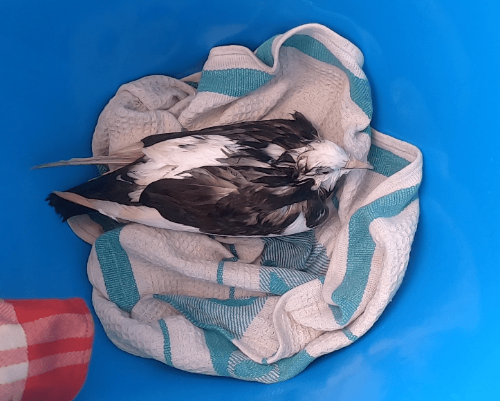
Unexpectedly, we found a bird thrashing about, obviously in distress and struggling to stay afloat right next to our boat. Drifting helplessly in the current, it was desperately trying to get ahold of anything it could.
Kris grabbed a plastic bucket while I hopped in the the dinghy, which was tied to the transom, and carefully fished the bird out of the water as it floated by.
The fact that the poor little guy didn’t offer the slightest bit of resistance to being held was more than enough proof that it was not in a very good way. And, though the bedraggled bird appeared to be thoroughly exhausted and in shock, we couldn’t see any obvious injuries.
Carefully, we set him down in the bucket in a little swaddle of towels and offered some fresh water. But, aside from an occasional twitch of the head or a shiver of its body, our new friend seemed content to simply sit on the dry towel, obviously much preferring his current location over the one he occupied only moments earlier.
Each time we checked during the remainder of the day, the bird’s status remained largely unchanged. Aside from shifting around a couple of times and even standing up for a while, it mostly just sat quietly, resting or sleeping on the towel in the bucket.
Our hope was that after the chance to dry off and a good night’s rest, he might recover fully and be happily on its way.
Unfortunately, Mother Nature had other intentions. When Kris checked in the morning, it became evident that the poor little guy had passed away during the night.
Kris placed him gently in the water, which was now smooth as glass, and ever so slowly our little friend floated quietly away.
Though we certainly wish we could have done more to help, there was at least solace in the knowledge that we had hopefully provided a comfortable and dry resting place for our friend’s final night.
One of the rather convoluted, confusing, conflicting, contradictory and oftentimes seemingly fluid challenges to navigate through in every new country we visit, are the policies and procedures of Customs and Immigration.
Fortunately, cruising guides specific to certain areas, websites (like noonsite.com), online forums, and even people at anchor around you are all great sources of information to make things simpler, or at least more digestible.
Clearing into a country with all the proper documentation in hand, forms filled out, questions answered, and procedures followed is the first process.
Moving around within the country sometimes can have some confusing procedures as well.
Such is the case with Jamaica.
Upon arrival, we have to clear into Jamaica at a Port of Call – Port Antonio in our case.
However, at that time we also have to declare the port that we are going to be clearing out of Jamaica from.Montego Bay, also a Port of Call on the northwest side of the island, is the typical place cruisers use.
To make it even more complicated, before departing Port Antonio, we are required to obtain written authorization to clear out of Port Antonio (just the town, not Jamaica itself).When we reach Montego Bay, we have to clear into Montego Bay (local clearance, because we’ve already cleared into Jamaica).Then, prior to departing Montego Bay, we have to clear out once again (this time to leave Jamaica).
If, for some reason, we turned around and returned to Montego Bay, we’d have to go through the whole process again.
Between the Port of Entry and Port of Exit it becomes even more convoluted.Our cruising permit is technically from Port Antonio to Montego Bay.We were instructed that if we wanted to anchor somewhere along the way (which seems only natural since our cruising permit is for three months), to simply inform the local port authorities that we were too tired to continue.
We interpreted this to mean that, while local authorities did not have Customs and Immigration officials to clear you in or out of the country, they still wanted to be informed of your arrival and departure in that area.
Confused?We were getting quite so.
In practice, aside from clearing both in and out of Port Antonio and Montego Bay, no one seemed to either notice or care.
The fact is that, in the hundred mile stretch between Porti and Mobay (as they are locally referred to), there are only a handful of potential anchorages, and some of those are tenable in fair weather only.
A lack of any protected bay, thirty foot or more depths nearly right up to the shoreline, rocks, coral, weeds, moorings or fish trap markers on the surface occupying space… any of a number of things can make an area unsuitable to anchor in.
An area with at least a patch of sand for a good anchor hold, room to swing, and depths between five and twenty feet can still be unsuitable if a mean swell can get to you or, even worse, another boat has already found it before you… damn!
Largely, it was hard to tell whether an anchorage was going to work for us until we got there.
The one thing we did know for sure was that, at twenty eight bucks a day to anchor in Port Antonio’s West Bay, the time to move on was quickly approaching.
And so, after getting clearance from Immigration, we picked up anchor and departed Port Antonio, managing to sail nearly seventy five percent of the time as we slowly worked our way along the northern coast of Jamaica.
Departing Port Antonio, Jamaica
DCIM100GOPROGOPR1087.JPG
DCIM100GOPROGOPR1092.JPG
DCIM100GOPROGOPR1096.JPG
DCIM100GOPROGOPR1090.JPG
Oracabessa Our first anchorage, approximately thirty five nautical miles west of Port Antonio, was Oracabessa. Unfortunately, the tiny bay designated as an anchorage was already chock full of boats by the time we arrived.
Tentatively, we nosed in. However, twenty knot winds on our beam threatened to push us sideways in a very tight space, including the narrow entrance to the bay itself. We quickly realized that, though we might be able to squeeze in, it was better to abort and get the hell out to find more space… possibly flashbacks to our dragging fiasco in Back Creek, Maryland.
We settled for the wide open bay just outside. Not identified as an anchorage on our charts. Rolly as hell, too. But lots of space… and that was the important thing.
This was where we first encountered a friendly group of boats that had loosely hooked up together and were all heading in the same general direction as us. Two cruising boats with kids aboard, S/V Andromede and S/V Piper, as well as S/V Barefoot Two and S/V Grace. As we worked our was along the northern coast of Jamaica, oftentimes we would find ourselves in the same anchorages as these guys.
Continuing onward from Oracabessa, we were a bit uncertain as to where we would be best off dropping the hook next.
Ocho Rios
Mid-afternoon, the first and only time it happened while we were traveling along the coast of Jamaica, we were approached by the Jamaican Coast Guard while under sail. Conditions were quite boisterous so a boarding seemed unlikely. Instead, they hailed us on the radio to ask our last port of departure and our destination, came within about a thousand feet of us, and then wished us a nice afternoon.
Ocho Rios was our first attempt. Threading our way around the massive cruise ship dock in near twenty knot winds put us in a bay that seemed to have very limited space left for anchoring between other boats and mooring balls.
We thought we’d found a viable spot and had even backed down on the anchor. However, as the wind swung us around, our anchor, which was obviously not set as well as we thought, broke free and we started drifting perilously close to the giant cement pilings next to the cruise ship dock. When the anchor came up with a big clump of sea grass embedded in the tip, we knew why we had not properly set (though our Rocna anchor generally does a stellar job of grabbing the bottom, grassy bottoms can prevent it from digging in deep enough, and a clinging clump of grass keeps the tip from reseting should it drag).
With the very limited space and winds, we instantly said, “Screw this.” Best to keep moving.
Discovery Bay
The wind had picked up from twenty knots and was now hovering around twenty five. Saint Ann was the next option, but conditions were simply too rough to even go in.
Which put us to Discovery Bay, realistically our last option before sunset.
As we approached the anchorage area, we were hailed by S/V Barefoot Two on the VHF (they had left Oracabessa a day earlier than us) and warned to be cautious about our anchor set as there was lots of grass on the bottom everywhere and only small patches of sand; boats had dragged the night before… great.
Inside the bay, the wind had thankfully settled slightly.
Nevertheless, we managed to set yet another record for anchoring attempts required to get a proper set.
After seventy frustrating minutes and an excruciating seven attempts in various locations, we finally managed to get the anchor properly dug in… I believe we doubled down on our anchor beers that afternoon.
DCIM100GOPROGOPR1171.JPG
By comparison, Discovery Bay seemed the antithesis of Port Antonio. Though we stayed there for five nights, it was not what we would describe as a prime location.
The far side of the bay was occupied by a massive bauxite plant owned by Kaiser, which provides the U.S. with over two million tons of bauxite every year.
And, although The Cruising Guide to The Northwest Caribbean indicates that Kaiser “does a lot for the local community”, we found the three most notable impacts to be:
1 – An all encompassing red dust from the bauxite that permanently covers the foliage around the bauxite loading area (thankfully, we were generally upwind from the dock)
2 – An undetermined amount of damage from a bauxite hauling tanker we watched run aground on the reef alongside the channel that had to be pulled free by a tugboat.
Tanker aground on the reef just outside the channel… idiots!
3 – A Kaiser owned and operated “fun park” which imprisons dolphins, sharks, and stingrays (as well as a donkey and camel, of all things). Visitors who pay enough money are provided with a photo of their encounter… visitors who pay even more are allowed to touch the prisoners… those who cough up enough money are apparently allowed to ride the dolphins…
DCIM100GOPROGOPR1166.JPG
DCIM100GOPROGOPR1165.JPG
… not sure how this “fun park” is a necessity for the mining and transport of bauxite.
… not sure how this “fun park” contributes to the betterment of the local community.
… pretty sure this “fun park” makes a shit-ton of money for Kaiser.
… absolutely positive that this pathetic money grubbing endeavor (or “fun park”) exploits and harms marine life purely for the sake of profit.
Apparently, this is the kind of thing that cruise ship guests want… which is why I would never be caught dead on a cruise ship.
I apologize to all cruise ship guests who have formally contacted the activities directors and/or dolphin encounter facilities and informed them they would not do business with anyone who promoted and supported such exploitative practices…
I’m pretty sure both of those cruise ship guests will forgive me…
Anyway… Discovery Bay… not our favorite place.
Trying to get a closer look at the dolphin prison
And, while disheartening to learn of Jamaica’s tolerance of captive dolphin and marine animal industries, it was even more disheartening to learn that these exploitations are quite normal business practices throughout the Caribbean.
Both as divers and sailors, we are dependents of the oceans… we are stewards of the oceans… by necessity, we must be guardians of the oceans… apparently someone has to. Come to think of it, don’t we all?
Montego Bay It became apparent that Port Antonio was our Jamaican highlight which we would be hard-pressed to surpass, or even match.
We decided it was time to head for Montego Bay.
Once again, we were grateful for the direction we were traveling. The minimum twenty to twenty five knot winds consistently over the six and a half hours we sailed would have been brutal going the other way. In fact, the gusts of thirty three knots we experienced near the end were the highest we have ever seen off anchor.
Haulin’ ass in 30+ knots of winds
DCIM100GOPROGOPR1179.JPG
We entered the bay with only a tiny scrap of sail out, still making over seven knots of speed. Fortunately, on this day our anchor set perfectly on the first try after reaching Montego Bay.
We both concurred that the anchor beers were, once again, well earned.
Wagwan – A Jamaican term short for “what’s going on?”
A typical response could be ‘nagwan’ or ‘nuttin nah gwaan’(nothin’s going on)
After clearing into Jamaica with Customs and Immigration officials, we were free to anchor in West Bay, just off the Errol Flynn Marina.
As an anchorage, it was about as good as you could ask for. The only thing it was lacking in was infinite space. Good depth and soft mud to set the anchor well. Beautiful surroundings. Excellent protection from weather conditions (West Bay’s only open ocean exposure is completely buffered by shallows which prevent any wave from entering). The bay generally has lake-like conditions, with minimal tides or currents to deal with.
Perfect in just about every way. Except…
You got to pay to stay… twenty eight bucks a day. You provide the anchor and ground tackle.
That may be the only reason West Bay is not full of sailboats that anchor and never leave.
In all honesty, it was substantially less than any marina would cost to stay at. And it provided a dinghy dock, access to showers, and a certain degree of security.
We wanted to do some land excursions, which would take time to sort out and would cost money as well. So, we decided to limit ourselves to not more than a week in Port Antonio at anchor in West Bay.
The following day we received a visit from the Marine Police. Not necessarily a problem… but certainly a moment of, oh shit… do we have a problem?
The two officers, George and his partner, tied up alongside us, boarded Exit, politely checked our paperwork, and proceeded to kindly offer a plethora of information.
George was so helpful we eventually took him up on an offer to utilize his services as a local guide during his time off.
George – Marine Police / Guide
A trip into the Blue Mountains.
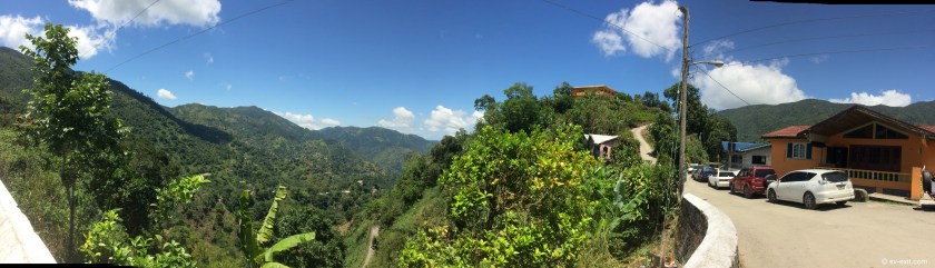
Incredibly lush and densely forested peaks that rise three thousand feet into central Jamaica before dropping back to the southern coast. Low clouds drift between the peaks creating an constantly shifting view of the surroundings. Tight winding roads criss-cross through the mountains, connecting tiny communities, family farms, colorful buildings and run down shacks.
Kingston can be seen in the distance during one of our stops. That was close enough for us.
George informed us that he was a police officer in Kingston before moving to Port Antonio. He said policing here is like a holiday compared to there; places in Kingston resemble a war zone. He even played a recording that had just been sent to him by a friend in which you can hear endless gunfire in the streets.
Quite the opposite of what we were experiencing…
DCIM100GOPROGOPR0970.JPG
DCIM100GOPROGOPR0968.JPG
DCIM100GOPROGOPR0963.JPG
DCIM100GOPROGOPR0961.JPG
DCIM100GOPROGOPR0954.JPG
DCIM100GOPROGOPR0950.JPG
Blue Mountains – Jamaica
Visiting the Blue Mountain Coffee farm… maybe not as popular as Starbucks, but world-class coffee.
James Dennis – Rasta Barista
Blue Mountain Coffee with a spot of over-proof Jamaican rum… ooo-wee…yum!
We had been warned not to rent a car due to the horrible state of Jamaica’s roads. At one point during the day I made the mistake of mentioning that the roads seemed to be in better condition than I had expected. Apparently that was enough to hex us…
Later that afternoon we were rewarded for my brazen comment with a flat tire.
DCIM100GOPROGOPR0965.JPG
After a day of stunning scenery and great company, we decided to arrange to go rafting on the Rio Grande…
These unique rafts have apparently been utilized for generations on the rivers by Jamaicans for transporting goods. However, it was actor Errol Flynn who first recruited their use as props to woo women he was romancing. Ever since, rafting the Rio Grande has become Jamaica’s version of a romantic gondola ride trough the Venice canals.
Our raft captain Trevor
George had arranged for us a capable and friendly captain with over thirty years experience on the Rio Grande named Trevor, who was a man of extraordinary multi-tasking capability.
Navigating while on the cell phone…
Navigating while drinking a beer…
Navigating while smoking a joint…
Approaching the floating raft-bar
DCIM100GOPROGOPR1064.JPG
DCIM100GOPROGOPR1060.JPG
DCIM100GOPROGOPR1026.JPG
DCIM100GOPROGOPR1023.JPG
DCIM100GOPROGOPR1032.JPG
DCIM100GOPROGOPR1057.JPG
DCIM100GOPROGOPR1070.JPG
Approaching the rapids…
A quick pit stop swim
Jamaica
DCIM100GOPROGOPR1064.JPG
DCIM100GOPROGOPR1049.JPG
DCIM100GOPROGOPR1044.JPG
DCIM100GOPROGOPR1028.JPG
DCIM100GOPROGOPR1039.JPG
DCIM100GOPROGOPR1017.JPG
DCIM100GOPROGOPR0993.JPG
The day was an amazing blend of beautiful scenery and relaxation, as well as one of the first times we’ve taken a ride on the water in a craft that we didn’t have to pilot since moving aboard Exit... brilliant.
It would have been great to do some additional land explorations. However, we also had to stay mindful of expenditures, as always.
Every place we visit provides endless opportunities for activities which, inevitably and understandably, cost money to undertake.
To travel indefinitely, we find that keeping self-induced restrictions on that spending is an absolute necessity.
Nevertheless, occasionally indulging ourselves allows us to not merely visit a location, but rather, to actually experience it.
To say the weather forecasts for the areas we have been in over the past four months have been inconsistent in their accuracy would be a gross understatement.
Wind directions ninety or even a hundred eighty degrees off from the forecasts. Five knots winds when twenty-five were anticipated; or, much worse, twenty-five knot winds when five was expected.One weather model spot on last week completely misses this week or visa versa…
The best bet is that the wind is coming from the direction we are trying to go.The best predictor of rain is Kris putting laundry on the lifelines. Laundry on the lifelines… rain coming for sure.
Wind double tasking – Clothes drier and hair drier simultaneously
We had heard that the Windward Passage, the body of water separating Cuba, Haiti and Jamaica, could be notoriously like the Gulf Stream in its ability to quickly stack up nasty or even dangerous conditions when building wind directions oppose continually shifting currents.
Our strategy was similar to what we had used in crossing the Gulf Stream at Hatteras / Cape Fear… respect the stories you hear and shoot for a window that risks excessively calm conditions that may force motor-sailing over excessively breezy conditions that cause you to shit your pants.
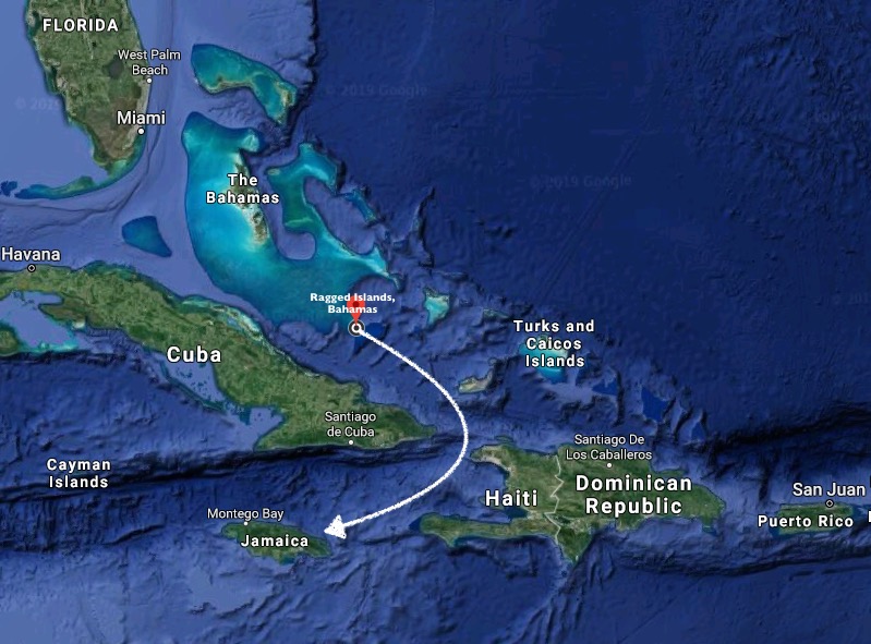
Jamaica was just under four hundred nautical miles away, slightly more than three days sail.
Our departure Wednesday morning was greeted with very calm seas.Unfortunately, the wind was only seven to nine knots, and it slowed down from there.
By mid-afternoon, the wind indicator hovered at two knots, and our Perkins engine was the only thing carrying us over perfectly flat waters.
We would have been more than willing to sit; the surface conditions were certainly conducive.However, in the end we concluded that getting down to what we saw as potentially the diciest section of the Windward Passage, the area directly between Cuba and Haiti, while the wind was minimal was ultimately in our favor, even if we had to sacrifice a bit of diesel to achieve that.
We managed to shut off the engine for a spell, content to wring three to four knots of boat speed out of four to six knots of wind speed.
DCIM100GOPROGOPR0833.JPG
DCIM100GOPROGOPR0837.JPG
DCIM100GOPROGOPR0834.JPG
As we passed clear of Columbus Bank, and the floor of the ocean fell dramatically away from a depth of forty feet towards eight thousand feet, we could clearly see the shadow of Exit cast on the ocean floor more than one hundred feet below! A short time later, we crossed over the edge of an immense drop off. And then suddenly there was nothing below us but amazing shades of blue… split by beams of reflected sunlight trying to pierce into the depths.
And, once again, the ocean’s surface all around us was a magical shade of indigo.
Though we wrestled to keep the sails filled, in the end, to our dismay it was largely diesel power that propelled us until the following morning. The display on our weather chart indicated we were right in the middle of the only area for hundreds of miles that currently had breezes of less than five knots (just our luck).
By 3 a.m., the engine had been running for nearly ten of the past twelve hours. We were ready to concede that our plan was not viable as things stood. With no wind, there was no way we were going to motor four hundred miles to Jamaica. A slight detour farther to the east would put us at Great Inagua, where we could get provisions and wait until the winds returned. Or we could head slightly farther north and make for a tiny dot on the chart called Hogsty Reef.
Choices…
Intrigue…
Hogsty Reef is a minute atoll barely breaking the ocean surface in the middle of the open Atlantic. The coral walls that comprise its outer ring plummet down thousands of feet while inside the depth is only about twenty feet. Because of its exposed nature and zero protection, the location is tenable as an anchorage in only the calmest of conditions… like now.
We decided to roll the dice. If we had to motor, it would take seven extra hours both ways, which would suck. But it would also provide the perfect conditions for anchoring overnight. For now, we could raise the sail and kill the engine, content to move along at a slow pace.
Its difficult to describe exactly how it sounds after being underway all night long offshore under engine power, to finally shut the engine off and, under only sail power, think wow… what a difference.Only to realize that the propeller still spinning beneath the hull is creating its own noise… so you momentarily put the transmission in reverse creating near absolute silence and immediately think WOW… WHAT A DIFFERENCE!
A six a.m. sunrise and a new day…
DCIM100GOPROGOPR0847.JPG
DCIM100GOPROGOPR0848.JPG
After the previous night, even seven to nine knots of wind seemed like a gift.
By nine a.m., we had definitively altered our course to Hogsty Reef (prior to that we had been experiencing more of a non-committal steering in the general direction of Hogsty Reef). A choice had been made. No increase in wind in the forecast for the next couple of days… new plan.
However, less than two hours later, that new plan disintegrated.
NNW winds picked up out of nowhere to the tune of fifteen to seventeen knots… holy shit! And, just like that… wham! We’re doing better than eight knots speed over ground. Only, the seas are starting to kick up quite quickly.
It didn’t take long to realize the Hogsty Reef option had just been taken off the table… bummer. On the up side, the engine was off and we were flying along with only the genoa out.
The upside of downwind sailing is undoubtably comfort level. Fifteen knots of wind from behind feels more like ten, and sliding atop three to six foot following seas is preferable any day to pounding through four foot waves while getting hit with fifteen knots of wind on the nose!
We altered course away from Hogsty Reef. The current surface conditions would never allow for anchoring and would take a while to settle back down again even if the wind dropped off. For now, we could return back to a course towards Jamaica and reassess the conditions as we passed Great Inagua. If the wind died again, we could stop there.
Yet, when we unfurled the genoa and shut down the engine just after eight a.m., we had unknowingly set the stage for the rest of the passage to Jamaica.For the next fifty four hours, we ran mostly within forty degrees of dead downwind under power of sails only. Our engine didn’t get used again until we were about to enter the bay at Port Antonio, Jamaica.
What a difference twenty-four hours can make in our log entries…
9:00 – Winds appear to be dying over next couple of days; making for Hogsty Reef
10:30 – Making for Matthew Town on Great Inagua. Squalls making sea conditions untenable for Hogsty
13:00 – GPS track looks more like someone learning controls on an Etch-A-Sketch than a sailboat but back on course for Jamaica mon!
17:50 – Brilliant sailing for past six hours; what a change from this morning. In 10,000ft. of water. Approaching Windward Passage.
1:45 – 13nm off the coast of Cuba (1nm outside Cuba’s territorial waters)
10:00 – Now in the Caribbean Sea – may be first time Exit has been in this part of the world.
Off watch reading under wing and wing
By 1:30 that afternoon we had rounded the southeastern tip of Cuba and passed within thirty five nautical miles of Guantanamo Bay, plenty close enough for us.
We’d been seeing fifteen to twenty knots of wind for over twenty four hours and it would remain like that for the next twenty four hours. Exit sped along comfortably atop the three to six foot following seas, which looked uglier than they felt.
As we approached to within nearly ten miles of Jamaica, an ominous stretch of very dark clouds lined up across the horizon, directly in our path. Almost as though a final gauntlet was being thrown down before we would be allowed to reach our destination.
But our radar revealed that we were actually looking at a very deceptively narrow band of storm clouds.
Radar display approaching Jamaica
Slowly, in the distance… through the hostile looking, though largely benign, cloud cover… a dark mass began to appear low on the horizon. As it began to take form, the color slowly shifted from gray to green. The cry “land ho” went out.
Jamaica!
First sighting of land
DCIM100GOPROGOPR0913.JPG
DCIM100GOPROGOPR0917.JPG
DCIM100GOPROGOPR0924.JPG
As we approached Port Antonio, we were immediately struck with the stark contrast the lush, green, mountainous terrain before us provided against the low lying, often inhospitably rugged and desolate Bahamas we had just come from.
Once inside the East Bay, conditions completely calmed down. As Kris circled around while I dropped the mainsail, she had to dodge a large number of coconuts, branches, and rubbish that was floating about in the bay. Initially, this seemed a bit shocking to us, until we realized it was the result of river runoff from the nearby mountains.
Our Bahamas courtesy flag, flying under the starboard spreader (which was now little more than a patch of torn cloth) had already been replaced with the yellow quarantine flag, which we had to fly until we cleared Customs.
In the Bahamas, we were able to anchor, then have one person dinghy ashore to visit the Customs office and Immigration office, where all the paperwork was dealt with.
In Jamaica, the Customs and Immigration officers come to your boat… slightly intimidating the first time, to say the least.
We had to tie up at the dock of the Errol Flynn Marina, run by the incredibly helpful and hard working Dockmaster George.
West Bay anchorage looking at Errol Flynn Marina
Clearing in turned out to be a rather painless process. About ten pages of forms and paperwork to be filled out. A visit from the Customs officer. A visit from the Immigration officers. No searches. No hassles. A lot of questions.
Then, after clearing in with the officials, a visit from a Jamaican named Presley who can help with whatever you need… Work on the boat? No problem mon. Go on a tour? No problem mon. Jamaican courtesy flag? US$10. Enough ganja to fill a mason jar? US$50… a weed magnet.
*****
Wandering around Port Antonio… a somewhat edgy but very friendly town that reminded us a lot of Semporna in Malaysia.
Not a cruise ship destination at all, Port Antonio felt more isolated from the typical tourist hustle… more laid back and certainly more authentic.
It just so happened our arrival coincided with the final days leading up to the local election. A much more festive and involved affair than anything we would ever see in the States, we got to experience music booming across the water of the bay until dawn for our first four nights.
A bit annoying? Possibly… but certainly better than the gunshots we heard people in Kingston got to listen to.
Port Antonio sunset
West Bay anchorage looking at Errol Flynn Marina
“The cutest lizard ever” according to Kris
Exit from the marina
Local beach patrol
Walking the goats, Jamaica
Local fishermen
Local recommendations proved worth their weight in gold when it came to choosing the best jerk shacks to visit. Oddly enough, it was a little shack called Piggy’s Jerk Center for incredible jerk chicken. But Honest John, fifty-four years young cooking jerk pork for thirty-two years, proved the master. And not just jerk pork… jerk wild boar. My tongue was on fire while my stomach was in Heaven.
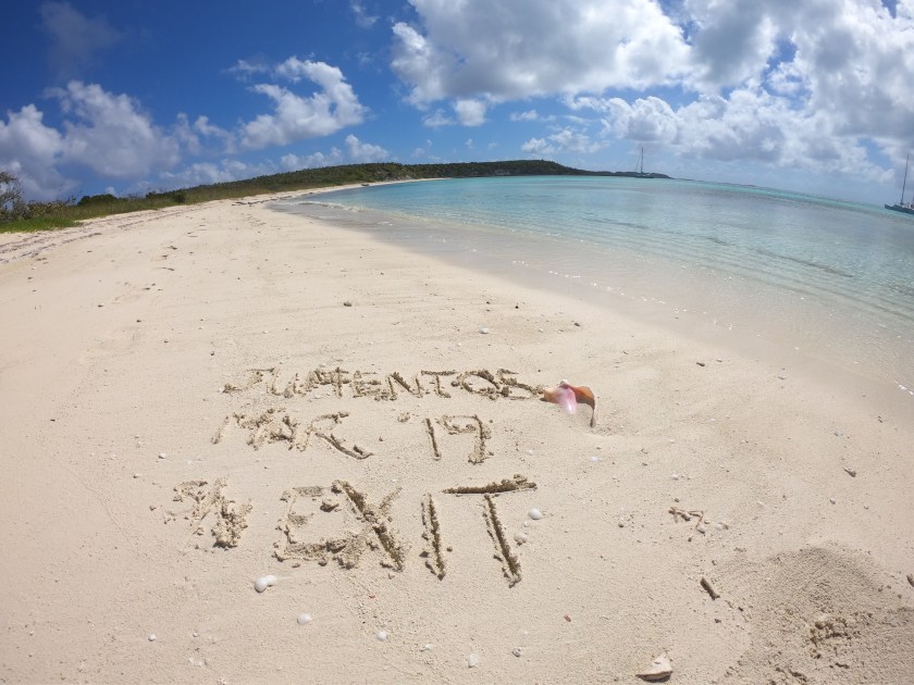
The southernmost point of a seventy-five nautical mile stretch of cays nestled in the wilderness.With the exception of two islands, they are unpopulated.
Explorer Chartbook refer to the Jumentos Cays and Ragged Islands as “little dots on a small-scale chart.Not the same as being in the middle of the Pacific Ocean, more than a thousand miles from the nearest land, but still the middle of nowhere.
The epitome of a communication black hole.
Our last cell tower reception had been March 8, when we left Salt Pond, Long Island.
The first cell tower we would see is located in Duncan Town on Ragged Island, the only settlement in the Jumentos Cays and Ragged Islands, and the only place cell service was even a possibility.
Currently, we were at anchor about ten nautical miles north of Duncan Town, just outside of cell range.
After two weeks of being at anchor in bays almost completely to ourselves, or maybe with one other boat in view, we found ourselves, possibly unfairly, quite annoyed at the small armada of four boats that had appeared in the distance and were in the process of anchoring next to another boat in the bay next to us.
It was the same group that had also invaded our space nearly a week before, at one point approaching us in their dinghy to ask if we had left the pair of sparkle covered flip-flops, being brandished in one of their hands, on the nearby beach.
To be fair, they currently were a bay away; and the greater victim was certainly the poor boat already at anchor that they all plopped down next to. Harmless enough… just bloody annoying.
Yet, we had been hearing one of these four boats yammering endlessly on the VHF since Long Island a month ago.They always seemed to be contacting other boats, discussing and relaying the day’s activity schedule and immediate future plans.Even at 6am, we would hear them calling in to Chris Parker’s weather broadcasts on the SSB radio.
During the previous weeks we had grown tired of hearing the immediately identifiable and thoroughly grating New Jersey accent every time the voice crackled through the speaker.
And here they were again… instead of heading back to George Town, which had been the tentative plans relayed during earlier radio communications.
It was the eventual drone of an outboard engine that alerted us that visitors were approaching in a dinghy… the same guy who had asked us about the sparkly flip-flops… great.
However, this time, instead of flip-flops they brought a cryptic message:Has anyone been in touch with you?We were told that attempts were underway to contact you regarding the death of a friend of yours in Indonesia…
We had heard nothing.
We immediately picked up anchor and made for Southside Bay at Ragged Island, near Duncan Town and the area’s only cell tower.But, upon our arrival, we discovered that there was no cell signal.We had heard days ago that there had been no cell service for days.Apparently, the problem had not yet been resolved.
Almost immediately, we were hailed on the VHF by the sailboat anchored next to us.
They asked the same question…
They then told us that they had heard that a request to locate S/V Exit had gone out on a SSB net broadcast days ago regarding the death of someone we were friends with in Indonesia.A sailor we had met earlier, while anchored near us in Thompson Bay, Long Island, was listening to the broadcast, recognized our name, had relayed our earlier position to the net moderator, and was sending word to boats in the area to keep an eye out for us.
Fortunately, though cell service was down in the area, our Iridium Go! was nowfunctional, allowing us to send and receive basic emails through a satellite connection instead of cell tower service.
After several email exchanges to a number of perople, a clearer picture began to materialize.
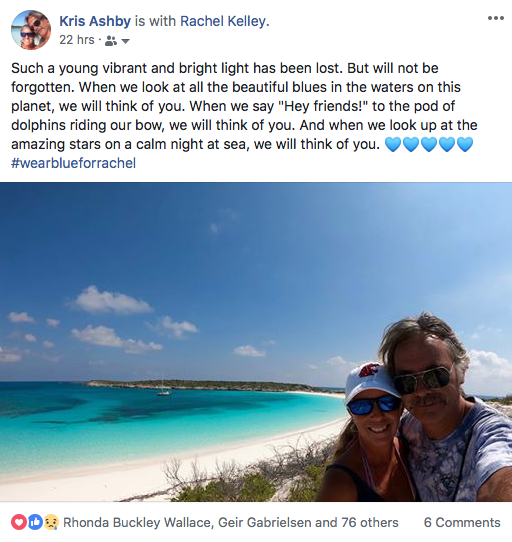
Tragically, one of our Scuba Junkie family, Rachel Kelley, whom we had worked with in Malaysia for nearly five years, had just passed away.
Rachel had returned to the U.S. after being diagnosed with cancer during our last year managing Scuba Junkie.After a hard fought battle, she had made an amazing return to Scuba Junkie and Mabul Island last year to resume teaching diving.
Sadly, her health took a turn for the worse, and her condition deteriorated quickly enough that emergency evacuation was just not possible.
Rachel passed away on March 15, 2019 in Kota Kinabalu, Borneo, with both family and friends at her side.
Rachel was an inspiring individual with an immense heart.She could surgically admonish someone’s political opinions while, at the same time, lovingly pet Scabby Pete the cat.Her commitment to teaching made her not just an incredible dive instructor, but also an energizing mentor.As a Scuba Junkie, she was not only friend, but also family.
Her final dive was far too soon; she was far too young.Those of us who had the incredible fortune of knowing her are better for it.We are all less without her. Her laugh was all it took to brighten a room.
And while we mourn Rachel’s passing with a heavy heart, we are simultaneously inspired by the Herculean effort that was put forth in getting word of this information to us.
A number of Scuba Junkie family (we love you Ric, Rohan, Lydia, Amanda, Dani, Simon) tried to get through to us via text message, Facebook, email, etc., but we had been without signal for almost two weeks.
Dani, who was at SJ when we first arrived in 2008, reached out to a yacht captain/dive friend in the Virgin Islands, who checked our blog site and posted a request for assistance on the Bahamas Cruisers Facebook page.Word made its way to the Cruiseheimers Net on SSB radio, where it was heard byS/V Imagine in Thompson Bay, Long Island.
Strangely enough, S/V Imagine had spoken with us weeks ago while randomly passing us at anchor in his dinghy.Now, he updated the SSB net of our recent location and passed word through the local morning cruisers’ net on the VHF.
Someone else who received the VHF net replied that he had seen us anchored in the Jumentos Cays and we should be within the Duncan Town cell tower range within a few days.
Meanwhile, we had emailed our friends Christian and Mary, aboard S/V I Wanda, inquiring about the SSB broadcast.They contacted the net moderator and informed him they had made email contact with us.That evening, the sailboat that had hailed us on the VHF when we arrived at Ragged Island, S/V Dot’s Way, contacted the SSB net and updated them as well.
Though the circumstances certainly were heart-rending, thank you to every single person who played a part in the effort that went into getting this devastating information to us in the North Atlantic Ocean, in the middle of nowhere, smack dab between Cuba and Long Island, Bahamas.
We departed Long Island bound for the remote destination of Jumentos Cays and Ragged Islands.
Once again, we stumbled across the Ancient Maritime Equation we first saw last month:
Ancient maritime equation: Boat Speed + Current Depth = True Wind Speed
This time:
Repeating the equation
Seems to only occur when the wind speed equals 14.1 knots… hmmmm. May require further studies…
There were repeated warnings not to undertake a journey to this area without first being entirely self-sufficient.
A combination of bad weather, bad luck, or bad decisions out here could prove unforgiving.
We had a full tank of diesel (enough to motor twelve hundred miles, or 10 days straight, if needed), two months normal supply of petrol for the outboard, enough propane to last at least four months, a potentially endless supply of fresh water (thanks to our new Spectra watermaker) as well as more than fifty lockers packed with provisions, beverages, tools, equipment, spares and things we still couldn’t identify… seemed to us like the fucking definition of the word self-sufficient.
We were not in the middle of nowhere… but we continually got the feeling that the the middle of nowhere was just around corner from us at any given moment.
DCIM100GOPROGOPR0539.JPG
DCIM100GOPROGOPR0537.JPG
DCIM100GOPROGOPR0534.JPG
Isolated.Exposed.
For the most part uninhabited, we were more likely to come across goats on the islands than people.
No Bahamas Defense Force.No Coast Guard. No marinas.No services.
Currently, we found we were one of maybe ten or so sailboats in the entire area.I can imagine that, not too many years ago, the Jumentos Cays and Ragged Islands didn’t have more than a half dozen or so sailboats visit during an entire year.
Buena Vista Cay has a population of one.Duncan Town on Ragged Island, at the very end of the chain, with a population of less than one hundred, represents the only settlement between Exuma and Cuba… and it is closer to Cuba (only sixty miles away) than George Town (it’s own country’s nearest significant population). Everything else… unpopulated.
Our arrival at Water Cay was rewarded immediately with what appeared to be an inquisitive bull shark swimming under us just after we had set the anchor.
A challenging climb in flip-flops up the steep, scrubby hill just beyond the beach provided a perfect view of the anchorage in a bay all to ourselves… nice.
DCIM100GOPROGOPR0546.JPG
DCIM100GOPROGOPR0551.JPG
DCIM100GOPROGOPR0558.JPG
Three days later, we picked up anchor and moved to Flamingo Cay fourteen miles, or about three hours, away.
DCIM100GOPROGOPR0592.JPG
DCIM100GOPROGOPR0594.JPG
DCIM100GOPROGOPR0595.JPG
DCIM100GOPROGOPR0598.JPG
DCIM100GOPROGOPR0599.JPG
We experienced a classic moment as we approached Flamingo Cay.We could see a boat already at anchor in the distance and a catamaran making straight for the anchorage from the opposite direction.
The race was on.There was no fucking way we were going to let this cat slip in just ahead of us and lay claim to the prime location we inevitably would want to anchor at.It was hard to tell with the opposing angles but it looked like we would arrive just barely ahead… yes!
Our pirate intentions gave way to laughter as we eventually realized that the cat was actually S/V Avighna.Tami and Jay had arrived at the same moment we had!
For us, Flamingo Cay holds the distinction of being the first anchorage requiring five tries to get a good anchor set.Four different locations.Even the patches of sand were not more than six inches deep over marl and rock that the anchor just scraped across the top of.
Eventually, we got an anchor set we were happy with, as did Tami and Jay, although they ended up two bays over before finally locating a spot their anchor would dig in.
We spent five nights at anchor at Flamingo Cay.
A dinghy excursion to a nearby cave.
DCIM100GOPROGOPR0602.JPG
Explorations ashore to the beach.
DCIM100GOPROGOPR0674.JPG
DCIM100GOPROGOPR0658.JPG
DCIM100GOPROGOPR0677.JPG
DCIM100GOPROGOPR0651.JPG
DCIM100GOPROGOPR0652.JPG
DCIM100GOPROGOPR0636.JPG
Though flamingos are one thing you will no longer find on Flamingo Cay, tiny red shrimp, once both a food source as well as the source of the resident flamingos’ pink coloration, are still to be found in some of the inland pools.
DCIM100GOPROGOPR0664.JPG
And finally… healthy coral and an abundance of fish to be found!The best we have seen in the Bahamas since scuba diving in the Abacos last year… which meant lobsters to be had just weeks before lobster season ends here in the Bahamas on March 30… yipee!
DCIM100GOPROGOPR0629.JPG
DCIM100GOPROGOPR0630.JPG
And sharks, sharks, sharks… woohoo!
DCIM100GOPROGOPR0623.JPG
DCIM100GOPROGOPR0625.JPG
DCIM100GOPROGOPR0626.JPG
DCIM100GOPROGOPR0624.JPG
Sadly, we had to bid fair winds and following seas to Tami and Jay for now, as S/V Avighna returned to Long Island… but the upside of sad farewells is the fact that they come at the end of happy reunions.
More than a week since arriving in the Jumentos and still yet to see our first permanent structure, much less an inhabited island. Nurse Cay… with a tiny little bay. Just enough room for us to tuck into a get out of the surge as long as the wind doesn’t shift, putting us way too close to the rocky shoreline on either side.
The only other souls to be seen are aboard a small fishing boat sitting at anchor a few thousand feet further outside the bay.They waved at us as we passed by earlier.
Twenty four hours later we would learn that the fishing boat was from Long Island and had been in the Jumentos for over a month.Manny, captain of the fishing boat, had motored over in a skiff to inquire if we had any tobacco.He had run out and his deck hand was growing quite surly as the incoming mail boat which would drop off a new supply was not due to arrive for another day.
Wanting to provide assistance to a fellow mariner, it saddened me to break the news that, alas, I had no cigarettes or cigars aboard our boat to offer.All I had was an unopened pack of rolling papers…
Immediately, Manny’s eyes lit up.
He asked if I would be willing to make a trade.
Considering I was speaking to a fisherman who had been here for a month… naturally, I expected fish to be at the top of the list of available trade commodities he would have to offer… instead, he pulled out a big bag of weed.
Immediately, Steve’s eyes lit up.
On a beach in Bali… in the countryside of Thailand… at a campsite in Australia… on the streets of Mexico… on the North Atlantic Ocean in uninhabited Jumentos, Bahamas… a weed magnet.
During a search for better protection from potential shifting winds (something we seem to continually be trying to out-guess here as our sources for weather forecasting this year have been mixed, at best), we passed right on by Buena Vista Cay, missing our opportunity to meet the one resident there, and only resident of the Jumentos Cays/Ragged Islands not living in Duncan Town.
We ended up at Double Breasted Cay, which had been highly recommended to us.
DCIM100GOPROGOPR0706.JPG
DCIM100GOPROGOPR0710.JPG
DCIM100GOPROGOPR0711.JPG
DCIM100GOPROGOPR0714.JPG
DCIM100GOPROGOPR0719.JPG
Nice… except the winds never really shifted; and we had to deal with a pack of buddy-boaters who had traveled together into the wilderness from George Town, invaded anchorages as a horde, and utilized the VHF as a preferred substitute for social media and text messaging.
However, the radio only required that you push a button when afflicted with diarrhea of the mouth instead of actually typing your thoughts, allowing you to have an even more random spewing of irrelevant thoughts…
We made a strategic move less than three miles away to what turned out to be one of the most peaceful and picturesque anchorages we have stumbled across to date.
Johnson Cay already had three boats anchored in its nearly completely enclosed horseshoe bay when we first passed by a few days prior… way too tight for our liking. But now they all picked up and moved seeking more protection from the predicted wind shifts.
When those winds never shifted, it left a perfect anchorage completely empty right next door to us… score for Exit.Which left us with a couple of days to ourselves in an epic and completely secluded anchorage.
DCIM100GOPROGOPR0729.JPG
DCIM100GOPROGOPR0723.JPG
DCIM100GOPROGOPR0728.JPG
DCIM100GOPROGOPR0735.JPG
DCIM100GOPROGOPR0737.JPG
DCIM100GOPROGOPR0741.JPG
DCIM100GOPROGOPR0747.JPG
DCIM100GOPROGOPR0761.JPG
DCIM100GOPROGOPR0752.JPG
Even better snorkeling here than at Flamingo Cay.The sharks were not one bit shy…
Here sharky, sharky…
But, after a couple of days, the wind eventually did shift with some sporadic squalls.Which left us with an ultimately drama-free though bouncy evening of experiencing just how quickly, with a bit of wind, two to three foot waves can stack up into an anchorage exposed to the open ocean.
Now that’s an anchor track!
Though the breezes tapered off the following morning, we opted to avoid a potential revisiting of the previously bouncy night with a thirty minute move to the much less picturesque though much more north-protected anchorage of Man-O-War Cay.
Turned out unnecessary.The wind never picked up again so we didn’t need the northerly protection.We traded out our sharks to snorkel with for a small herd of goats on the beach… ouch!
Hog Cay.Quite nondescript with the exception of a very large and strange looking marine creature that we happened across which appeared stranded in the shallow waves of the beach.Eventually we concluded two things:1) it must be some kind of nudibranch…2) it must not be so rare as we saw two more shortly thereafter.
At least we had a huge space all to ourselves… well, for a while.
Then a sailboat anchored in the bay next to ours.The nerve of some people… and only one bay away.Then our favorite armada of buddy-boats came and plopped down next to the boat in the other bay… had to feel sorry for that guy!!!
DCIM100GOPROGOPR0813.JPG
DCIM100GOPROGOPR0809.JPG
DCIM100GOPROGOPR0818.JPG
But to end on a more positive note… a riddle:
DCIM100GOPROGOPR0788.JPG
What do you call it when the depth gauge and wind speed indicator read the same?A Bahamas Phenomenon…
or a “Baha-menon-dat-dahhh-dat-dada…Baha-menon-dat-dahhh-dat-da…” Am I the only one with the Muppets in my head right now…?
Hey… fuck you!Comedy is not pretty!















FWIW looks like a white crowned pigeon
https://en.m.wikipedia.org/wiki/White-crowned_pigeon
Like