February 18, 2018
The distance on our Navionics software indicated just under fifty miles from Ft. Lauderdale to Bimini. Without dropping anchor or even making it into the entrance channel, we departed Ft. Lauderdale, plotting our course about twenty degrees south of Bimini to compensate for the current that would continually push us north at an average of two knots as we crossed the Gulf Stream.
The wind was forecasted as SE to ESE at five to ten knots with less than two foot seas – not promising for sailing but we’d rather compromise by running under engine power to make the jump than wait for perfect sailing conditions to appear.
The water around us was almost completely flat and glassy as we looked about. For the first time since Exit had launched (almost six months ago to the day), we were looking at the United States in our proverbial rear view mirror again.
In some ways, it had been a long time coming.
In many other ways, it had been a whirlwind of events in a very short period of time.
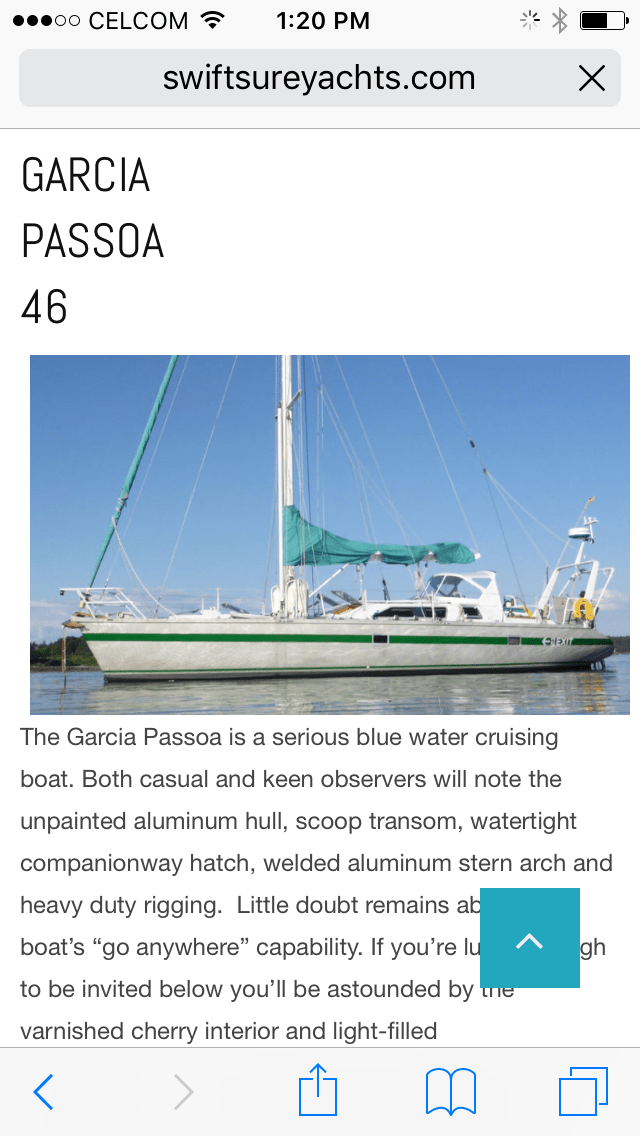
Almost exactly one year ago to the day, we had just booked our flights back to the U.S. from Borneo and were completing the last managerial tasks we had to perform before turning the reins over for good at Scuba Junkie. Ironically, we had also just saved a screen shot of a listing with Swiftsure Yachts of a Garcia Passoa 46 called Exit… obviously, wishful thinking at the time!
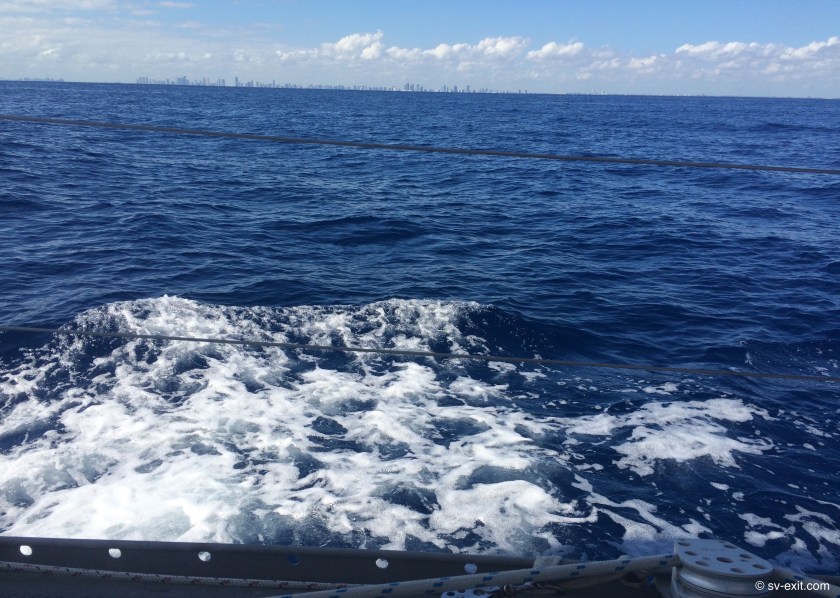
Now, as the sun crept across the clear afternoon sky, we inched our way across the gap between Florida and Bimini. Our depth gauge quickly displayed “- – -“ as we passed beyond its’ six hundred foot (or so) depth range. Our only reference came from our charts, which revealed that, beneath us, the ocean’s depths were increasing from one thousand to two thousand five hundred feet.
We hoped to sail for part of the passage; though our priority was getting across the Gulf Stream as quickly as possible. Once we had gotten beyond most of the northern pull of that current, we had all the time in the world.
Our literal last moment departure that morning at 10:00am had created a bit of a complication regarding our arrival at Bimini. Averaging five knots of speed, we expected it to take approximately nine and a half hours, which would mean arriving just after dark.
We had been warned by many people that navigating in anything but deep water, anywhere in the Bahamas, was a recipe for disaster. Random and uncharted coral heads dangerously near the surface require visual piloting anytime a boat is in shallow waters. And, unlike the forgiving mud of Chesapeake bay, running aground on coral would have much more dire and catastrophic consequences.
By nightfall, we were far enough east of the Gulf Stream and had made enough southerly progress that we were able to shut down the engine and sail throughout the night. We knew we would arrive well before dawn, but would just have to sail a few miles offshore until after sunrise.
The individual lights of buildings and towers dotting the Florida coast had disappeared from view hours ago. All that remained was a persistent glow on the horizon which could still be seen even as the gentle glow of Bimini slowly began to materialize. With seven to eight knot winds, we quietly sailed along, only occasionally seeing the navigation light of a boat well off in the distance.
The evening was uneventful until well after midnight when I began to track three different ships off both our starboard and port bow, on headings that looked like they would criss-cross well in front of us in opposite directions.
It wasn’t any big deal, but their movements began to make me suspect we may be approaching a shipping lane, which wouldn’t be ideal to navigate through for the remainder of the night.
I had been referencing the AIS to confirm the boats’ headings and speed, and was glad to have it available as another source of information. Shortly thereafter, I would eat those words as the electronics I was relying partially on were sucked into the Bermuda Triangle.
In hindsight, the first oddity may have occurred just after the three big ships passed in the distance in front of us. When I looked again at the AIS display, it indicated another ship I hadn’t seen before on the same course as the one that had just passed, only much closer.
Looking out into the night, I could see nothing at all where I anticipated a ship’s lights should be. Nonetheless, I was not at all reassured, given I could see the unmistakable AIS target clearly on the screen. Caution won over what my eyes were telling me. I decided a quick tack was in order.
I never saw the phantom ship; but there was little time to contemplate it as weather conditions quickly went from benign to feisty. The seven to ten knot winds jumped to thirteen and suddenly the mild rolling surge became three to four foot confused seas. When we reached nine and a half knots of speed, I chickened out and brought in the genoa.
I remember thinking to myself after getting in the genoa, this whole technical aspect of sailing seems to be getting a bit easier but the decisions that have to be made seem to be getting harder.
I began to notice multiple lights dotting the horizon around us. With some, I could make out green or red navigation lights, telling me their direction, but others were just a white light that I couldn’t even determine distance from.
Over the course of the next two hours, I grew more and more confused as the information I was getting from the AIS just didn’t match what I was seeing.
Eventually, we had eight different boats in all directions around us. It became impossible to tell which boat was which as the AIS seemed to actually contradict what I was thinking again and again. At one point, I hailed the ship SeaExpressII on VHF trying to ascertain their intentions as we seemed, on the AIS, to be at a constant ninety degree angle to them that was closing in distance.
Though I assumed they were the boat directly to my beam in the distance, their captain indicated to me in a very heavy accent that he couldn’t see me on his AIS and if I didn’t pass him starboard to starboard he’d have words with the Coast Guard.
Heavily fatigued and confused, I reluctantly woke Kris early to get her assistance.
Once we got visual bearings on what every boat was doing and began referencing our heading more closely, we started to realized that, not only was the AIS out of whack, but also all three chart plotters (including the independent Navionics on our iPad) were giving incorrect heading readings.
Using any GPS electronics, the heading which was supposedly taking us straight for Bimini, actually put the glow of Florida on our bow… all readings consistent… all wrong.
However, using both our main compass at the helm in the cockpit as well as our handheld compass, we were able to verify that all of the GPS electronics were in error by over one hundred degrees!
By the time I went to bed, the seemingly ridiculous amount of boat traffic seemed to be tapering off, and enough lit markers had been visually identified to give us confidence in our actual location.
I still was incredibly unnerved and perplexed by the whole affair, and continued to try to figure out what the fuck had just happened until Kris grew tired of my exhausted rambling and said, “Obviously something’s wrong with the electronics. We know where we are and where we need to be heading. Now go to bed!”
As usual, Kris’ logic won out. Still trying to wrap my brain around things, I finally climbed into bed at around 5:00am, probably still talking to myself about the Bermuda Triangle and that crazy green light I had seen that looked like a flare coming down into the water earlier in the afternoon… shit! I told myself I wasn’t going to mention that.
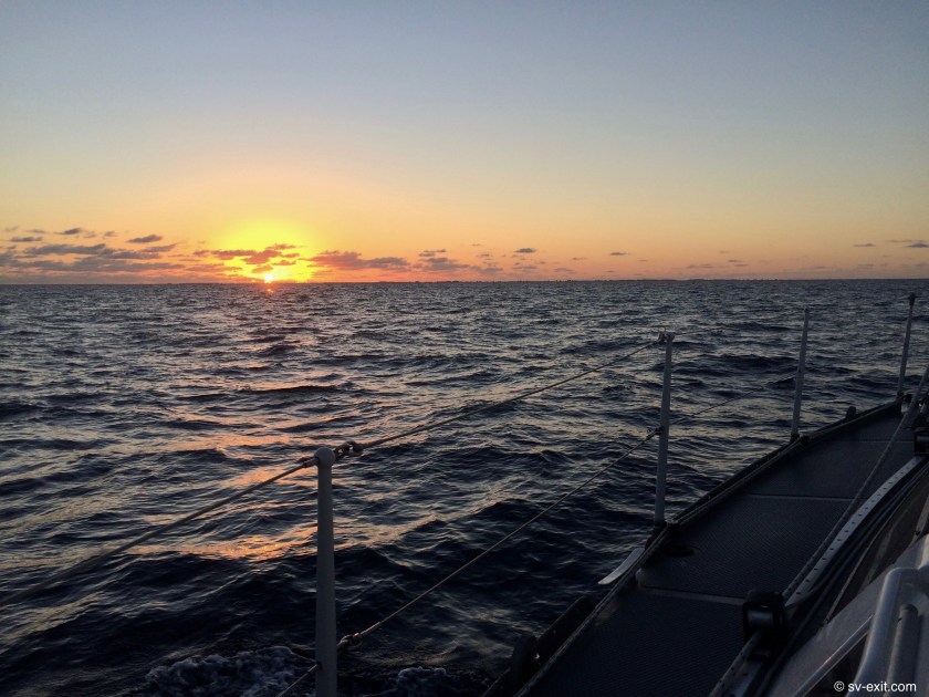
Just like Ft. Lauderdale, I awoke to Kris at the helm, circling the boat until I was rested enough to be functional again. Only now, it wasn’t Florida in front of us, it was the Bahamas.
Bimini sat in the midst of incredibly colored water. From deep blue, to turquoise, to white in the sandy shallows, it all stretched out before us.
There was a fair wind blowing; and the power boats, sailboats, trawlers, and mega-yachts moving in every direction made the entry into Bimini’s main harbor quite challenging, not to mention the missing or moved navigational markers that hadn’t been sorted out since the last hurricane.
We were flying the yellow quarantine flag, as is required when entering a new country; and one of us had to go ashore to clear Customs and Immigration before we could do anything else. But the marina that supposedly allowed boats to tie up temporarily to do just that wasn’t answering the VHF, and we really had no idea where we were going to anchor, so we just motored along the channel looking for potential spots.
Eventually, we came upon a small promising bay. The chart indicated it was a turnaround point for seaplanes that were landing and taking off, but a note had been added that it was a nice anchorage as long as you stay out of the seaplanes way… wrong!
As soon as we had set the anchor, a large Bahamian standing on the nearby dock started aggressively signaling for us to move on.
At the risk of being yelled at from a closer distance, we quickly dropped the dinghy into the water, and I motored over to have a very apologetic chat with the man.
As it turned out, he was exceptionally friendly. Though unyielding in regards to us not being able to stay at anchor in that location, he kindly let us remain long enough for me to catch a cab into town and clear Customs and Immigration. During this time, Kris had the unnerving pleasure of sitting in Exit’s cockpit watching small seaplanes land, taxi around us, and eventually take off in a flurry of noise and spray.
My cab driver, Scooper, advised me which were the best food shacks in the area, and informed me of all his conspiracy theories when he learned we had just watched SpaceX launch.
After successfully returning to Exit with all our proper documentation in hand, we picked up anchor, continued a bit further down the channel until it basically reached an end, and dropped the hook again.
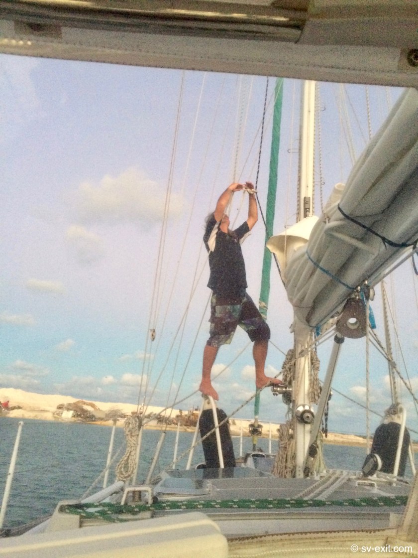
Nestled alongside a small island of holiday rental properties, just opposite a construction area that appeared to be where sand was harvested and loaded on a barge, and also the bay seaplanes that had to abort their takeoff ended up turning around in, it seemed as good a location as any.
As far as postcard perfect anchorages, I’ll admit it fell a bit short… but, then again, it is the Bahamas… and that qualifies as an exotic location. Now, after a nap, I can get to work on that fuel leak…