November 22, 2017
We opted to duck into Willoughby Bay, located on the South side of the harbor just behind the Norfolk Naval Base, when we arrived two days ago. It was nearby, well away from the shipping channel (which can get very bumpy due to boat, barge, and ship wakes), and reportedly offered good anchor holding.
Nearly the entire entrance to Willoughby Bay is only one to four feet deep, with the exception of a quite narrow channel that runs thousands of yards around the back of Willoughby Spit, guiding boats into the ten to fifteen foot depths of the bay itself. The boundaries of the channel are marked with buoys; entering the bay red markers designate the right edge of the channel and green markers indicate the left edge.
In retrospect, we should have better researched and studied the entrance before trying to navigate through it. However, our focus had become somewhat distracted on the overall approach into the Norfolk area, monitoring the boat and ship traffic, as well as the constant radio chatter.
The Waterway Guide made references to shoaling on the left hand side of the channel, and our Navionics charts even had updated information added on the charts reporting as little as 2 foot depths at points on the channel’s left hand edge.
We were caught us off guard when we noticed, shortly after entering the channel, one of the green markers ahead (that we would normally pass to the right of) appeared on the charts to be about eighty percent over on the right hand side of the channel. As this seemed quite irregular, confusion immediately set in followed immediately by a discussion.

Following a quick conference and look at the iPad screen, we concurred that while the placement of the marker seemed strange as Hell, it’s color dictated that we should squeeze all the way over to the right hand edge of the channel, keeping to the right of the mysteriously located green marker.
We had just passed the prior green marker and were less than halfway to the marker in question when Kris sounded the Oh Shit! alarm. By the time I had seen where she was looking and turned to face the cockpit instruments, the depth gauge had plummeted from twelve feet to five feet. Before I could even speak, the gauge dropped to four feet…
The instant drop of forward momentum and growing-more-familiar-each-time sound of the underside of Exit’s hull sliding along mud immediately preceded the depth gauge display coughing out “- – -“ in protest.
During both our previous too-close encounters with the Chesapeake bottom, I was at the helm. But, in both instances, we were lucky enough to be able to slide immediately back off into deeper water… this time we were stopped dead.
Kris gunned the engine and tried turning off both directions but nothing moved… same with reverse.
Our centerboard was partially down. Attempting to raise it at this point proved pointless as it was already in the mud; the line wouldn’t budge. Furthermore, because the centerboard pivots at the forward edge and swings downward from the back, if we continued to try to back off the bottom there was a high risk of simply jackknifing the centerboard open even more, causing it to jam further down into the mud… so forward it was.
They say that, because sailboat engines are often run for short periods of time and are typically operated only under very low loads, they can be plagued with a buildup of carbon inside the engine. Occasionally, pushing the engine to higher rpms (we typically motor at about 2000 rpm though our Perkins is rated for 4000 rpm) and running it under a higher load is actually good for it… they say.
Suffice to say, Kris initiated a thorough cleaning out of the old Perkins engine right then and there. Uttering a bevy of expletives, she must have blown most of the carbon right out of that engine as she pushed up the throttle. But, amidst the barrage of colorful language and roaring of the Perkins as the revs topped 4000, I’ll be damned if Exit didn’t start creeping forward a bit. As we ever so slowly inched off the shoal, we could start breathing again. But it would be fair to add that the Perkins engine settled back down well before Kris’ heart did!
She vowed never to traverse this channel again as we slowly made our way into Willoughby Bay, hugging the right side of the channel the entire rest of the way. Of course, that was merely wishful thinking as we would need to get back out of the bay via that same channel.
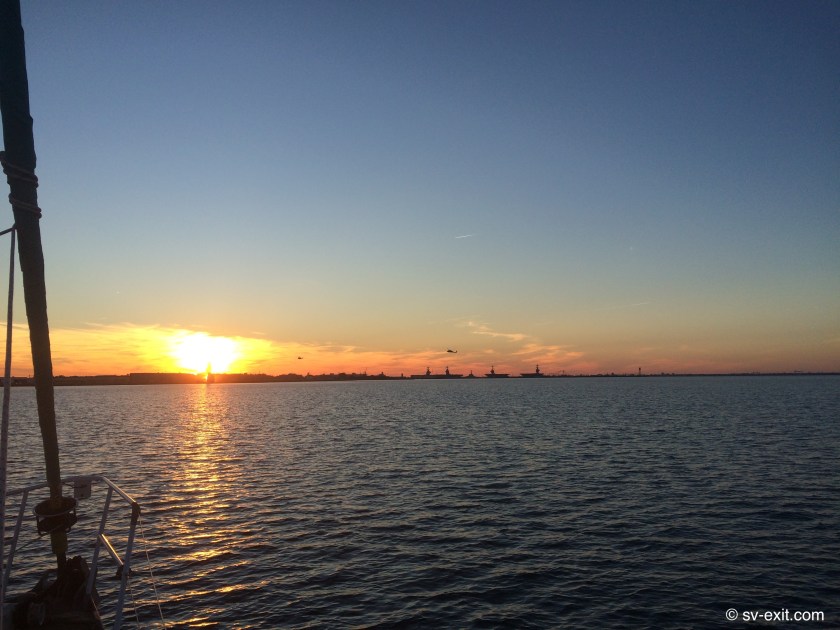
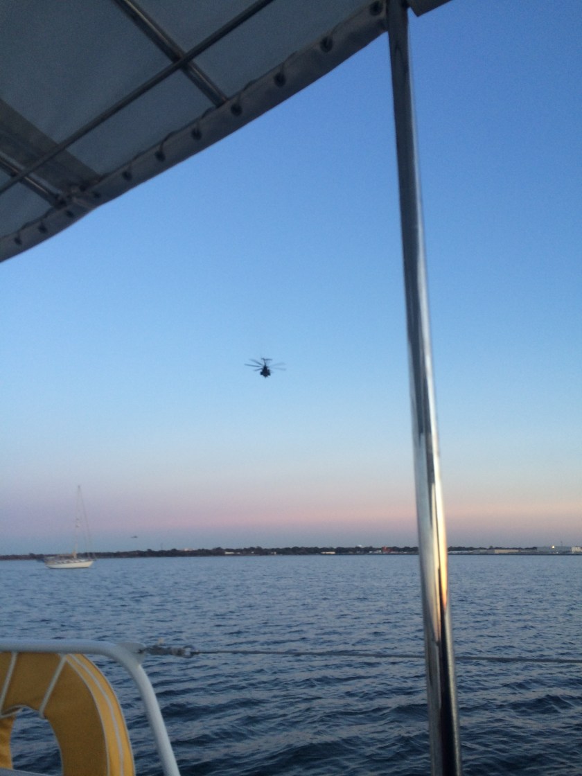
At the opposite side of the bay, the entire shoreline is comprised of tarmacs and massive hangers housing dozens and dozens of Naval helicopters. We dubbed Willoughby Bay “The Hornets Nest”, as there was a non-stop 24 hour agitated whirring and buzzing of helicopter traffic coming and going.
In addition, the Navy conducts daily helicopter training exercises over the water with frogmen. For hours on end, only a few thousand feet away from where anchored amongst a half dozen or so other sailboats, the training helicopter would circle around, descend to just above the water, drop a frogman into the water, lower a line while hovering above, pick up the frogman, then circle around and repeat the exercise.
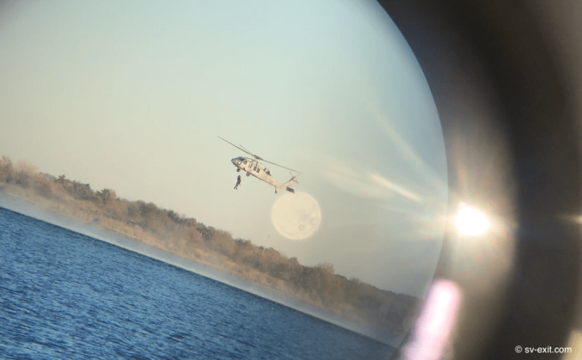
The prop wash from these helicopters can be 170mph; hovering as low as only about ten feet higher than our mast height, they are potentially a catastrophic risk to sailboats… essentially an extremely localized hurricane with big guns. We had heard about these helicopter exercises and obviously stayed well clear. Fortunately, the Navy was also very cognizant of the presence of nearby sailboats and avoided us during their low flybys.
The following day, we made it our mission to get to a marina. We were still good on water and fuel but could always use the opportunity to top up, just for good measure. However, our holding tank situation was now critical. Since our failed pump out attempt at Mobjack Bay, too many days had passed and we feared another overflow fiasco was eminent.
Of course, the marinas in Willoughby Bay didn’t have pump out facilities. This meant the closest options were back across Hampton Roads Bay, probably ninety minutes away… this also meant navigating the Willoughby Bay channel again.
On the way out, we hugged the channel’s absolute left-most sliver of edge we could maintain a line on, all the while creeping along in a state of total paranoia with eyes glued to both the Navionics screen and depth gauge. Kris vowed for the second time never to traverse this channel again!
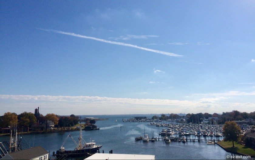
Ninety minutes later we made a pass by Blue Water Marina’s fuel dock, came back around, tied up, and viola! Diesel and water… no drama. The pump out would not be quite as simple.
Maryland pump out facilities almost always seemed to be located either along a long “T” at the end of the dock or, even better, right at your toe rail where ever you’re anchored when the pump out boat comes around!
Here in Virginia, placement seems to follow a strategy that favors a shorter plumbing route, locating the pump out machine close to land, on the bulkhead, or at a shoreside slip.
Getting back into the spot at Blue Water Marina was no problem – a ninety degree right turn off the fuel dock and straight back a few hundred feet. Getting out was possibly going to be a bitch. We really didn’t relish the idea of backing all the way out, but there was no possible way we were going to get turned around in that space. The overall width of the channel couldn’t have been much more than fifty or sixty feet, giving us a margin of less than ten feet on either side while broadside if we attempted a turnaround. That was a no-brainer!
In the end, we opted for the clever sure-bet over any claim of salty courage or seafarer’s prowess. Humbly requesting the assistance of two of the marina employees, we added a couple of extra long dock lines and physically walked Exit around in a 180 degree pivot… not pretty, but effective.
So we departed Blue Water Marina almost two hundred dollars poorer. But we now had 200 gallons of diesel in the fuel tank, both 100 gallon water tanks full, and (yay!) an empty 50 gallon holding tank – something we would come to fully appreciate as circumstances played out over the course of the next two weeks. And, as an added cherry on top of the sundae, Kris even sweet-talked the manager at the marina into letting us use their shower facilities… yes! A long… hot… shower!
On the down side, every potential anchorage around Hampton Roads we checked out was either too shallow, too narrow to put out enough chain, too much in the way of traffic, or already occupied.
This left us two options. Option One: take a chance on finding anchorage in one other area; but if we crapped out, the sun would be already setting, leaving us to navigate the harbor at night… not ideal. Or Option Two: return to Willoughby Bay and tuck in just in time for sundowners… Kris immediately saw through this rouse and recognized what Option Two really meant.
On the way in, as we hugged the channel’s absolute right-most sliver of edge we could maintain a line on, all the while creeping along in a state of total paranoia with eyes glued to both the Navionics screen and depth gauge, Kris vowed for the third time never to traverse this channel again!
The following day, one day before Thanksgiving, we left Exit at anchor after having another small pod of dolphins come swimming directly up to us while we sat in the cockpit. We headed ashore in the dinghy for what was only our second “touristy” activity in four months (the first was attending the Eastport/Annapolis Annual Tug Of War event just before departing). This excursion was to the Langley/NASA Museum in Hampton Roads which had amazing displays including actual fighter jets and helicopters hanging from the ceiling, lunar landers and planetary exploration craft, and even an IMAX theatre currently showing “Hurricane 3-D”, which couldn’t be missed. All that and a trip to the nearby grocery store… ya gotta love Uber!


We couldn’t help but notice when we returned to Exit how quiet it seemed the Hornet’s Nest had become. By nightfall, and throughout the night, the constant droning sound of helicopters we had become accustomed to ceased entirely. We surmised that Navy pilots were high enough up the totem pole that they must get at least two nights off for Thanksgiving.
Our plan was to set out Thanksgiving Day, make our way past Portsmouth and anchor before reaching the lock, just above the entrance to the long anticipated Dismal Swamp. This route would also require us to pass through our first lifting bridge, as well as a bridge with 65 foot clearance. We have been assured that our mast has a 63 foot clearance; but, up to this point, even 180 foot bridges seem close when traveling under them!
At 9:00am Thanksgiving morning, we lifted anchor and set off in search of the Dismal Swamp.
On the way out, as we hugged the channel’s absolute left-most sliver of edge we could maintain a line on, all the while creeping along in a state of total paranoia with eyes glued to both the Navionics screen and depth gauge, Kris vowed for the fourth time never to traverse this channel again!
…this time I actually believed her.