
November 20, 2017
Virginia is turning out to be more and more of a proving ground with each passing day. A number of times in conversation over the past few months we have heard the comment, “So this is your first boat and you’re heading down the ICW, eh?” We couldn’t figure out what they meant. After all, we weren’t headed offshore or north to Newfoundland.
But there are indisputable comforts, conveniences, and security blankets to be had in the relative safety of Maryland’s Chesapeake Bay, and the extensive river systems feeding into her, that we are quickly learning may not be universal.
All in all, really nothing more than growing pains, learning curves, and the initial shock of first time experiences that will grow easier to process, digest, navigate, and sometimes tolerate with repeated exposure.
***
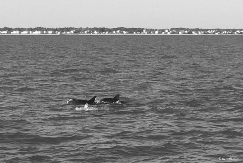
We had the incredible deja vu experience of a pod of inquisitive dolphins swimming just off our stern as we approached Norfolk. Although, my reaction to seeing them, as well as the noise one of them made as it surfaced, nearly caused Kris to have a heart attack. She was already on frayed nerves at the wheel trying to make sense of the shipping traffic and immediately thought a boat was coming up behind us!
After I received a smack for contributing to her pounding heart rate, we reveled in the dolphins’ company while they hung around us. There are a handful of creatures whom any interaction with is truly a magical experience, and dolphins have to be right up there near the top of the list. After a short time, the dolphins headed off and it was back to business.
Any traffic at all can be nerve racking when the traffic consists of cargo and cruise ships the size of a football field moving at 25 knots which can appear on the horizon in front of you and disappear on the horizon behind you in ten minutes time. Yet, we both were surprised with how little traffic we actually saw on the water as Norfolk grew near.
That having been said, Hampton Roads (right across the harbor from Norfolk) is home to the largest Navy base in the world. Once there, we knew navy patrol boats, aircraft carriers, destroyers, helicopters, and even submarines would be added to the list of potential encounters.
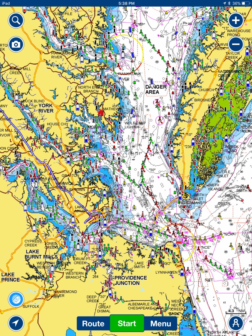
Paper navigation charts make the waterway entering Norfolk look like a confusing mess of markers and channels, though in reality it was quite straightforward. While I don’t buy the argument that paper charts are obsolete, the benefit of having our recently purchased iPad in the cockpit has become immeasurable.
The Navionics program that we use superimposes our GPS position onto a digital version of the paper chart that can easily be zoomed in or out for reference. That, in combination with looking around and actually seeing what is represented on the iPad screen, makes for much simpler and safer navigating. The iPad doesn’t blow away like a paper chart in the cockpit would, plus it displays the coordinates of our position and current speed, which we can compare to our onboard instruments.
As we crossed over the Hampton Roads Bridge Tunnel at the Southwestern-most tip of the Chesapeake Bay and entered the Hampton Roads Harbor, Norfolk to our left and Hampton Roads to our right, the four and a half month Chesapeake Chapter of our adventure came to an official close. From this point on, everything would be further South than we had ever sailed.
