December 10-15, 2017
By the time we reached Oriental, we had experienced enough navigating through ICW channels to satiate our appetite for as far as we could see into the future. Though we couldn’t wait to press forward, ironically enough, it was the open spaces and infinite number of isolated bays and river anchorages in the Chesapeake that we sincerely started to miss.
If a black-hearted blue water cruiser were cursed by the Devil, and banished to spend all eternity sailing an endless maze of narrow channels fighting tides, currents, limited anchorages, and negotiating bridges barely taller than the mast, that sailor would be sent to the ICW south of Oriental, NC.
We spent only two nights at Oriental and never stepped ashore. Just enough of a pause to meet up with with James and Dena, who we finally managed to rendezvous with for the first time since we were stranded with a broken raw water pump in Virginia, to talk about possible plans and drink far too much Kraken rum.
From Oriental, we made a small leap to Morehead City. With limited anchorages available and bridge schedules always affecting progress, we find ourselves often having to stop ten or fifteen miles short of where we’d like to get to, or having a ten hour day that stretches from sunup to sundown in order to make forty or fifty miles.

Currents, which are now reaching three knots both with and against you at times, as well as tidal changes of five feet that can control our ability to cross under bridges are always having to be taken into consideration. It is an immense difference from our initial experiences in the Chesapeake Bay area where tides and currents were almost non-existent.
Nonetheless, this is good as well as comparatively benign training for what is to come ahead. As we push farther south, currents will reach five knots at times and tides will change by as much as nine feet which will have profound impacts on our ability to safely move at times and anchoring location choices we will have to make.
It turned out to be good fortune that we arrived at Morehead City early. Just prior to reaching the city was yet another bridge with 65 foot clearance, and the present high tide put our mast within one foot of that… too close for us. We needed to turn around and wait until the tide dropped a bit.
This gave us time to check out a potential spot to anchor we had just passed up. The location we had scoped out earlier on the charts turned out to be far too small for us to be able to put out a reasonable amount of chain; in fact, it was barely wide enough to get turned back around in! But it did take us long enough that, by the time we got back to the bridge, the tide had dropped enough for our psychological wellbeing to proceed.
The only other option for anchoring was off a channel between Sugar Loaf Island and the marinas on the opposite shore. It was a quite limited area and already had eight boats occupying space there, two of which were wrecks on the shore and two sat at anchor, barely afloat, decks covered with bags and possessions that looked like they had sat for months. Derelict corpses, they now served only as depressing memories in the aftermath of Hurricane Irma.
Trying to stay well away from the other boats, we ended up testing the limits of our draft by anchoring in a spot that put us swinging in three knot currents into an area that dropped to only four feet deep at low tide. While sitting only six inches above the bottom didn’t do much to help us sleep that night, it did wonders to boost our deep commitment to Exit’s shallow draft.
Anchor up first thing in the morning and, once again, we were pressing forward in North Carolina. It would have been nice to spend more time going ashore and exploring more of the surrounding towns and their histories, but the end of the year is bearing down on us.
Our late start has meant we need to forego a lot of sidetracking options as we pass from state to state down the East Coast, but we can feel the December weather becoming more and more hostile. Good weather windows seem to be farther and fewer in between. The weather here is certainly better than what Annapolis is currently facing. Still, there is no doubt that the cold is stalking us from behind; and often it seems to be overtaking us.
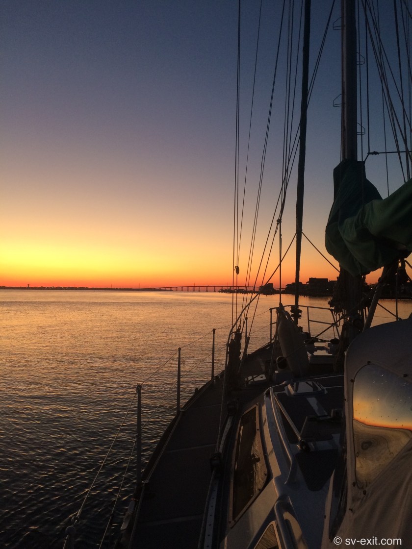
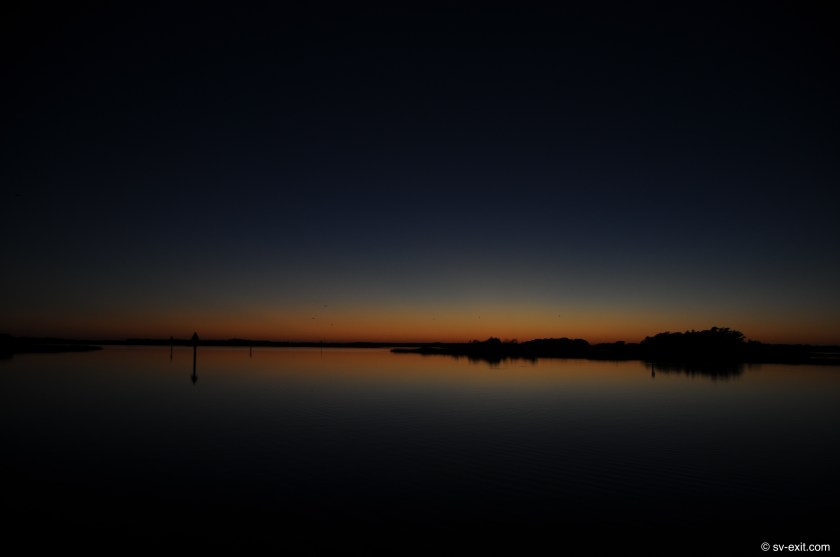
The destination by day’s end was Mile Hammock Bay, a truly unique anchorage. It was a long day of motoring between red and green markers… straight… red and green markers… turn… red marker… straight… red marker… straight… green marker… straight… on… and on… and on.
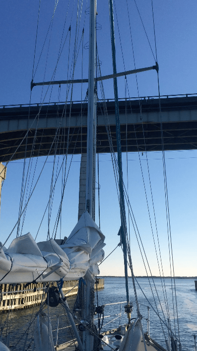
And bridges… always the bridges. Even more difficult to work around than bridge clearances are scheduled bridge openings. If you have the luxury of a requested opening, then no problem. But many of the bridges will not open during morning or afternoon rush hours, and many more only open every half hour or even only on the hour.
There is a lot of estimating and guessing involved in trying to time arrivals to coincide with bridge openings during the day. Multiple best estimates result in the frustrations of just missing a swing or lift bridge opening, or having to slow our pace to three knots so we don’t arrive at a bridge forty minutes prior to a scheduled opening on the hour.
Very few things raise the adrenaline rate like being forced to try to maintain a stationary position for more than half an hour in a current trying to carry you towards a giant iron bridge with only fifteen feet of vertical clearance when closed.
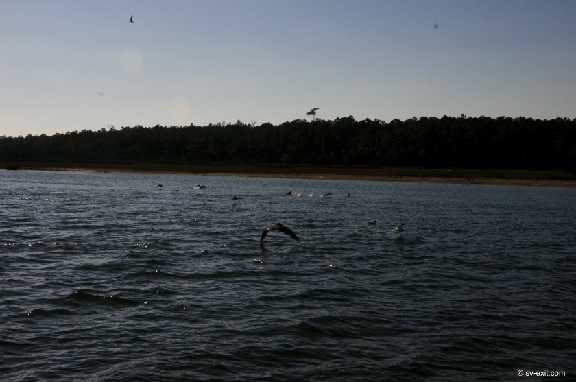
As we made our way down the channel, dolphins approached. Exit provided a momentary distraction for them as they inquisitively played around us for a few minutes, then continued on in the opposite direction we were going. And on we continued… past marker… after marker… after marker. Green… straight… red… ten degrees to port… straight… red… straight… red… gentle ninety degree turn to starboard… straight… green marker… straight…
Then… signs began to appear along both shores… every hundred meters or so at times. We had seen lots of real estate signs along the way, and even some signs indicating restricted military areas, but these were much less ambiguous.
They read, “KEEP OUT – Live ammunition” , “KEEP OUT – Unexploded ordnance”, and “When lights are flashing – Live Fire Exercise in progress”.


The ICW cuts through Camp Lejeune, the United States Marine Corps’ largest training reservation in the world, which encompasses an eighteen mile area including the shores running along either side of us. We had heard that, on occasion, boat traffic was delayed due to live fire exercises, but this was not the case today. In fact, the only Marine we interacted with along the way was the person who opened the bridge for us at the Onslow Beach Swing Bridge.
However, the mangled hulks of smaller armored vehicles, which were riddled with the holes of small to medium sized rounds of ammunition, as well as the outlines of tanks across the horizon line on the shores of the small outer islands, and the intermittent appearance of groups of Marines onshore, building what appeared to be targets or staging areas for the next round of exercises, all testified as to the liberal amount of ammunition utilized by the USMC during training exercises.
We steered into Mile Hammock Bay, a large open area just off the ICW at which is located a massive staging area for Marine exercises and thousand foot wide launching ramp for amphibious craft.


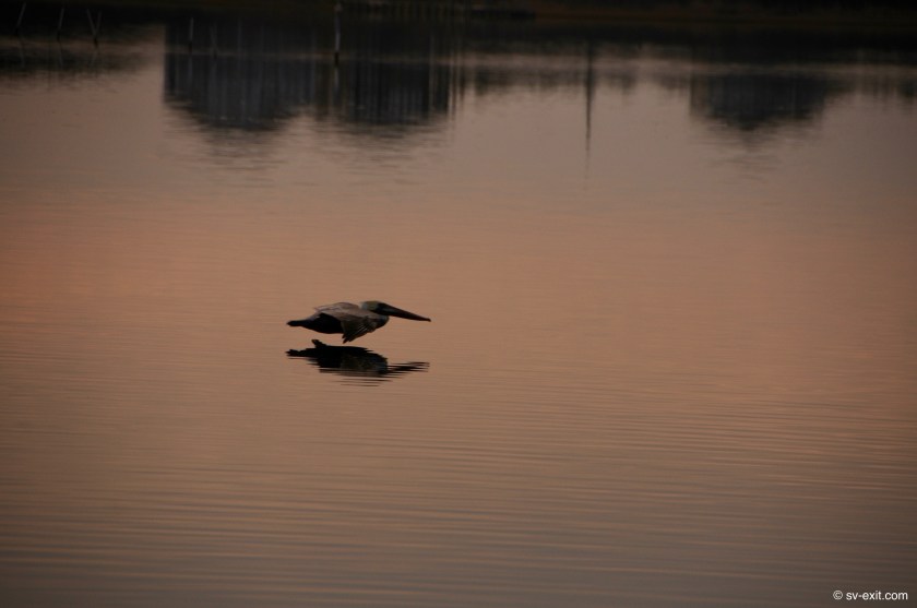
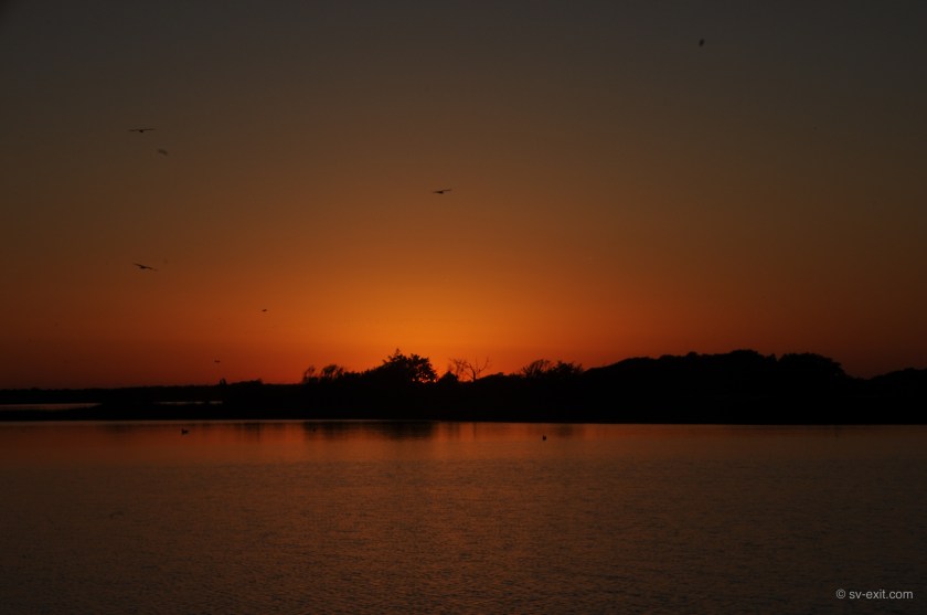
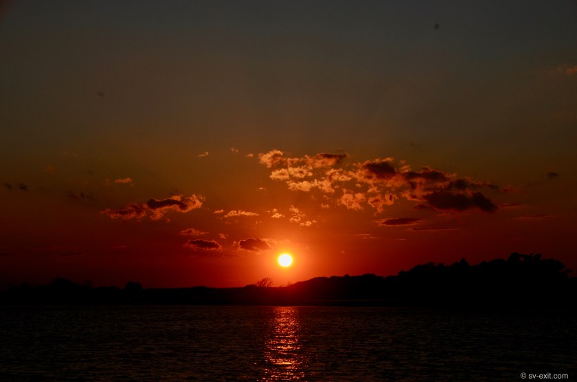
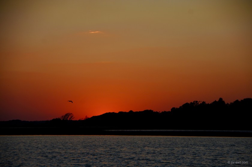
Once again, we met up with Dena and James, who had arrived before us, and proceeded to consume far too much Kraken rum while watching the dramatic silhouettes of pelicans hunting against a stunning sunset.


James and Dena left the following day. They had a secret anchor spot ahead just large enough for their boat. We decided to stay put. Another weather front was bearing down on us and the forecast called for heavy winds and shitty conditions for the immediate future. Rather than take a chance on finding something farther along, we concluded that we were in as good a spot as we could hope for, so best to wait it out where we were.
What that meant was, for 24 hours, we had the bay all to ourselves. Well… more accurately, we were the only boat there. There was also a brigade… or company… or platoon… a something of Marines ashore. With a lot of people, came trucks and a backhoe.
They arrived in full combat attire. After setting up an armed perimeter onshore complete with sniper, the Marines built what appeared to be a command post tent surrounded by razor wire; then sent patrols out into the surrounding area for the next couple of days. All the while, this was accompanied by the sounds of explosions in the distance, occasional helicopter traffic, and Marine RIBs patrolling the river just outside the bay.
To say the least, it was quite surreal sitting at anchor in the midst of all this, watching like the proverbial fly on the wall.

For four nights, we sat at Mile Hammock Bay awaiting the crappy weather to pass, until another window opened up allowing us to continue in reasonable weather.
At one point, we were startled to see a mahoosive barge being pushed by Coast Guard tug boat enter the bay. With us watching anxiously, it slowly circled around us. Once it was between us and the shore, it lowered four giant posts, or spuds, attached to the tug and barge. They jammed down into the bottom, effectively securing the barge and tug in place. The tug remained there overnight, looming beside us with penetrating spotlights trained on the barge, and then departed the next day… very strange.

After four days, the weather cleared up enough for us to pick up anchor and make for Wrightsville Beach, thirty five miles to the south.
As we continue further and further south, we are finding that increasing tidal ranges and the resulting currents can cause extensive shoaling in the rivers. Consequently, navigational markers may be moved; or worse, actual depths both inside and outside the channels may not match the charts – both of which can lead to navigational moments of acute confusion.
We have to be ever vigilant of the depth gauges in Exit’s cockpit. Running aground in this area, which has been likened to running into a bowl of pudding, is a much more forgiving prospect than running aground on rocks or coral. Typically it is more damaging to one’s schedule than one’s boat.
Nonetheless, as a rule, we try to avoid it.
In fact, when we are navigating in waters where depth issues are a potential concern, we leave the lifting line for our centerboard attached to a winch. If we have a situation where the depth gauge unexpectedly drops below eight feet, we can initiate an “emergency raising” of the centerboard. In about fifteen seconds, we can decrease Exit’s draft from the six or so feet we normally have with the centerboard partially lowered to three and a half feet with it raised completely… an added insurance policy for a “didn’t see that one coming” situation.