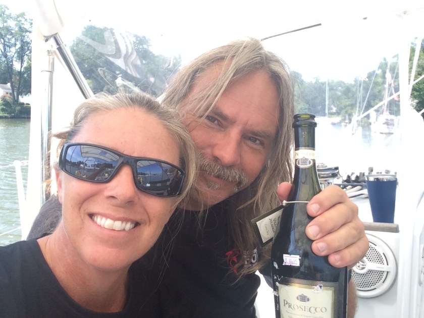
We have been told cruising aboard a sailboat is performing endless repairs in exotic locations.I don’t think this was the exotic location that was envisioned.
The location of our breakdown could have been much, much more dire.The timing of our breakdown, however, couldn’t have been orchestrated at a worse time.Because of the Thanksgiving holiday, we had to sit from Thursday until Monday before we could speak to any human on the phone that could check stock, take an order, or ship parts.
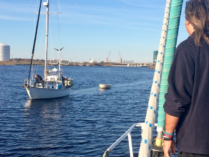
Sunday afternoon James and Dena, aboard S/V Nomad, who had left Annapolis shortly after we did, arrived at our location.Lacking a spare raw water pump for a Perkins engine aboard their boat, all they could do was offer a cheerful greeting and moral support as they sailed past.We vowed to catch up.
James capturing the moment from the deck of S/V Nomad
The photo James took
Left in Nomad’s wake
Monday finally came.We had not left the boat.There had been no problems; at least after four days we knew with confidence that our anchor was well set.Undoubtably, passing power boats, because of their wakes, caused the most pitching about for Exit.But it was the passing tugs pushing barges, especially at night, that we found to be the most intimidating.You could hear them coming, even over the din of the I-64 Bridge noise.Oftentimes, it was the flood of a powerful spotlight beaming in momentarily through the windows indicating the tugboat captain had seen us at anchor.
After four days, we were starting to go a bit stir crazy not making any progress.
The scenic side of the shoreline
When we finally were able to start speaking with people on the phone Monday morning, as was already expected, the pump was readily available;it was the damn drive coupling, specific to the Perkins engine, that was not so easily located.
We called TowBoat U.S. to find out what our options were; but, after talking to them, we decided to stay put where we were.A tow could have been arranged, and we were even insured for it, but the only option would have been to get a tow to a marina which would then charge us $100 a day to tie up at.We rolled the dice on still being able to work through this ourselves.If necessary, we could arrange for the tow later.
Finally, by the end of Tuesday, we had mixed news from Trans Atlantic Diesel, in Virginia.We were ecstatic to receive confirmation that the parts we needed had been located and ordered.On the other hand, we were mortified to learn that it would be two more days before they received the parts and another day before we got them (any later and we’d have to wait through another weekend, which we did not want to think about).
Waiting for parts was nothing new, even for us.At least we weren’t looking at six weeks again!But, after four days of sitting already, we hoped things would materialize with a bit more haste.
In the interim time, we needed to sort out where we were going to get the parts shipped to, once Trans Atlantic Diesel had them.“S/V Exit, at anchor 1000 feet North of the I-64 Bridge” just wasn’t gonna cut it for UPS.Our best bet was Chesapeake Yachts, a small yard right on the other side of the I-64 Bridge, which had a long dock accessible to our dinghy, unlike the barge docks across the river.
After calling and explaining our predicament, the initially suspicious Vice President of Chesapeake Yachts, Kymberly, grew sympathetic and offered to let us tie our dinghy to their dock and ship the parts to the office there.
Considering we hadn’t stepped off the boat since Hamptons Road, a week ago, we took the opportunity Wednesday to go ashore and catch an Uber taxi to pick up some provisions and extra tools that were obviously going to be needed over the long term.
Passing through the Gilmerton Lift Bridge, which had very kindly been raised from thirty five to seventy three feet for us, we still seemed to have barely enough room to squeak under. This did not bode well for our overall blood pressure.
This slideshow requires JavaScript.
It had taken us only three hours to get here. On the up side, we had made great time and experienced no navigational issues along the way. On the down side, that efficiency had our arrival coinciding with the highest point of a very high tide.
We figured that we still had about ten minutes before reaching the I-64 Bridge, so we continued on, with the intention of at least sussing out what lie ahead before deciding how to proceed.
Our Perkins engine control panel, mounted just below the main hatch behind the first companionway step, has a buzzer that sounds when ignition key is in the “on” position just before hitting the start button and after shutting it down. If you are prepared for it, the sound is merely annoying. If the engine alarm suddenly triggers while you are underway, the the incessant buzzing immediately has a more pressing and more ominous overtone to it.
When the engine alarm buzzer sounded moments after we passed under the Gilmerton Lift Bridge, it was one of those WTF? moments.
A quick check revealed an engine temperature red light, which was confirmed by the position of the needle on the temperature gauge, just left of the light. We had no choice but to immediately shut down the engine rather than risk causing far more serious damage.
With the engine shut down, we were merely coasting along. Our speed hadn’t died immediately so we still had steering and there was no wind to speak of that could push us sideways. If there was any current at all in the water, it may have been helping us to continue forward momentum.
No boat traffic to be seen in front of or behind us meant we had some time to sort things out. However, our speed had already started dropping, so the first priority was getting up some sail so we could maintain helm control. The genoa is a huge sail but it is on a roller fuller, and far faster to deploy than the mainsail; so we decided to unfurl just enough of the genoa to keep us moving.
Immediately ahead of us was a decent sized area off to the side of the shipping channel. I suggested we temporarily drop the anchor there, but Kris noticed on the charts that it was actually a turning area for the tugs and barges. So we continued onward until we reached the last option… a space to the right of the channel just opposite a large industrial dock.
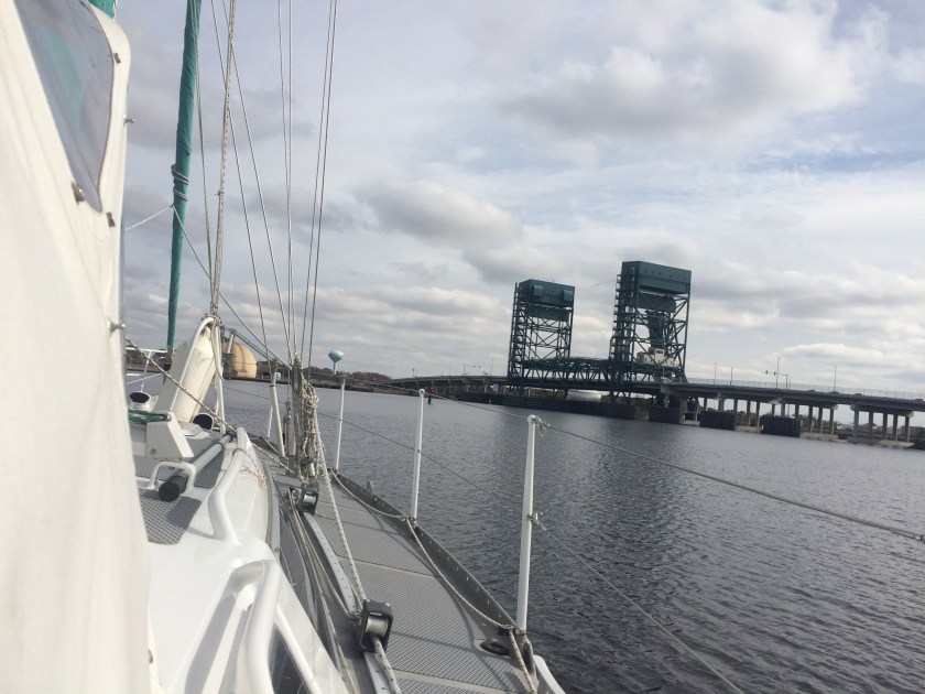
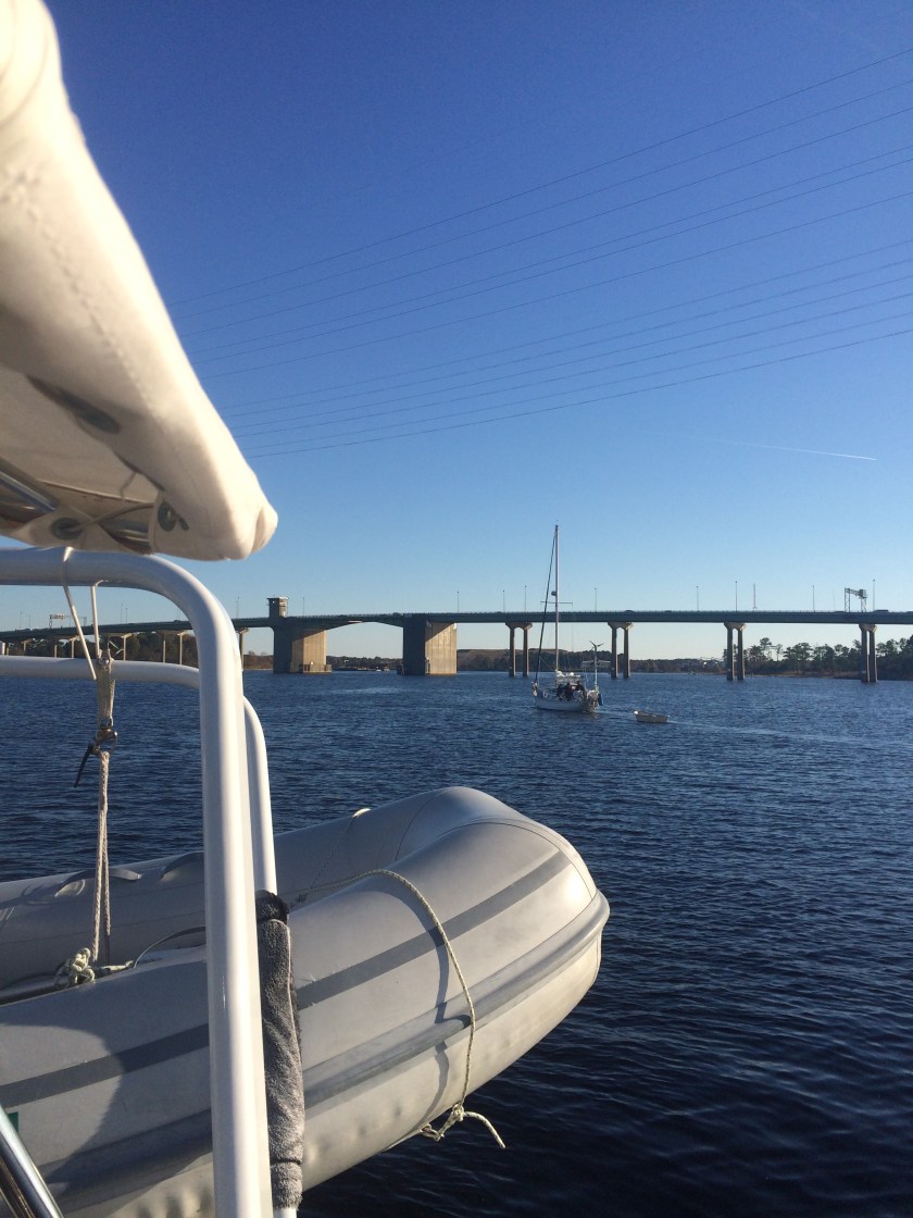
Only a thousand feet further ahead, loomed the Interstate 64 Bridge with its reported 65 foot clearance… we had no intention of sailing under that bridge. I hustled to the bow and dropped the anchor with only about ten meters of chain out – just enough to temporarily keep us safely in place so we could focus on the ailing Perkins.
Once the engine cooled off and both the oil and coolant levels checked out ok, we started the Perkins again. It fired up without any hesitation; but, we immediately noticed there was no water coming out of the exhaust port (a rookie mistake that we didn’t notice that immediately after hearing the temperature alarm, before shutting off the engine).
As is typical of many marine engines, our diesel has an internal freshwater coolant circuit which also utilizes a separate raw salt water circuit to assist in temperature control (instead of a standard radiator and fan like a car). Sea water is pumped into the engine and then spit out an exhaust port. It would be ok running our cool engine for a short period without the raw water system but the rubber impeller inside the pump which forces the salt water through can disintegrate in less than a minute if allowed to run dry. So, assuming that our impeller had no water getting to it, we had no choice but to shut down the engine again.
Then… began the process of troubleshooting.
The obvious suspect was the impeller itself. We had found a plethora of spare impellers in one of the lockers when we conducted our initial inventory of Exit while on the hard. But, I must confess, having hoped to gain the assistance of someone who knew exactly what they were doing the first time I tried a switchout, the impeller had not been changed since we climbed aboard.
So be it… no time like the present. Now would be the time to learn.
The process was rather straightforward, if not messy. With the guidance of the Perkins Diesel Shop Manual (graciously left on Exit) and my Nigel Calder mechanic’s bible (which explains how to fix nearly everything on a boat), I got the old impeller out and, sure enough, it was in pretty bad shape. Eventually, I emerged from the engine compartment cramped, sore, and aching… though, victorious. Exit had a brand new impeller and now we could get moving again.
Confidently, we turned the key and the old Perkins revved to life. But, alas… as hard as we looked and as much as we willed it, no water came out of that damn exhaust port… shitballs!
Back to the drawing board… now, on to find Problem #2.
A blockage preventing the raw water from flowing seemed like the next likely candidate. So, the next step was to start at the through hull (*see inset below) and work forward, disconnecting hoses to try to verify how far the water was getting. After wrestling with what seemed like endless double hose clamps and stubborn hose ends, I determined that raw water was getting to the pump (which housed the impeller) but not any further.
Through Hulls & Seacocks
A through hull is one of many intentional holes put in the side of the boat (literally through the hull) below the waterline. It is connected to a manually controlled open/close valve, or the seacock. This allows sea water, or raw water, to be plumbed to various places on the boat for different purposes including engine or generator cooling, water makers, raw water plumbing options for the sinks/toilet, deck hoses (for cleaning anchor chains or the decks), and even salt water showers for above or below deck.
In the case of engine and generator cooling, sea water is used to cool the freshwater cooling system and is an integral part of the system. Without the raw water flow, the engine overheats.
In the case of plumbing, typically the idea is to utilize the endless supply of water outside your boat as much as possible and, in turn, minimize the use of your very limited and precious fresh water supply aboard.
I recently saw a statistic that the average American uses approximately one hundred gallons of water per day!!! We have the benefit of a pair of one-hundred gallon water tanks aboard Exit, which is actually a quite a lot of water to carry on a sailboat of this size. Obviously, we have modified our water habits substantially enough that we don’t have to fill the tanks every day. However, I doubt we will acheive the Spartan level of consumption reached by some liveaboard cruisers of less than one gallon of freshwater used per day per person… at least any time in the near future.
I was 100% certain that I had installed the impeller correctly… but I had also just yesterday read that the hardest error to recognize is when your memory of how to do something correctly is faulty, because you’re sure you’re doing it right (words spoken by the guru himself, Nigel Calder). So, certain I had done it right, I began to second-guess whether or not I had actually done it right.
But, when I removed the hose connected to the pump’s output and had Kris turn over the engine, it became apparent that the impeller wasn’t even turning!
Off came the impeller cover again. Everything looked ok… which meant the pump was going to have to come off.
Removing the raw water pump revealed the end of the camshaft which, thankfully, did turn freely when the engine was turned over. But, it also revealed the end of the pump’s drive shaft and the metal drive coupling bolted to the end of the camshaft – both of which were completely trashed. The rectangular metal tab on the coupling had basically been lathed into a round post over ten or more years use by the slotted, and now very damaged, pump drive shaft… shit!
Coupler from pump to camshaft
The coupler I removed…
… and the spare I found
A brief rummaging through the parts lockers uncovered Exit’s original raw water pump, which had exactly the same damage to it; but no spare pump we could use was to be found. Had this been an emergency, we may have been able to “McGyver” a temporary solution, allowing us to get out of a tight spot and limp into a marina, by re-routing our raw water deck/anchor wash pump to supply the raw water for the engine.
What I was hoping to find…
The drive shaft on our pump
And the same damage on a spare
As it was, the situation certainly wasn’t ideal but it was far from an emergency.
At our location, the river was only about 800 feet wide, and probably 500 feet of that was taken up by the shipping channel and the docking area for the barges directly across from us, which left us with about 300 feet of space between the buoy, beyond which barges would be passing, and the shoreline.
Seems like quite a bit of space, initially. But, at anchor, we have to leave room to swing potentially 360 degrees around. Exit’s length creates a one hundred foot circle, not including the length of anchor chain that has been paid out. Considering our proximity to a busy shipping lane, and the unknown effects changing currents or wind would have funneling through, we thought it prudent to have at least sixty feet of chain out. This made the perimeter of our anchor circle now 220 feet, potentially putting us within about forty feet of the shore or forty feet of the shipping channel, depending on the wind. Just enough room to squeeze in… it seemed.
The one absolute certainty we faced was that there was no way in Hell we would be locating a replacement raw water pump and drive coupler on Thanksgiving Day. Progress on the engine would be at a standstill until parts could be located. This was going to be our Thanksgiving anchorage.
So we put out sixty six feet of chain, or twenty meters, confident that our scope was sufficient. At the same time, we cringed at the fact that, without an engine, we could not back down on the anchor to properly set it. For the first time, we’d have to have faith that our trusty 55 pound Rocna anchor would set itelf. No worries… we were outside the shipping channel, on a secure anchor not going anywhere, and relatively protected from any wind or weather caused wave action.
Sitting in the cockpit, having post-anchor beers, the scene was truly surreal.
On the opposite side of the channel, industrial docks stretched all the way around the bend to our left.
Just across from us, gigantic barges and stout tugboats were tied up to a huge ten foot tall dock. Sections of steel piping that had to be fifty feet across were offloaded from one barge by a massive crane.
The I-64 bridge, a thousand feet to the south, buzzed and hummed like an angry beehive with non-stop traffic.
And, every so often, a barge that could probably fit fifty Exits side by side on its’ deck, would pass by, propelled through the water by a stocky four deck tall tugboat.
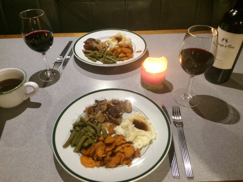
It was our first Thanksgiving aboard Exit; and, despite the current situation, we certainly felt we had a lot to be thankful for. Kris’ experimental holiday dinner was a smashing success – “fake duck”(a soy based product), or F-uck as we were introduced to it as by James and Dena, really did have the texture and taste of duck.
So, there we were – at anchor on our sailboat enjoying a “Thanksgiving F-uck in the industrial park”. People keep saying it’s livin’ the dream… well it’s a pretty fucking weird dream!
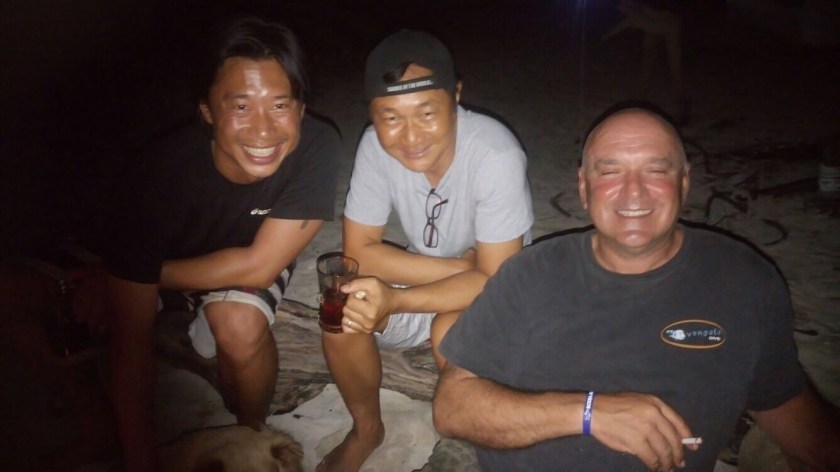
Old SJ family (Luke, Thien and Simon) celebrating Thanksgiving 2017 half a world away
We didn’t want to get too late of a start Thanksgiving Day, but we also didn’t have that far to go. With no idea of what we would encounter for boat traffic, we estimated at least three hours and no more than five hours to get to the bridges, which was not ideal timing-wise. But it would give us a minimum of two hours at the other end to sort out an anchorage just above the lock before sunset; and that would prepare us for a leisurely motor through the Dismal Swamp the following day.
The chart designated “65 foot bridge clearance” of Interstate 64 is based upon the average high tide. At noon on Thanksgiving Day, the actual high tide would be one-tenth of a foot higher than that… not a problem. But Kris and I did discuss the fact that, when talking about having only two feet of clearance below sheering off all of your masthead electronics, suddenly any extra space you can gain by a falling tide would be, at least, psychologically significant.
So we found comfort in the fact that, from noon forward, we would be gaining extra bridge clearance thanks to a falling tide.
As we worked our way through the massive main harbor area of Norfolk we were immediately struck by how little boat traffic we encountered. Navy and commercial ships, tugboats, huge barges, fishing trawlers, private powerboat and sailboats that were all expected could be counted on our fingers today. If we were lucky, our holiday timing would provide both minimal traffic and minimal stress.
As we rounded Hospital Point, we also reached Mile Zero, the “official” beginning of the 1,243 mile long Atlantic Intracoastal Waterway which we had actually already been following since departing from Annapolis.
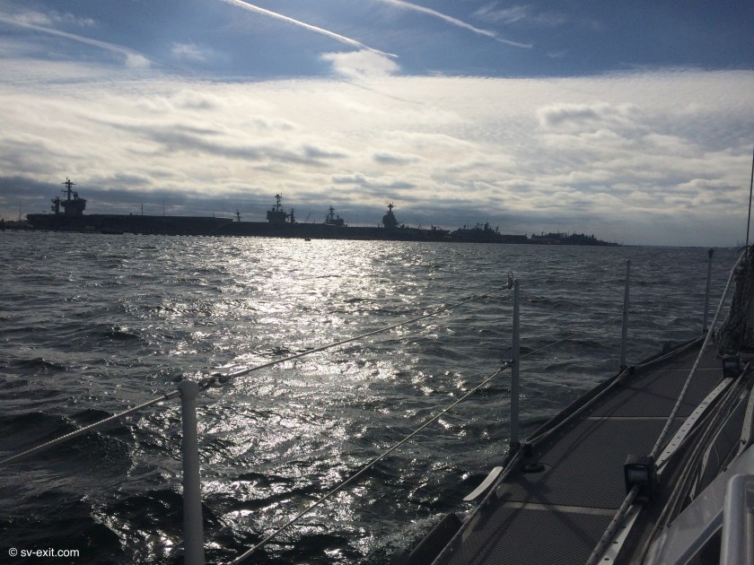
We motored steadily along at about five and a half knots, passing through a very surreal environment. As we came around the first bend, to our left stretched a line of a dozen or more behemoth Navy ships secured to the docks side by side – four aircraft carriers, destroyers, supply ships, even a surgical hospital ship; all towering above us as we passed each one. Cruising past the largest naval installation in the world, and homeport for the U.S. Navy’s Atlantic Fleet, aboard a forty six foot sailboat was both quite intimidating and exhilarating.
Pelican patrol
Easily distracted
Intimidating view out the port
Aircraft carrier docked
Continuing forward, naval vessels became scattered amongst more commercial looking ships at rest to either side of us. However, regularly spaced signs constantly reminded us that we were passing a Naval Facility – No Trespassing. The signs, as well as the Navy patrol boat with flashing blue lights at rest alongside the channel (identical to one that continually patrolled up and down the bay in front of the helicopter hangers at Willoughby Bay), provided enough deterrent from considering any shore landings.
It must have been after somewhere between ten and fifteen miles that the shoreline began to take on a much more commercial and industrial appearance. Naval vessels, which had overshadowed everything else, began giving way to Goliath barges and cargo ships. Towering cranes and strange, monstrous wheeled machines lined the docks. Piles of steel piping, mountains of coal, stack upon stack of shipping containers, dwarfed only by their own staggering numbers – quite the change in scenery for us from the week just prior. Overshadowed only by the military’s continued presence, the merchant fleet’s endless loading and unloading hundreds of thousands of tons of cargo at a time dominated our attention from every direction.
Gilmerton Bridge… our official baptism through a lifting bridge (that wasn’t already up). Really, it’s probably not going to make anyone’s Top Ten list of undertakings. But, there is still a certain sense of awe to be had in calling the tender in the bridge control room on VHF radio to arrange for the bridge to open, allowing your sailboat to pass. There is a certain mystique in stopping both directions of vehicle traffic, just to make room for your mast. Ten years ago I might have been one of the people cursing the inconvenience of being stopped for the whims of a sailboat.
Gilmerton Lifting Bridge
The Gilmerton Bridge Tender working the 8 to 5 shift on Thanksgiving Day couldn’t have been a more friendly person to interact with. And Hollywood couldn’t have provided a voice-over with a more authentic sounding Southern Belle accent than the voice of the woman we spoke with. It was a good thing, too; because we’d need definitely need to be in a calm state of mind five minutes from now…
We opted to duck into Willoughby Bay, located on the South side of the harbor just behind the Norfolk Naval Base, when we arrived two days ago. It was nearby, well away from the shipping channel (which can get very bumpy due to boat, barge, and ship wakes), and reportedly offered good anchor holding.
Nearly the entire entrance to Willoughby Bay is only one to four feet deep, with the exception of a quite narrow channel that runs thousands of yards around the back of Willoughby Spit, guiding boats into the ten to fifteen foot depths of the bay itself. The boundaries of the channel are marked with buoys; entering the bay red markers designate the right edge of the channel and green markers indicate the left edge.
In retrospect, we should have better researched and studied the entrance before trying to navigate through it. However, our focus had become somewhat distracted on the overall approach into the Norfolk area, monitoring the boat and ship traffic, as well as the constant radio chatter.
The Waterway Guide made references to shoaling on the left hand side of the channel, and our Navionics charts even had updated information added on the charts reporting as little as 2 foot depths at points on the channel’s left hand edge.
We were caught us off guard when we noticed, shortly after entering the channel, one of the green markers ahead (that we would normally pass to the right of) appeared on the charts to be about eighty percent over on the right hand side of the channel. As this seemed quite irregular, confusion immediately set in followed immediately by a discussion.
The Willoughby Bay channel marker of confusion
Following a quick conference and look at the iPad screen, we concurred that while the placement of the marker seemed strange as Hell, it’s color dictated that we should squeeze all the way over to the right hand edge of the channel, keeping to the right of the mysteriously located green marker.
We had just passed the prior green marker and were less than halfway to the marker in question when Kris sounded the Oh Shit! alarm. By the time I had seen where she was looking and turned to face the cockpit instruments, the depth gauge had plummeted from twelve feet to five feet. Before I could even speak, the gauge dropped to four feet…
The instant drop of forward momentum and growing-more-familiar-each-time sound of the underside of Exit’s hull sliding along mud immediately preceded the depth gauge display coughing out “- – -“ in protest.
During both our previous too-close encounters with the Chesapeake bottom, I was at the helm. But, in both instances, we were lucky enough to be able to slide immediately back off into deeper water… this time we were stopped dead.
Kris gunned the engine and tried turning off both directions but nothing moved… same with reverse.
Our centerboard was partially down. Attempting to raise it at this point proved pointless as it was already in the mud; the line wouldn’t budge. Furthermore, because the centerboard pivots at the forward edge and swings downward from the back, if we continued to try to back off the bottom there was a high risk of simply jackknifing the centerboard open even more, causing it to jam further down into the mud… so forward it was.
They say that, because sailboat engines are often run for short periods of time and are typically operated only under very low loads, they can be plagued with a buildup of carbon inside the engine. Occasionally, pushing the engine to higher rpms (we typically motor at about 2000 rpm though our Perkins is rated for 4000 rpm) and running it under a higher load is actually good for it… they say.
Suffice to say, Kris initiated a thorough cleaning out of the old Perkins engine right then and there. Uttering a bevy of expletives, she must have blown most of the carbon right out of that engine as she pushed up the throttle. But, amidst the barrage of colorful language and roaring of the Perkins as the revs topped 4000, I’ll be damned if Exit didn’t start creeping forward a bit. As we ever so slowly inched off the shoal, we could start breathing again. But it would be fair to add that the Perkins engine settled back down well before Kris’ heart did!
She vowed never to traverse this channel again as we slowly made our way into Willoughby Bay, hugging the right side of the channel the entire rest of the way. Of course, that was merely wishful thinking as we would need to get back out of the bay via that same channel.
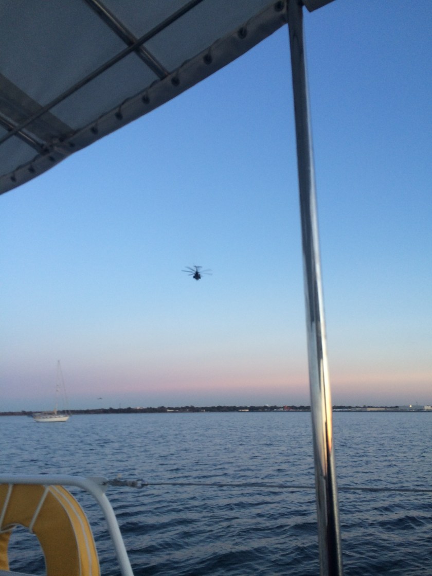
At the opposite side of the bay, the entire shoreline is comprised of tarmacs and massive hangers housing dozens and dozens of Naval helicopters. We dubbed Willoughby Bay “The Hornets Nest”, as there was a non-stop 24 hour agitated whirring and buzzing of helicopter traffic coming and going.
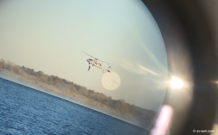
In addition, the Navy conducts daily helicopter training exercises over the water with frogmen. For hours on end, only a few thousand feet away from where anchored amongst a half dozen or so other sailboats, the training helicopter would circle around, descend to just above the water, drop a frogman into the water, lower a line while hovering above, pick up the frogman, then circle around and repeat the exercise.
Binocular view of the frogman exercises
The prop wash from these helicopters can be 170mph; hovering as low as only about ten feet higher than our mast height, they are potentially a catastrophic risk to sailboats… essentially an extremely localized hurricane with big guns. We had heard about these helicopter exercises and obviously stayed well clear. Fortunately, the Navy was also very cognizant of the presence of nearby sailboats and avoided us during their low flybys.
The following day, we made it our mission to get to a marina. We were still good on water and fuel but could always use the opportunity to top up, just for good measure. However, our holding tank situation was now critical. Since our failed pump out attempt at Mobjack Bay, too many days had passed and we feared another overflow fiasco was eminent.
Of course, the marinas in Willoughby Bay didn’t have pump out facilities. This meant the closest options were back across Hampton Roads Bay, probably ninety minutes away… this also meant navigating the Willoughby Bay channel again.
On the way out, we hugged the channel’s absolute left-most sliver of edge we could maintain a line on, all the while creeping along in a state of total paranoia with eyes glued to both the Navionics screen and depth gauge. Kris vowed for the second time never to traverse this channel again!
Ninety minutes later we made a pass by Blue Water Marina’s fuel dock, came back around, tied up, and viola! Diesel and water… no drama. The pump out would not be quite as simple.
Blue Water Marina – fuel and water at the end of the nearest dock… sweet.
Maryland pump out facilities almost always seemed to be located either along a long “T” at the end of the dock or, even better, right at your toe rail where ever you’re anchored when the pump out boat comes around!
Here in Virginia, placement seems to follow a strategy that favors a shorter plumbing route, locating the pump out machine close to land, on the bulkhead, or at a shoreside slip.
Getting back into the spot at Blue Water Marina was no problem – a ninety degree right turn off the fuel dock and straight back a few hundred feet. Getting out was possibly going to be a bitch. We really didn’t relish the idea of backing all the way out, but there was no possible way we were going to get turned around in that space. The overall width of the channel couldn’t have been much more than fifty or sixty feet, giving us a margin of less than ten feet on either side while broadside if we attempted a turnaround. That was a no-brainer!
In the end, we opted for the clever sure-bet over any claim of salty courage or seafarer’s prowess. Humbly requesting the assistance of two of the marina employees, we added a couple of extra long dock lines and physically walked Exit around in a 180 degree pivot… not pretty, but effective.
So we departed Blue Water Marina almost two hundred dollars poorer. But we now had 200 gallons of diesel in the fuel tank, both 100 gallon water tanks full, and (yay!) an empty 50 gallon holding tank – something we would come to fully appreciate as circumstances played out over the course of the next two weeks. And, as an added cherry on top of the sundae, Kris even sweet-talked the manager at the marina into letting us use their shower facilities… yes! A long… hot… shower!
On the down side, every potential anchorage around Hampton Roads we checked out was either too shallow, too narrow to put out enough chain, too much in the way of traffic, or already occupied.
This left us two options. Option One: take a chance on finding anchorage in one other area; but if we crapped out, the sun would be already setting, leaving us to navigate the harbor at night… not ideal. Or Option Two: return to Willoughby Bay and tuck in just in time for sundowners… Kris immediately saw through this rouse and recognized what Option Two really meant.
On the way in, as we hugged the channel’s absolute right-most sliver of edge we could maintain a line on, all the while creeping along in a state of total paranoia with eyes glued to both the Navionics screen and depth gauge, Kris vowed for the third time never to traverse this channel again!
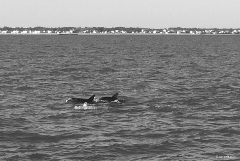
The following day, one day before Thanksgiving, we left Exit at anchor after having another small pod of dolphins come swimming directly up to us while we sat in the cockpit. We headed ashore in the dinghy for what was only our second “touristy” activity in four months (the first was attending the Eastport/Annapolis Annual Tug Of War event just before departing). This excursion was to the Langley/NASA Museum in Hampton Roads which had amazing displays including actual fighter jets and helicopters hanging from the ceiling, lunar landers and planetary exploration craft, and even an IMAX theatre currently showing “Hurricane 3-D”, which couldn’t be missed. All that and a trip to the nearby grocery store… ya gotta love Uber!
Langley/NASA Museum
Langley/NASA Museum
We couldn’t help but notice when we returned to Exit how quiet it seemed the Hornet’s Nest had become. By nightfall, and throughout the night, the constant droning sound of helicopters we had become accustomed to ceased entirely. We surmised that Navy pilots were high enough up the totem pole that they must get at least two nights off for Thanksgiving.
Our plan was to set out Thanksgiving Day, make our way past Portsmouth and anchor before reaching the lock, just above the entrance to the long anticipated Dismal Swamp. This route would also require us to pass through our first lifting bridge, as well as a bridge with 65 foot clearance. We have been assured that our mast has a 63 foot clearance; but, up to this point, even 180 foot bridges seem close when traveling under them!
At 9:00am Thanksgiving morning, we lifted anchor and set off in search of the Dismal Swamp.
On the way out, as we hugged the channel’s absolute left-most sliver of edge we could maintain a line on, all the while creeping along in a state of total paranoia with eyes glued to both the Navionics screen and depth gauge, Kris vowed for the fourth time never to traverse this channel again!
…this time I actually believed her.
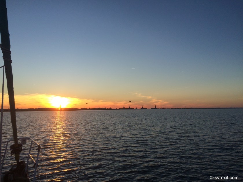
Iconic Willoughby Bay sunset… complete with helicopters and aircraft carriers
Virginia is turning out to be more and more of a proving ground with each passing day. A number of times in conversation over the past few months we have heard the comment, “So this is your first boat and you’re heading down the ICW, eh?” We couldn’t figure out what they meant. After all, we weren’t headed offshore or north to Newfoundland.
But there are indisputable comforts, conveniences, and security blankets to be had in the relative safety of Maryland’s Chesapeake Bay, and the extensive river systems feeding into her, that we are quickly learning may not be universal.
All in all, really nothing more than growing pains, learning curves, and the initial shock of first time experiences that will grow easier to process, digest, navigate, and sometimes tolerate with repeated exposure.
***
We had the incredible deja vu experience of a pod of inquisitive dolphins swimming just off our stern as we approached Norfolk. Although, my reaction to seeing them, as well as the noise one of them made as it surfaced, nearly caused Kris to have a heart attack. She was already on frayed nerves at the wheel trying to make sense of the shipping traffic and immediately thought a boat was coming up behind us!
After I received a smack for contributing to her pounding heart rate, we reveled in the dolphins’ company while they hung around us. There are a handful of creatures whom any interaction with is truly a magical experience, and dolphins have to be right up there near the top of the list. After a short time, the dolphins headed off and it was back to business.
Norfolk welcoming committee
Any traffic at all can be nerve racking when the traffic consists of cargo and cruise ships the size of a football field moving at 25 knots which can appear on the horizon in front of you and disappear on the horizon behind you in ten minutes time. Yet, we both were surprised with how little traffic we actually saw on the water as Norfolk grew near.
That having been said, Hampton Roads (right across the harbor from Norfolk) is home to the largest Navy base in the world. Once there, we knew navy patrol boats, aircraft carriers, destroyers, helicopters, and even submarines would be added to the list of potential encounters.
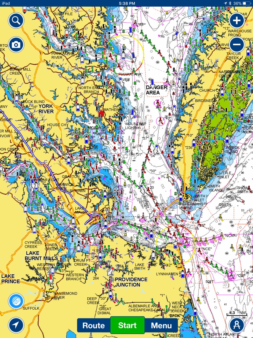
Paper navigation charts make the waterway entering Norfolk look like a confusing mess of markers and channels, though in reality it was quite straightforward. While I don’t buy the argument that paper charts are obsolete, the benefit of having our recently purchased iPad in the cockpit has become immeasurable.
The Navionics program that we use superimposes our GPS position onto a digital version of the paper chart that can easily be zoomed in or out for reference. That, in combination with looking around and actually seeing what is represented on the iPad screen, makes for much simpler and safer navigating. The iPad doesn’t blow away like a paper chart in the cockpit would, plus it displays the coordinates of our position and current speed, which we can compare to our onboard instruments.
Navionics zoomed out to show south Chesapeake Bay and Norfolk area
As we crossed over the Hampton Roads Bridge Tunnel at the Southwestern-most tip of the Chesapeake Bay and entered the Hampton Roads Harbor, Norfolk to our left and Hampton Roads to our right, the four and a half month Chesapeake Chapter of our adventure came to an official close. From this point on, everything would be further South than we had ever sailed.
Beautiful Mobjack sunsets mask hidden dangers lurking just below the surface…
November 19, 2017
After our unsuccessful attempt at a pump-out, we decided to sit tight in the Severn River (the last of the four rivers as you work counterclockwise around Mobjack Bay). Wind estimated at 25-30 knots with gusts around 40 knots (not gale force but a good blow) were forecast in a few days.
Instead of making a sprint for Norfolk, towards the oncoming wind, where traffic and protected anchorage space could prove challenging, it made more sense to wait it out where we were. Mobjack Bay is large, but it is off the Chesapeake, and we were well upriver from the open space of the bay as well.
Surprisingly, we were tossed around much more than we expected. So, after one night, we picked up anchor and relocated from the southern branch to the northern branch of the Severn River, a location we thought would provide even better protection from the southerly winds expected in a couple of days.
We were well settled into a spot that we felt offered the least amount of exposure to the wind, which was expected to shift by 180 degrees over the course of a few hours, when Kris called down to me from the cockpit, “Houston, we have a problem… get up here, now!”
She pointed down at the water.
Exit’s stern slid slowly across the surface, pivoting on its’ anchor chain as the wind shifted slightly. In the water, I could see the hazy image of what appeared to be some sort of a barely submerged pipe structure. The pipe just sat there as Exit drifted closer and closer until it was right off the starboard side, and then we passed over it. Then there was the unmistakable scraping sound of the pipe as it made contact and was pushed out of the way by the rudder.
With the pipe so close to the prop, we didn’t dare fire up the engine to try to move out of the way. Our expensive new Maxprop could easily be destroyed if it hit the pipe spinning at 2000rpms. Instead, we quickly grabbed the anchor windlass controller, hustled to the bow, and started hauling in the anchor chain, trying to pull ourselves away from the pipe by shortening the amount of chain between our bow and anchor.
Putting a comfortable amount of distance between Exit and the dreaded, evil pipe (we still had 80 feet of chain out but at least now were on a radius about 20 feet inside of the pipe), we decided to stay put but wanted a reference marker so we would know where it was at all times. That way, we could immediately tell if we started to drag and could lift anchor and move if it became a necessity.
After tying a bit of rope to an empty plastic bottle, a longer line was attached to the dinghy we had just lowered. Then Kris slowly eased me back in the dinghy until I was right next to the submerged pipe. It was metal, about three inches in diameter, attached to another pipe angling out 90 degrees from it, and descended out of view to what I assumed was probably the bottom about thirteen feet below… bastard! I attached the line and Kris pulled me back.
Though the wind never reached the levels forecasted over the next 24 hours, we found it much bumpier than other anchorages we had utilized in higher winds.
As we departed Mobjack Bay for Norfolk, we left the plastic bottle tied to the submerged pipe as a warning to other boats. We didn’t consider it littering, it was marking a navigational hazard in true Borneo fashion.
We had the good fortune of excellent sailing conditions to Mobjack Bay. Though we had to fire up the engine a couple of times because of temporary lulls in the wind, we were able to keep the sails up the entire day and, of the nine hours we were underway, we were sailing without engine for six of those.
There is a marked change in weather, even though we are only about 100 miles south of Annapolis. There can still be a serious chill in the air, but with the sun out we find ourselves actually shedding layers during the course of a day! The early sunsets bring a crash of the thermometer by 5:00pm and we still find ourselves going belowdecks almost immediately after it gets dark. Still, the return to late-autumn rather than early-winter conditions is most welcome.
Upon entering Mobjack Bay, we opted to head up East River, the closest of the four rivers feeding the bay (East River, North River, Ware River, and Severn River if you are going in a counter-clockwise direction around the bay). We dropped anchor in a spot with good wind protection from everywhere but the South. On the shore just across from us was a small, old, abandoned mill complete with paddlewheel which sat right next to a pristine, though apparently also unoccupied, massive plantation-style mansion. The location was great, and it would have been easy to stay for more than a day.
Abandoned paddlewheel mill
However, two factors contributed to our decision to move the next day. Our holding tank, though not at a critical level, would need to be pumped out within the next few days; and our limited experience was quickly teaching us that waiting until the last minute to address an issue was how small problems became big problems. The second factor was weather information (something we constantly have to monitor for just such a situation) which was indicating a high probability that we could see heavy winds from the South in a few days.
Calling around to marinas in the bay started to establish a pattern that suggested easy access to pump-outs, fuel, and water may be a much easier prospect in Maryland than Virginia. Hopefully, this is a Virginia weakness rather than a unique Maryland strength – meaning, it would suck if Maryland is the exception to the rule and we simply got spoiled right out of the starting gate!
We found only one marina that offered the possibility of at least a pump-out (every other marina dock was far too shallow for us to access); however, after motoring for an hour to get there, we found that the facilities were located right at the shore inside a tiny slip.
We circled a couple of times to try to suss out things as best we could. After deciding to give it a go, we committed to entering the narrow alley. Slowly passing a dozen boats secured in their slips on either side of us, we approached the slip we’d have to get in and out of.
Immediately, we both realized the slip was tiny, the turn into it was going to be way too tight, and backing out would be a nightmare. We momentarily tried to think through a solution, but a bit of breeze was coming directly at our port beam.
Anytime Exit’s speed drops below one knot, we start to lose all steering control which is obviously something we always have to maintain an awareness of. Just creeping along, steering was already becoming a concern. But as we slowed, the wind began to push our bow around in a clockwise direction, compounding the problem.
We had no choice but to abort, trying to get around and out before the wind pushed us sideways into the slip pilings directly to our right. With no way to stop the clockwise spin as well as the drift being caused by the wind, Kris made the quick decision to gun the engine forward, giving us a tighter steering turn, trying to complete the turnaround the wind had initiated while we still had room between us and the closing pilings… we thought.
Riding on a 40,000+ pound metal object traveling forward through the water at about one knot, straight toward a stretch of wooden posts and boats, can instill an almost dreamlike moment when time both seems to speed up exponentially and slow to a crawl, simultaneously.
The geometry question (once again, damn my near failing high school geometry grade!): given the forward momentum of Exit, is the angle of turn sufficient to avoid a collision with the objects ahead? On one hand, more speed makes the turn tighter but makes the stuff we’re trying to miss get closer even faster; slower seems logical but forces a wider turn. The calculations relentlessly clicking away in the brain continue, although the reality is we can’t change anything more at this point… it’s either enough or it’s not.
From the bow, forty feet forward of where Kris is standing at the wheel in the cockpit, I am trying to judge whether the turn is going to clear us or, worst case scenario, where do I need to be to try to help push off if necessary. Poking out ominously from between each of the wooden slip pilings are the pointed bows and bowsprits of a dozen or so boats. Even more ominous looking are the line of anchors affixed to the front of each bow, like armored soldiers in a battle line with weapons bristling forward.
In a movie, the sideswipe maneuver of sheering the bow off each boat as we pass by would be a brilliant special effects stunt; in an insurance claim it would be… game over.
As the distance between us shrank and the excruciatingly slow turn continued, my mind vacillated back and forth between “We’re gonna make it” and “It’s not gonna be enough”. Oh shit… oh shit… oh shit…
Positioning myself on deck just left of the bow, I prepared to try to push off the first thing I could reach, trying to gain us an extra degree of turn to help our 55 pound Rocna anchor jutting about 18 inches forward of the bow from becoming a joisting lance; or more accurately, a battering ram.
Suddenly, as our distance of separation dwindled to only about a foot, it became obvious that our anchor and bow were going to clear the piling just ahead. At least we weren’t going to slide in behind a piling and start plowing through the inside of the slips. Woohoo!
But the sideswipe was still a real danger. The flared shape of Exit’s hull means that her widest point is midship, and we were yet to clear that.
I quickly walked back along the deck pushing off every piling I could reach as I worked my way towards the stern. And then our widest point abeam was clear of danger. It looked like we had just squeaked through until I looked back at Exit’s stern. Protruding a good eighteen inches from the stern arch was the bow of our inflatable dinghy, which hung from a davit over our transom, about five feet above the water.
A boat planing on the water turns more like a car trying to turn in snow than on dry pavement. The turning momentum causes the back to come around and slip a bit sideways; that is exactly what happened to us.
Thankfully, the dinghy’s point of contact was a wooden piling instead of a passing anchor. A glancing blow about a foot back from its’ bow caused quite a jolt to the dinghy which got shoved violently around on the davit, but the heavy rubber tube flexed and we passed clear. As we motored away from the marina, the small consolation that should have occurred to us was that, having both just shit our pants, at least our holding tank wasn’t any fuller…
During a phone call to my Dad, he made the observation how fitting it seemed that, having been born in Maryland, I had now returned to Maryland 50 years later to be re-born again. His words took a while to sink in, but there is certainly a bit of a cross between a Twilight Zone and a Zen angle to them.
However, it is now it is time to say farewell to Maryland… again. Experiences to seize, and seas to experience! (Author’s note: if that’s an original quote, I want credit for it. If not, sorry to whomever I stole it from…)
Over the past week we’ve only traveled about 150 miles. In another lifetime that could have been a day trip from Pullman to Spokane and back, but right now its a leisurely sailboat pace towards the southern end of the Chesapeake Bay. At this rate, we wouldn’t make the Bahamas until 2019 but momentum should start building by the Carolinas.
We got a one day earlier start than Dena and James so we’re blazing the snail’s trail (so to speak) in search of warmer weather in a land they say exists beyond Maryland.
Zig-zagging down the Bay from the Choptank River on the east side (just south of our previous excursion across the Bay to the Wye River), back over to Solomons on the west side, and into the Wicomico River, we crossed a line visible only on our charts and celebrated our arrival into Virginia. Woohoo!
Flaking the mainsail approaching the Solomons
Unfortunately, the wind did little to cooperate with us over the past week. While underway, minimal wind coming mostly from directly behind us forced us to run our engine most of the time. Motor-sailing became the norm; oftentimes the discussions revolved around whether the breeze would hold long enough to justify turning off the engine or whether having the sails up was forcing us to alter course and lose any gains we’d made on speed.
Finally, an increase in the wind and shift of wind direction allowed us to sail for six hours straight on our way from the Wicomico River to Mobjack Bay. Gliding along the surface at as much as eight knots, no noise from the engine, only the sound of the wind in the sails and rigging and the water lapping up against Exit’s hull made for a welcome change. On one hand, it’s simply a great day to be sailing; on the other, it’s days like this that truly help us to learn by giving us plenty of opportunity to experiment with the sail trim and rigging.
Exchanging watch duties…
… and helm duties
The down side of the change in wind meant that weather fronts were shifting. Forecasts indicated winds were likely to kick up dramatically in a few days. We decided we didn’t want to get hit with something while in Norfolk if we could avoid it. Traffic and complicated navigation would make poor conditions untenable and finding a protected anchorage with space to put out enough anchor chain could be questionable at best.
One of the real benefits of the Chesapeake is the infinite number of hideaways and protected bays that exist. Though the Chesapeake Bay chop can kick up quite a stink in nasty winds, by getting into a smaller bay, then up into one of the branches of a connecting river one can find nearly lake-like conditions even when its blowing 40+ knots out on the Bay… which was exactly what was forecasted to hit in a couple of days.
So we decided that Mobjack Bay not only put us within about five hours of Norfolk, but also gave us a plethora of options for finding a good, protected spot with plenty of space to ride out the wind at anchor. Though a rather massive body of water, Mobjack Bay is fed by four substantial rivers, all winding in different directions and accessible to sailboats. Regardless of where the wind was coming from, we should be able to tuck into a spot that would give multiple land barriers for protection.
Twenty years from now you will be more disappointed by the things that you didn’t do than by the ones you did.So throw off the bowlines. Catch the trade winds in your sails.Explore.Dream.Discover.-MARK TWAIN
November 12, 2017
At 8:30am the frigid November chill was certainly about, but it was not going to immediately penetrate the three additional layers of clothing that lay beneath the outer shell of foul weather gear we were each wearing.
Setting off from Back Creek this morning was another one of those big victory with a small step moments. A significant minor achievement in an ongoing saga of firsts.
When we arrived in Deale 149 days ago we had already been owners of a sailboat for four whole days. The transfer of title had finalized just before we jumped aboard our third Amtrak train in as many months with our designated 500 pounds of stuff in tow.
We moved aboard Exit and spent the next six weeks living aboard her on the hard at Herrington Harbor North Marina. It was only three months ago that we launched her and only about ten weeks ago that we were given the green light by our insurance company to sail without supervision. For the better part of two months we have lived at anchor, learning to sail and maintain Exit.
She is our home. She is our means of travel and exploration.
In some ways, Exit represents all the maintenance, frustration, sanctuary, and pride of ownership that every homeowner experiences. In other ways, Exit represents the absolute freedom to travel and explore… almost the antithesis of a home.
Nav table, salon & galley
The bar is open
Movie night
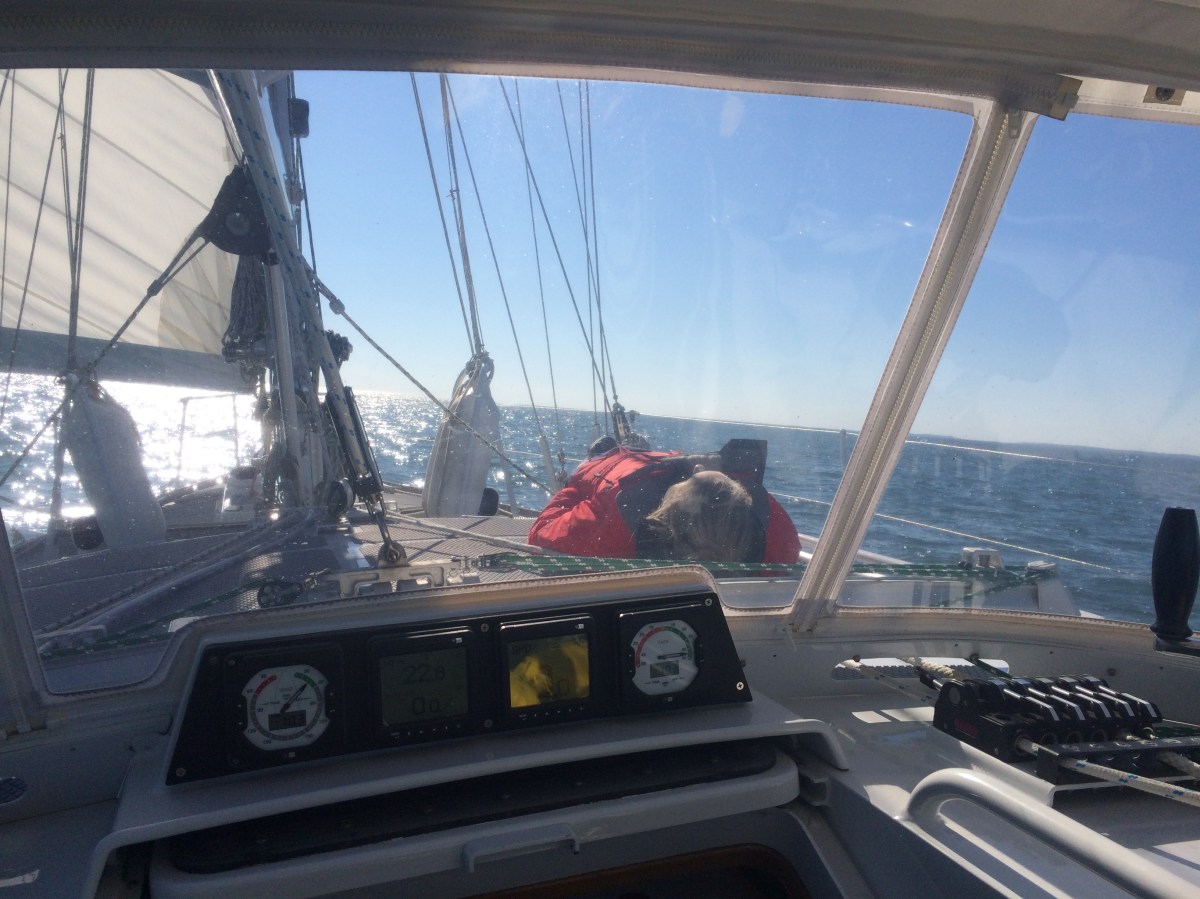
The helmsperson’s perspective
Increasingly, Exit represents an almost living organism. A largely self-sufficient entity with its own life support systems that, if properly cared for and maintained, can sustain our own existence for indefinate periods of time.
In such a short span of time, we have learned immense amounts about sailing in general, our boat in particular, and as always, about ourselves and each other.
Just when we think we’ve got control, it all goes to shit. Just when we think it’s all going to shit, we pull it together as a team. Though we have barely scratched the surface, every day we feel like we have a better grasp of things; only time will give us the experience and wisdom that hopefully follows.
We have already met a long list of people who have befriended us, offered advice and consultation, volunteered their time, assistance or even possessions, and supported our efforts.
We have sailed under the Chesapeake Bay Bridge and into the Baltimore Harbor. We have completed overnight passages. We have sat at anchor safely in gale conditions. I would like to think that we have generally proven that we can maintain a certain grace under pressure.
We have watched the seasons change from summer to fall for the first time in years and come to more fully appreciate the intricate beauty of the amazing transformation of colors. We have gained a never-before held interest in bird watching (and now understand why there was a bird watching book already aboard).
Camera birdhouse
Autumn deer
Pelicans rock!
We have had the opportunity to set up home at random locations off the beaten path, not because a hotel has vacancy or a camping site exists, but because there is a water depth of more than three and a half feet and we decided to stop.
All very small steps… and we haven’t even left the Chesapeake Bay yet!
Yet, at the same time, as we pass by Dena and James standing on deck of Nomad, waving us off as we depart Back Creek, we can’t help but feel an indescribable sense of accomplishment to finally be undertaking our first sailing journey that isn’t part of a predetermined round-trip.
There is no doubt… winter is here and we need to get going south!
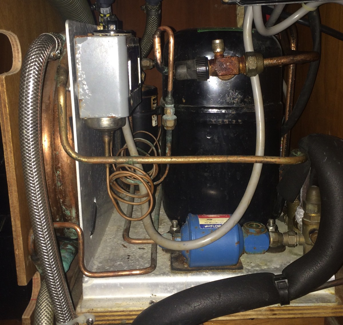
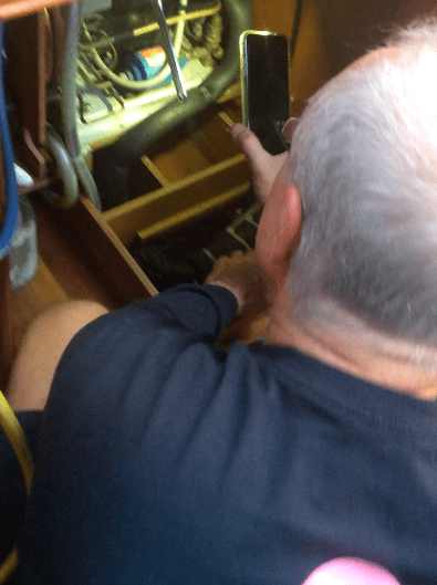
On the morning of the 7th, we had to tie up at a marina slip for Bryan to be able to get all his gear aboard. By mid-morning it had started pouring rain. Though a few challenges had to be overcome, the two new condenser units and evaporator plates for the fridge and freezer had been installed and wired by 6:00pm… a one day job… hallelujah! Our fear that things could hit an unforeseen snag at any moment turned out unfounded.
On one hand, it was a shame to have to gut a functional system. Bryan lamented this on more than one occasion, indicating that his Dad built very similar custom refrigeration systems, and this was as well built as any he’d seen. The fact that it was 25 years old and still worked so well was a testimony to the quality; Bryan said this system would easily cost upwards of $10,000 to build today.
Bryan installing the new fridge/freezer system
But… it is what it is. In the end, a desire not to be slaves to the generator as well as a step in the direction of self-sufficiency and the ability to get as far off the grid as possible outweighs any loyalty to the status quo.
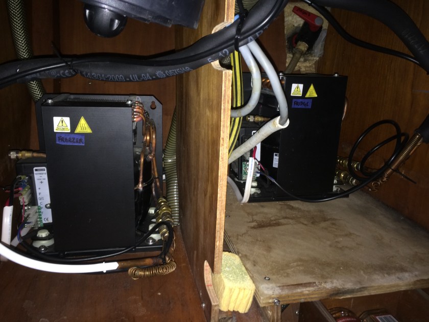
For now the focus is getting the system converted to 12V power with separate systems for the fridge and freezer – isolated control as well as redundancy should one fail. We may have to address potential insulation issues or even look at replacing the boxes themselves at some point, but those are projects for another time.
Freezer box with hatch removed
Front loading fridge
Adequate space for our needs…
With Bryan’s work done, we untied from the dock. As we once again dropped anchor in our spot at Back Creek just after 6:00pm, probably for the last time, the rain pounded down and the cold wind cut through every stitch of clothing I was wearing. Standing at the bow putting out the anchor chain and then setting up the snubber line (a rope line put between the boat and the anchor chain to act as a shock absorber), I couldn’t recall another time in the last ten years that my hands and feet had become so numb from the cold with the exception of visiting Antarctica in 2010!
Thirty minutes later, belowdecks with the hatch closed, heater running full blast, and a new set of multiple layers of warm clothes on, we got word via Kris’ iPhone that a freeze warning was in effect for the night. By early morning, the aluminum hatch frames, which for the past few days had been sweating and dripping endlessly as condensation built up on the inside, actually had frost on them!!!
Our 110ºF aluminum frying pan that we had lived on in Deale had now become a 30ºF aluminum cooler!
*****
The plans are already in place. With the refrigeration sorted, our chains here have been cut. Dena and James, who already have more than a decade’s experience doing what we’re trying to do (and know the East Coast waterways intimately), have graciously invited us to loosely join them as they start making their way south within the next week.
It seems like a perfect situation. In many ways the two sailboats couldn’t be any more different, and while they’ll obviously behave differently at sail or while motoring, this shouldn’t be any problem. The plan is to head in the same general direction and leap frog around each other at times, with a few rendezvous mixed in, always within easy radio or text contact at any time.
Immediate goals: get down the Chesapeake Bay, through the long-awaited Dismal Swamp and into a Latitude closer to the Carolinas where warmth may return!
Short term goals: make our way down the East Coast (exact navigational path still being determined) and out to the Bahamas, which opens the door to the Caribbean at least until spring approaches.
We pay for our late departure in degrees of temperature for probably a week, but gain a massive reduction in all the traffic we would be dealing with had we left at the same time as everyone else.
Now… it’s time to provision and do final maintenance checks, visit the laundromat, get a holding tank pump out, enjoy a last complimentary hot shower at the Watergate Apartments (thanks Dena!), and make a trip to Goodwill for some more warm weather clothes before setting sail for the warmth of the south!
Brand new 12V system with separate fridge/freezer condenser units