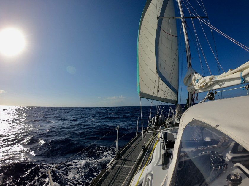
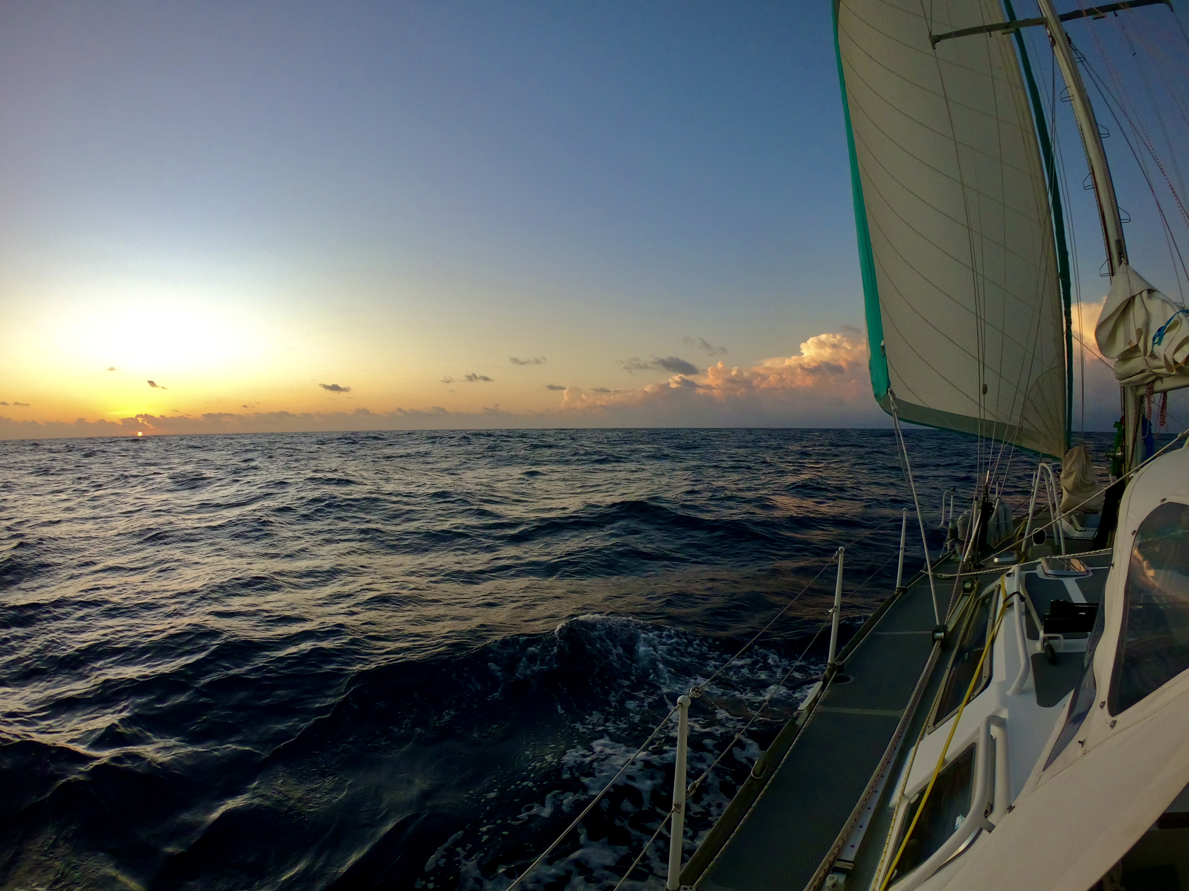
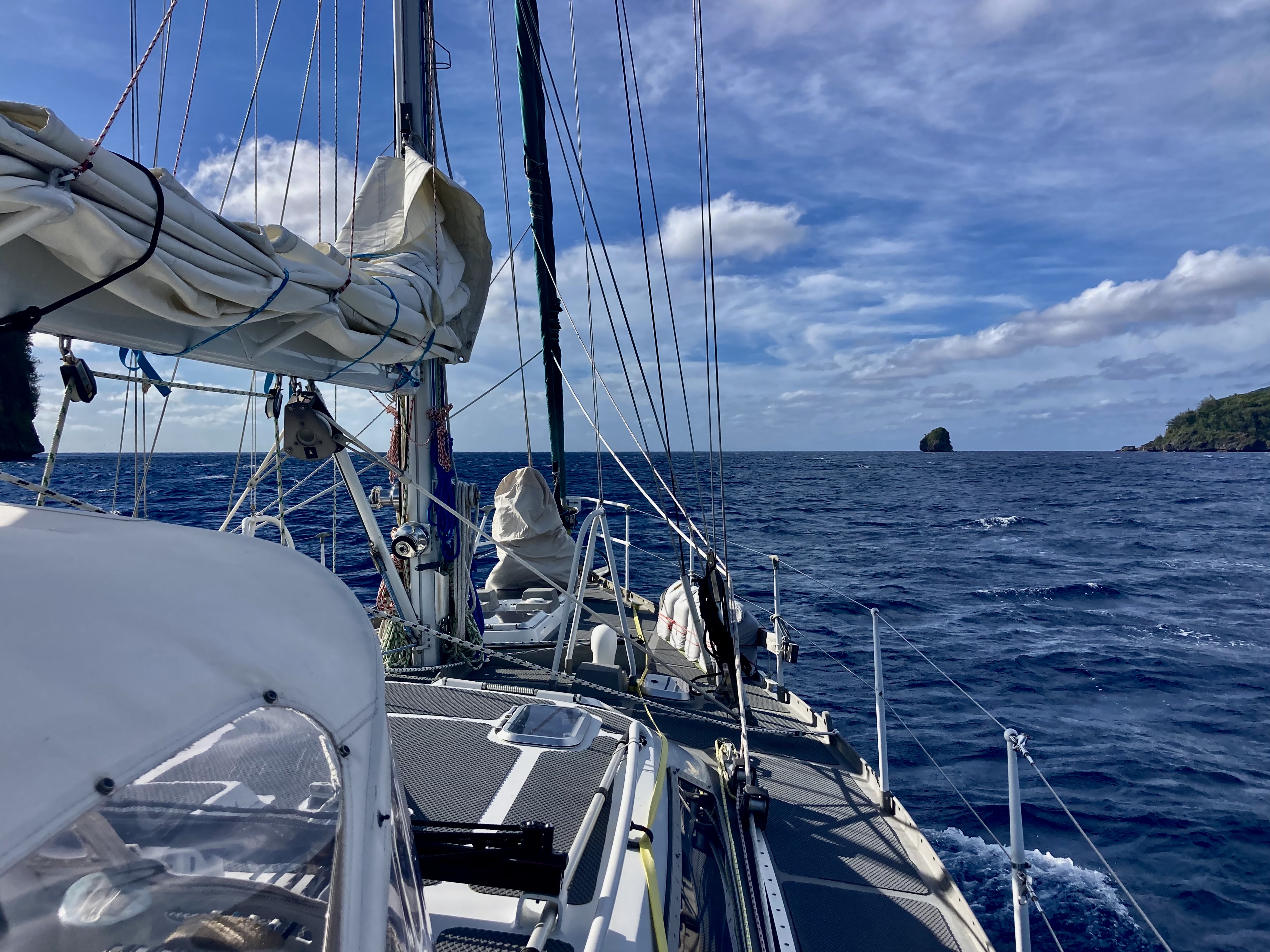
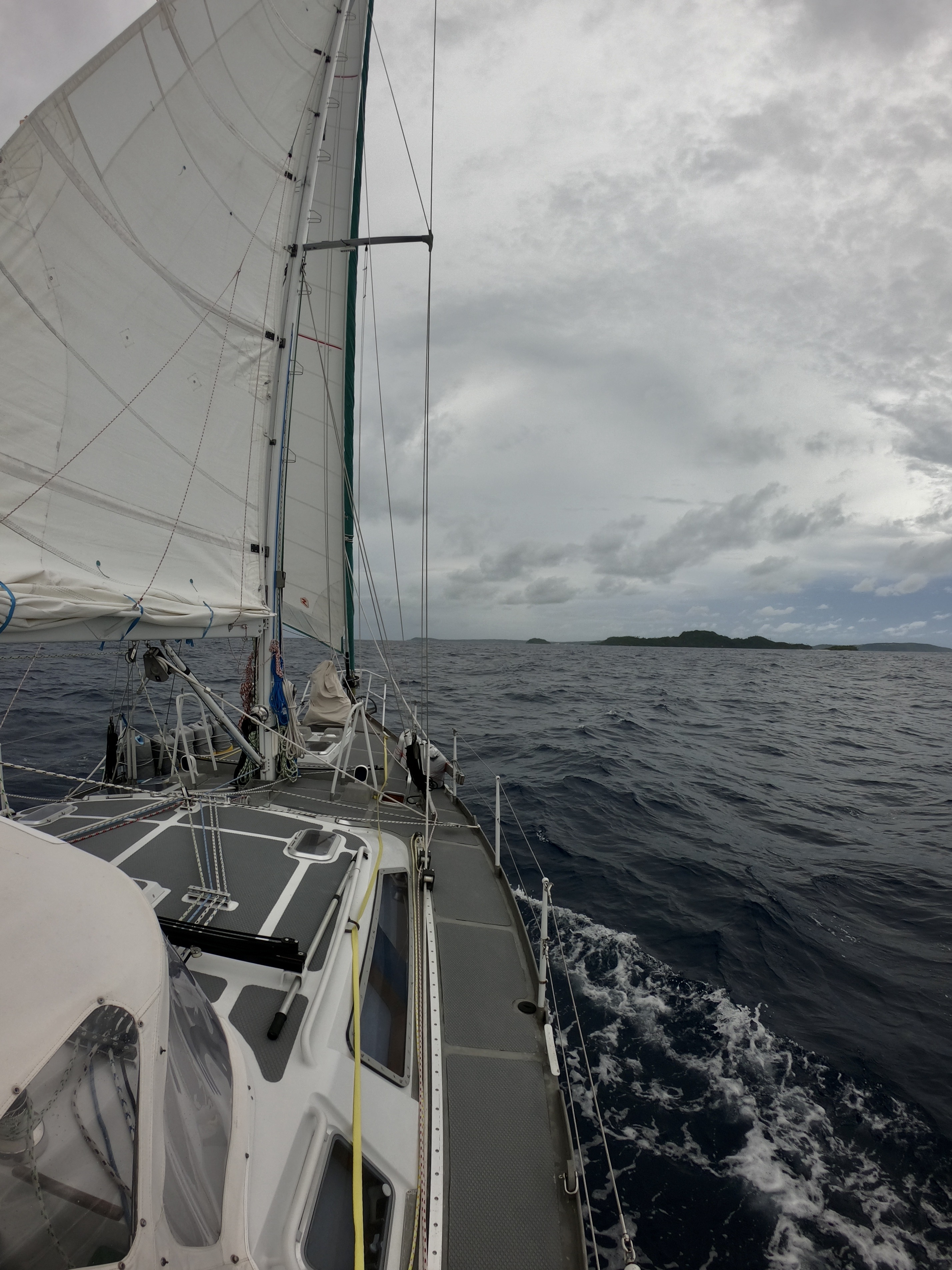
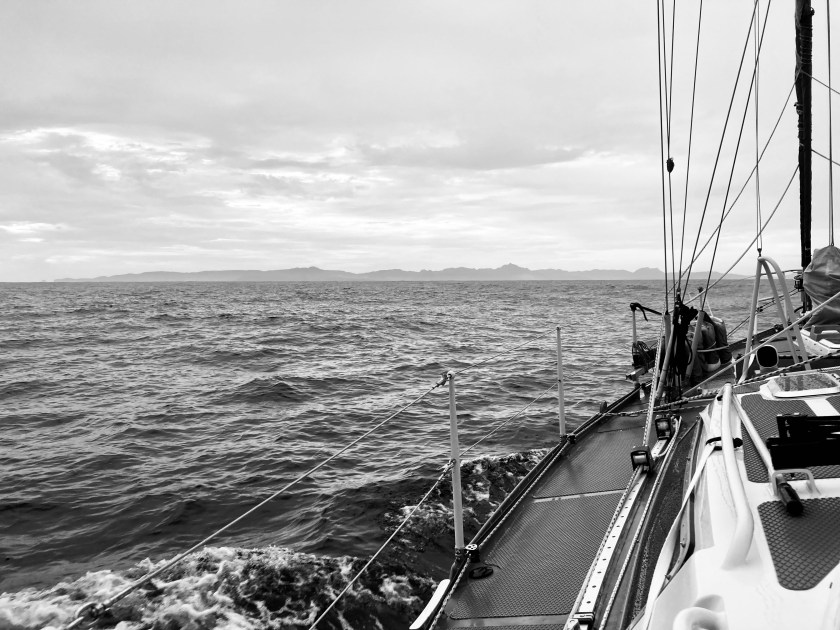
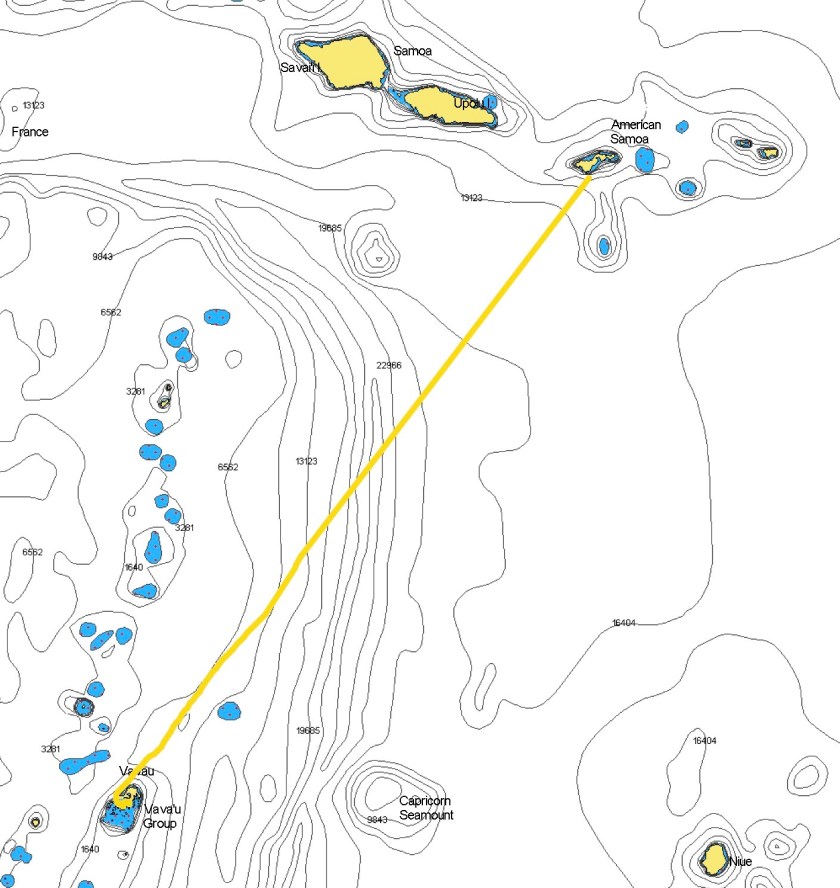
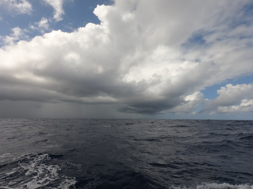
Three to four days was what we anticipated the four hundred nautical mile passage to Tuvalu would take us. The forecast wasn’t great, nine to twelve knot winds from the east, but it seemed about as good as we could hope for given what we had been seeing for the previous weeks.
In actuality, it ended up being more like four to six knots…and from the south. So much for accurate forecasts. It took almost nine hours before we were finally able to shut off the Perkins, and even then we had to be satisfied with merely crawling along at a snail’s pace, not much faster than if we were swimming alongside the boat. Oh well.
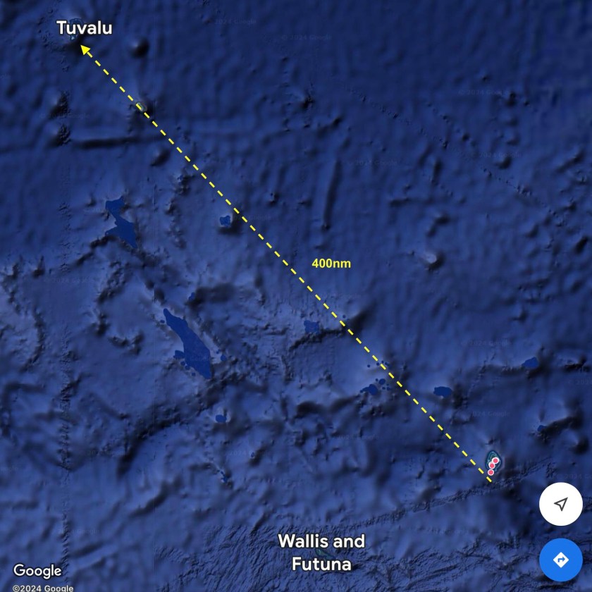
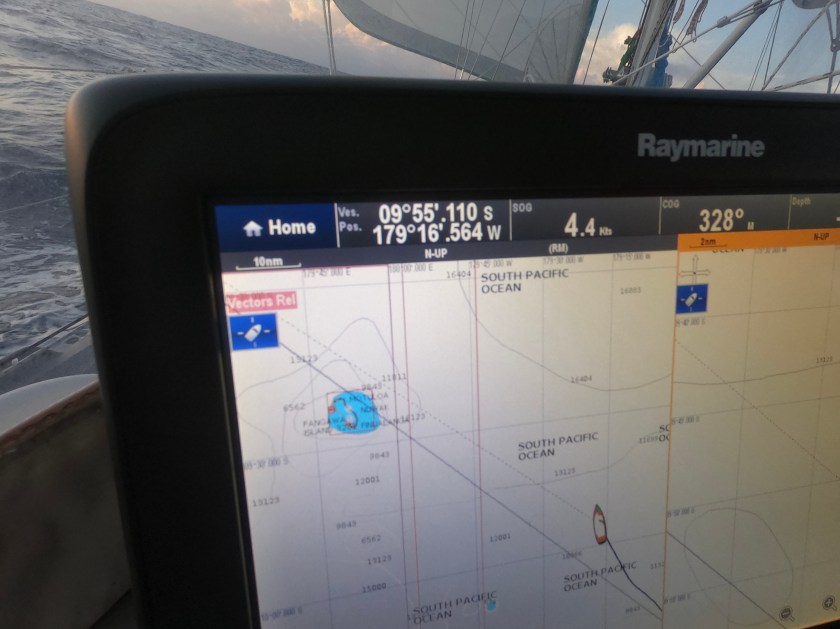
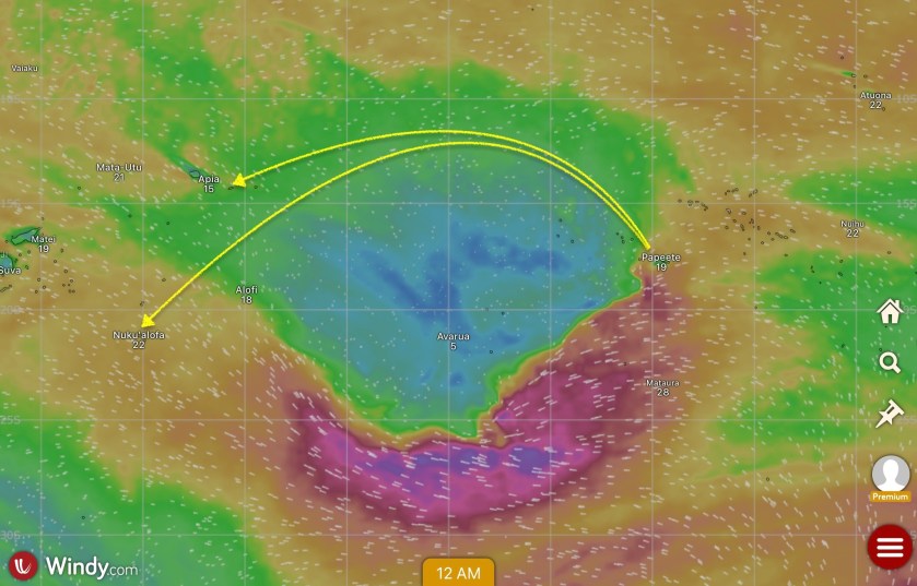
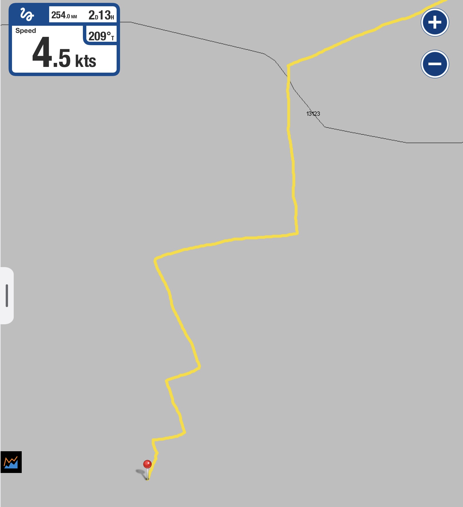
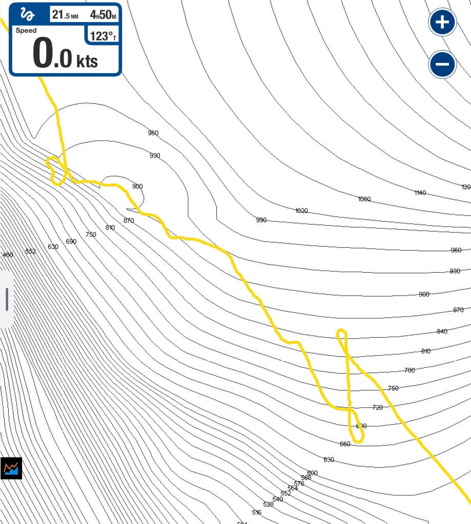
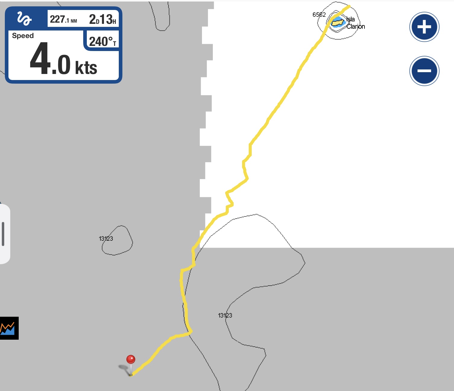
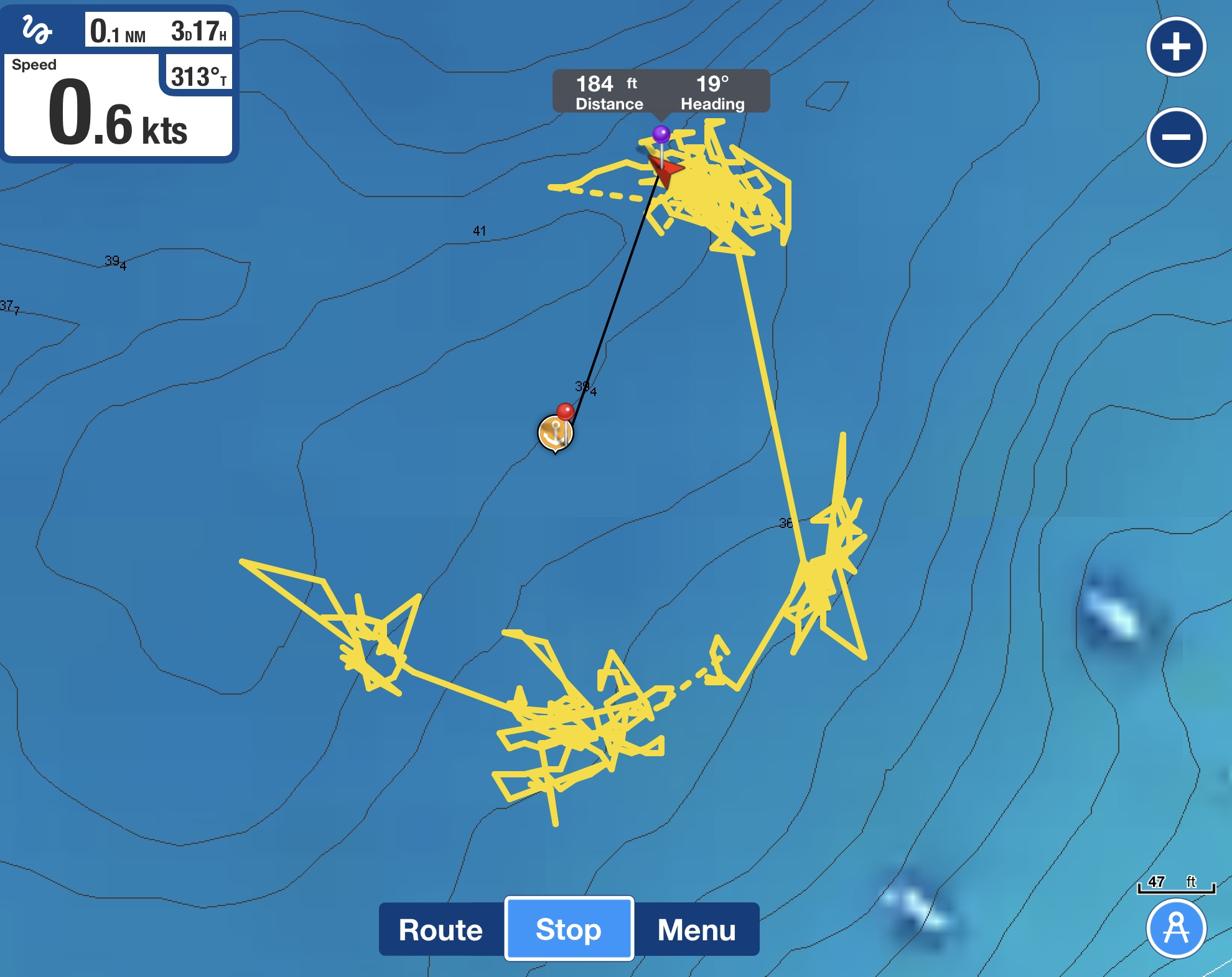
The trajectory
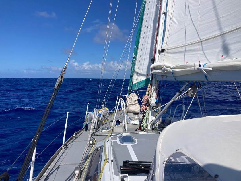
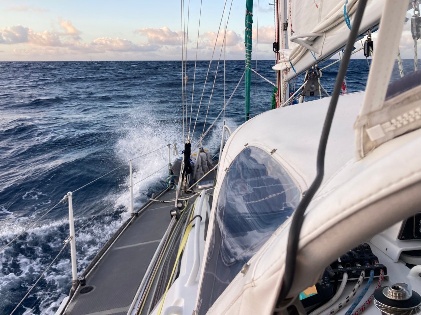
A 1:00am squall that finally brought fifteen knot winds also made for a rough night, but finally we were making good progress hauling ass at between six and seven and a half knots.
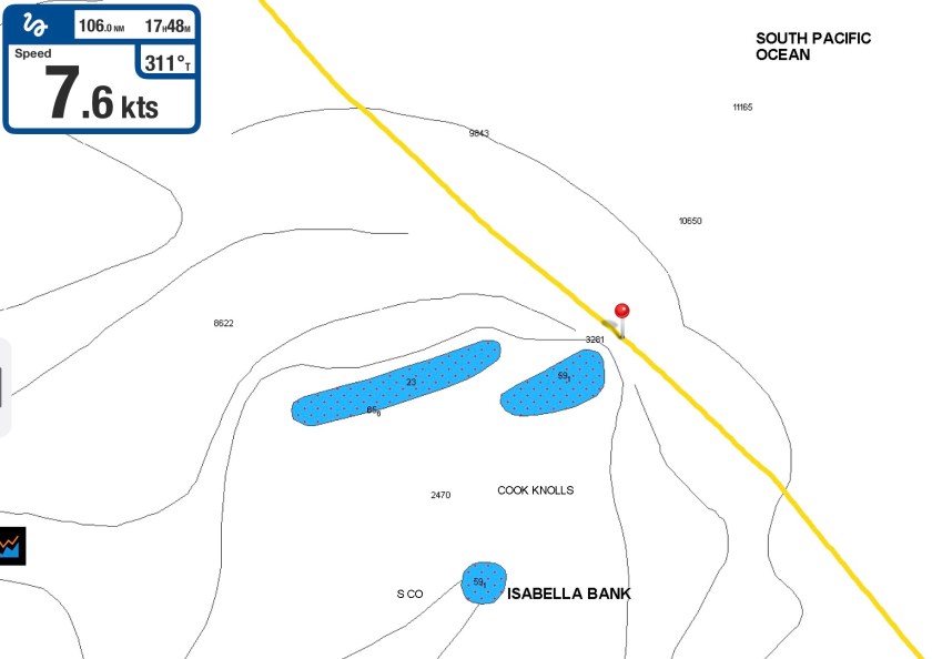
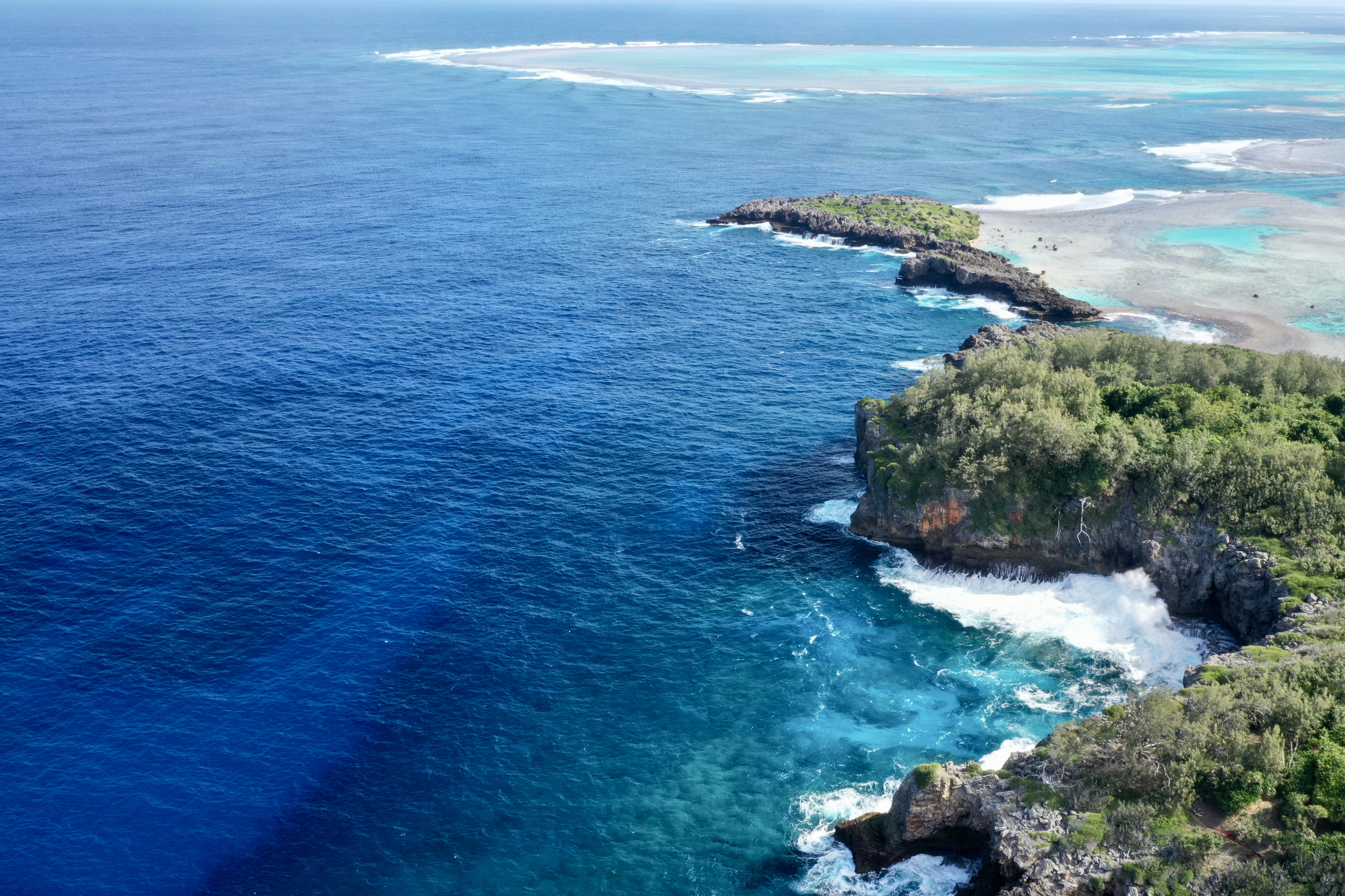
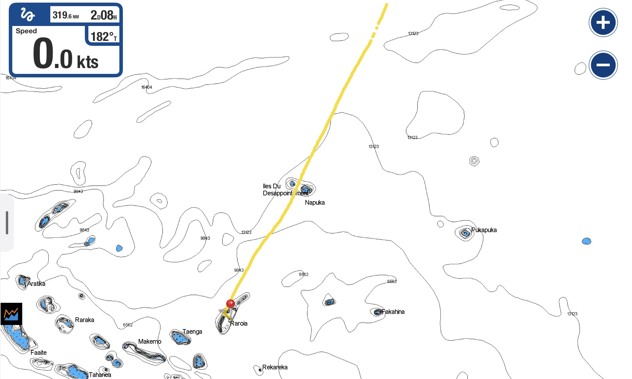
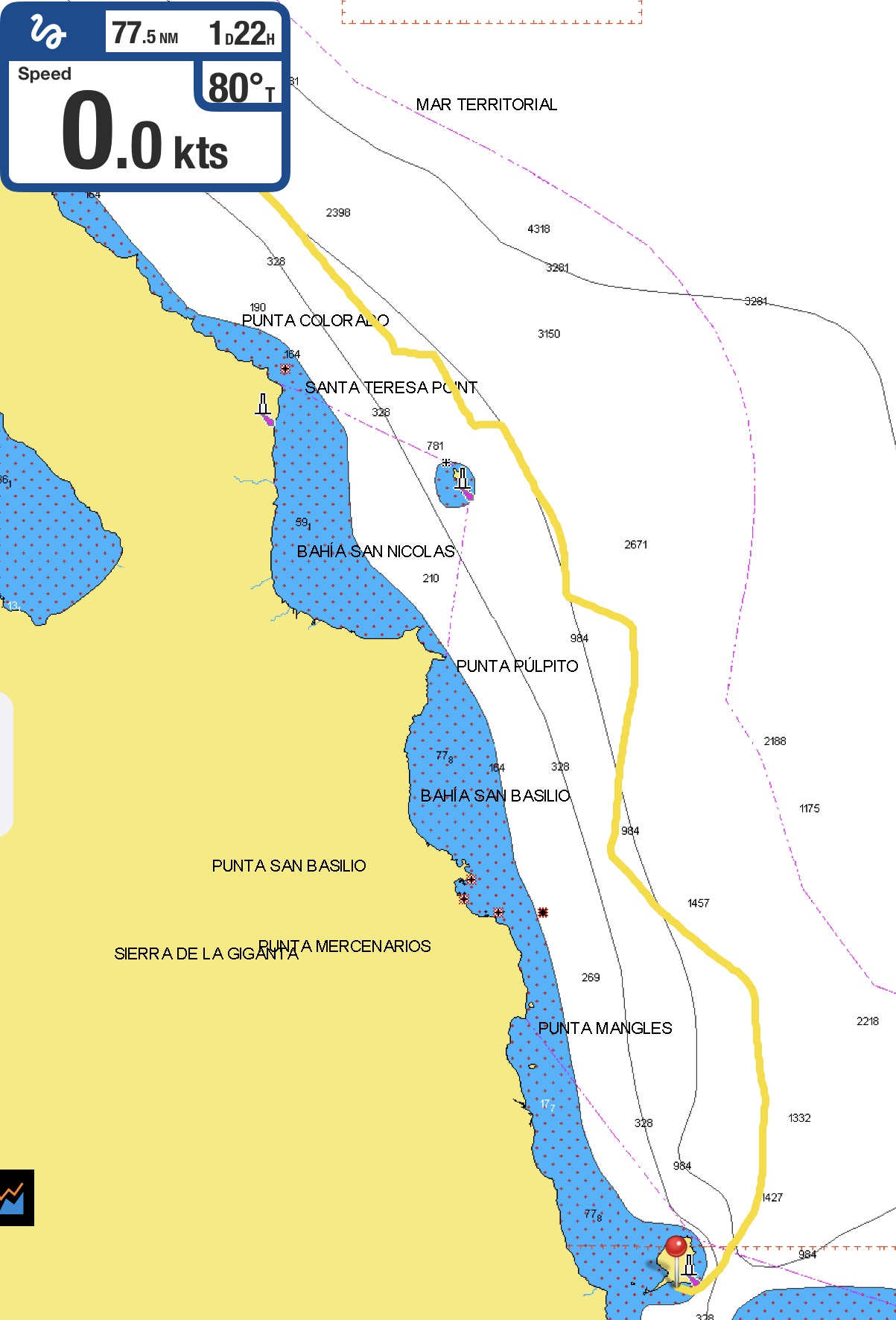
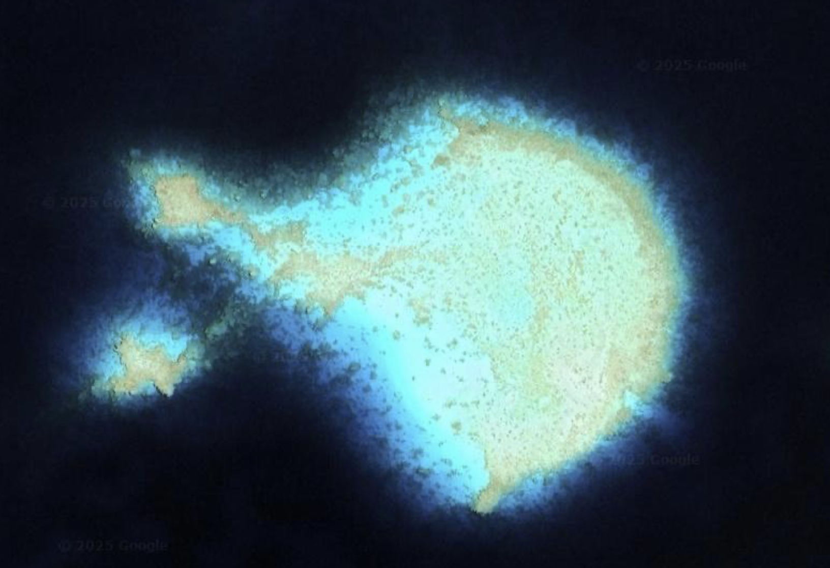
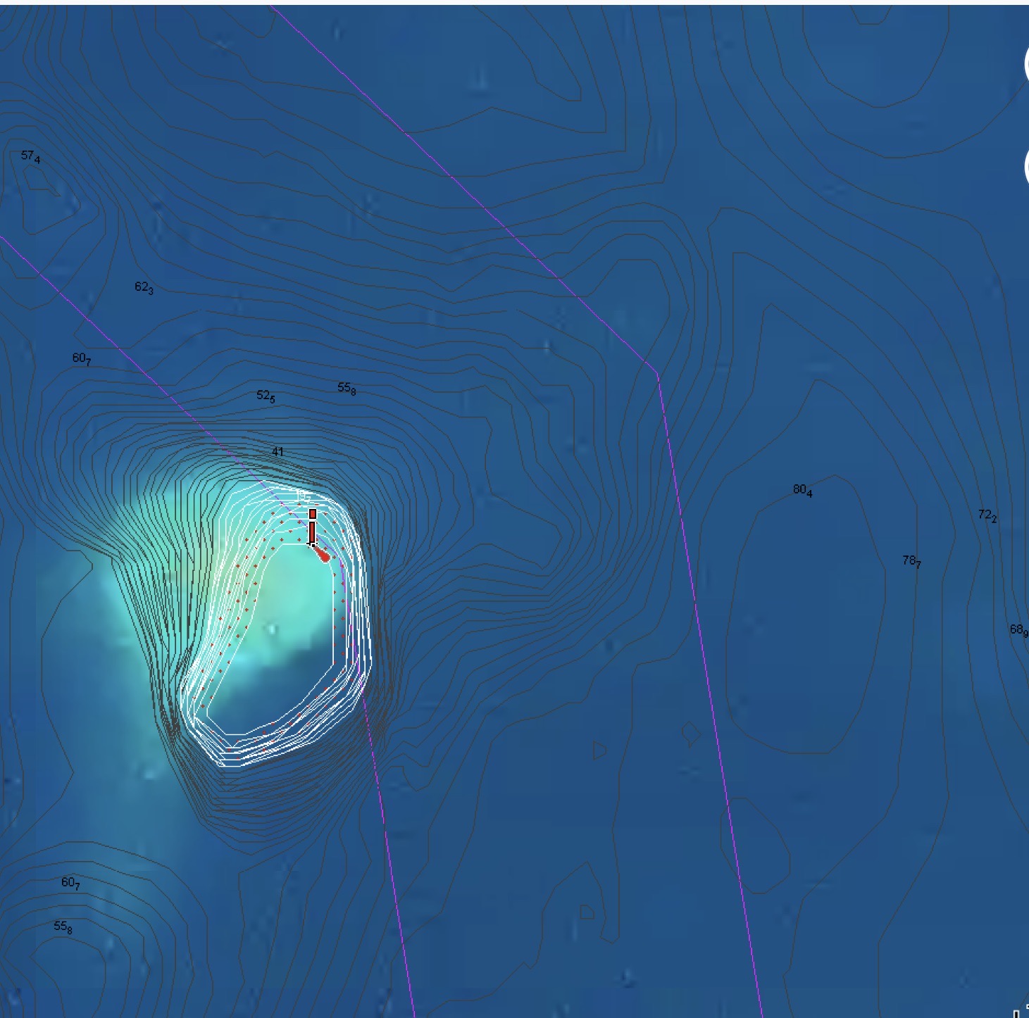
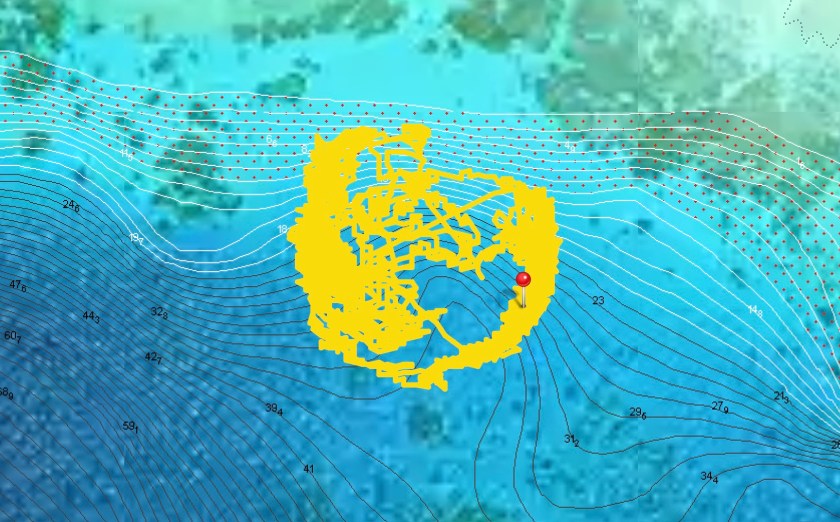
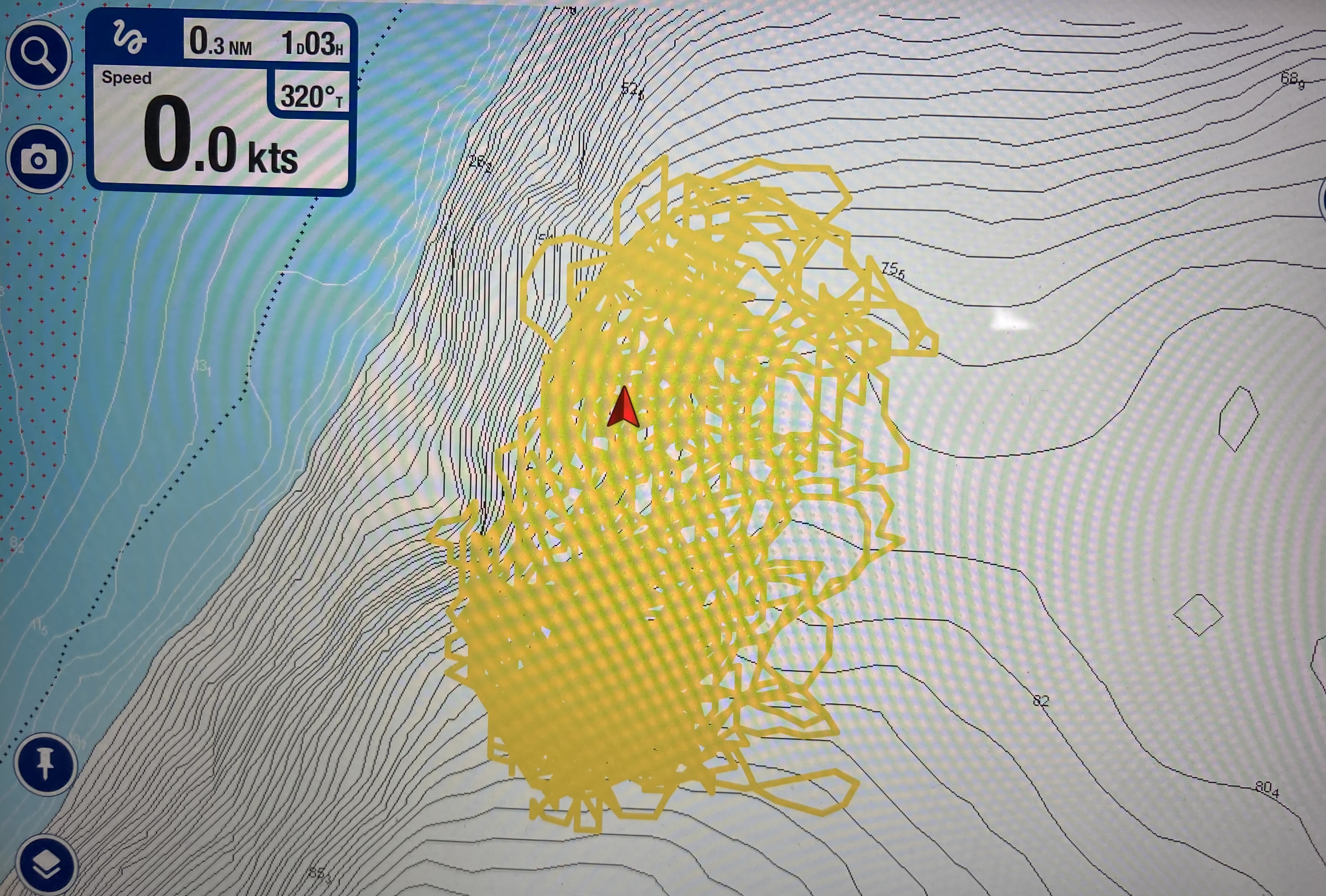
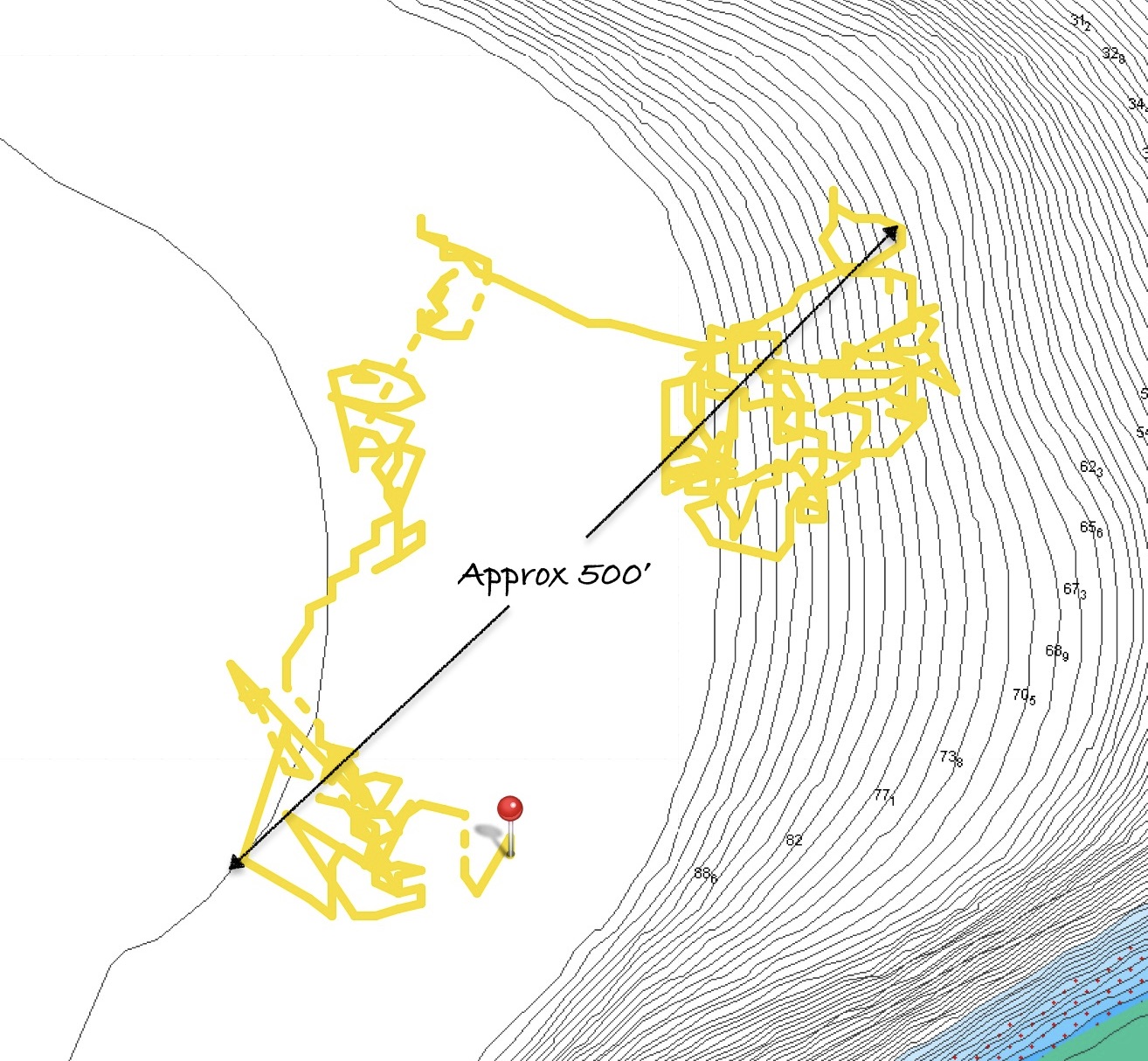
By sunrise we were passing by Isabella Bank – a massive underwater mountain whose base rests at a depth 12,000 feet. Less than two nautical miles to port of our location, it comes within sixty feet of the surface; just ten miles further west it is less than twenty five feet under water. Unbelievable.
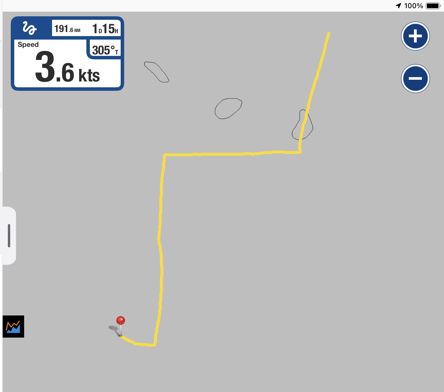
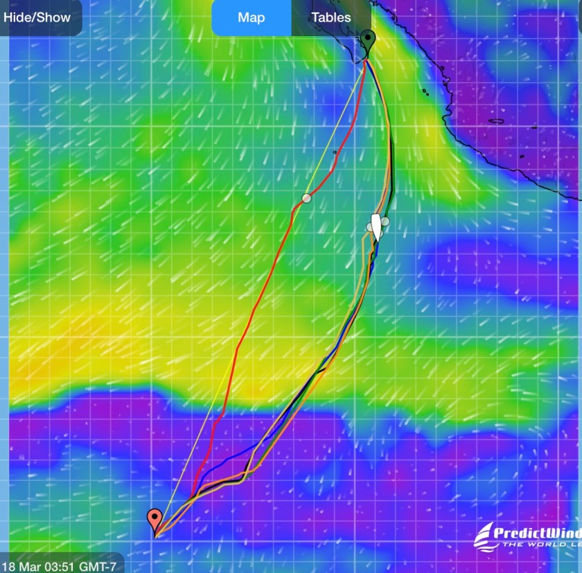
Isabella Bank as seen on the Navionics charts
Passing over areas like this only happens every so often.
I always envision them as holding some exotic dive secret that just begs to be discovered, like the sea mounts at Malapascua in the Philippines – one of the few places on Earth that deep-sea dwelling Thresher sharks consistently congregate at depths scuba divers can visit. Cleaning stations, mating grounds, navigational references…who knows? But it’s these underwater mountaintops, pinnacles, and sea mounts that seem to attract pelagic marine life and action.
Which is why, every time I see them on our charts, I hope circumstances allow us to stop, at least briefly.
Sometimes they turn out to be areas that create exceptionally volatile and rough surface conditions which prevent even getting in the water to take a look. Other times they prove to be a magnet for fishing boats navigating erratically as they string out nets, long lines and other implements of death – a place best avoided entirely. Sometimes it turns out they don’t even seem to exist…we actually do pass over the top and manage to jump in the water only to find nothing but blue water underneath us. Possibly real, but certainly not where the chart indicates. Or we never find out because we pass by in the dead of night.
As is often the case, multiple contributing factors would dictate whether or not we decided to stop and have a look. In this instance, we reached the Isabella Bank area just after sunrise, and Kris was still enjoying her hard earned sleep time after a rolling night of squalls and rough seas. If we were going to stop, it would only happen if I woke up Kris. Also, after struggling with uncooperative winds the day before, we were finally scooting along at seven and a half knots, an admirable speed for us. Diverting course to reach the nearby area indicated on our charts, dousing the sails, stopping Exit, and digging out our snorkeling equipment would entirely kill the momentum we had finally built up.
With a twinge of disappointment, I quickly realized that whatever secrets King Neptune potentially had hidden away under the surface were not going to be revealed to us today.
As Exit continued zipping along with full sails, our depth display never registered anything but “—“, indicating there was over five hundred feet of water beneath us though, in reality, it was probably closer to five thousand feet.
In short order, Isabelle Bank was behind us and any secrets it held remained intact.
Our first two days largely ended up being an experiment in sailing adjustments.
Sometimes settling to be content with only the solent sail deployed and a book in hand. Other times trying to harness more power from the wind by putting out both the solent and genoa, either wing and wing or trying to get them to work together in tandem stacked on one side.
The winds ranged between four and seventeen knots, the swell was on our beam, and the true wind direction wandered in almost a ninety degree arc over time. It seemed like we were continuously making endless adjustments to try to keep the sail filled.
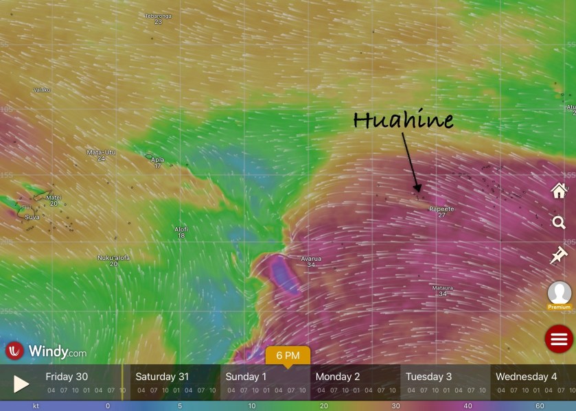
As we were preparing for our second night underway, about thirty hours and one hundred seventy nautical miles into our passage, we passed the magic number of Latitude 10°S.
Arriving to the “safe zone”
Nothing obvious appeared to change; no dramatic shift occurred. However, both our insurance company and, just as importantly, history were of the opinion that we had just crossed an invisible line that meant our risk of encountering a cyclone had decreased dramatically. It hadn’t disappeared entirely, but close.
North of 10°S before December 1st. An arbitrary location by an arbitrary deadline that had loomed in the back of our minds for months like the black clouds on a temporal horizon. We had finally made it out of the dreaded cyclone box.
We both could breathe a bit easier…it was only November 26. We were actually ahead of schedule.
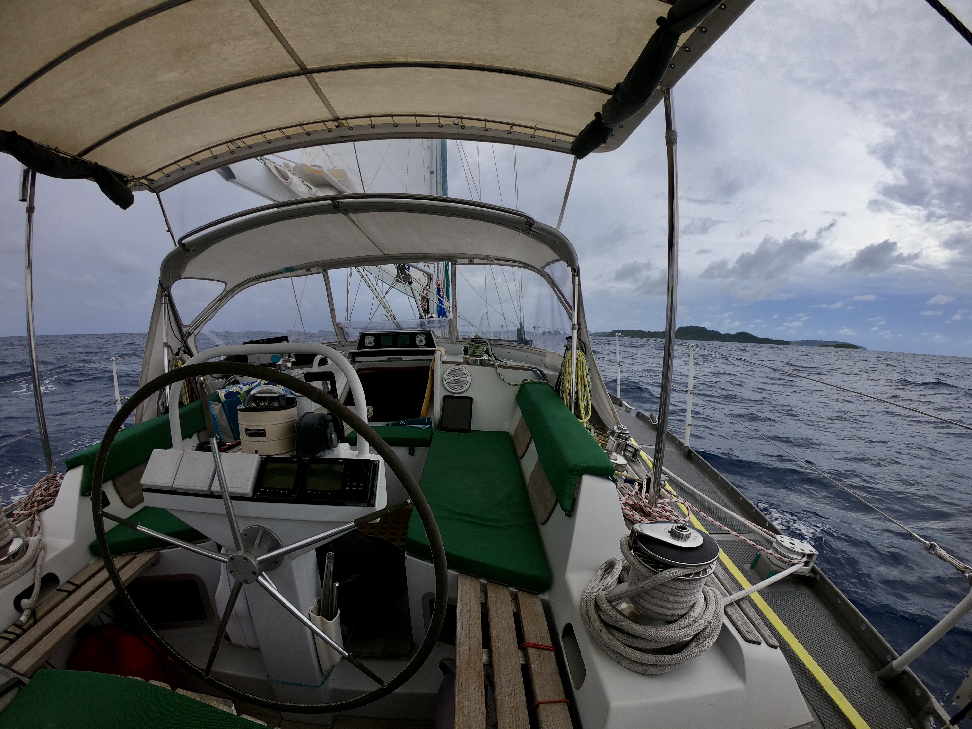
Still, erratic wind direction and wind speeds continued to plague us for the next thirty six hours. Our progress was good – in three days we had managed to make good on about 360nm – however, so far we had also added about eighteen hours of run time to our Perkins diesel engine.
As the sun rose. preparing to usher in the beginning of our fourth day at sea, we passed another significant milestone…crossing Longitude 180°.
180°…the International Date Line, the meridian opposite the prime meridian which together create the circle that divides the Earth into Eastern and Western Hemispheres.
Our Longitude West instantly became Longitude East.
Oddly enough, we had already been a day ahead of those occupying the Eastern Hemisphere for weeks. Tonga, though east of 180°, chose to artificially shift the International Date Line to run east of their international borders, effectively placing themselves on the same calendar day as the Western Hemisphere (and those that they have more day to day interactions with).
So, despite not experiencing a shift in the date, nor having the pomp and circumstance of an official mariner’s achievement – unlike our Equatorial crossing which resulted in our ascension from lowly Pollywogs to Shellbacks, crossing the International Date Line apparently carries no recognized maritime distinction – it still seemed rather significant to us.
Despite our progress, with almost ninety nautical miles remaining, it became apparent that we would not make it to Tuvalu until after sundown. It was also apparent that, at our current pace, we would arrive before the following day’s sunrise, an equally unappealing option.
Even motorsailing for twelve hours straight, it was still highly unlikely that we would beat the sunset. Thus, a twenty-four hour slow sail became our new strategy – a pace slow enough to assure we would have the light of a new day to guide us through the winding pass.
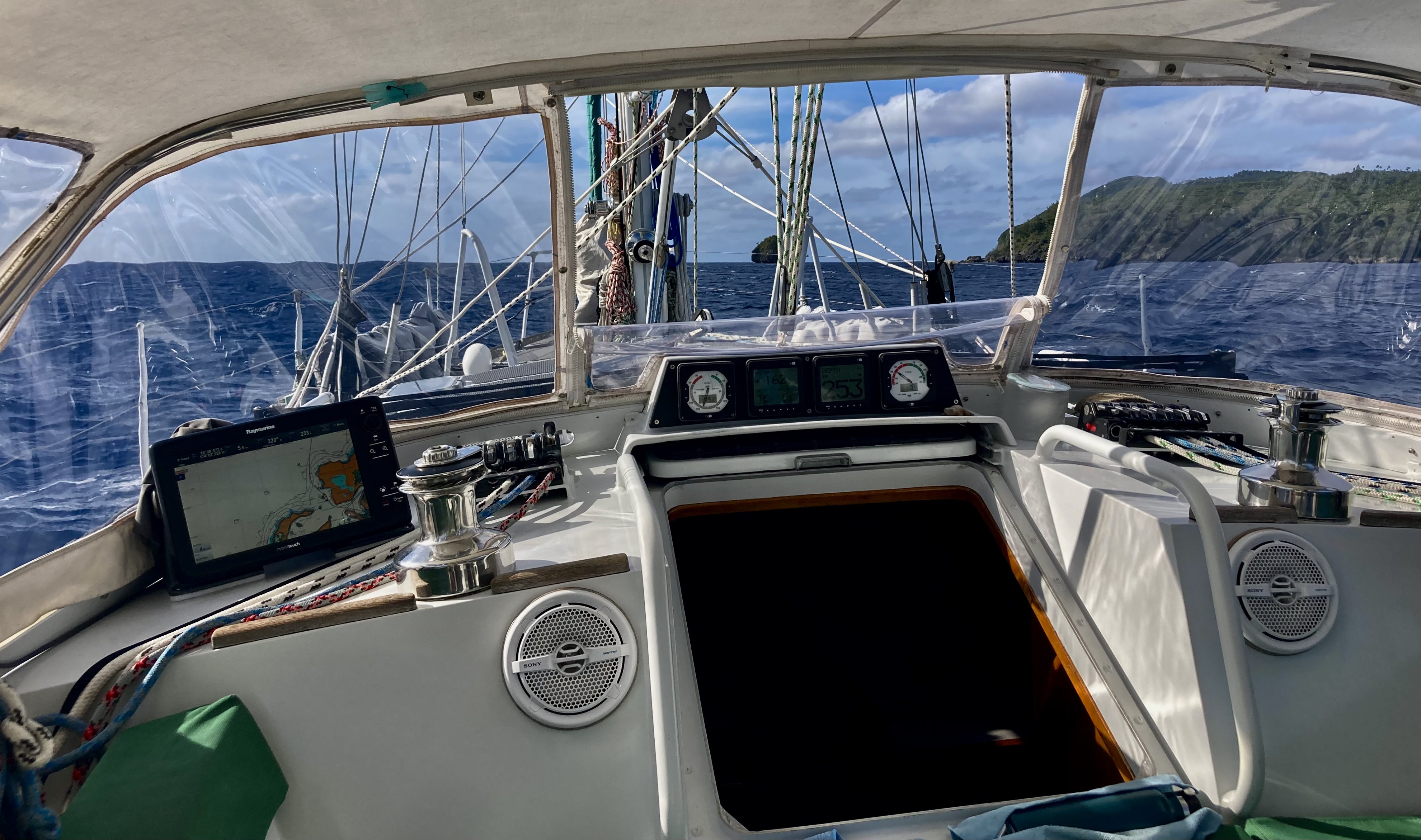
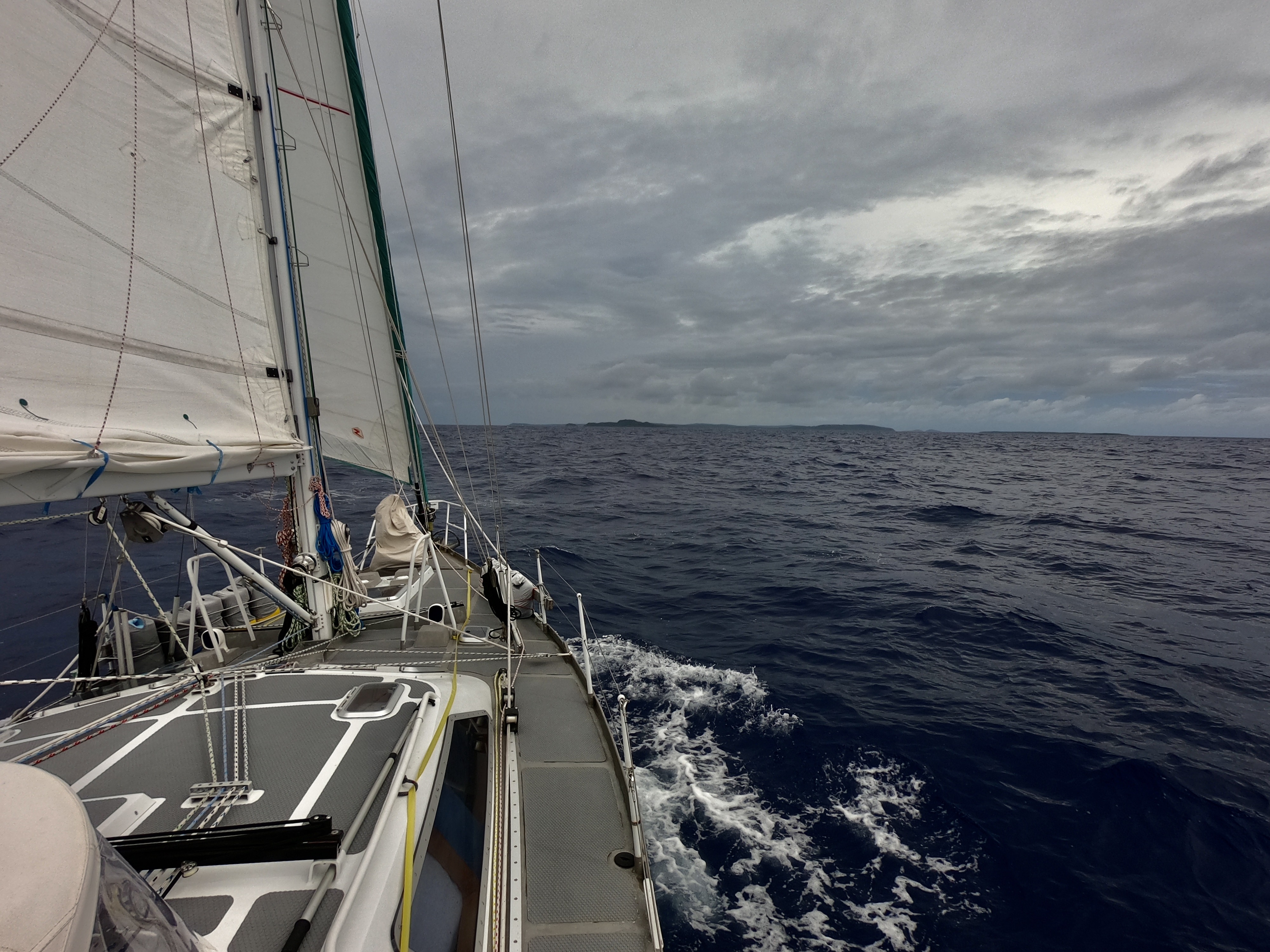
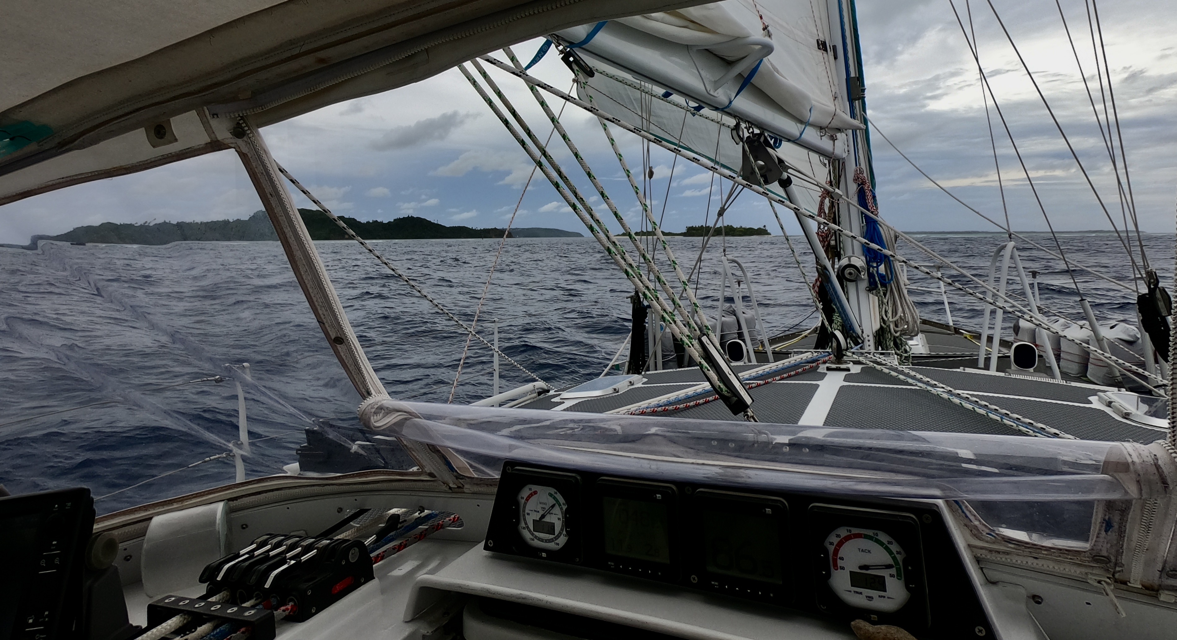
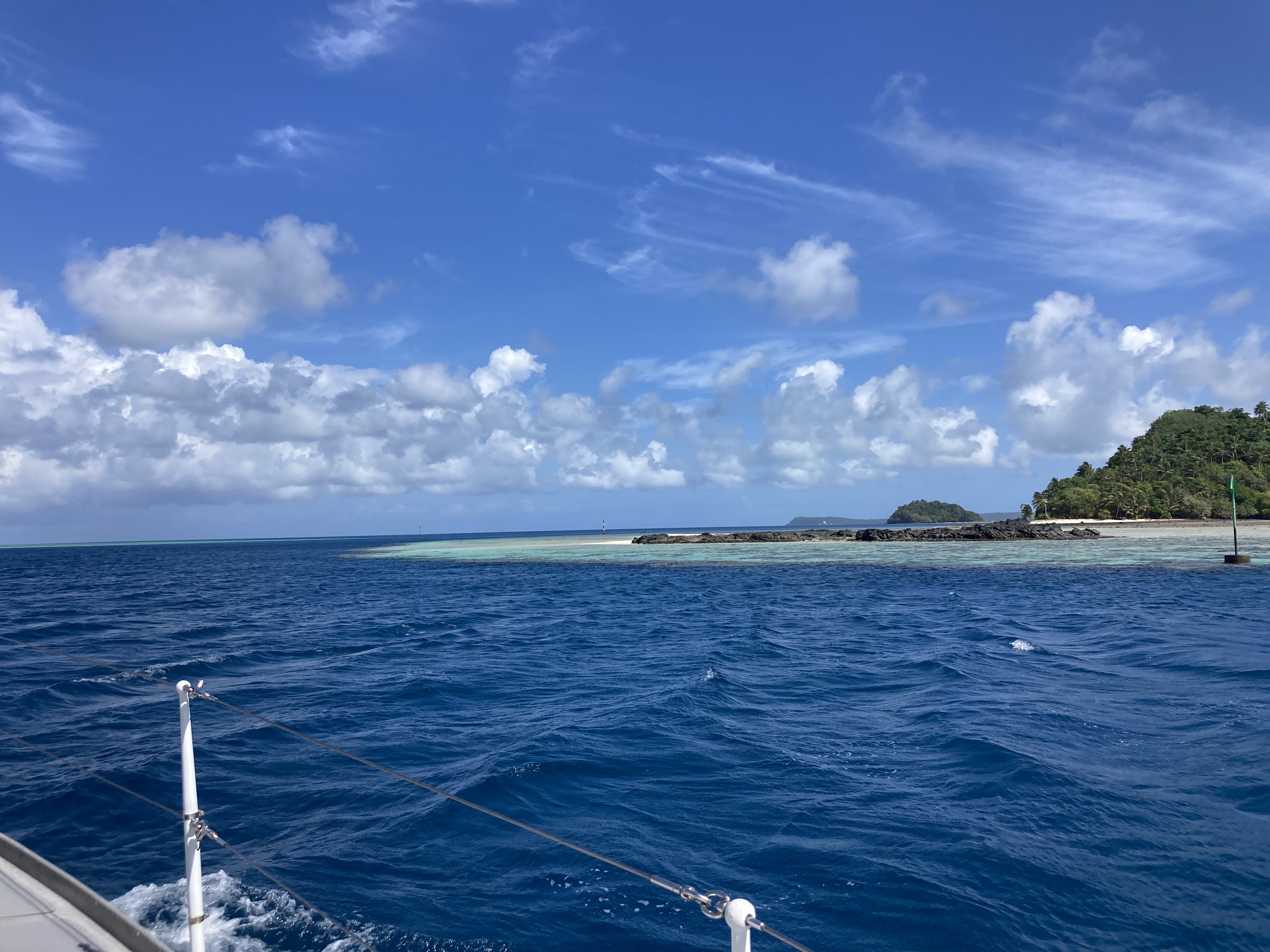
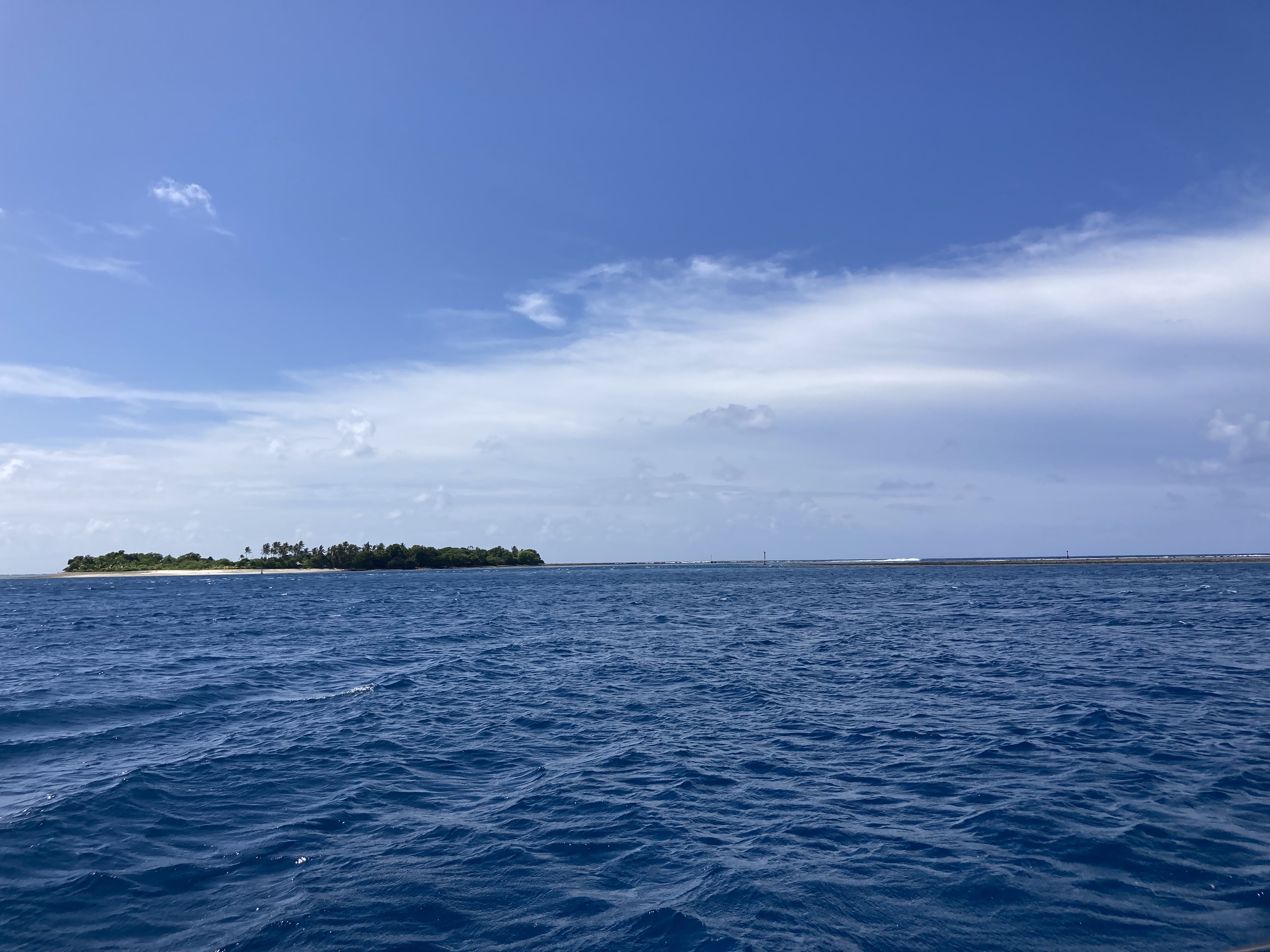
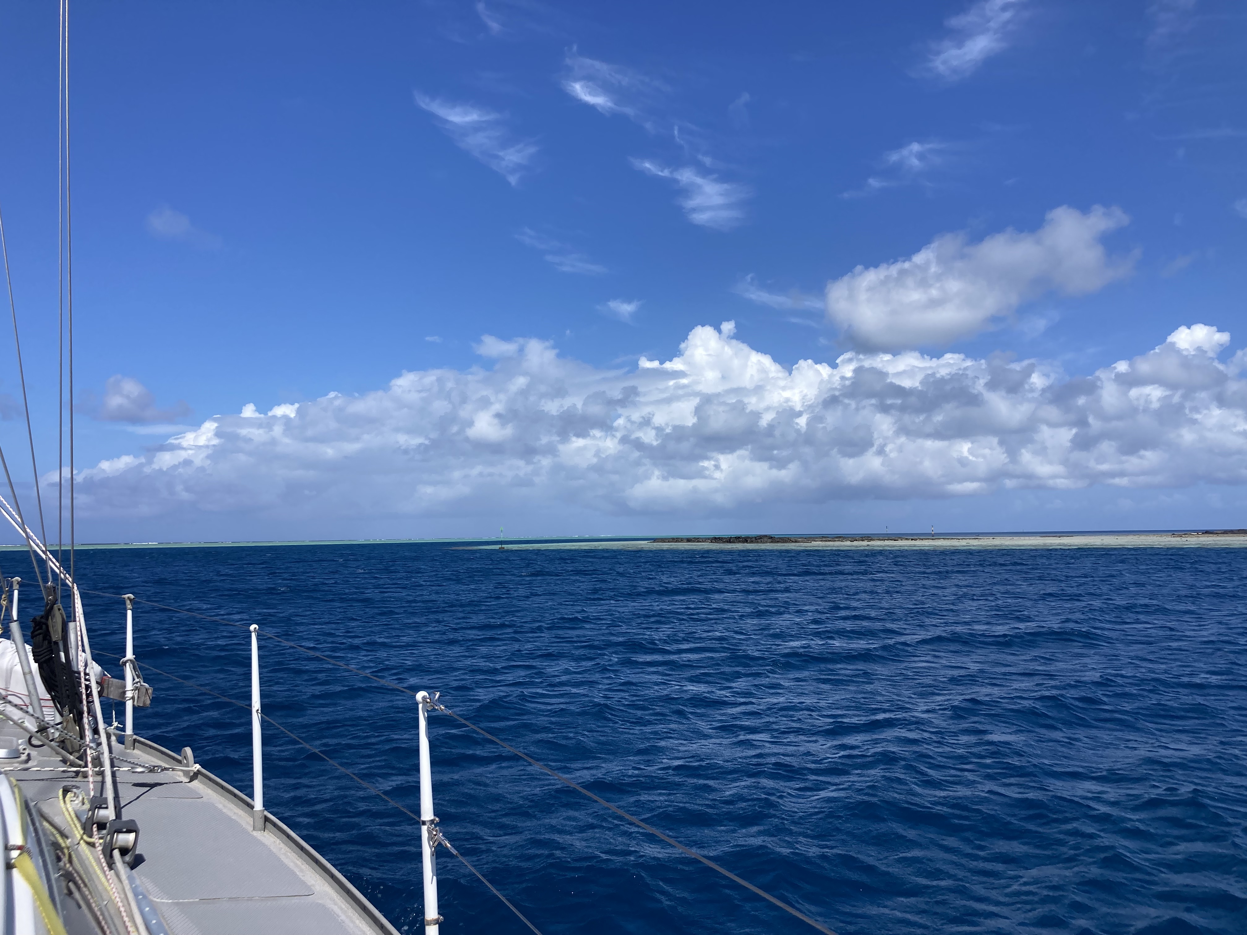
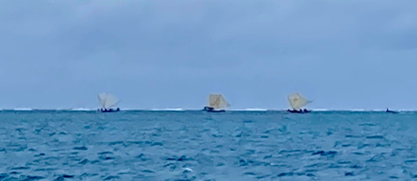
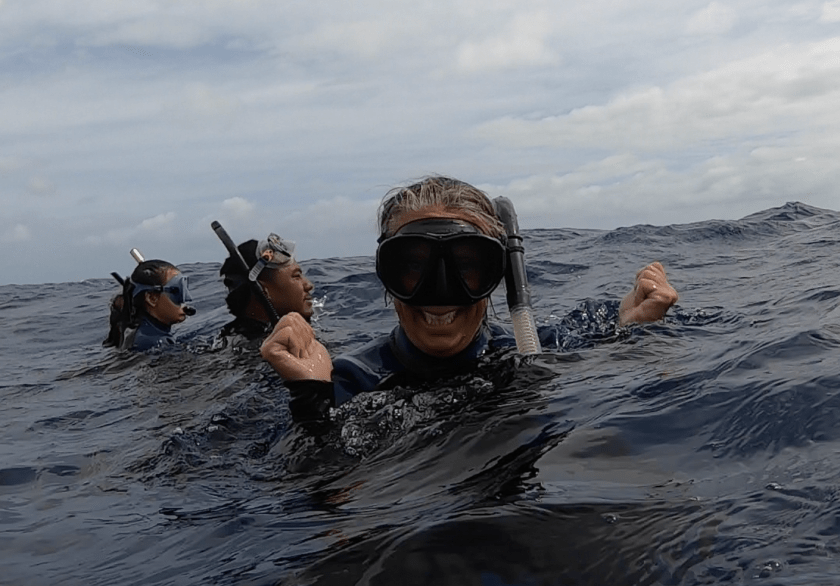
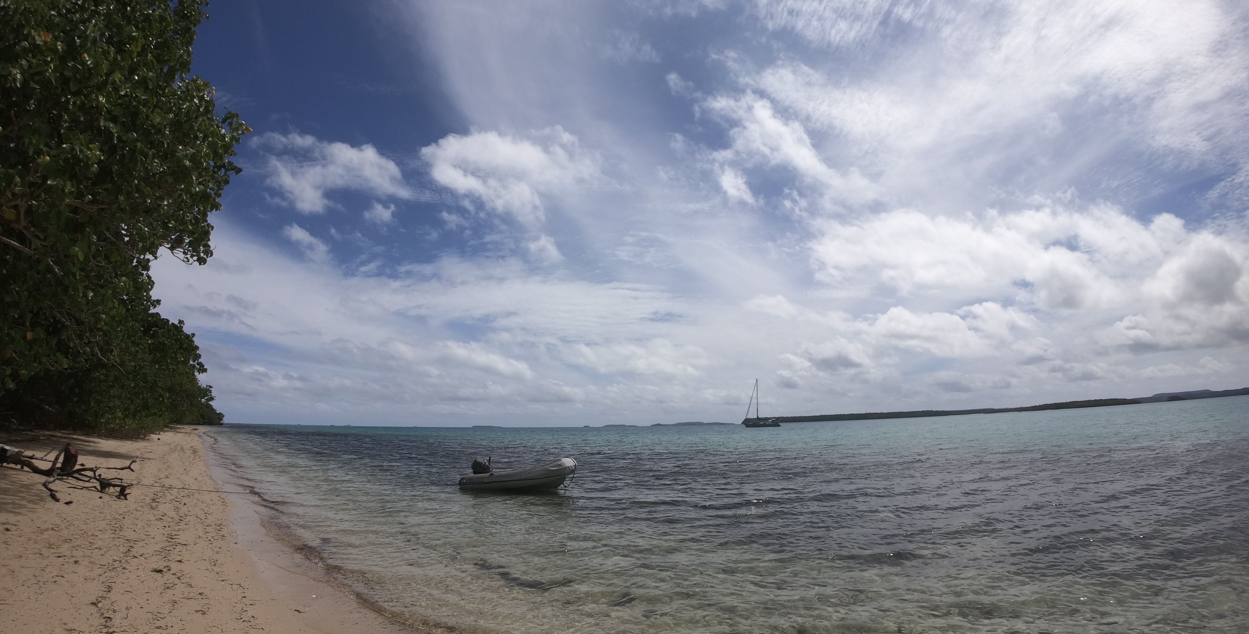
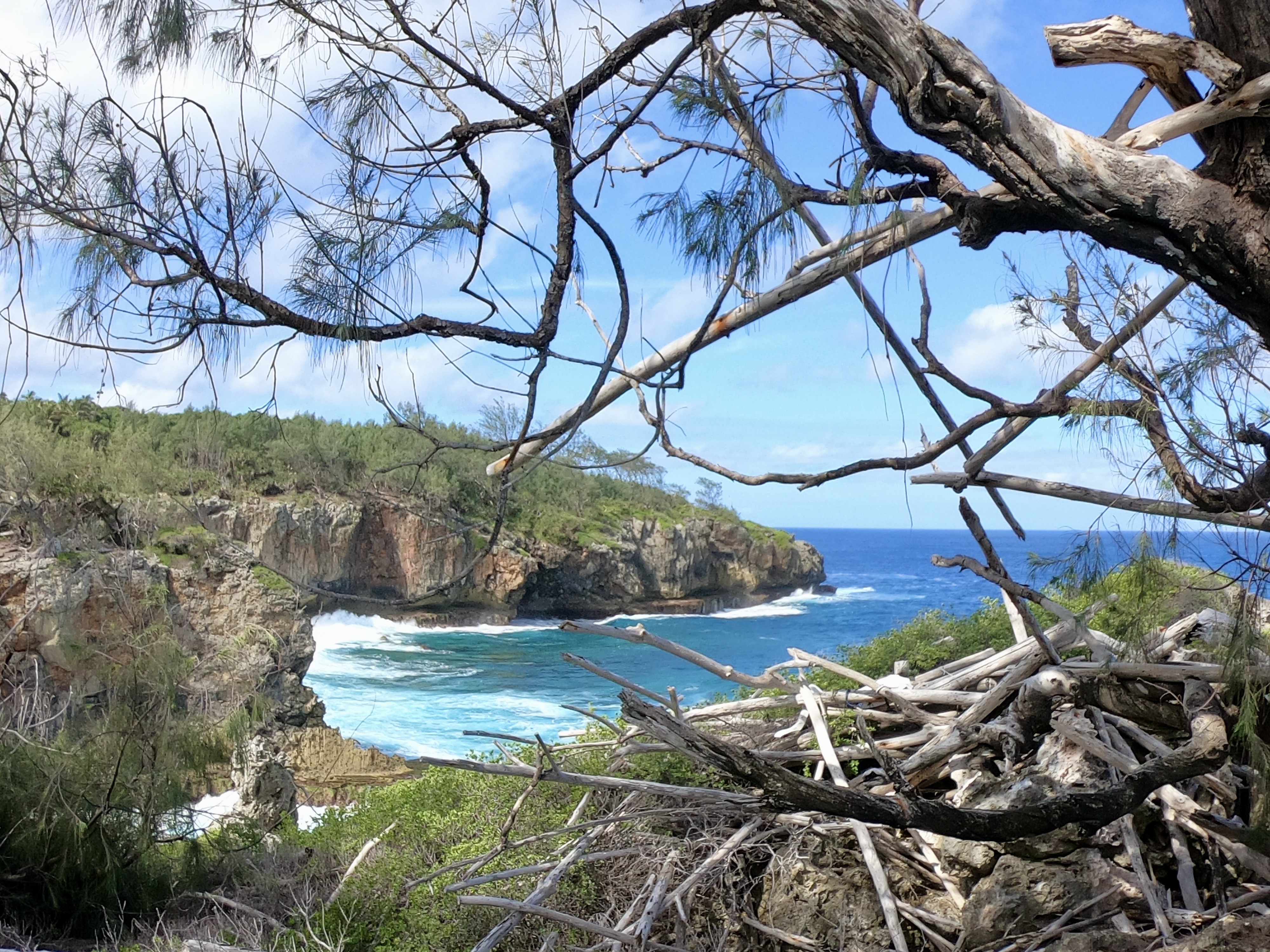
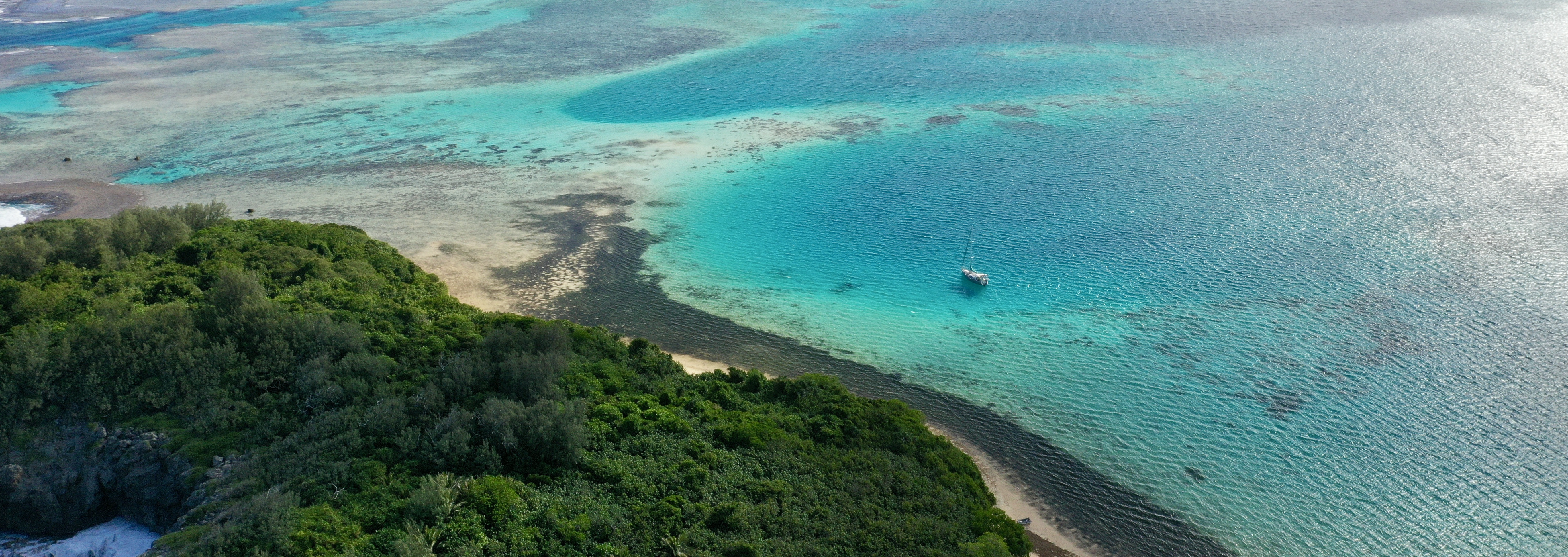
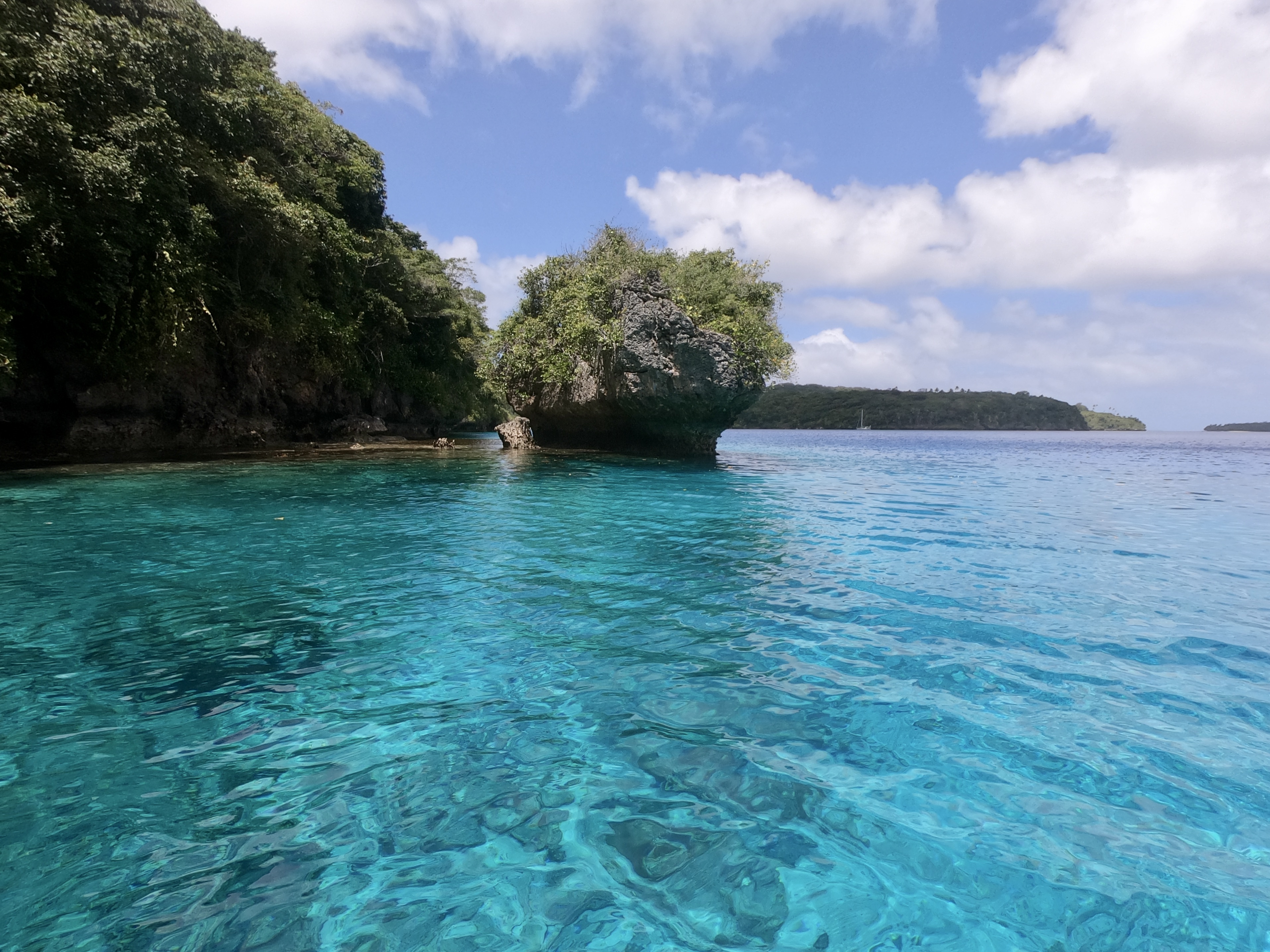
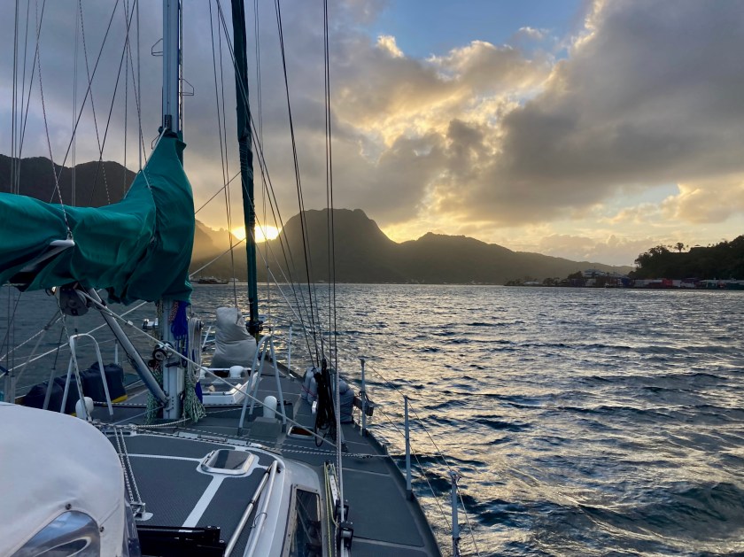
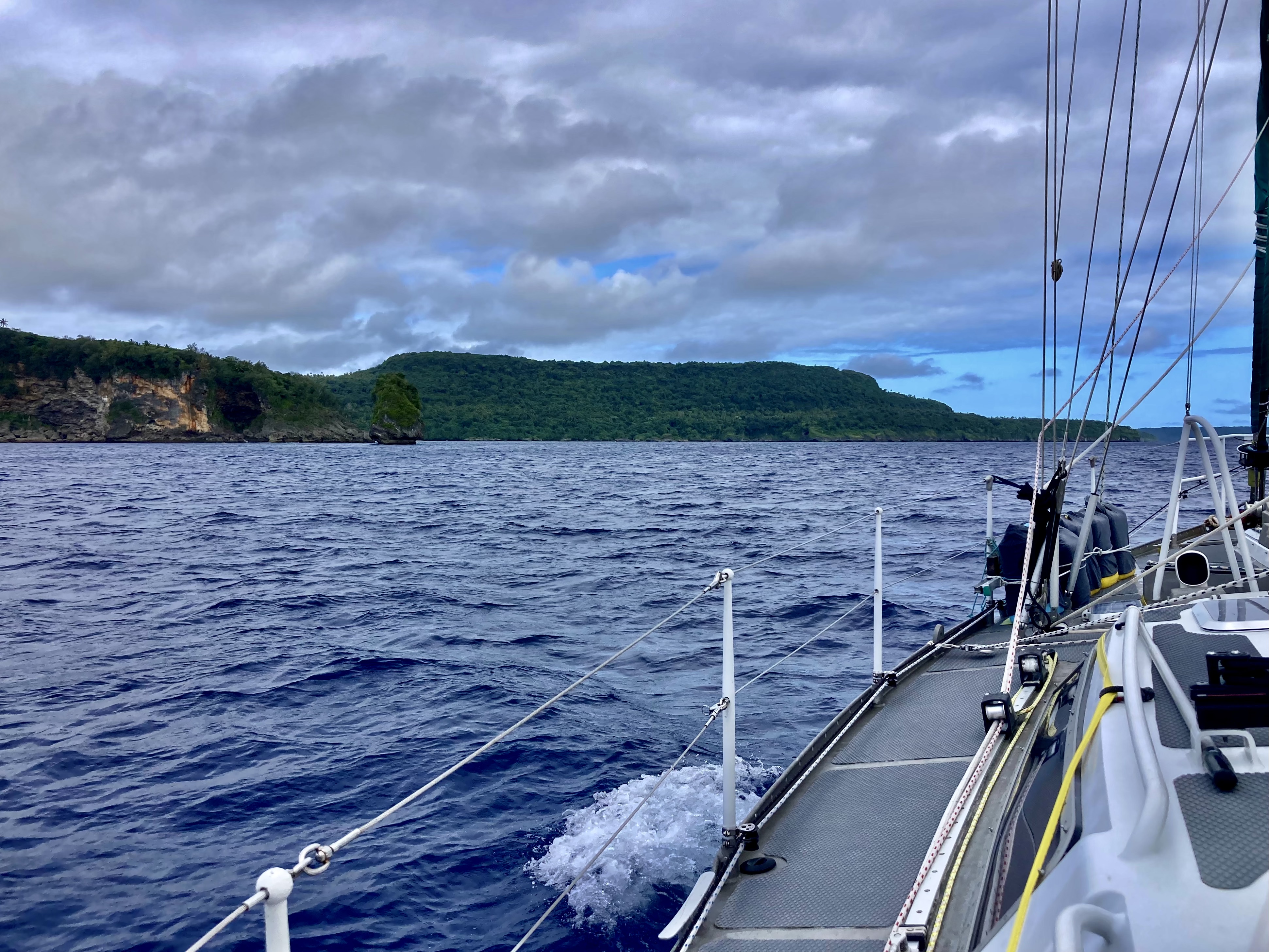
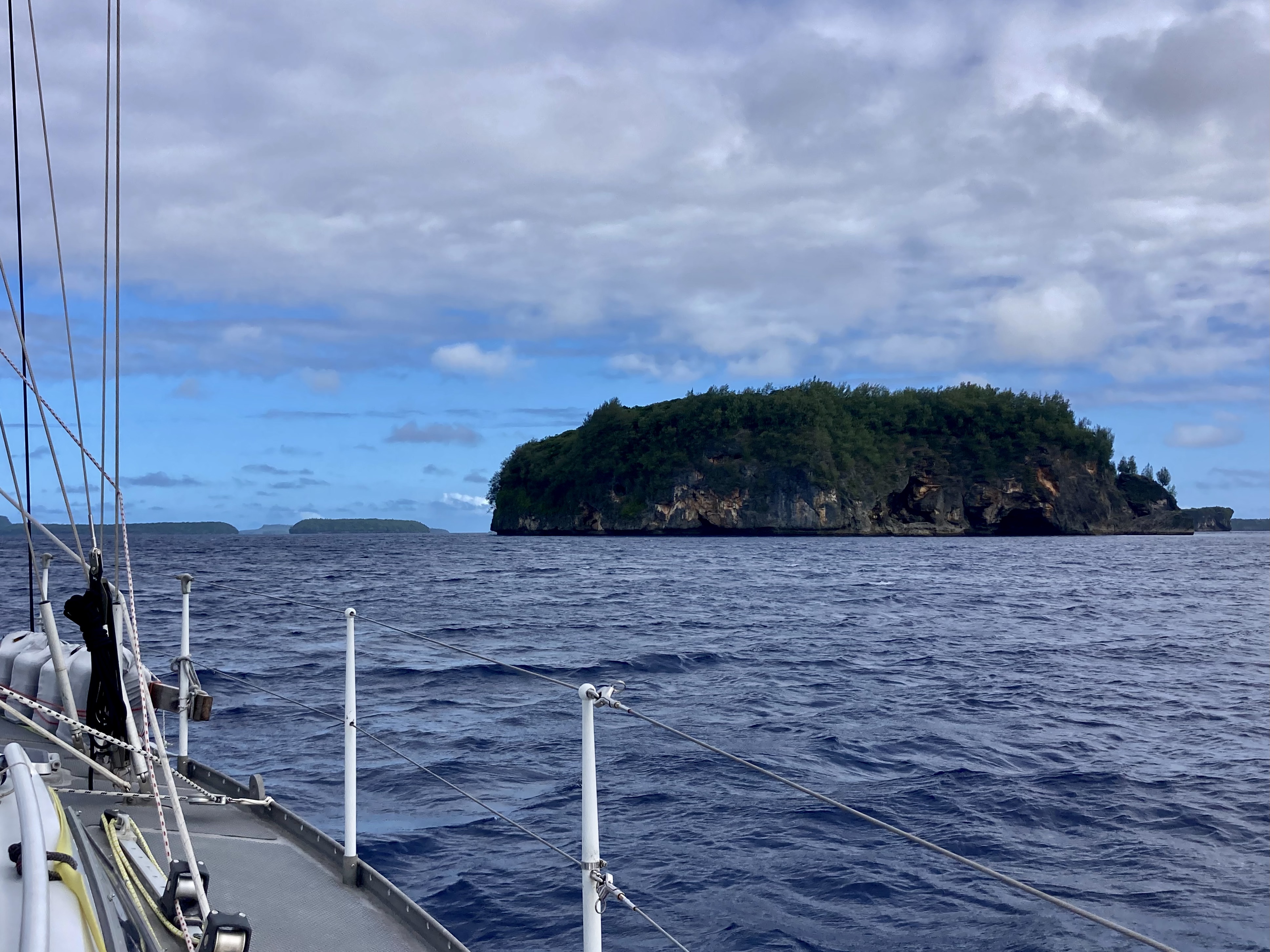
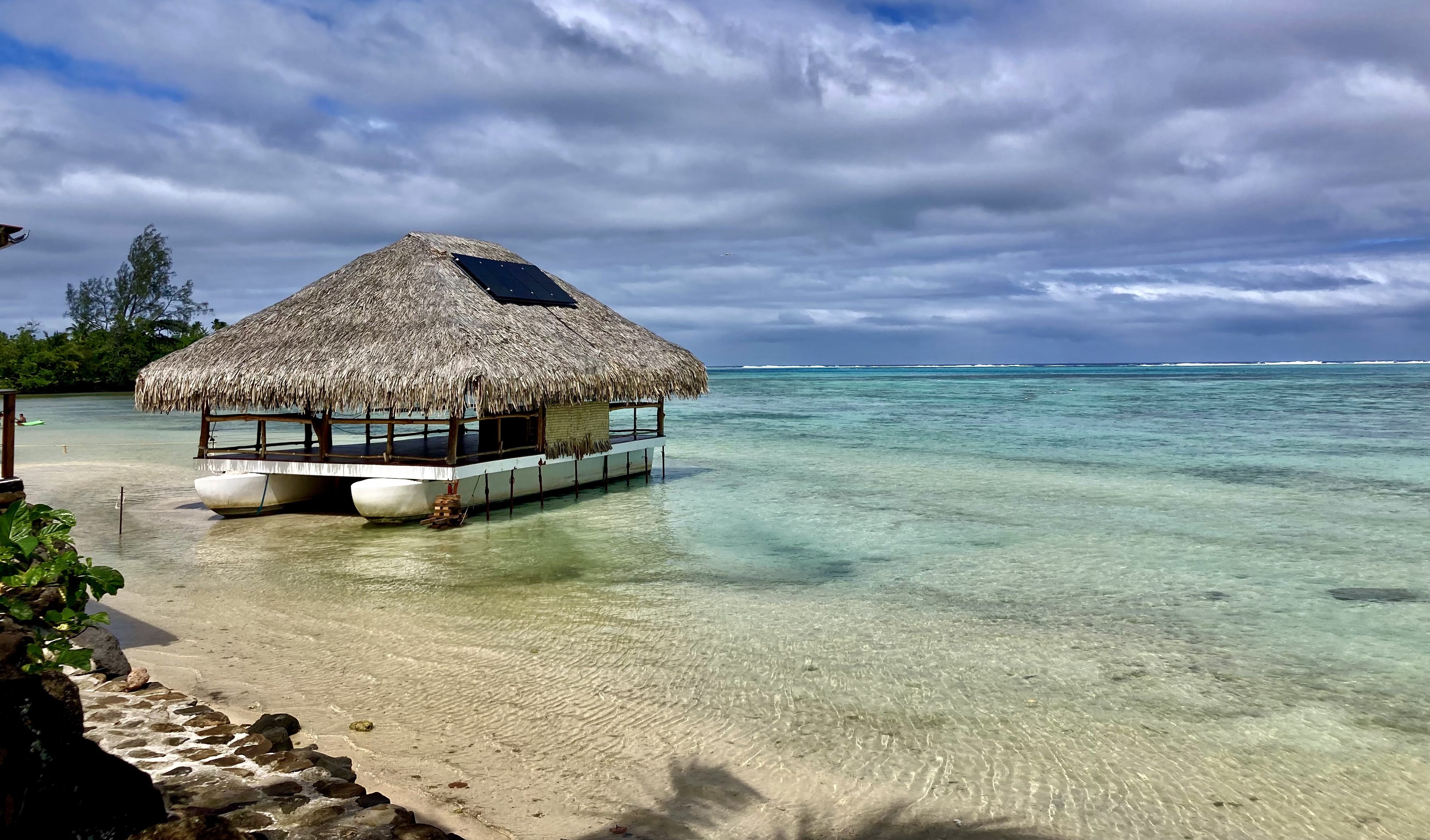
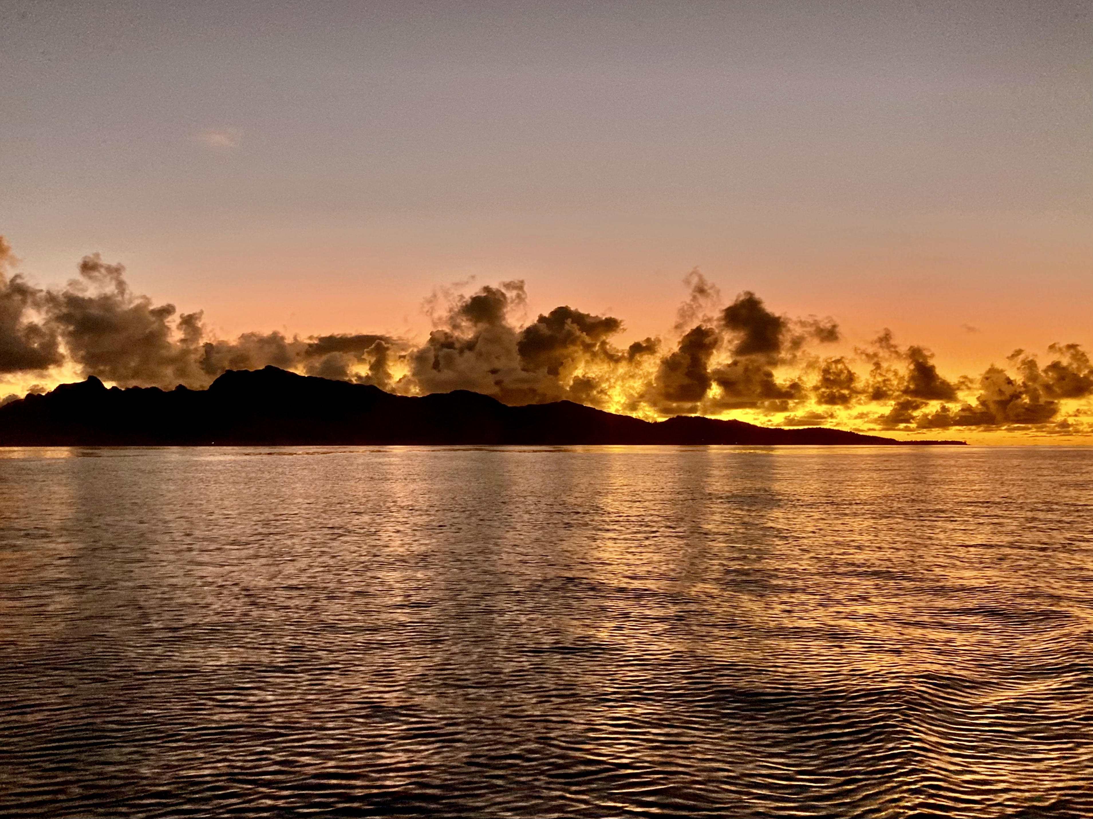
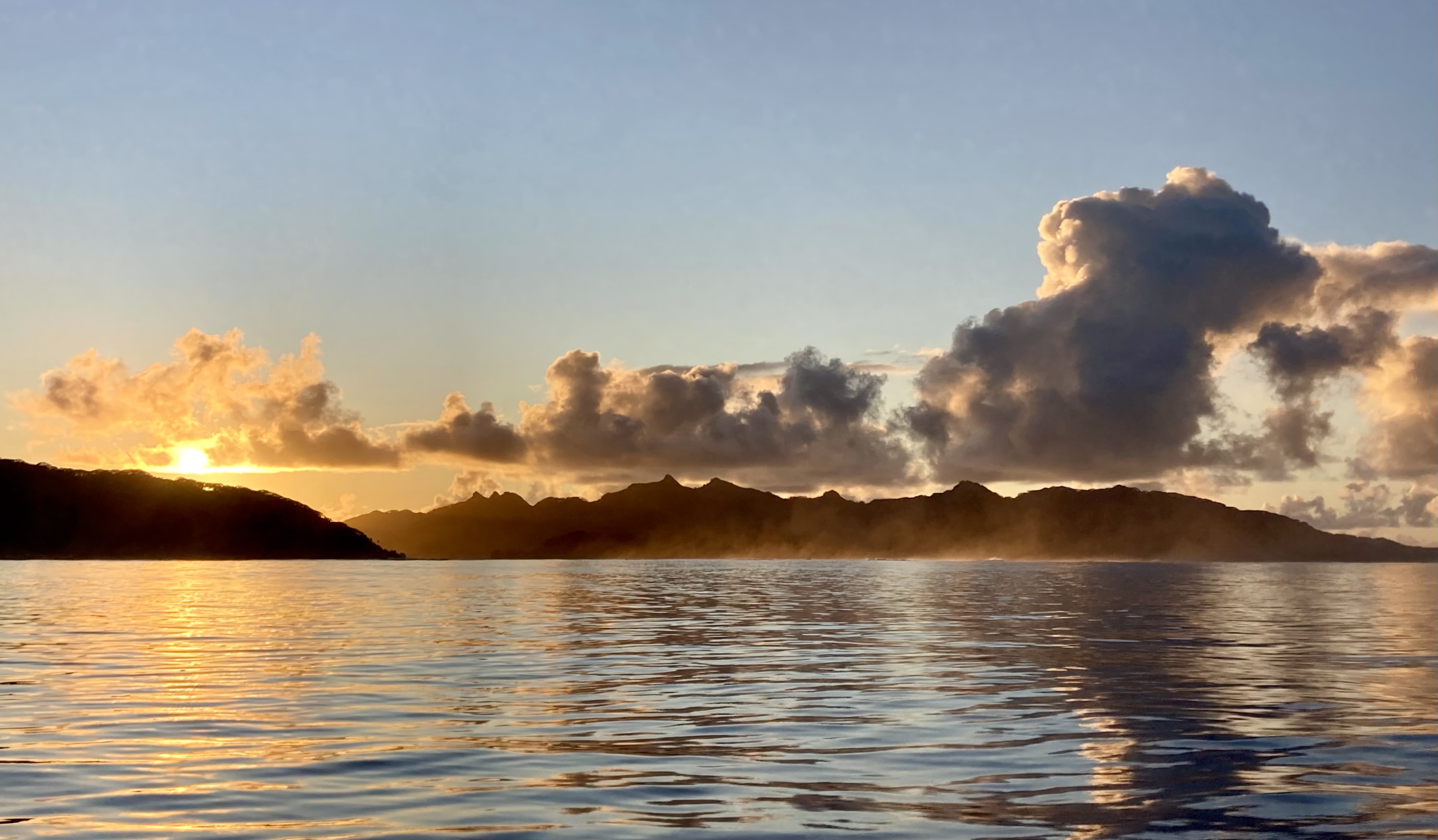
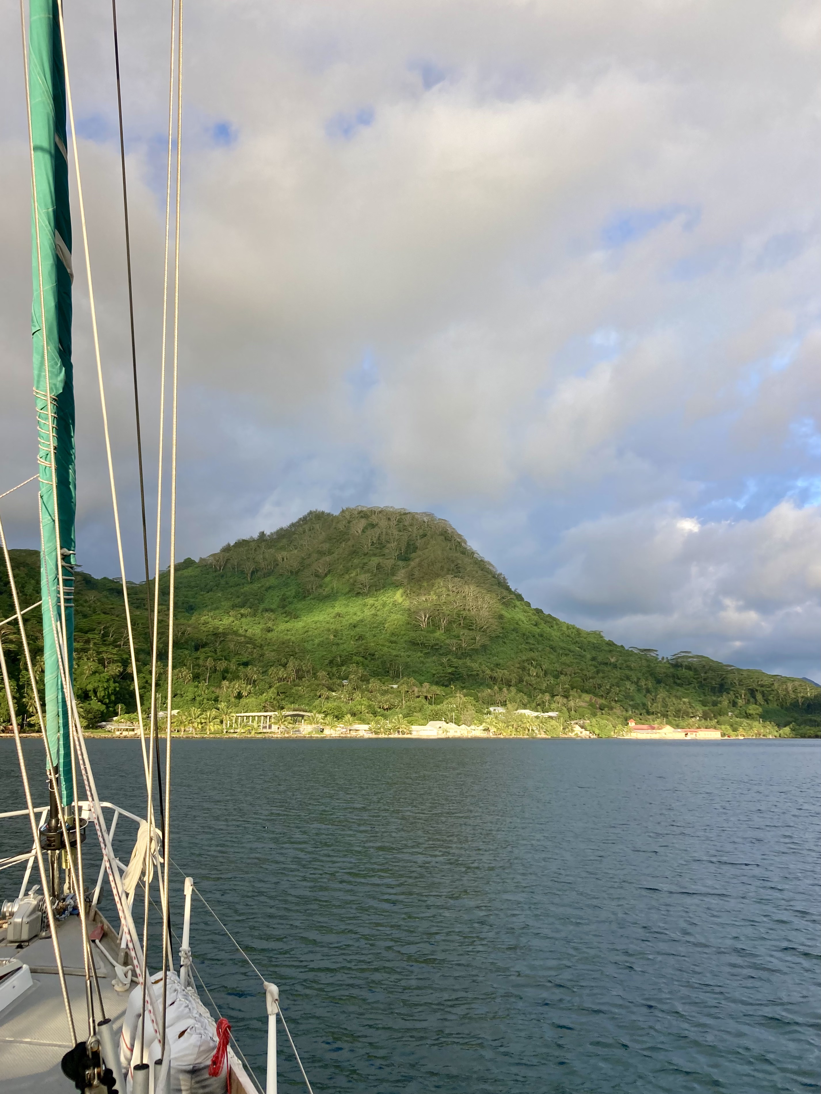
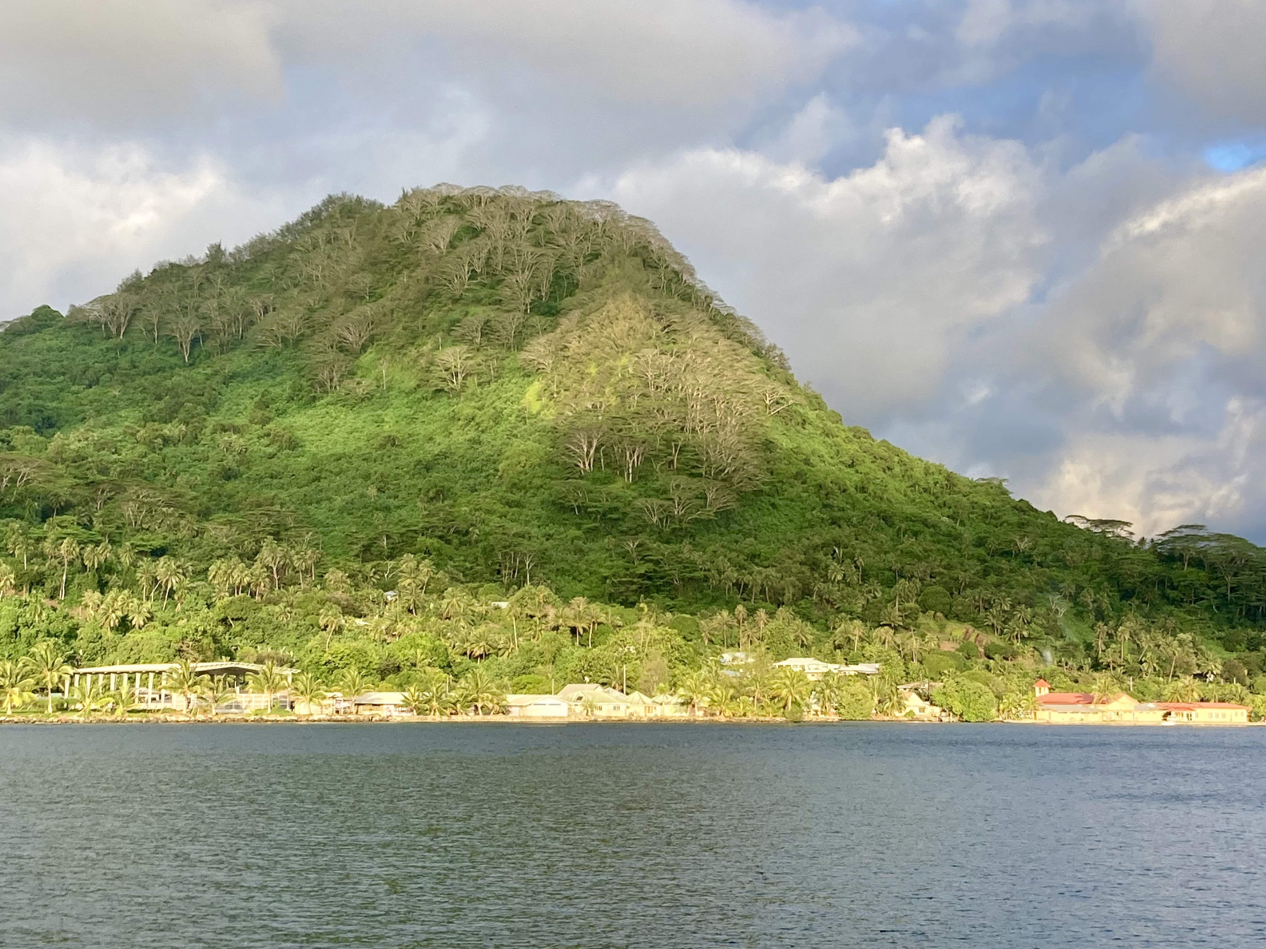
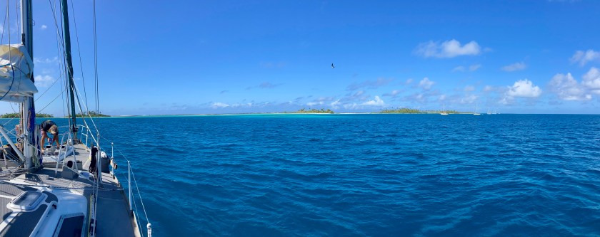
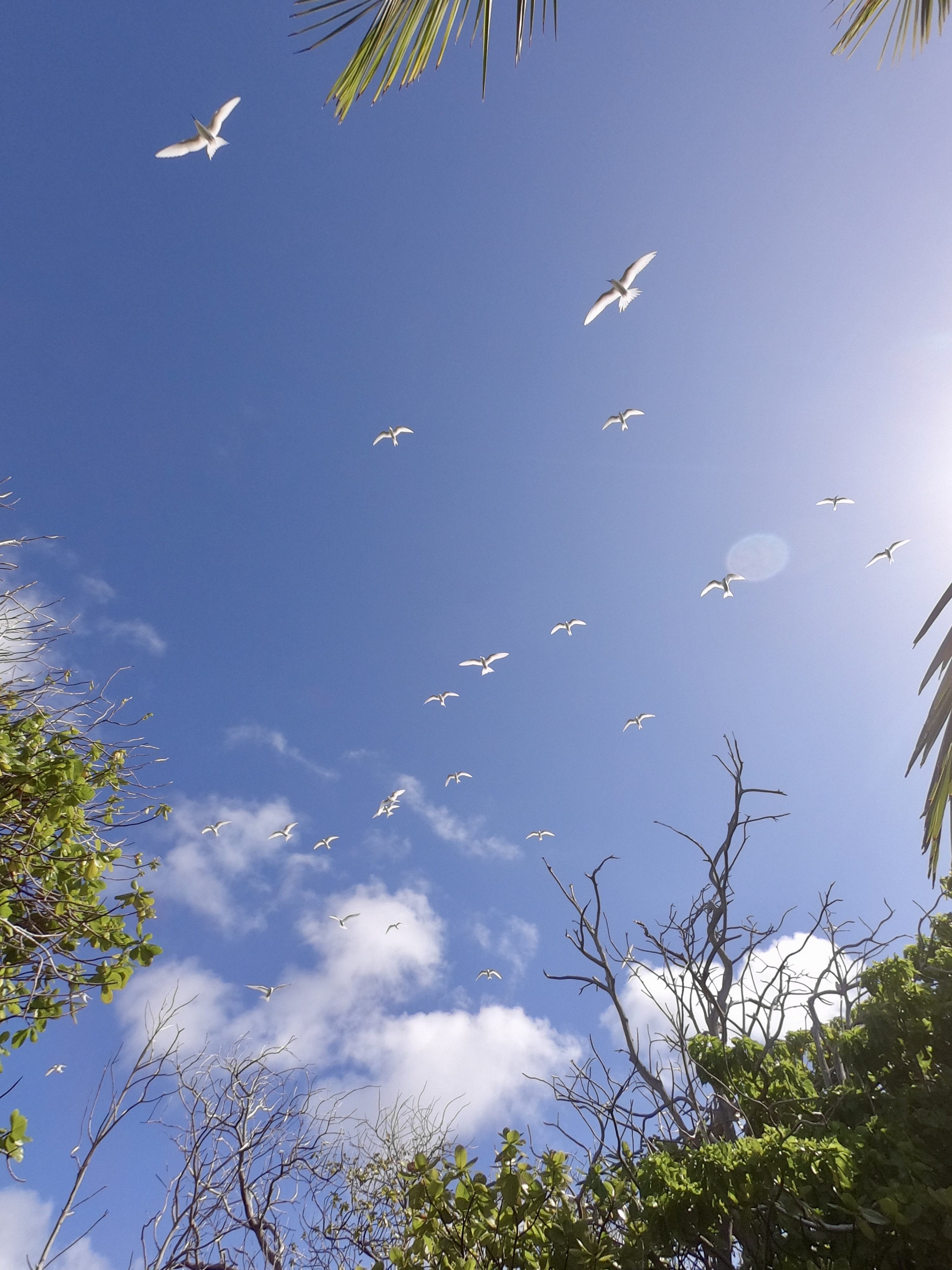
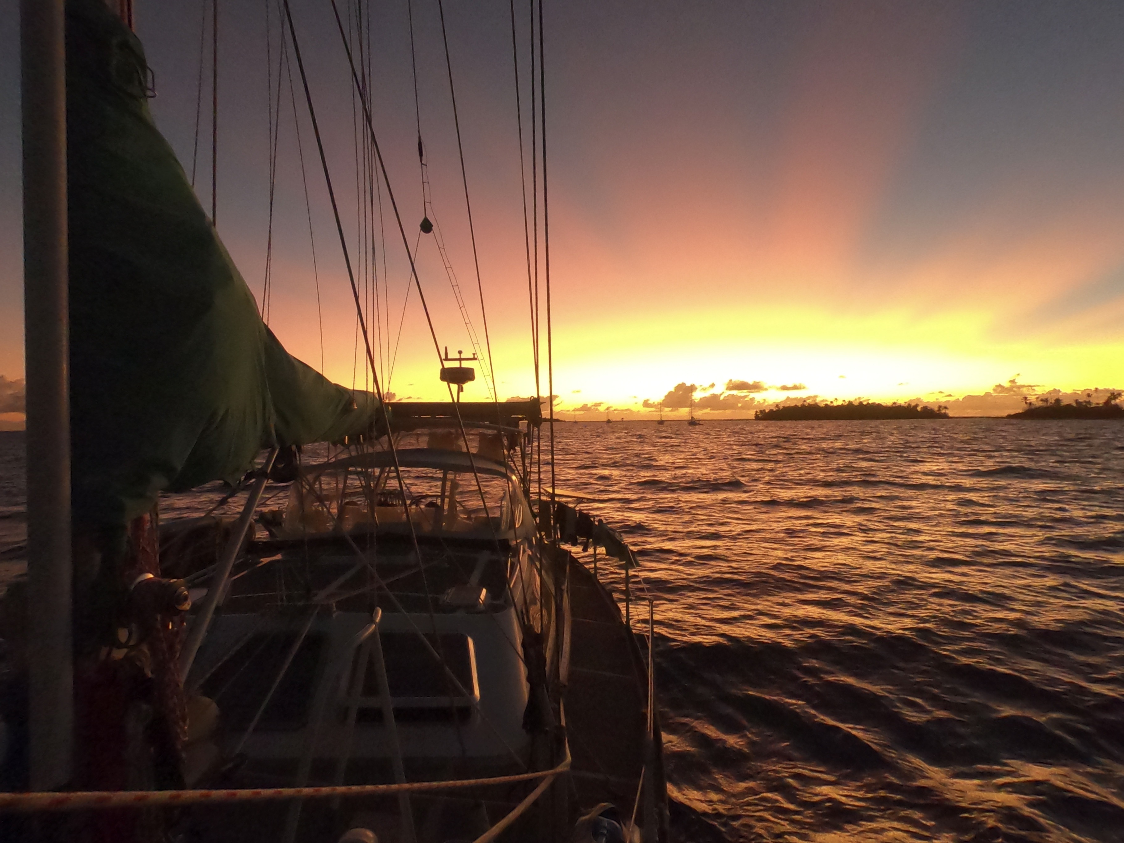
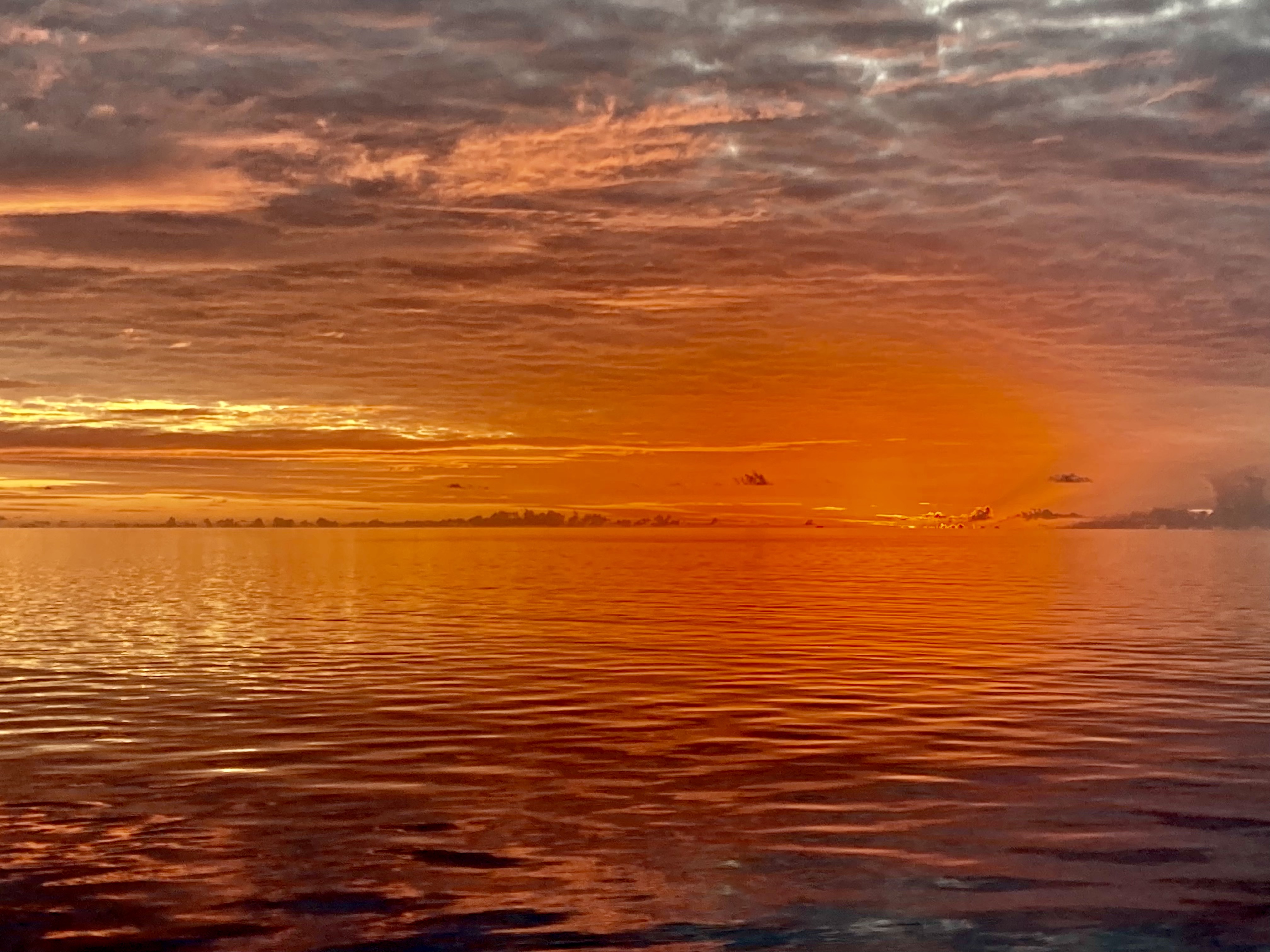
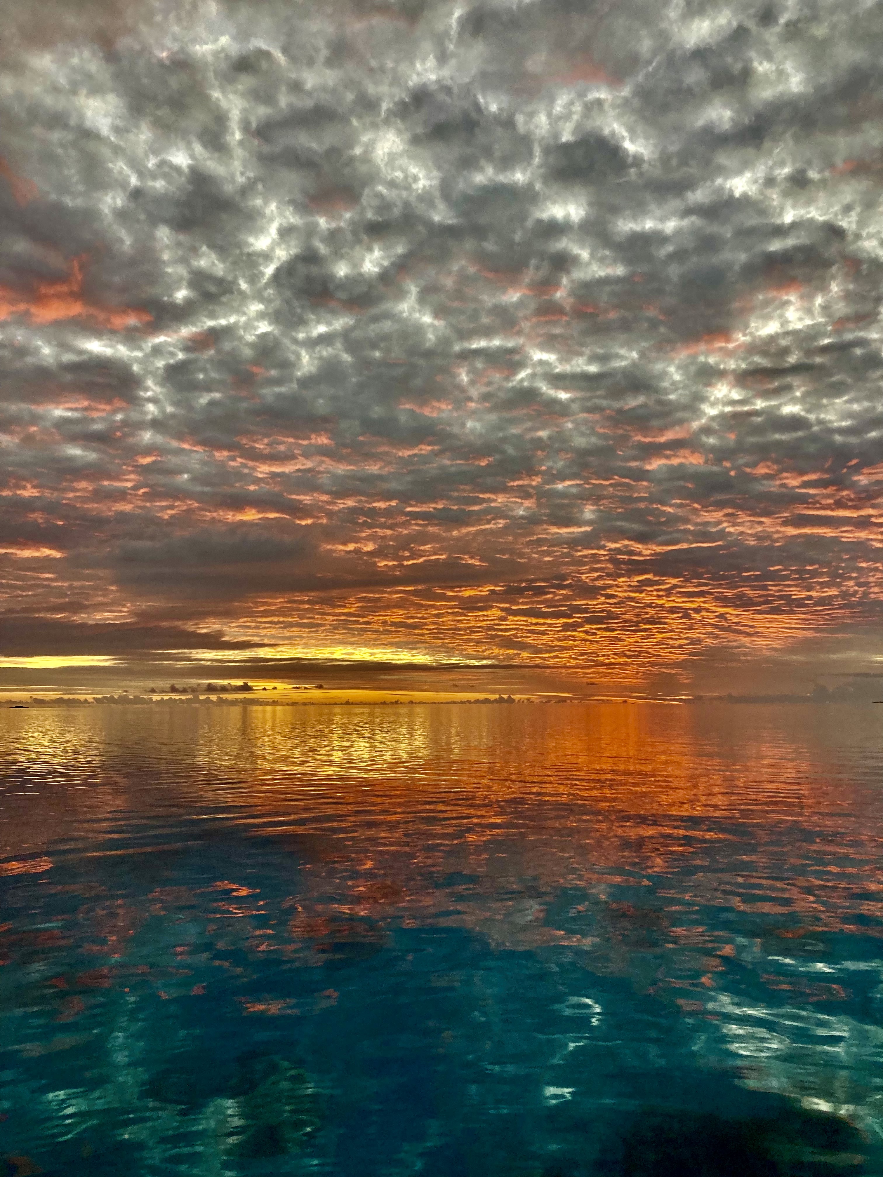
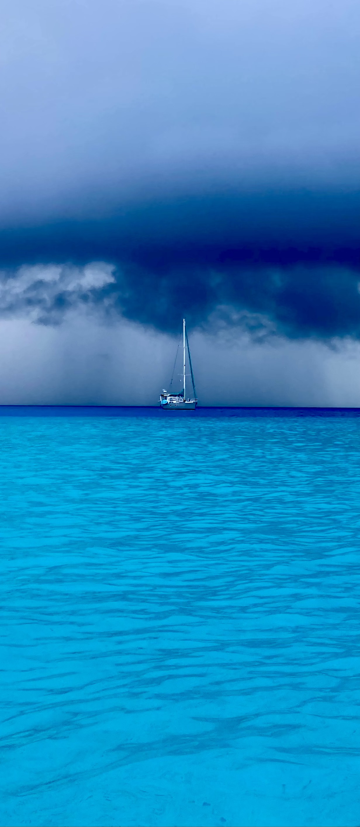
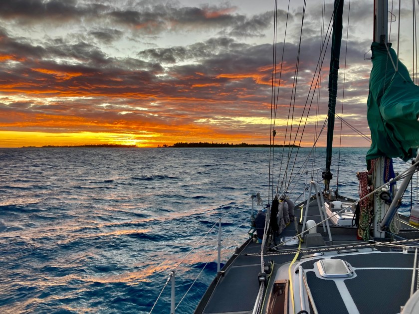
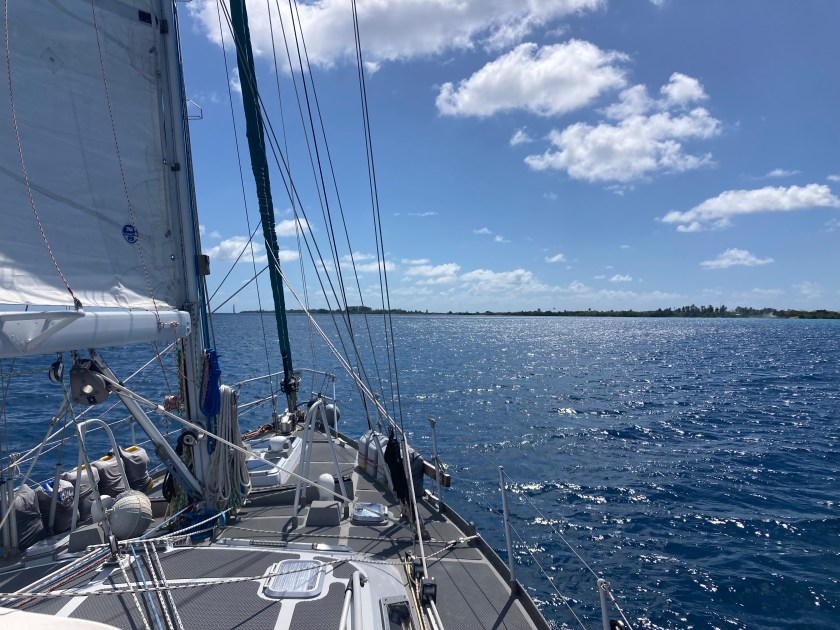
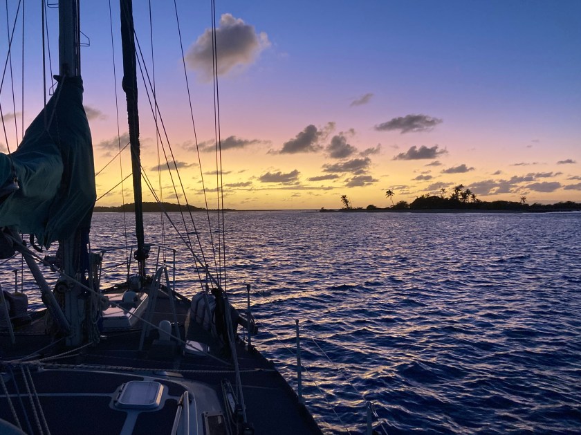
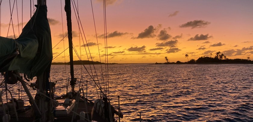
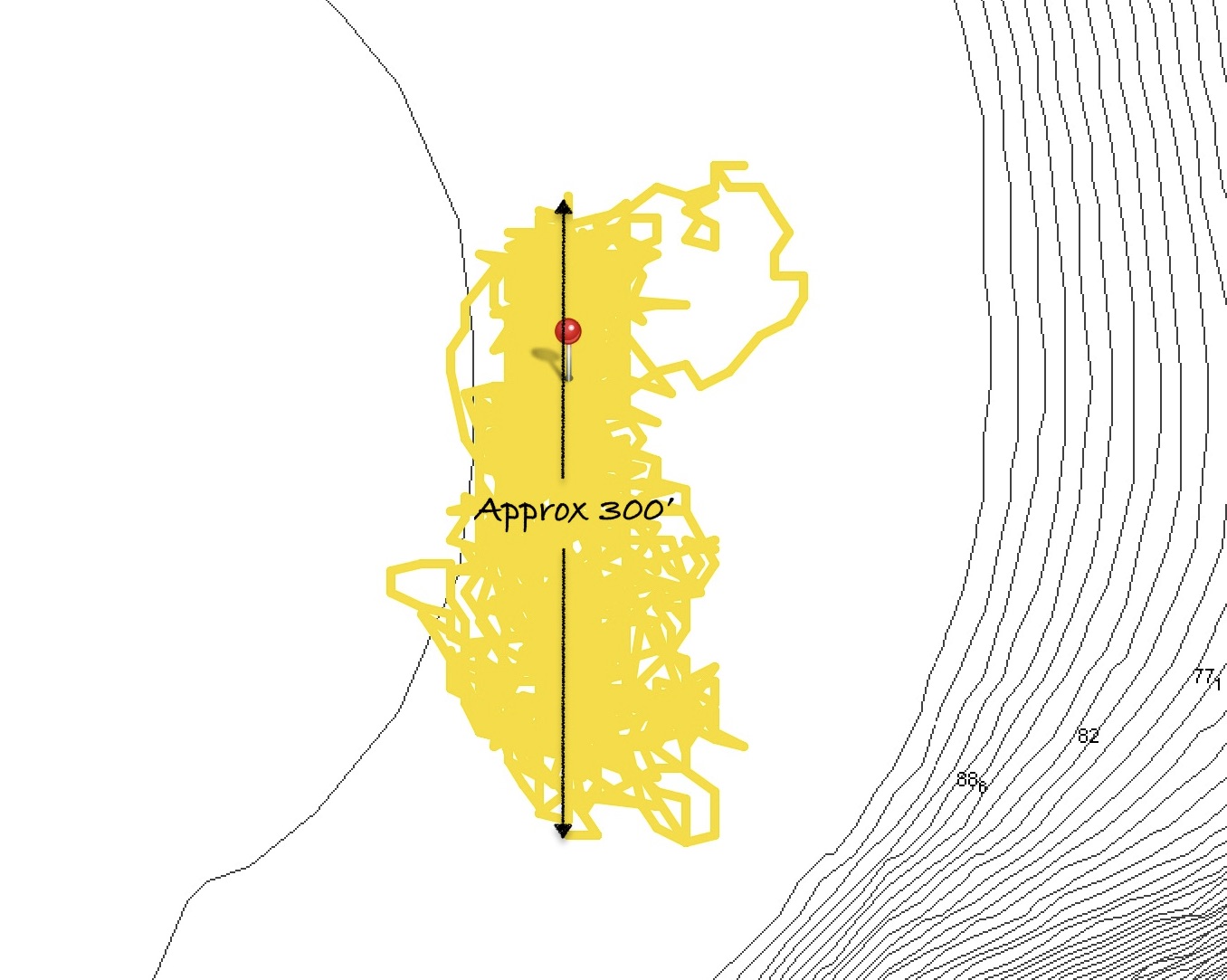
Just before midnight, three and a half days into our passage, we began to see a glow on the horizon…the lights of the atoll Funafuti. We were almost at the doorstep of Tuvalu.
Six hours later, the dark silhouette of Funafuti lay directly in front of us, barely left of the new day’s sun, which had just cleared the horizon line.
Dawn arrival at Tuvalu
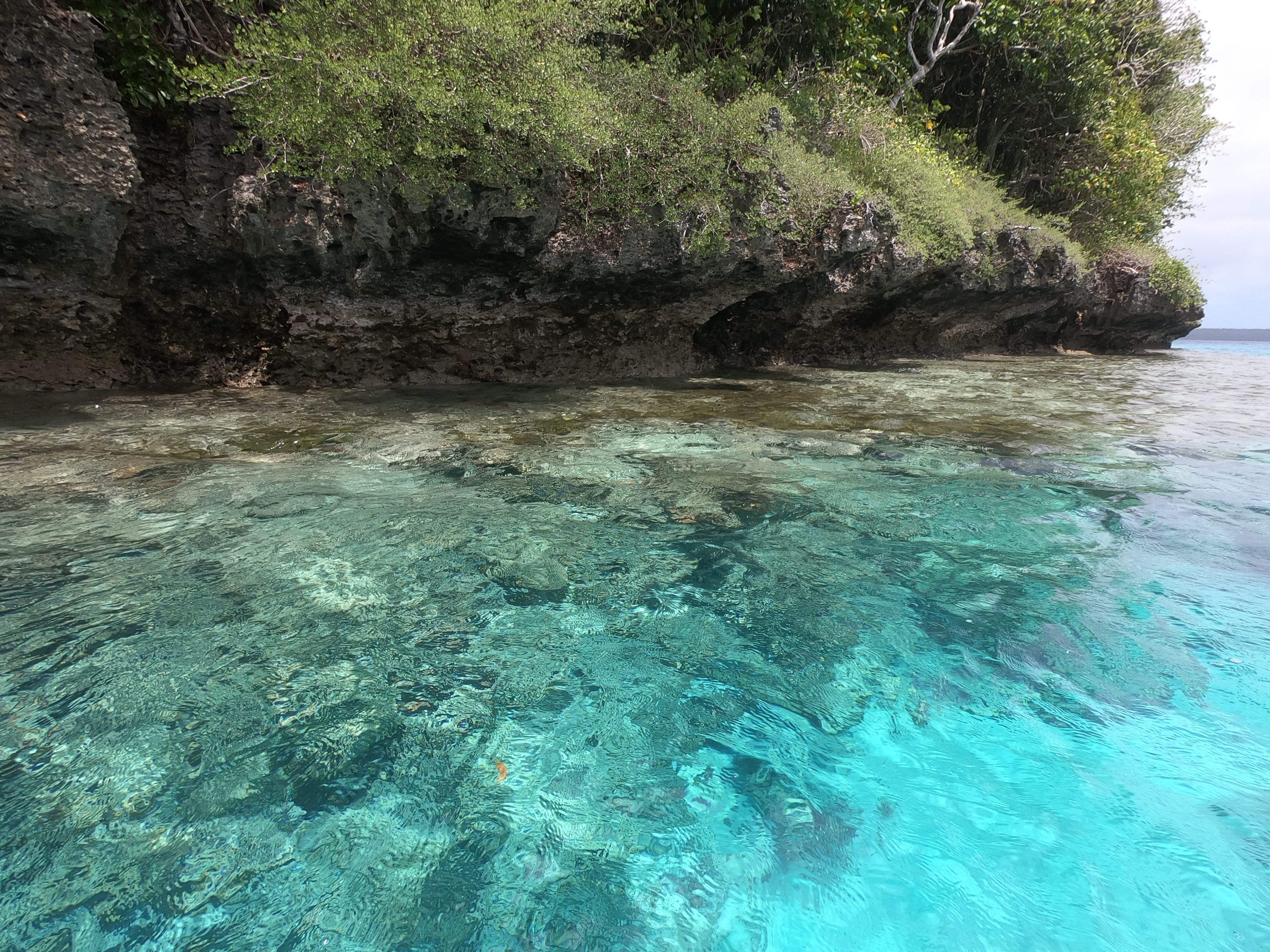
Amazingly, as we approached the channel, a pod of pilot whales as well as a pod of dolphins swam past us! It appeared Tuvalu took the responsibility of welcoming new guests quite seriously.
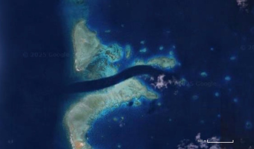
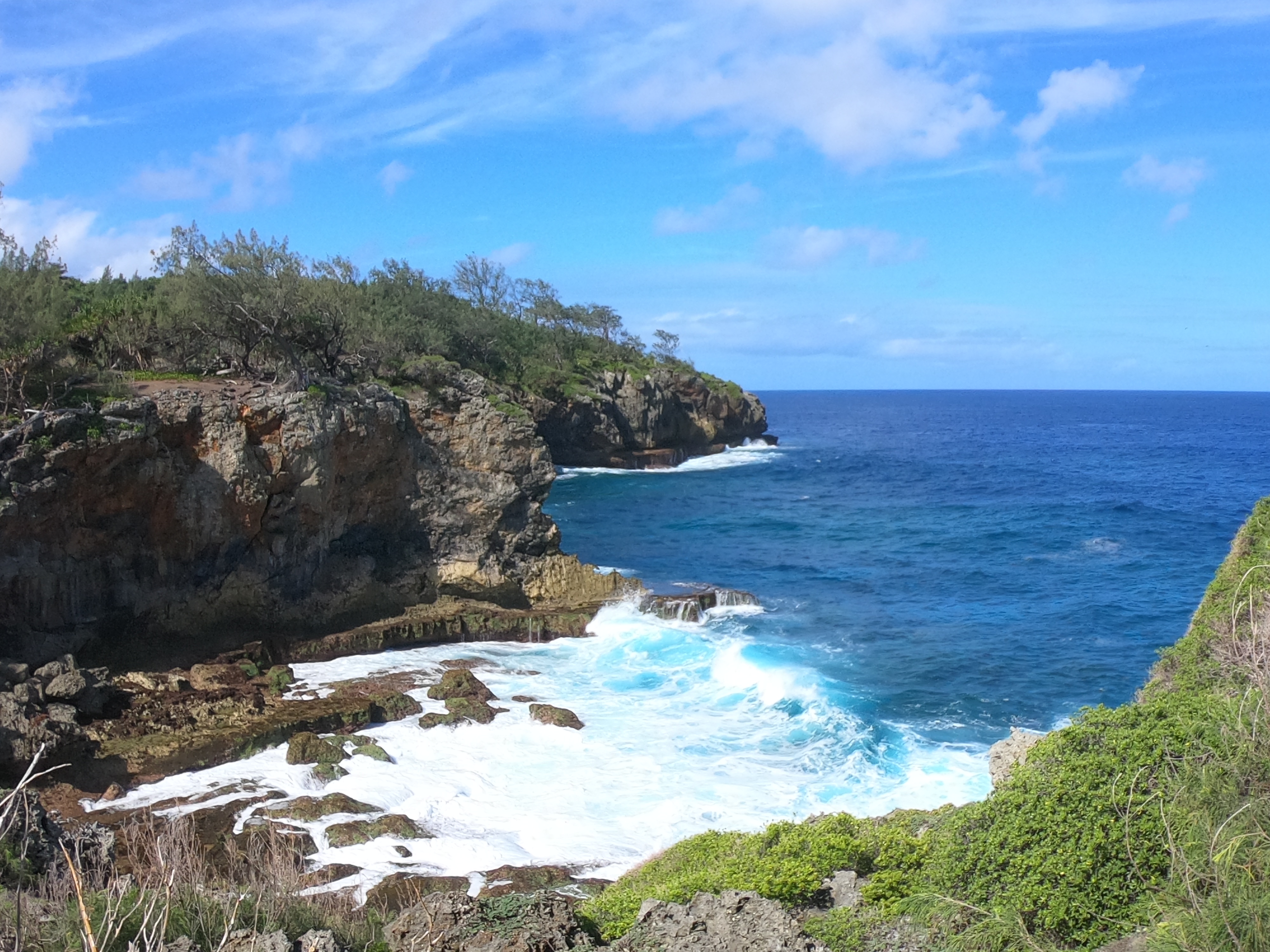
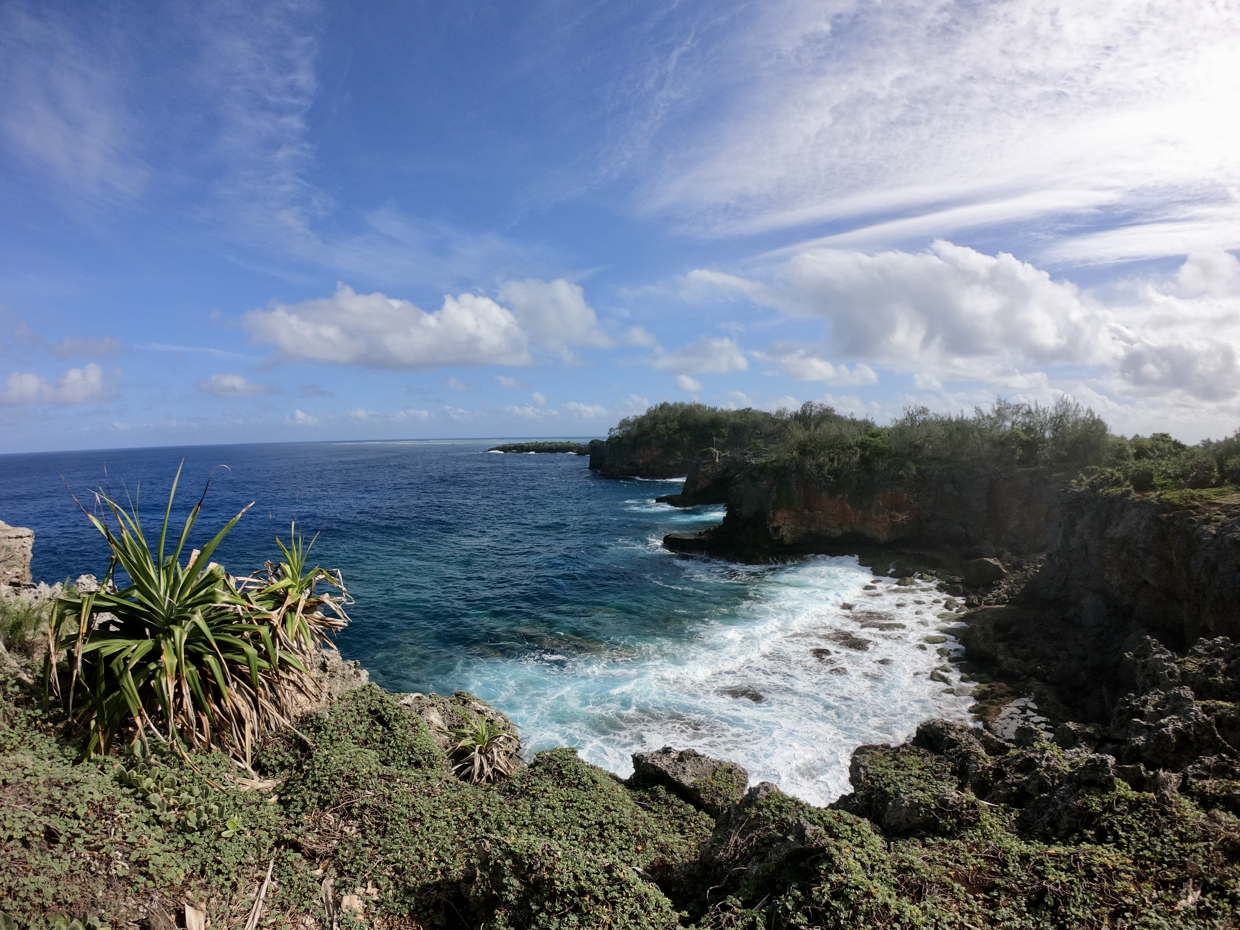
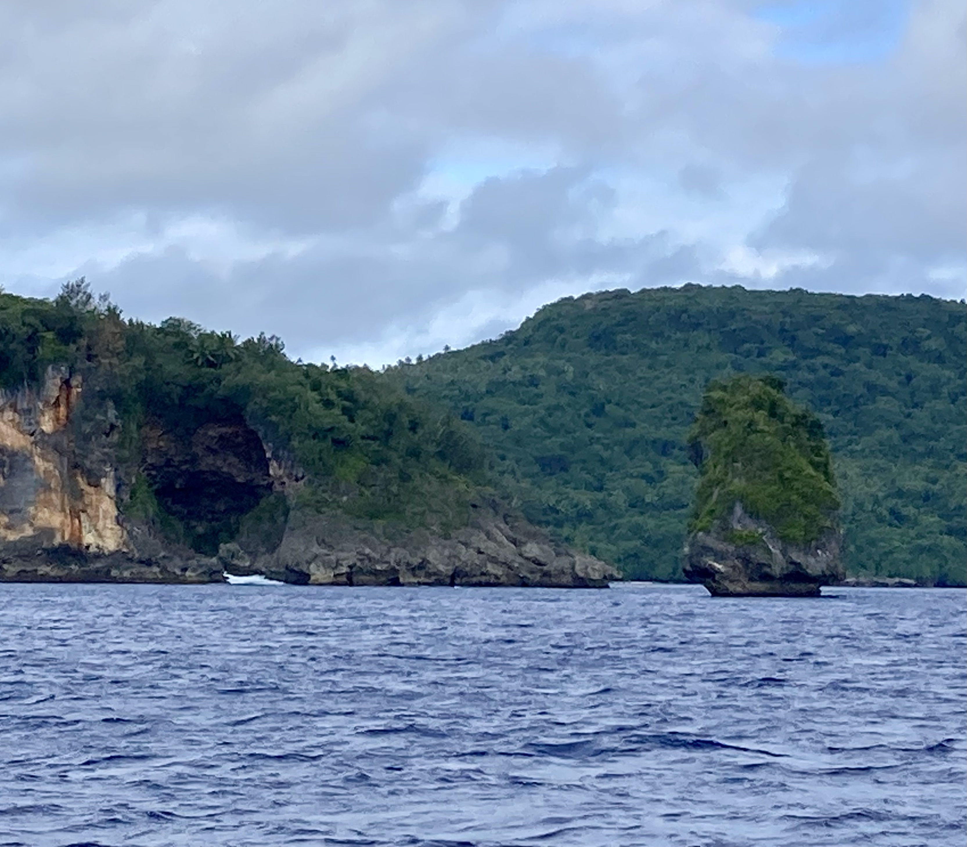
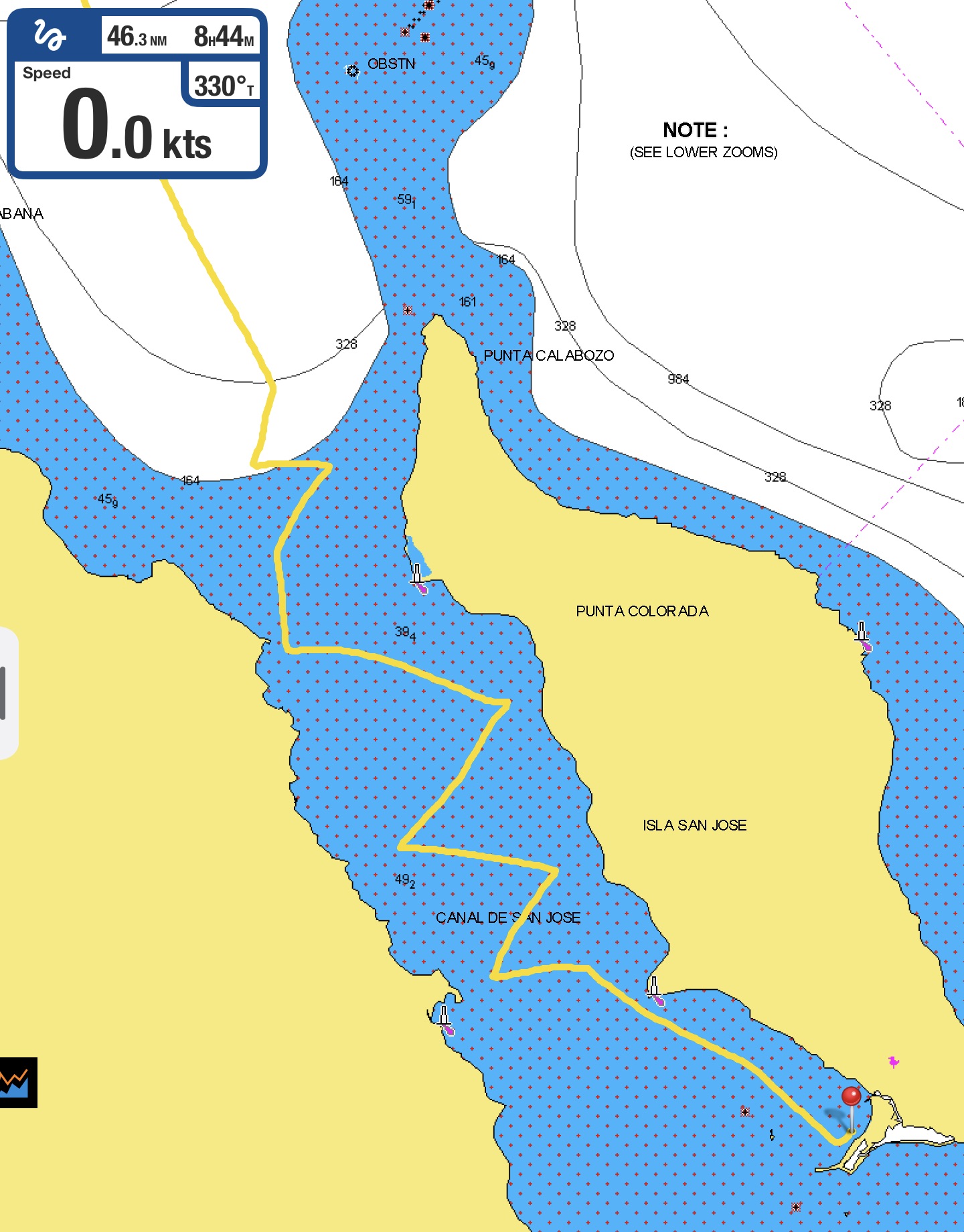
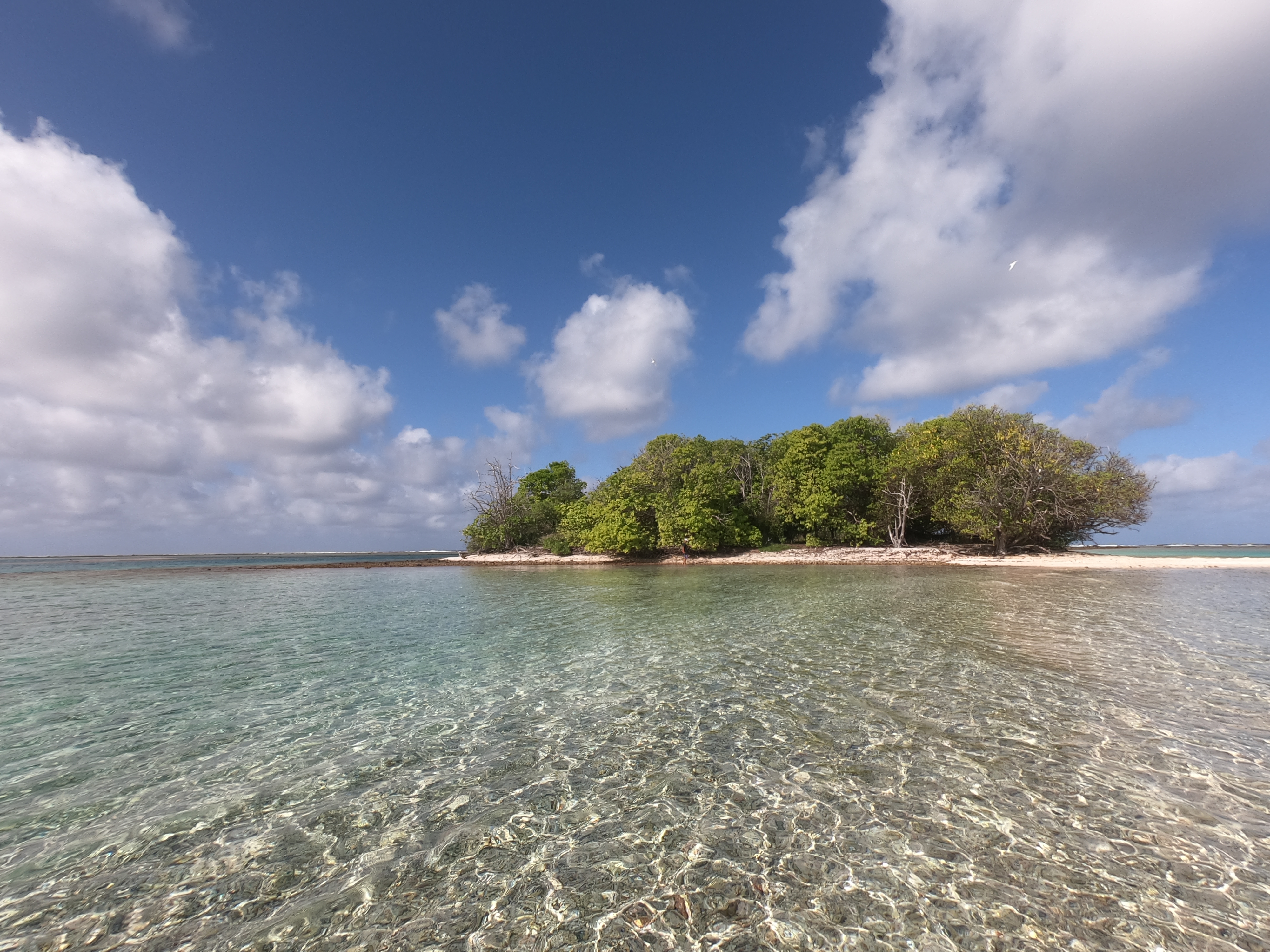
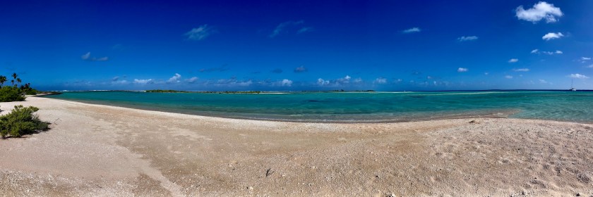
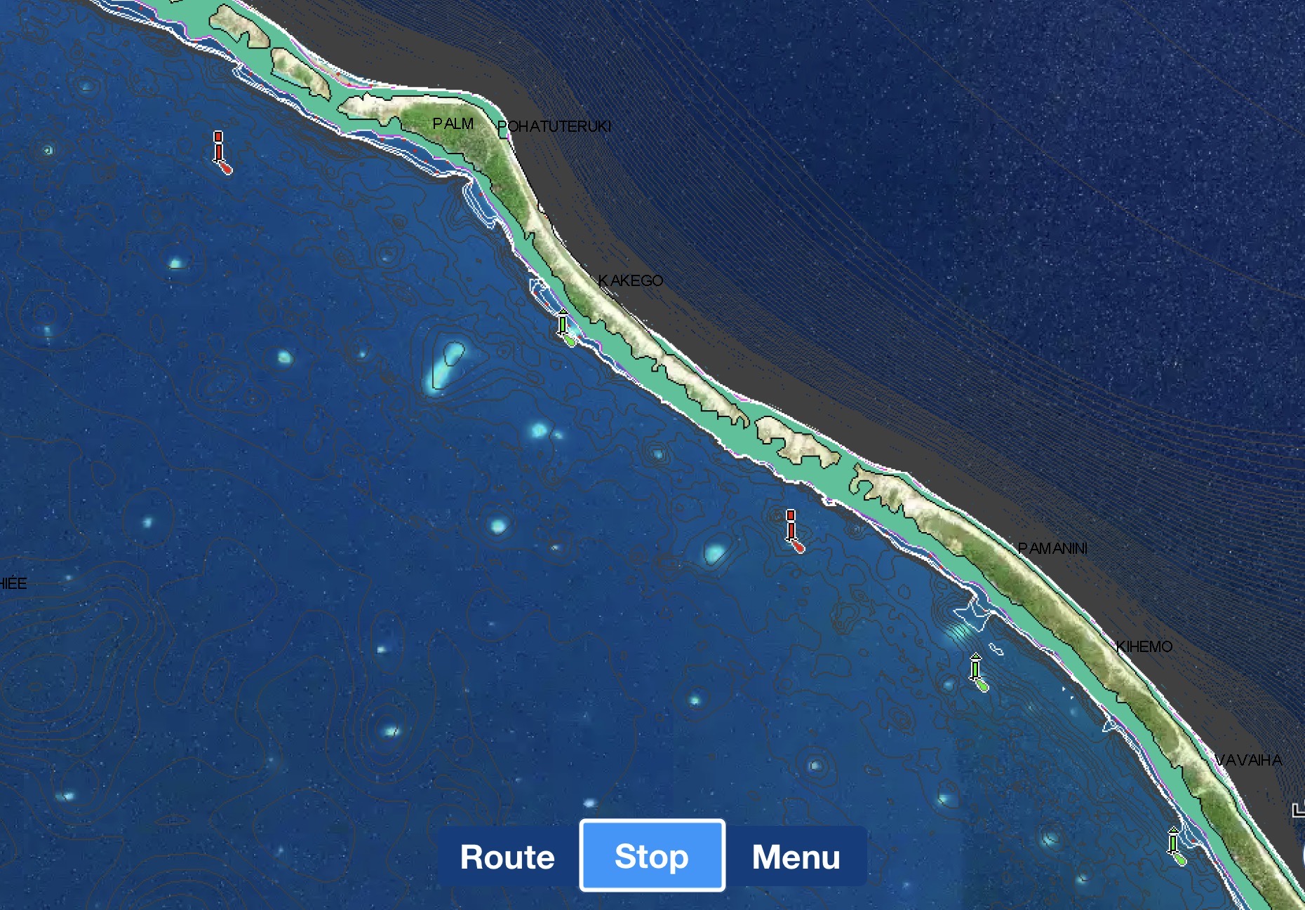
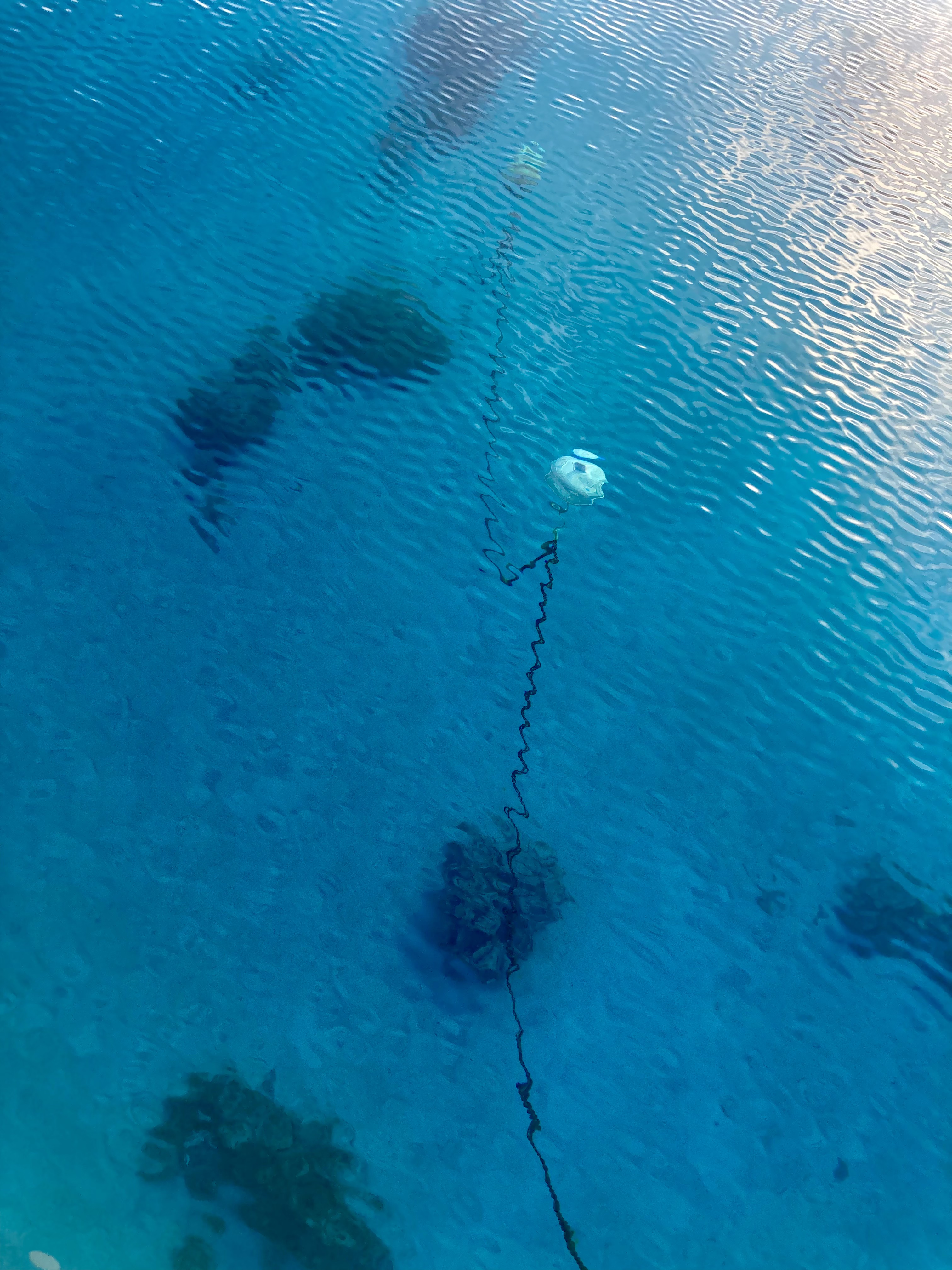
The western pass of Funafuti
Though the mile and a half long channel looked rather intimidating on our Navionics charts, it was over a hundred thirty feet deep in places and more than four hundred feet wide.
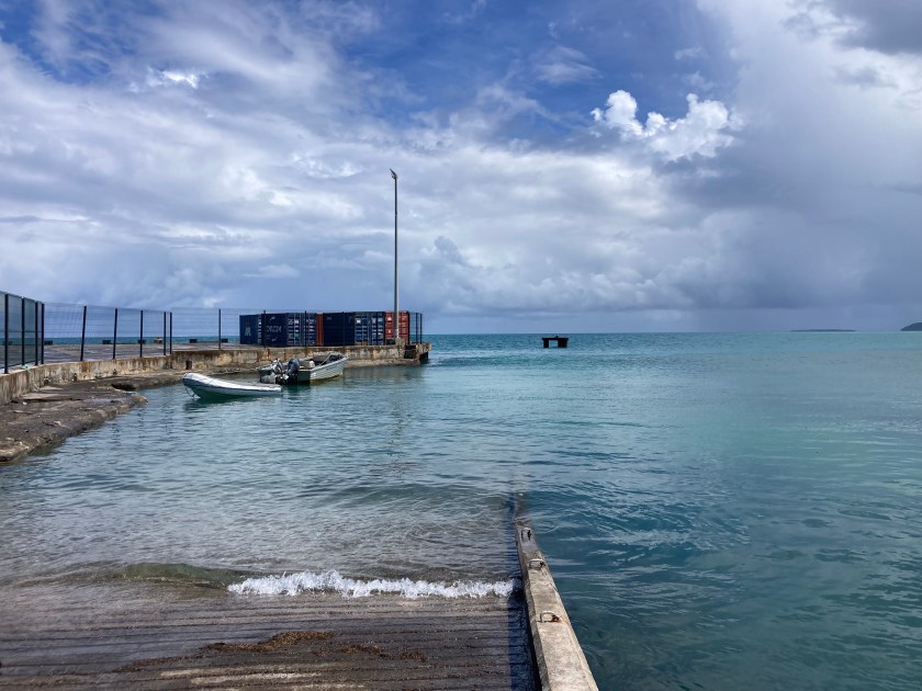
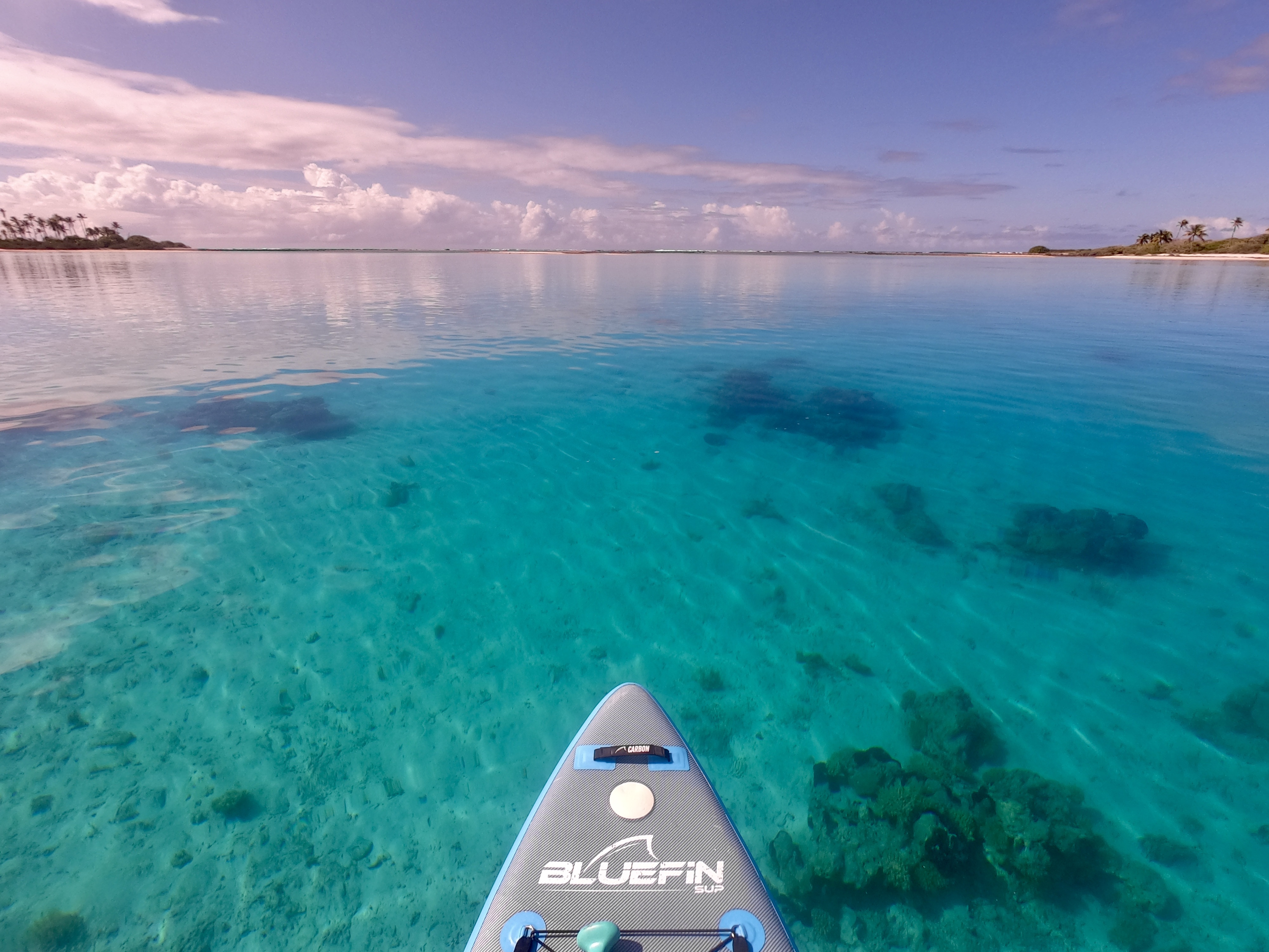
After about fifteen minutes of high alert navigating, we found ourselves inside the main lagoon. Safe harbor North of Latitude 10°S.
It remained to be seen whether we would be able to ride out the entire five month cyclone season here…but that was a detail to be addressed at a later time.
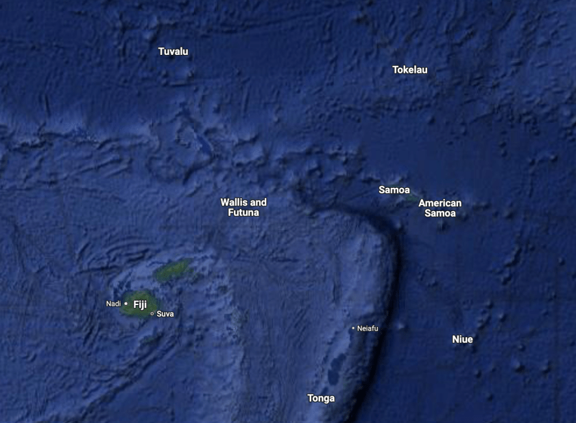
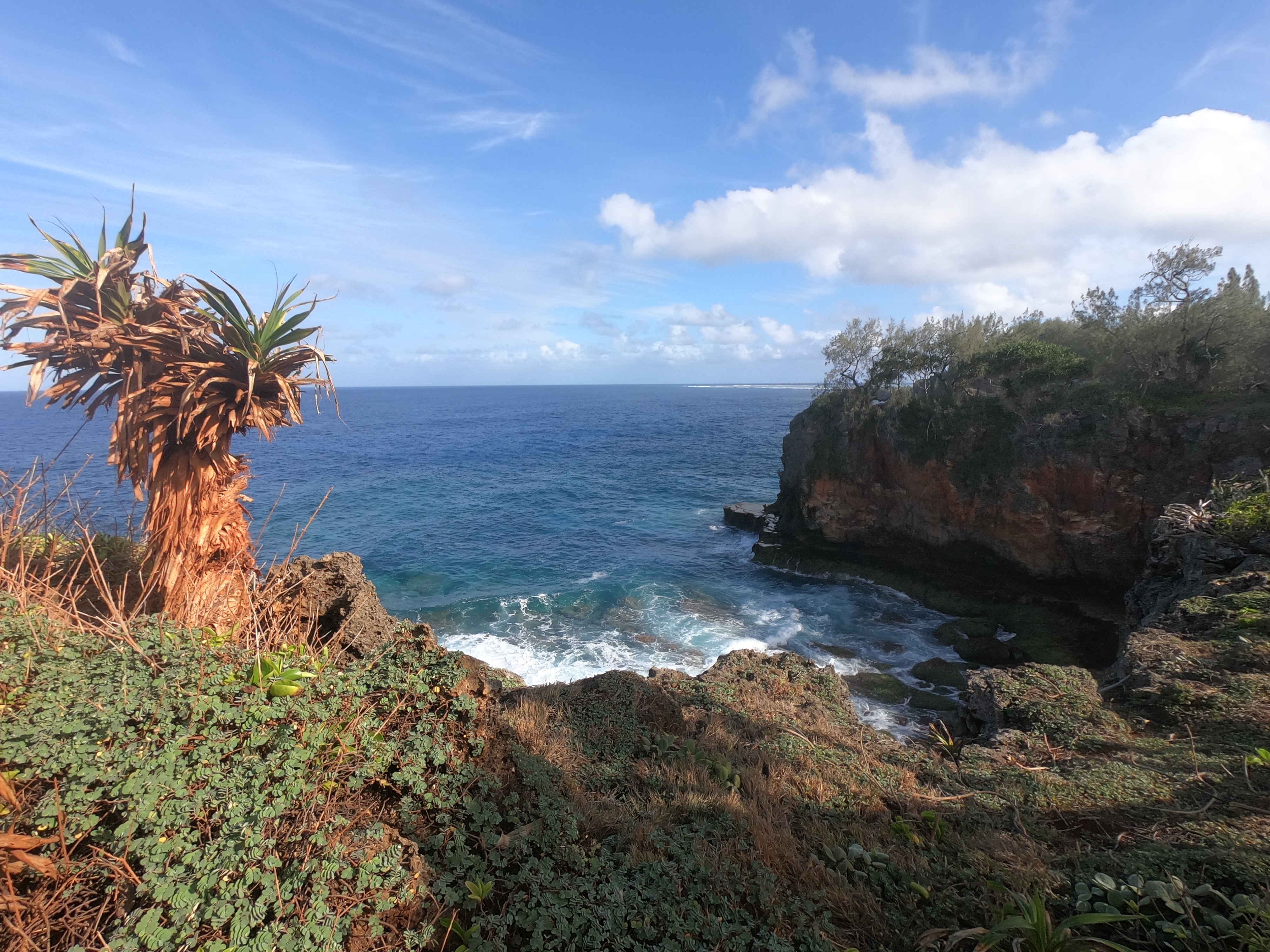
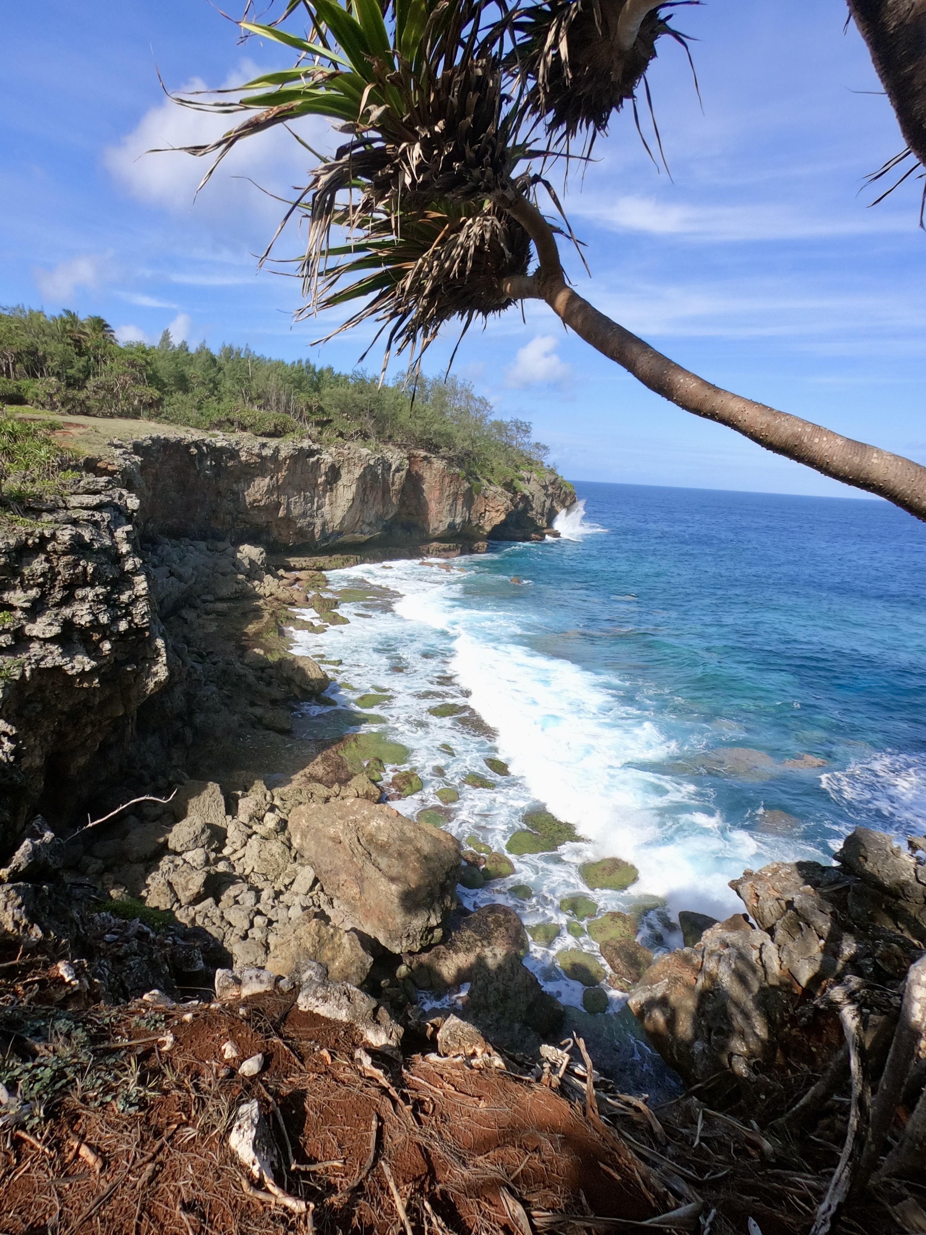
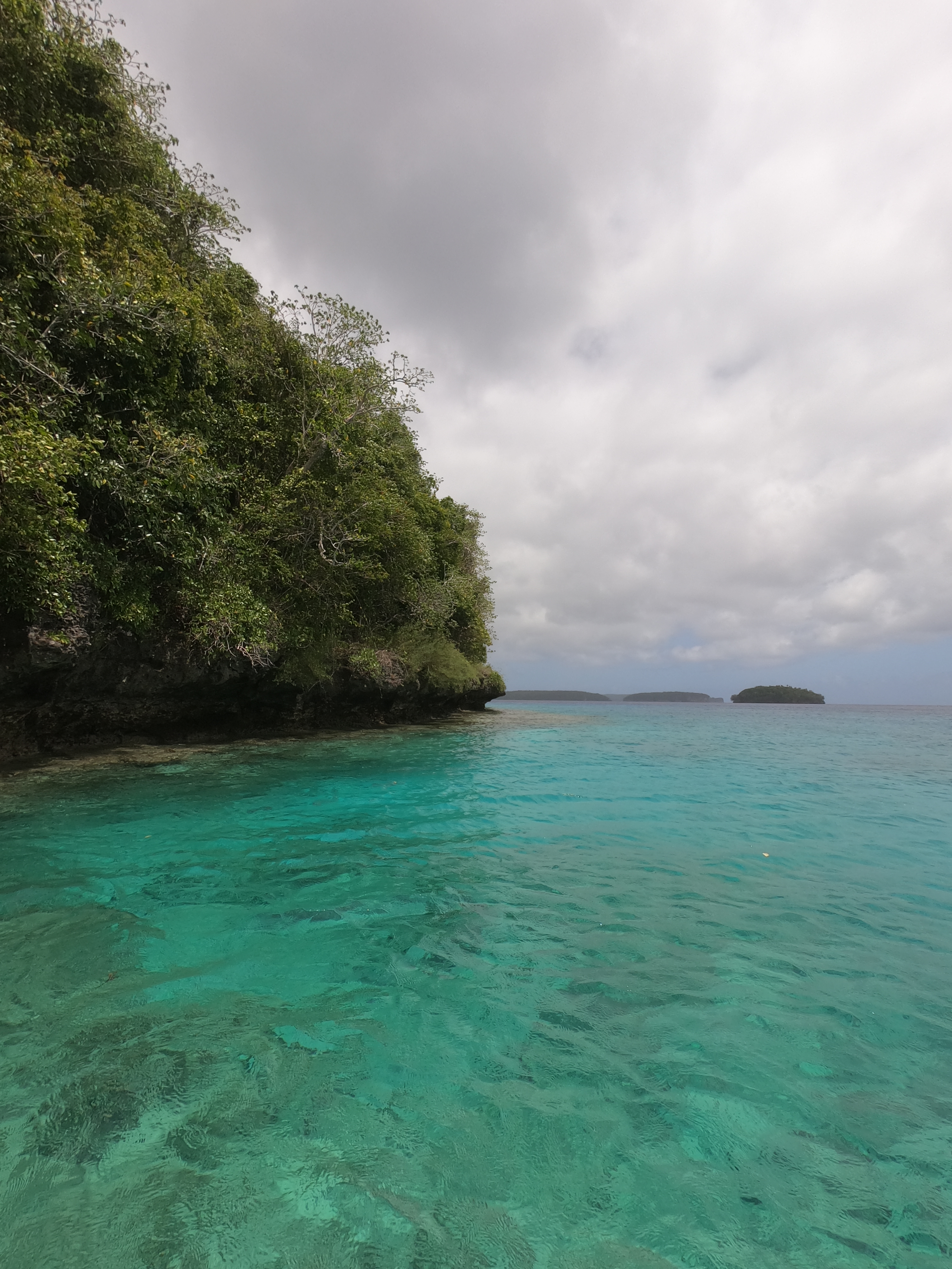
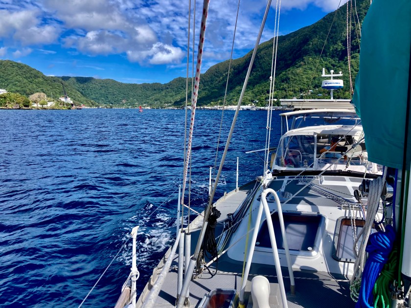
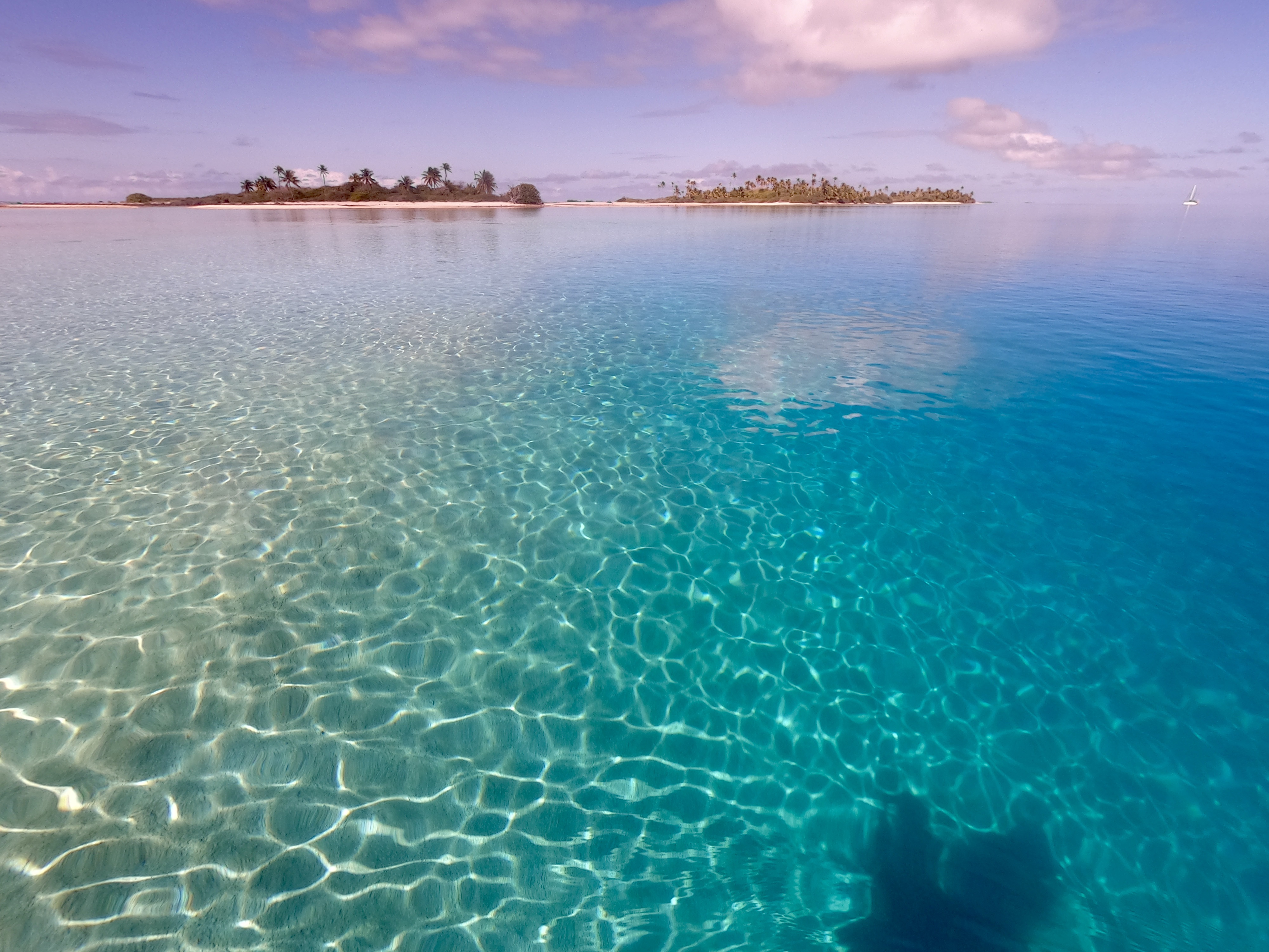
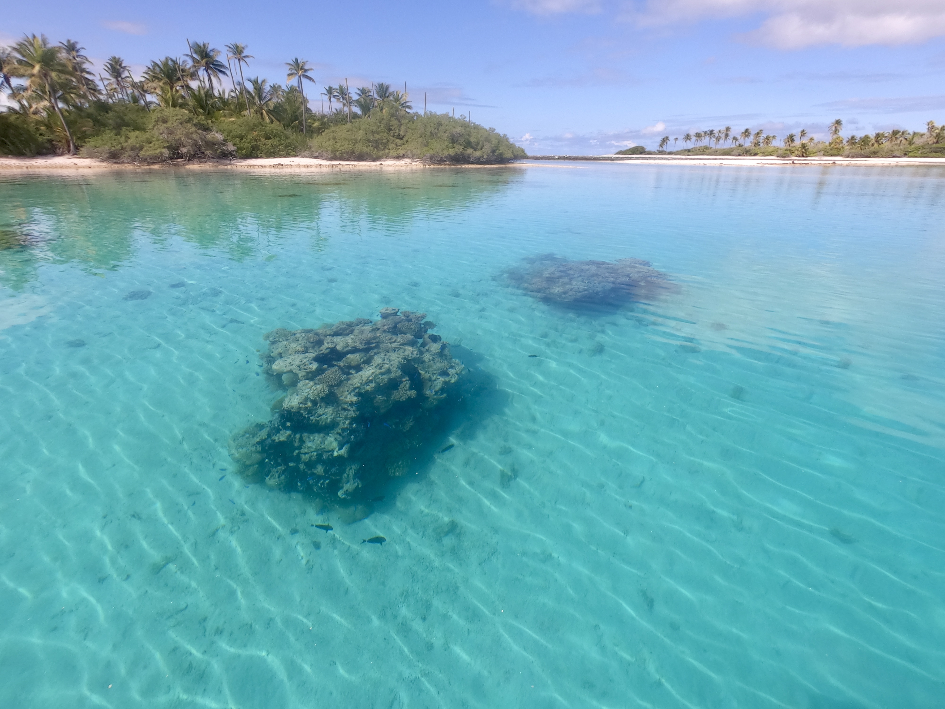
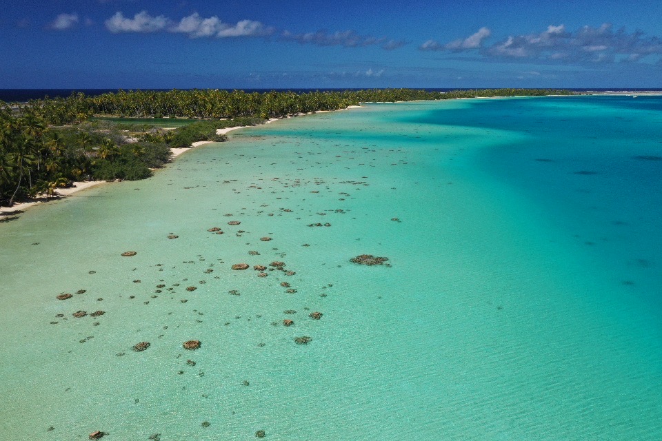
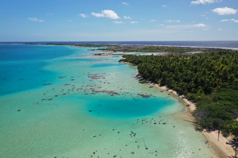
We had arrived at Tuvalu, the least visited country on the planet.
Funafuti Atoll, in the tiny South Pacific country of Tuvalu
From a latitude of 19°S in Vava’u, Tonga to 13°S. We had travelled roughly 370 nautical miles. To a tiny oval shaped atoll, only about 13nm long from top to bottom with an 8nm long island inside.
It provided our first refuge for Exit while sailing towards our latitude 10°N “safe zone” outside the cyclone box designated by our insurance company.
Wallis and Futuna, a country made up of two island groups (oddly enough, one atoll Wallis and the other Futuna, which is actually comprised of two islands) which lie approximately one hundred twenty nautical miles apart. Its truly Polynesian heritage has ancestry tying back to both Tonga and Samoa, though it was briefly occupied by US troops during WWII and officially became an overseas territory of France in 1959. The entire country’s population numbers only about 12,000, approximately two-thirds of which live on Wallis.
Regarding the location of Wallis and Futuna, off the beaten path would be a comical understatement. Though there is an airstrip on Wallis, visitors number only about 3,700 annually, and I would imagine a significant portion of those must be relatives of some sort. Very few sailboats pass by and even fewer stop. Unlike other Pacific islands that see hundreds or even thousands of sailboats a year, Wallis and Futuna count visiting yachts only in the dozens.
Speaking neither Polynesian nor French, the two primary spoken languages on the island, we knew communication could be a bit of an issue for us. We had already learned this in French Polynesia. A great deal of the population speaks no English at all, and even those that do sometimes don’t let on until the last sentence or two of an exchange.
For us, the process of clearing out in Tonga had turned out to be far more stressful than the passage that followed.
In order to clear out, it had been necessary to bring Exit to the main dock in Vava’u. Our approach to the intimidating cement dock (with its submerged wreck at one end, rusty rebar sticking out, and nasty overhang that tried to suck our toe rail underneath it when we cleared in) was made even more ominous by fifteen knot winds that pushed right at the dock. Moreover, the dock was already stuffed full of sailboats, already rafted two-deep in a couple of spots.
As we passed slowly by, trying to assess the situation, an older guy on the only sailboat that didn’t already have another boat rafted to it, yelled over that we could raft up to him if we wanted. Normally, this would be something we would try to avoid in any way possible, but we didn’t see much of an alternative. We had no idea how long everyone was going to be, so we yelled back that we’d come around a second time to try. At least this would put a bumper between us and the cement dock.
We circled around, allowing Kris to bring us in close enough to throw a line but not so close that we would end up side-swiping the guy. It was perfect. We had about ten feet between us when I got our bow line in the guys hands. Except with fifteen knots of wind, as soon as we stopped moving forward the bow started drifting towards the boat. Fast. The stern was barely moving which meant suddenly our anchor, jutting out from the bow roller, was going to make contact far before the fenders that were hanging off the port side.
It looked like a disaster was imminent. I was already envisioning our seventy three pound Rocna anchor gouging a deep line into the fiberglass hull of the sailboat we now were only about two feet away from. The guy on the other boat had already moved astern to try to grab a line from Kris, so I was the only person nearby.
There was no way Kris could power away from the boat; gunning the engine would have just rammed us into the side of the guy. There wasn’t time to reposition the fenders. There was only about three seconds left before our anchor was going to start deconstructing his hull. Seeing no alternative, I jumped over our lifeline and put myself between the two boats, hoping I could push off, and stop the bow from drifting closer without becoming a fender myself. It was one of those moments – push with everything you’ve got plus a little bit more, or have something crushed between two gigantic objects each weighing multiple tons.
Somehow…the anchor stopped with only about three inches separating it from the other sailboat, and I managed to avoid being in between the two. As the stern slowly drifted in, the fenders hanging alongside our hull were the only things that made contact.
I could feel my heart start beating again as I breathed out. I was pretty sure I hadn’t actually shit myself, but I wasn’t absolutely certain for a minute or two. Jesus Christ! That was close.
Soon after we were adequately tied to S/V Shandon, the sailboat we had nearly given a face lift to, we learned that the Customs Officer was off island.
Shit.
And he had the required customs stamp in his possession.
Seriously?
However, he was about to land at the airport and would be here before long.
Okay. Not a fiasco.
As it turned out, when a white pickup with ‘CUSTOMS‘ in big green letters on the door of the truck pulled up and stopped at the edge of the dock, we learned it wasn’t just the customs officer who had been returning on the plane. He opened his door, stepped out, walked around to the back of the truck, dropped the tailgate, and opened the wire door of a plastic kennel sitting in back. Out jumped Tonga’s new canine customs agent.
Once the customs officer concluded we were not smuggling drugs, weapons, or any other contraband, the remainder of the clearing out process went rather smoothly. Eventually, we had our paperwork and passport stamps in hand.
Getting back off the dock was another matter entirely. Only after lowering our dinghy into the water, with the assistance of our friends aboard S/V Solstice Tide and their dinghy as well, were we finally managed to get clear of the sailboat we had been rafted up to. It required a simultaneous push off by both dinghies at both Exit’s bow and stern.
Having successfully cleared out of Tonga, Exit departed Vava’u late in the afternoon on November 6. Perfect timing considering we were one day ahead of the U.S. which made it Election Day there. A good day to not be online.
Only twenty nautical miles north of Tonga we passed within five miles of the location a 2000 foot deep undersea volcano which had erupted in 2019. A bit scary to think about what would happen if history repeated itself here, but still not nearly as scary as the history that was about to repeat itself in the States.
Turning on Starlink to get a weather update turned out to be a big mistake when we glanced at the news and found out that the Trump Shitshow 2.0 and MAGA Zombie Parade was about to officially be scheduled for another four year season…great.
The sixty-seven hour passage from Tonga was a bit sporty at times but nothing dramatic. All the ominous forecasts that predicted huge deluges of rain dumping upon us turned out to be false alarms. To the contrary, we witnessed a stunning sunrise and enjoyed some bright blue skies and fantastic sailing.
Even our arrival to Wallis, which had threatened to be quite wet that morning, turned out to only be gray with a few drops. The crappy weather had very politely skirted around us, for which we were very grateful.
Despite having to acknowledge we had been pretty damn fortunate while underway, we couldn’t argue with the perspective our anchor beers relayed…
We had set anchor inside the atoll of Wallis on a Saturday just before noon. That evening we ended up enjoying a magical sunset at anchor just off a small uninhabited island named Île Faïoa in the southeast corner of the atoll while we awaited the arrival of Monday, when we thought we could clear in.
As it turned out, S/V Kuaka (who had departed Tonga a few days ahead of us) was already in Wallis and had cleared out the day before our arrival. They had left town the morning after we had come through the pass and ended up anchoring at Île Faïoa right next to us, awaiting better weather at the end of the weekend as they continued north to Kiribati.
It gave us an opportunity to see them once again, thank them again for first planting the idea of heading this way, as well as get timely and current information about the area we had just arrived at.
First thing Monday morning, we raised anchor and headed seven miles north to Mata-Utu, the main town and capital of about 8,000 people, where we would officially clear into Wallis and Futuna.
Clearing into the country, we had to delicately tiptoe our way through an interaction with a quite irritated police officer who would serve as our Immigration official. While we waited outside the port authority office, he had very aggressively pulled up in front of us in his marked police car and stepped out with his partner beside him. In full uniform, he was short and stocky with a tiny tuft of hair at the front of an otherwise shaved head. He spoke English very well. He was not happy. Today was Monday. We had arrived on Saturday. Why had we not already visited them?
We politely explained to him that, after attempting to hail the port control authorities on our VHF radio and getting no response two days prior as we were passing through the entrance channel, we had concluded that they were closed for the weekend (not an uncommon situation in some places). We had then dropped anchor just off a nearby island, raised our yellow “Q” flag (an indication that we had not yet cleared into the country), and remained on the boat for the weekend. First thing Monday, we sailed the nine miles to town and came directly to the port authority office where we had been awaiting his arrival for three hours. We profusely apologized for anything improper we had done and expressed that we were trying our best to follow the correct protocol.
After sternly reprimanding us for not coming directly to the town and visiting the police station immediately – an offense we were informed could result in us being told to leave immediately – he ended up stamping our passports, shaking our hands, and smiling. Whew!
Subsequently, when we preemptively apologized to the Customs Officer inside the nearby office, he gave a bit of a smirk and said something along the lines of, “that’s just him.” Filling out the customs paperwork, I misinterpreted one of the blank spaces at the top of the document. When I handed it back to the customs official, he looked it over and promptly said, “Oh…no, no…”, while crossing out the date I had written in the blank. Still gunshy from the Immigration official, I immediately grimaced, wondering what we’d done wrong now. He walked across the room, checked a big three-ring binder, walked back over and wrote something above the date that he had just crossed out. I looked and it was the number “35”.
He looked at us, smiled, and told us we were the thirty-fifth sailboat to visit during 2024. We returned the smile and started breathing again.
Once we had cleared in, even with the language barrier we found people unbelievably friendly. Walking along the roadside, almost everyone waved and smiled at us as they passed by. We laughed at how ridiculous you would be received in the U.S. waving at every passing car…oh ya, you’d be ignored or looked at as the homeless person seeking a handout.
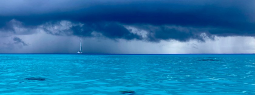
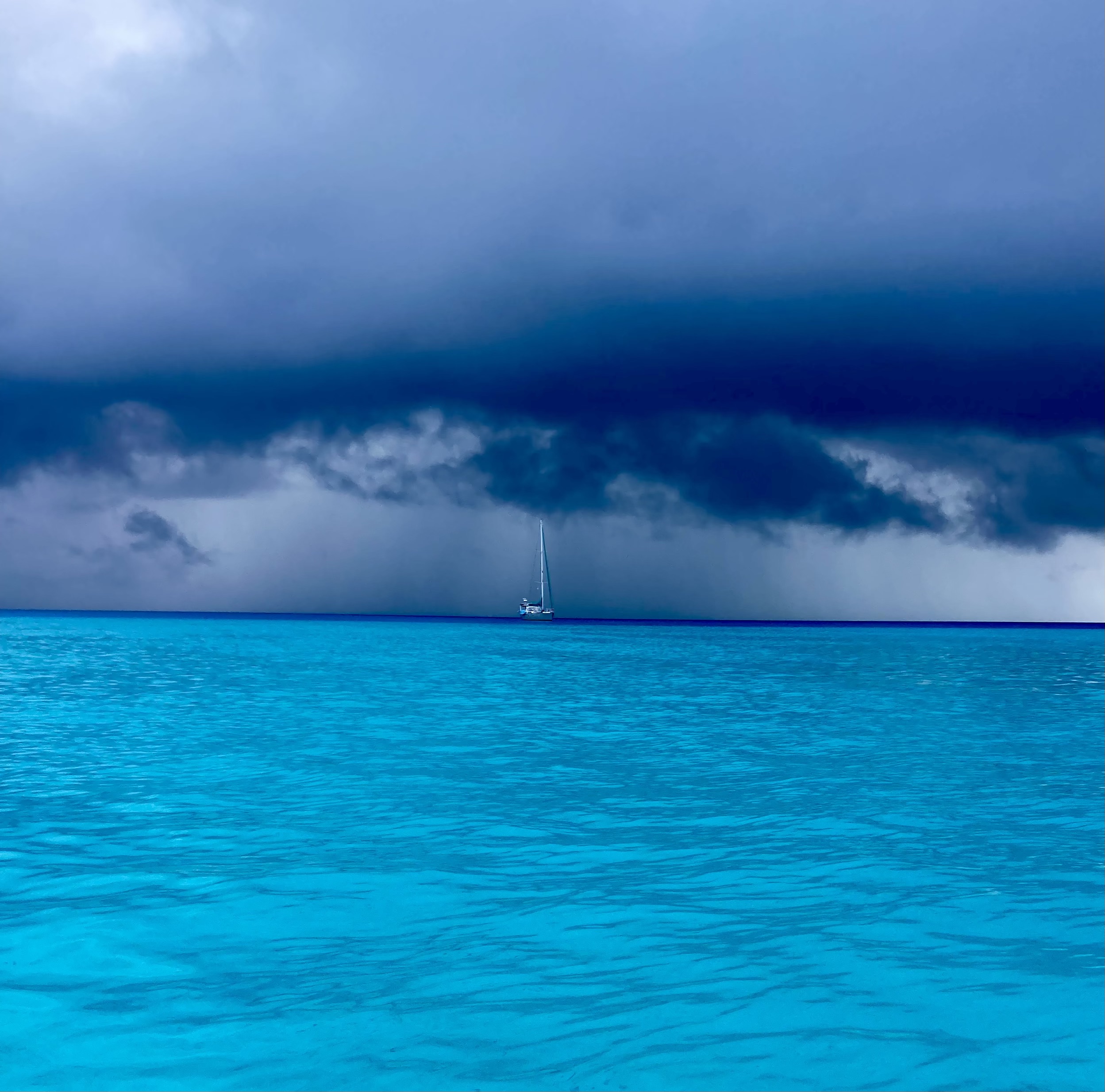
We learned quickly that weather conditions here could shift very rapidly. A brutally hot day with nothing but sunshine and puffy clouds was apt to be offset by a downpour at any time.
Just standing on the causeway, we could experience the gamut of changing weather.
A deceptively fast moving squall drifting toward us turned out to be a nearly daily occurrence, oftentimes multiple times in a day.
This one turned out to be a pretty modest amount of rain. Not always the case though.
We soon learned it could be a bit challenging to coordinate our time in town. Winds and/or ran might make for a difficult trip in to town or back to the boat; or the incessant heat of a relentless sun beating down could make walking around an exhausting affair. Even if the weather cooperated, we often found we had arrived in town before anything was open, or during the afternoon when things seemed to close as well, or it was too late for us to risk having to make our dinghy commute after dark.
We couldn’t tell if this time of the year was outside of any kind of a tourist season…or whether that even existed here.
After having a bit of a wander about the town, we decided to head back south to the small island of Nukuatea, on the opposite side of the pass that the island we had anchored at upon first arriving at Wallis was.
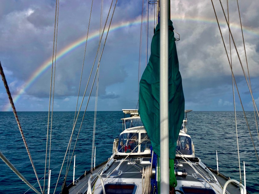
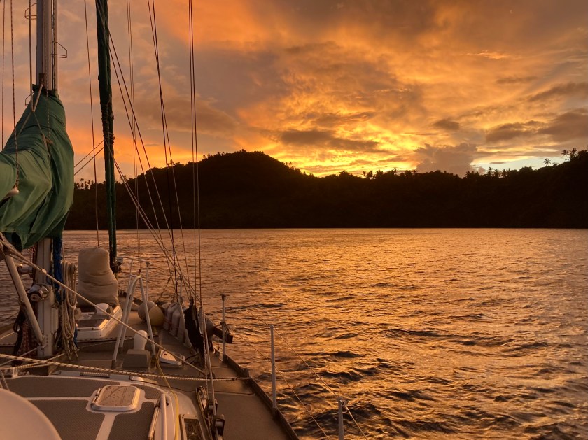
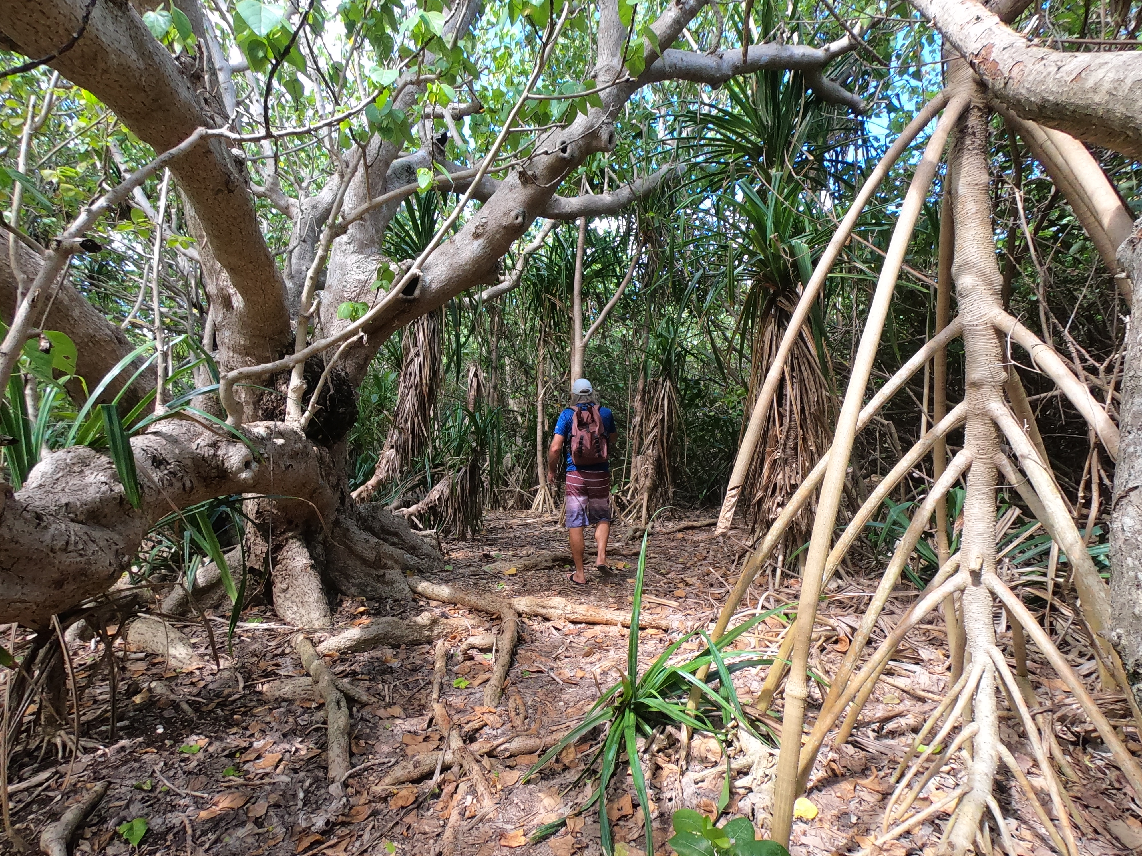
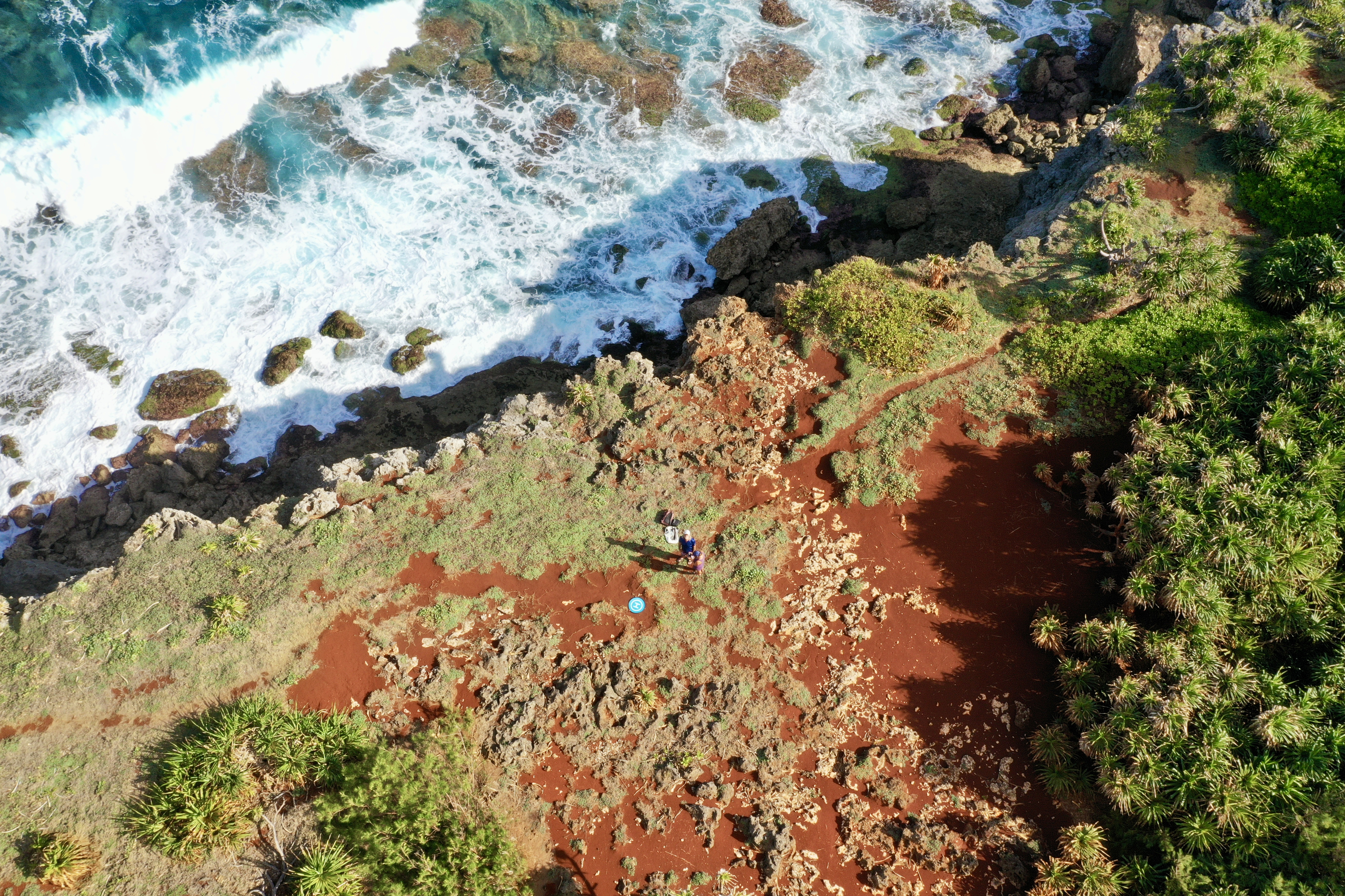
Once we had settled in at Nukuatea and appeared to have a fair weather window of opportunity with no squalls or deluges emanate, we decided on a trip up the mast.
Not an emergency; just necessary for an inspection of everything – both to check on any potential issues that had developed during the previous passage as well as for peace of mind before commencing on our next passage. As is usually the case, it provided a great vantage point.
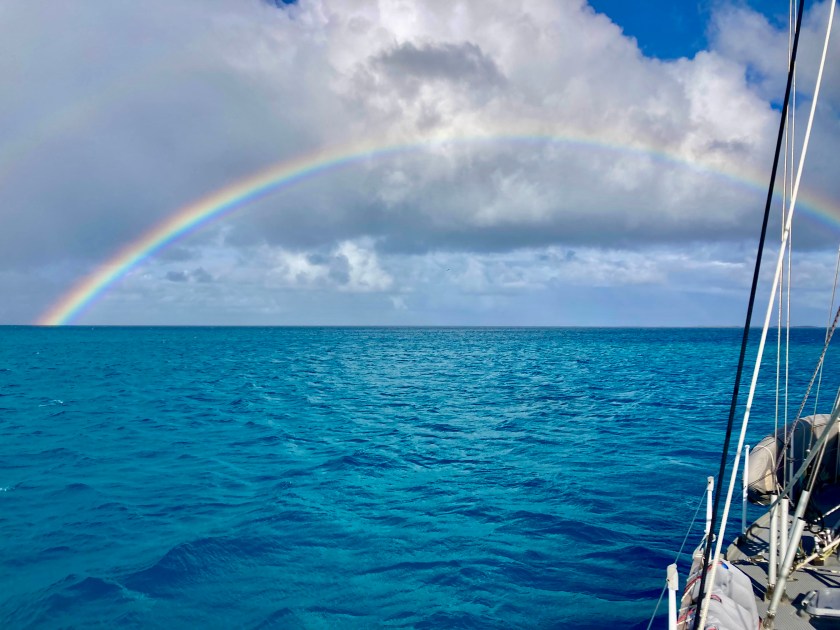
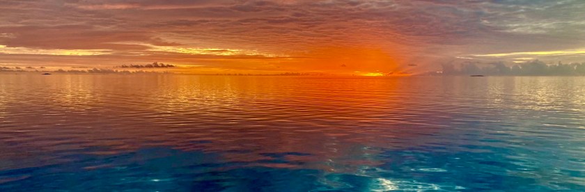
Fortunately, it turned out one didn’t need to be at the top of the mast for an excellent view. Whether it be an afternoon rainbow…
Or another brilliant sunset…
As Polynesians Islanders, the inhabitants of Wallis have an obvious historical tie to the ocean with an incredible lineage of nautical navigation and mariner skill. During our stay, we had the pleasure of witnessing their fascinating traditional sailing outriggers gracefully plying about the lagoon inside the atoll.
Soon after, we learned there was a dive shop on the island. It was owned and run by a French expat named Pascal who had moved to Wallis twenty three years ago. We stopped by his tiny shop – more of a hut, complete with equipment hangers made literally from sticks – and signed up to join a dive already scheduled for the following day in one of the passes.
When we arrived the following morning three other divers, very chatty and friendly French expats who spoke perfect English were there also. Because they were quite inexperienced, the plan had been for Pascal to take the three while we accompanied another dive instructor who was familiar with the pass. Unfortunately, the instructor was sick and wouldn’t be coming along.
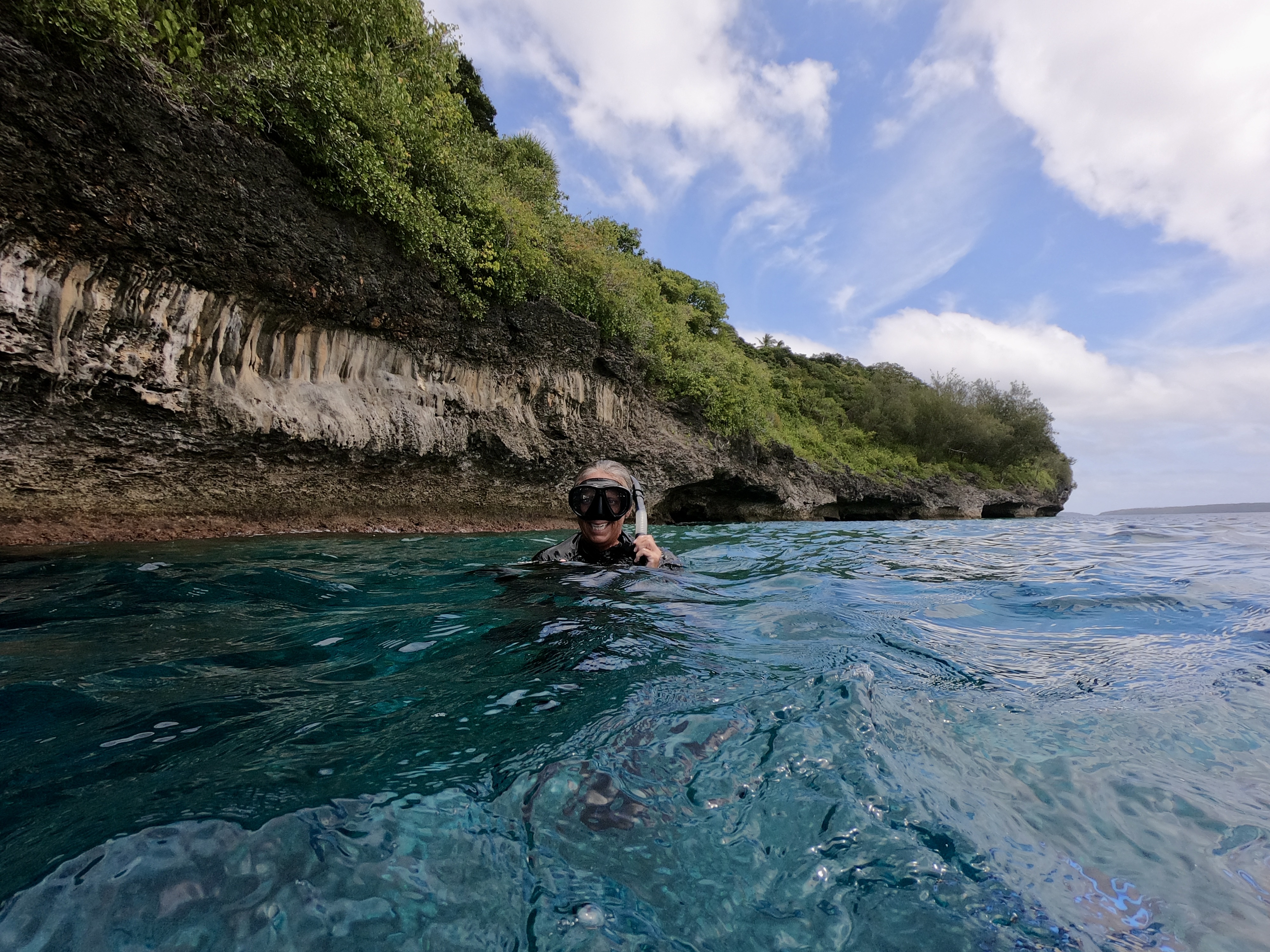
No worries. We were used to diving alone; and after a thorough briefing felt completely comfortable with the situation. As it turned out, when the dive boat arrived at the pass, the current was outgoing and it was absolutely ripping. The call was quickly made to alter the plan, and we all headed outside the pass in the dive boat to a spot on the outer side of the atoll. Pascal said we were still free to go on our own. Despite having very little information about where we were going, we hopped in the water and had a great dive wandering randomly amongst underwater canyons. We had a surface marker to deploy at the end of the dive so, without meandering too far or doing anything silly, we were confident knowing there was a boat to pick us up when we surfaced. It wouldn’t make the list of best dives ever; regardless, we had an awesome time doing our first solo dive on the outside of a remote atoll in the middle of the Pacific Ocean.
Among the many things we have learned living aboard Exit for the past eight years, one of those is the fact that everything takes about five times longer to do on a boat than it would otherwise. Another is that we have friends all over the world; we just haven’t met them all yet. Case in point…
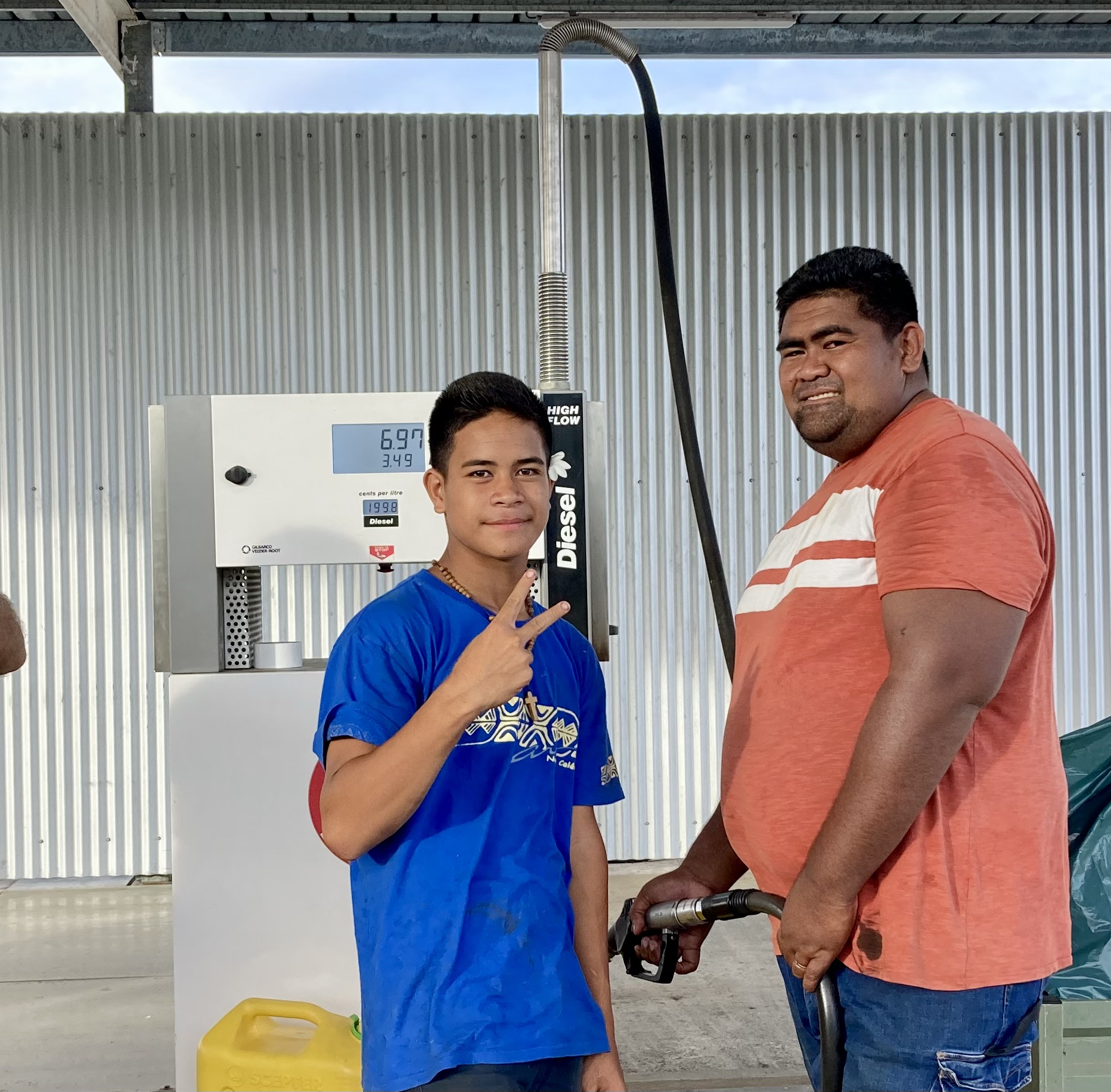
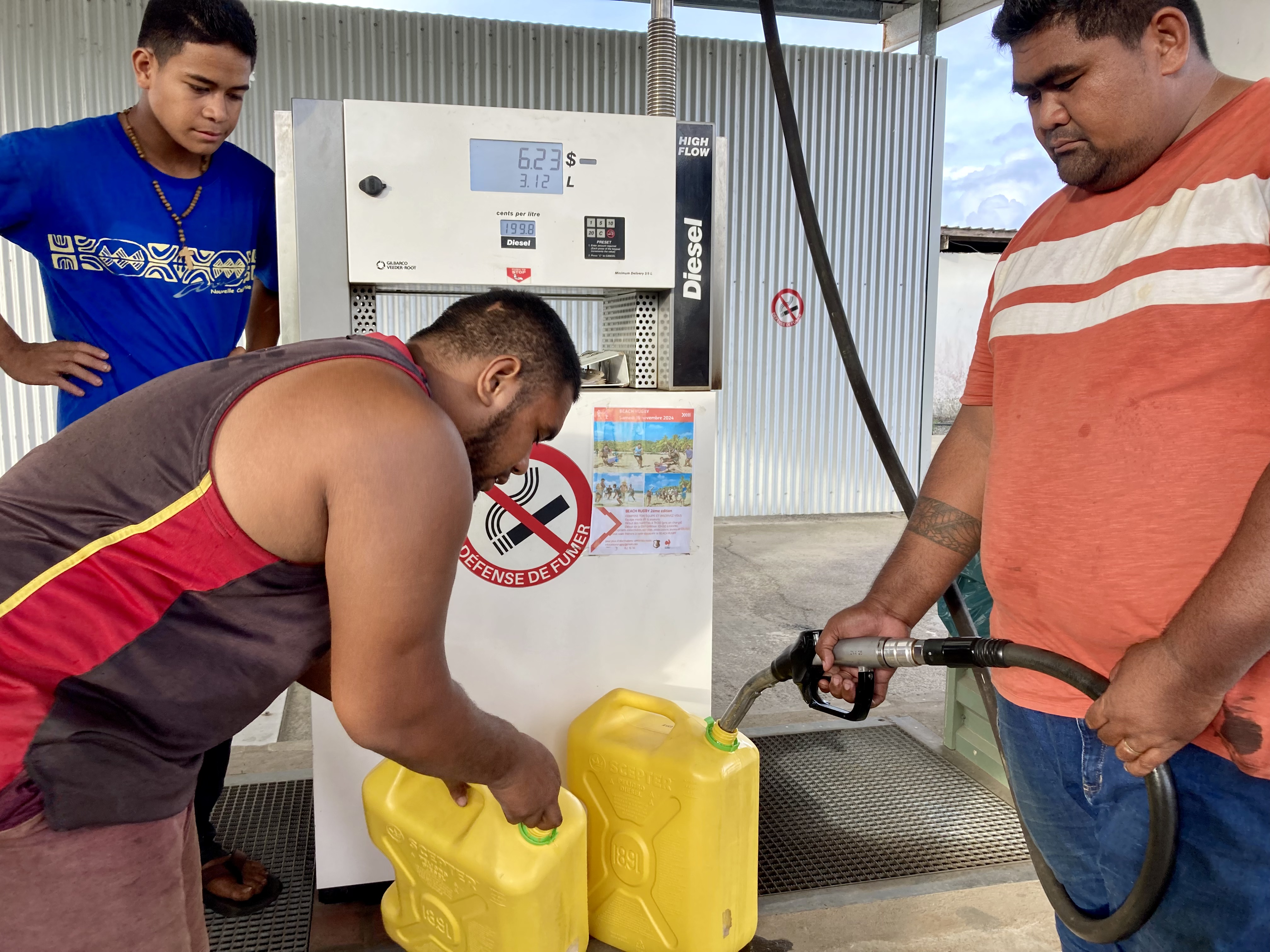
Our next mission was to secure diesel and gasoline for Exit’s reserve jerry cans. Ironically, this turned out much more challenging than our earlier dive had been.
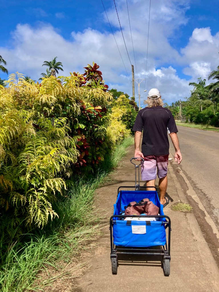
The typical procedure is to go ashore in our dinghy, walk to the nearest gas station with empty five-gallon jerry cans, fill them with either diesel or petrol, then haul them back to the dinghy in our wagon, repeating the process as many times as is needed to fill tanks or top up our reserves.
It’s no red metal toy wagon. Rather, more of a utility cart – blue canvas covering a metal frame that folds up for storage with swiveling front wheels and a 150 pound load capacity… maybe we should call it the “Bluetooth Hauler” as a tip of the hat to the old classic “Radio Flyer”…hmmmm.
Anyhoo…
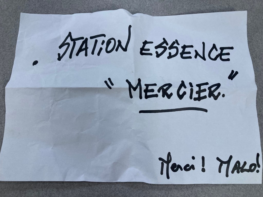
Google Maps had identified a “gas depot” just over a mile from the dive shop. We tied up the dinghy at the dock next to the dive shop and proceeded to walk casually down the road toward the gas station, immediately realizing we had opted to undertake this task in the excruciating heat of a relentless midday sun. After walking for what seemed like more than the anticipated distance without seeing a filling station, we decided to check GoogleMaps on Kris’ iPhone, only to discover it was now behind us!
Confused, we turned around and started backtracking, this time paying much closer attention to GoogleMaps. When we arrived at the supposed location, we looked around quite perplexed and were quickly dismayed to see off the road, tucked away behind a fence, a small yard that contained dozens and dozens of stacked portable propane tanks. We had obviously misunderstood the nature of the business identified as a “gas depot”. Cooking gas…not engine fuel.
Fuck.
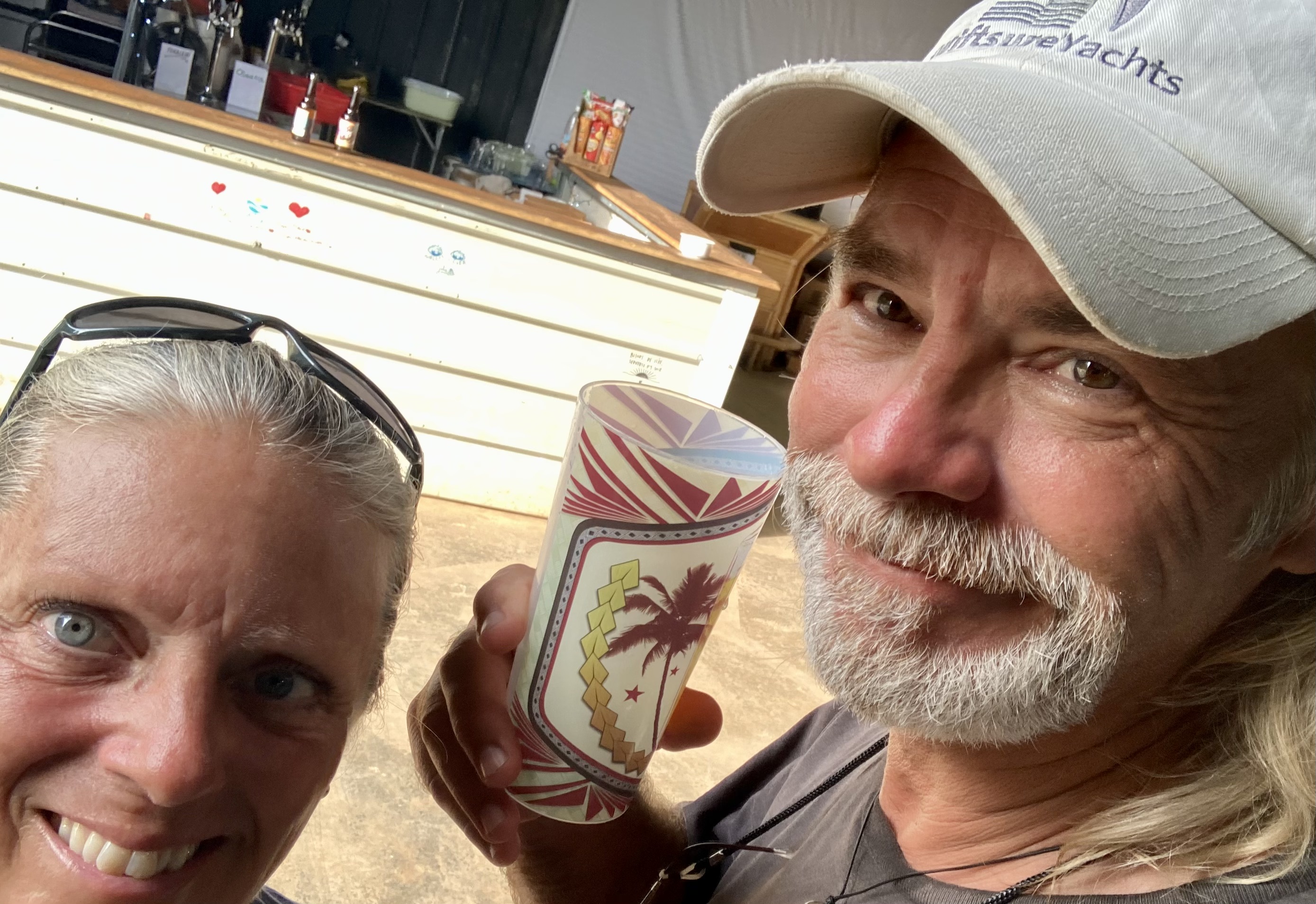
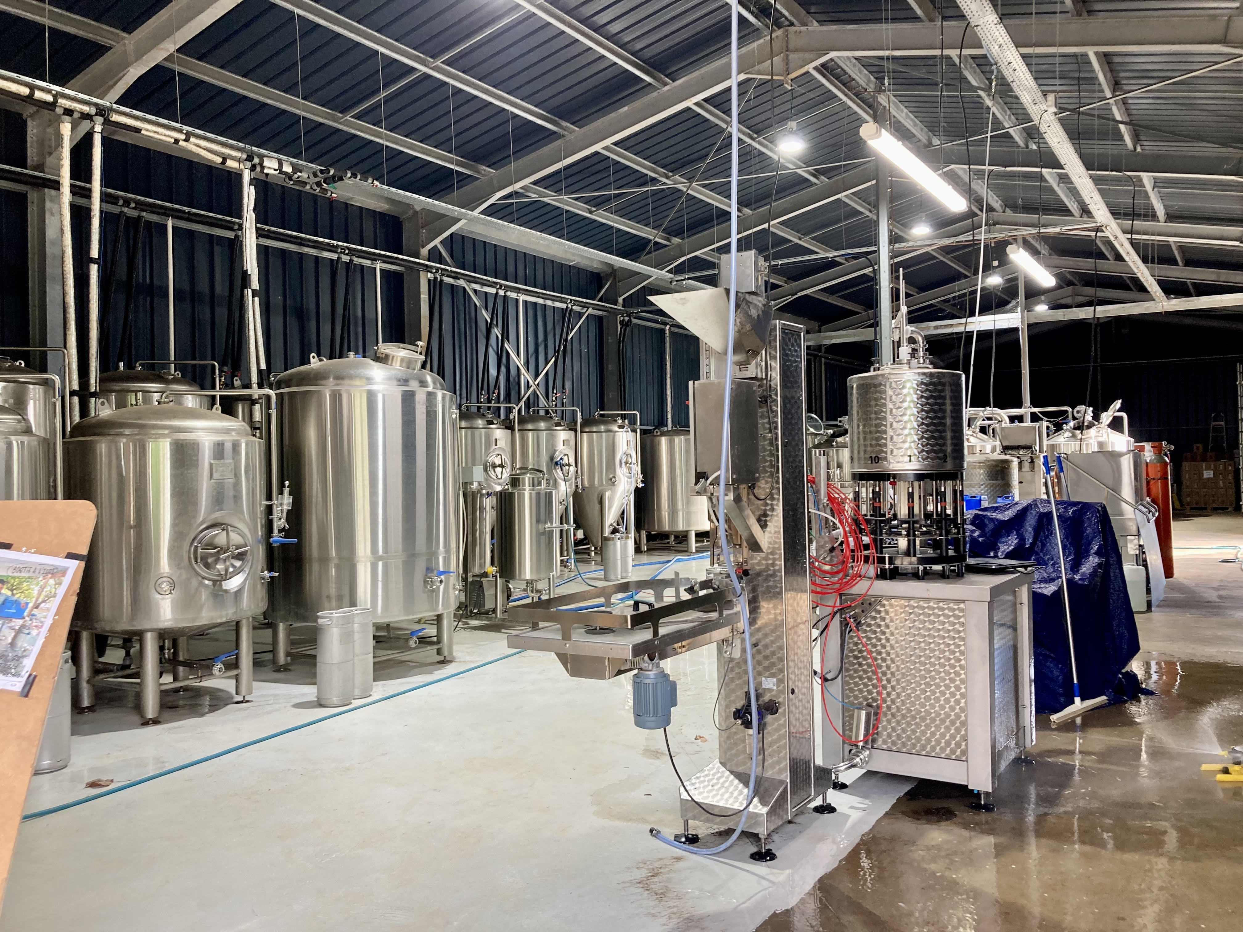
Amazingly, we were only a hundred or so yards from a small brewery we had walked past earlier. We were hot, frustrated, and still without fuel. Sweating buckets and completely parched, we immediately decided to drown our misfortunes in a couple of bottles of locally brewed beer.
Inside we met Serge, the French proprietor who spoke absolutely zero English. After we had two glasses of semi-cool beer in hand (the brewery didn’t officially start serving for three more hours), a great deal of gesturing, attempted use of Spanish as a somewhat intermediary language, and references to the props we carried in the wagon (fuel jerry cans) allowed us to convey the essence of our situation to him. While Serge relayed vast amounts of information back to us, all of which we had absolutely no idea what he was saying, he managed to communicate that the gas station we were seeking was actually a number of miles further up the road.
After finishing our beers and buying a variety pack of twelve more, Serge provided us a solution… a sheet of paper with a handwritten message in French: “Gas station please”. He pointed to the road out front, held up the sheet of paper, and stuck out a thumb. Brilliant.
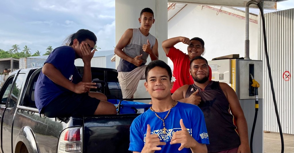
After three or four cars drove by, the occupants all with confused looks, a scooter with two boys, maybe fifteen years old stopped next to us. They read the sheet a number of times and spoke to each other back and forth. Eventually they nodded their heads, only we couldn’t figure out what they were saying. We weren’t sure if they wanted us to give them money (which we didn’t know how much or whether they would even return), or how this could even work with four people and a wagon carrying jerry cans given they were on a scooter. After a lengthy back and forth exchange of words, gestures, and expressions that generated more confused looks on both sides, we were able to establish that they were going to go round up a car. We waited for about five minutes before they returned as passengers in a pickup that contained three of their friends and a driver who looked to be in his twenties. The driver signaled for us to hop in the back of the pickup. We did, and they proceeded to drive us to the gas station. All the while the three other kids sitting in the back with us asked questions in very broken English, smiled, and chuckled amongst themselves.
A few minutes later we were standing at the pumps getting our jerry cans filled. Afterwards they proceeded to give us a ride all the way back to our dinghy at the dive shop. What was nearly a maddening fiasco and afternoon of unproductive frustrating misery turned into an opportunity to meet new friends and experience the kindness and generosity of Wallis.
The episodic rains, which seem to be nearly a daily event, are the one thing that breaks up the withering tropical heat which also seems to be a staple of the island. Some momentary drizzles come and go quickly – “all seventeen drops” as we would refer to them. Others fall more under the category our friends on S/V Solstice Tide refer to as “biblical rains”.
Trying to keep an optimistic outlook, we had celebrated the fact that our rain catch was the best it had been for about as long as we could remember. Well, years for sure. The twenty two gallons of water jerry cans were completely full for laundry and even both of Exit’s one-hundred gallon water tanks had been pretty much topped up.
So far, throughout our explorations into the Pacific Ocean, we have had the good fortune of largely avoiding the electrical activity that often accompanies these wet occurrences. However, during one of these overnight biblical rain events, our luck ran out.
Early in the morning (after all, 2-4am is the typical time the shit hits the fan), as one particular deluge continued unabated, lightning flashes began bursting around us. The wind wasn’t unreasonable, and we were anchored in a hundred feet of water all by ourselves in a protected bay on the leeward side of a small island that had to be a couple hundred feet taller than our mast, so we weren’t exceptionally concerned or nervous. Any lightning is always disconcerting, but the thunder wasn’t exploding like bombs all around us in ways we had experienced in places like Panama, so we knew it wasn’t right on top of us. However, at one point, a pretty big blast kicked off.
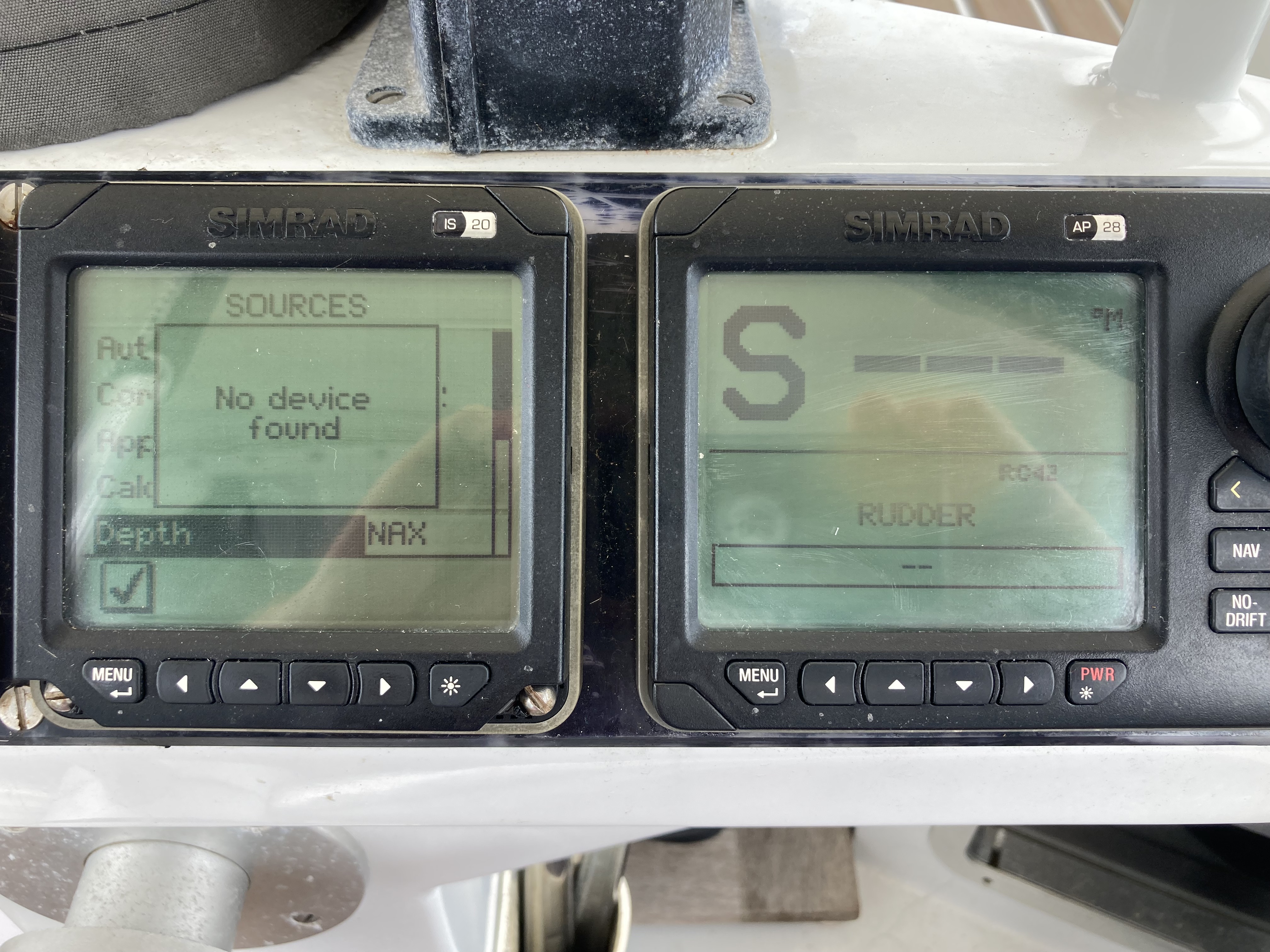
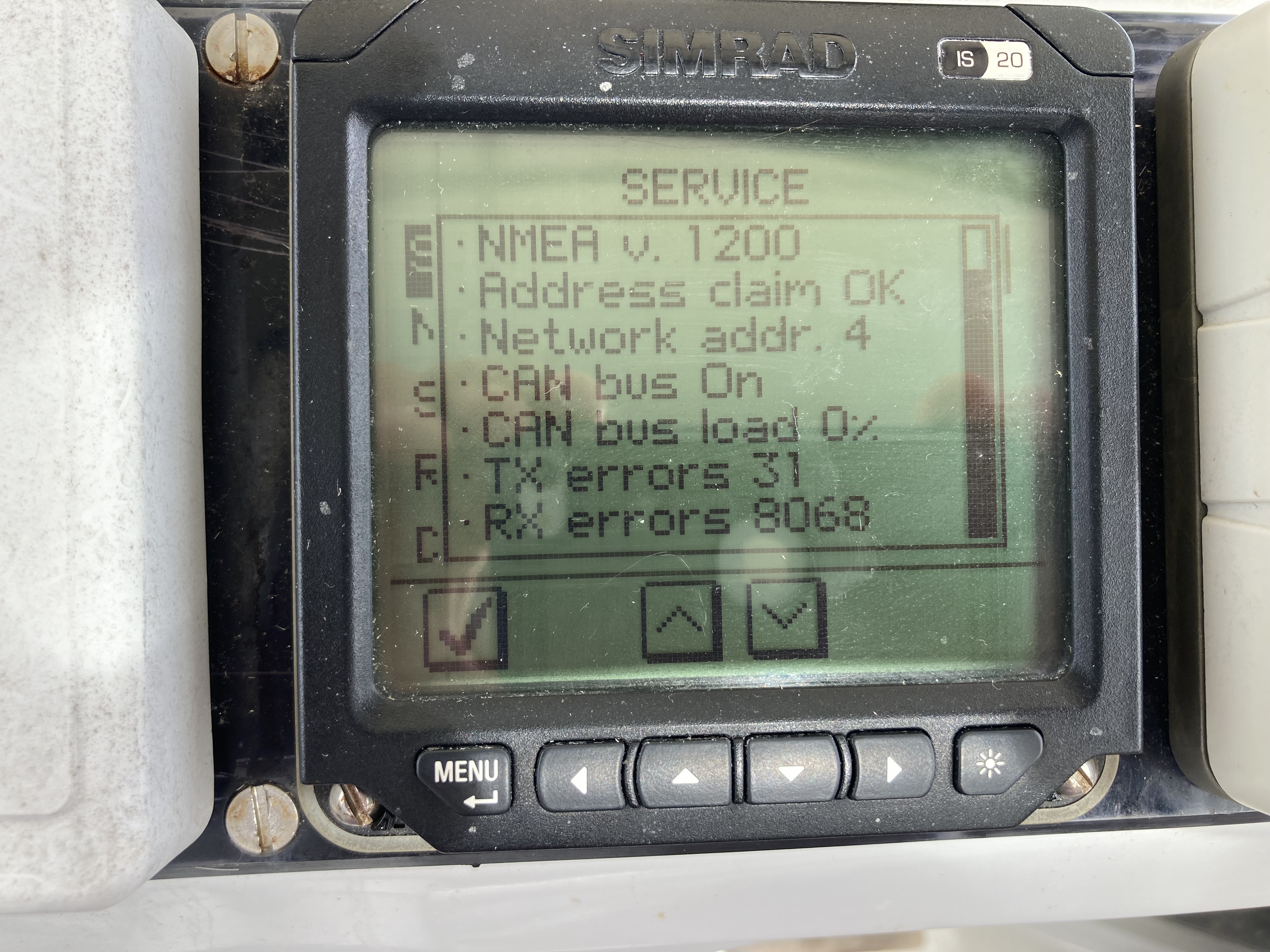
When I turned on the navigation electronics the following morning, a groan emanated from my mouth that was probably immediately chased after by a string of expletives. All of the data that would normally pop up on the displays as numbers came up as only dashes.
“- – – ”
Nothing more.
Shit.
No depth. No true wind speed or direction. No apparent wind speed or direction. No boat speed. No magnetic heading. Not on any of the six displays.
Furthermore, when we turned on the autopilot, the ominous message came up, “No Autopilot Detected”. Both displays (one at the nav table below decks and one at the helm) concurred.
Double shit.
We were still getting power to all of the navigation electronics, but no data readings. Starlink still powered up, and thankfully worked fine. The watermaker was still powered up with the display indicating all was good. The VHF, radar, and AIS systems were all good.
We came to the conclusion that there was no way we had received a direct lightning strike. There would have been much more catastrophic damage to the electrical systems. Our running theory was that some sort of an electrical static or electro-magnetic halo from close proximity lightning had done some serious voodoo shit to our systems, and one or more components in that network had either failed or been affected.
The reality was it was pretty academic. Didn’t really matter. At this point, it was about troubleshooting things and finding the source of the current issue, not the cause.
After day one, ten hours of tracking wiring routes, testing components, bypassing things, and attempting various options and possibilities got us nowhere. We were mentally exhausted, flummoxed, and no closer to a solution. No answers, no successes and lots of additional questions. We resolved ourselves to a morose happy hour and called it a day.
The following day, the black tunnel we found ourselves in began to reveal a dim light in the distance. We first got the magnetic compass reading to appear on one display. Success; tiny but undeniable. Additional troubleshooting began to eventually reveal other answers and slowly the complete fog of confusion began to dissipate. Other data began to appear on various displays at certain times under certain conditions. The autopilot began to see itself.
Without going into a long and boring breakdown of system details as well as the step by step drama which included endless re-routing, network isolating, and component testing, suffice to say we finally had almost everything back online by the end of the day. FUCK YA! By sundown we had determined that our wind sensor at the top of the mast was fried, as was an older electronic converter box that was no longer a necessity but had stuffed up the data communications by still being in the chain of things that were hooked together. The dead converter was bypassed and removed. An older wind sensor we still had as a backup could go back on the top of the mast.
That night, our happy hour was truly happy; victory tasted almost as sweet as the gin and tonics! Success had only followed in the wake of a long stretch of angst and frustration, but the confidence it built in our ultimate self-sufficiency and resourcefulness was palpable.
Two days later, we were rewarded for all our efforts with the realization we had both come down with some sort of nasty bug, probably during our human interactions on the day of diving, and found ourselves completely knocked out of commission for a handful of days. Victory celebrations are often fleeting.
This completely eliminated any motivation to get out and about for some well deserved exploration and play. Unfortunately, we had some hard decisions to make that couldn’t wait.
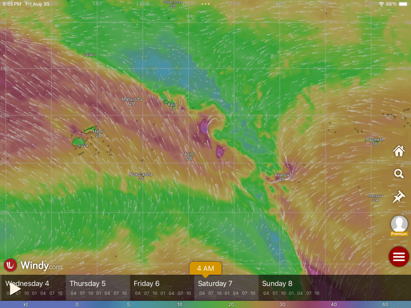
With only a week left of November, we knew we should be moving on. Yet Wallis was a fabulous place and we had only scratched the surface; we were seriously contemplating accepting to push our boundaries of good fortune by remaining a while longer. Except we’d been warned by another sailboat (S/V Queen Jane, who had been in this area twice before) that we needed to get going as favorable winds (or any winds at all) would soon become more and more scarce and turn more predominantly north.
If we could just make it to Tuvalu, a tiny cluster of nine islands four hundred nautical miles further northeast, we would be above ten degrees latitude, the threshold for still having a valid insurance policy. We could potentially wait out the cyclone season there and still have an option for returning to, not only Wallis, but also Tonga as well as Fiji. Tuvalu would be a primitive location regarding supplies; but if we pushed a thousand nautical miles further all the way to the Marshall Islands, a more tangible option for supplies and civilization in general, we would realistically be too far to consider returning. Tuvalu might keep all options still on the table.
It also wasn’t simply cyclone risks we needed to be aware of. The areas that can produce cyclones are just as likely to produce slightly less extinction level weather that can still be exceptionally problematic. Our recent electrical drama could be interpreted not only as an example, but also a bit of a warning omen.
We finally decided that if an apparent weather window opened up which afforded us the probability of sailing the entire way to Tuvalu, we would take it.
As an opportunity appeared on the forecast horizon and we decided departure was eminent, we picked up anchor and headed back to the main town to prepare for clearing out with the authorities, as well as provisioning at the supermarket – as much cheese, gin, tonic water, and wine (as well as less exotic priorities) that would fit in our lockers. If we were going to the edge of the world, we wanted to bring as much civilization as possible with us.
During our second day ashore, a barrage of rain began pounding down while we were in the supermarket. As we stood beside our “Bluetooth Hauler” wagon piled high with groceries under the supermarket’s awning awaiting a lull, we were approached by a couple with a young child. Though they spoke no English, they were able to convey an offer for a ride. We graciously accepted.
And, though we had avoided getting thoroughly drenched on the way back to the dinghy due to the kindness of locals, there was no getting around the one mile dinghy ride back to Exit.
It was though Mother Nature laughed and said, “Hah…do you really think you can out-maneuver me?” As we guided the dinghy away from the ship dock, another biblical rain commenced with twenty knot winds that pitched us all around. The ensuing waves and spray tossed what seemed like buckets of salt water on us. We arrived back at Exit looking like a couple of drowned cats, but with an another dinghy full of provisions that had amazingly remained mostly dry wrapped under a tarp.
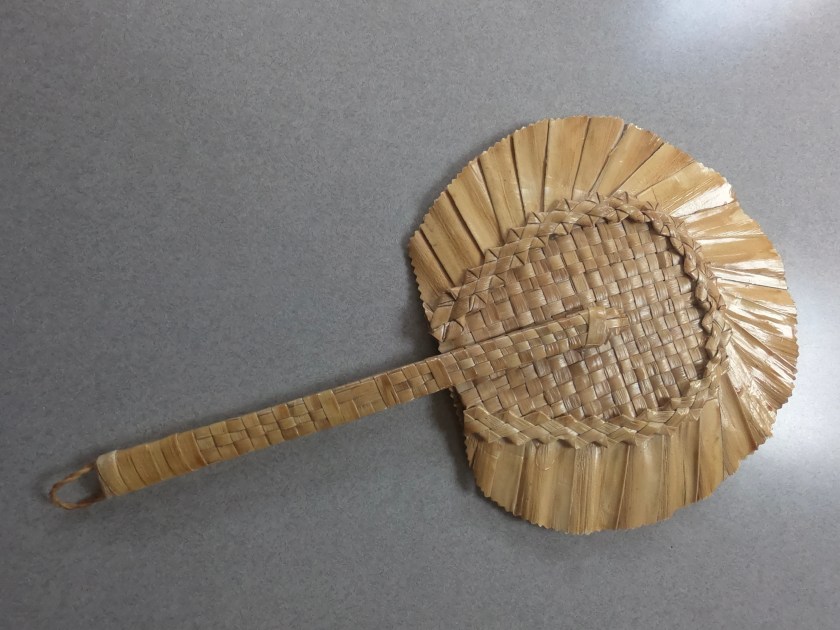
The following day during our final journey to the supermarket, instead of rain we were assaulted by the oppressive heat of a brutal sun that had our clothes almost equally soaked, with sweat this time. Along the way, a man driving by veered to the side of the road, stopped, and started speaking to us in French. When we indicated we spoke no French, he repeatedly motioned for us to get in his car, which we did. As he fired up the car’s air conditioning, we learned his name was Olivier (as in Lawrence…). When we arrived at the supermarket, in true “Wallis form”, he gestured that he would do some quick shopping, meet us back at the car, and give a ride back to the dock. He even left the car running with the air-con on, in case we got back first!
We were so touched by his kindness, we bought him a box of fresh chocolate chip cookies and handed them to him after he helped unload the groceries from the back of his car at the dock. Briefly, he tried to refuse them. But when we insisted, he smiled, momentarily returned to his car, and climbed back out holding a gift of his own…a beautiful handwoven fan!
A local gift from Olivier
As Olivier drove away, we stepped into the Customs office, filled out our clearing out documents and received the official stamp. While we waited for the Immigration officer to drive down from the police station, the Customs officer, Bosco, made a truly valiant effort to fill what could otherwise have been awkward silence, with a barrage of friendly questions, struggling to communicate to us in broken English, supplementing his limited vocabulary with a flurry of finger tapping on his phone. No doubt, thanks Google Translate!
To our relief, the Immigration officer that arrived in short order was not the same person we cleared in with. This time the exchange was as pleasant as we could ask for and, moments later, we were returning to Exit with completed official paperwork in hand and a dinghy full of the final provisions we had collected.
It was crazy to think that, thirty days ago, we had never even heard of the country of Wallis and Futuna. Now, after sailing over six thousand six hundred nautical miles in the Pacific Ocean since departing Mexico seven months ago, it had taken only fourteen days here to conclude we had truly discovered a gem in the middle of nowhere. If possible, we fully intend to return.
But for now, it is time to continue onward.
If all goes according to plan, the next time we drop anchor will be above the latitude of ten degrees south on the other side of the International Date Line, which lies at 180 degrees, where our longitude will change from west to east. Our destination is a cluster of nine tiny atolls that make up Tuvalu, which has the unique title of being the least visited country on the planet.
It is not goodbye we say to Wallis; rather, until next time.
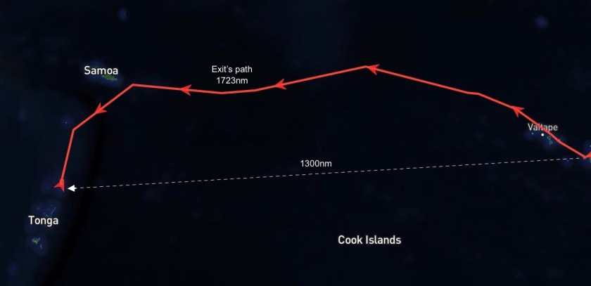
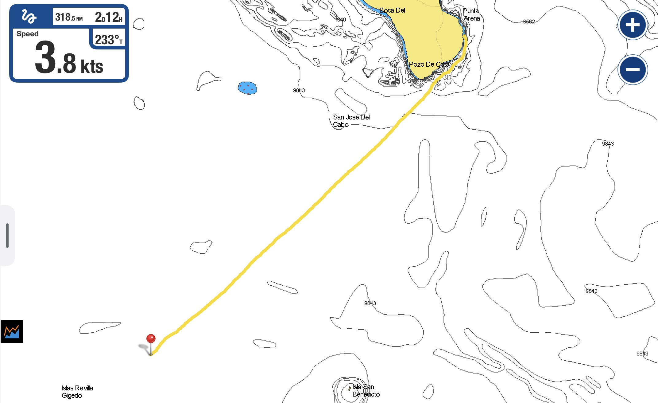
After nearly seven months we had run out of time. Over six thousand nautical miles and three countries, but this time it wasn’t immigration expiration deadlines…cyclone season was now upon us.
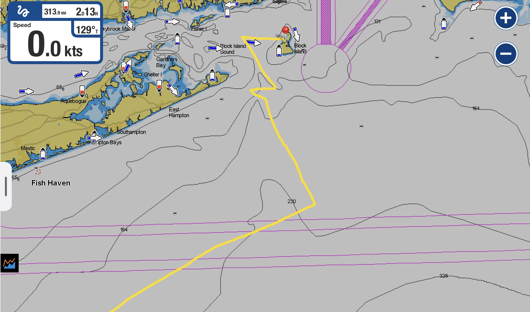
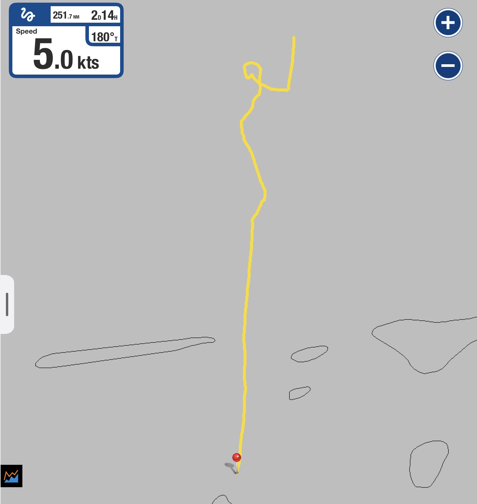
Exit’s path over the past six months
We had long been lamenting the fact that we seemed to have been pulled into the gravitational pull of New Zealand like hundreds of other sailors. Following the herd was never our way, yet we had simply accepted heading there to escape the cyclone season as “the practical thing to do”.
New Zealand certainly has its appeal as a prospect to visit. However, it seemed more realistic for us to visit by plane than boat. The reality was that our true goal to was to eventually reach SE Asia, and that lie in the exact opposite direction. Sailing nearly three thousand nautical miles round trip to spend six months in anchorages with water too cold to swim in without wetsuits, under the constant threat of hostile weather (after all, almost every bit of scary weather we had been monitoring for months had come from that area), quite expensive living conditions, and hundreds of other boats simply seemed like a pill we were forcing ourselves to swallow. Most of the other sailors whose opinions we valued had ended up storing their boats to rent camper vans – something we did in Australia fifteen years earlier but not something we wanted to do now.
Up to this point two things had molded our thinking and dictated our options regarding our immediate future: a common sense realization that staying where we were during the cyclone season would be a pretty fucking stupid display of faith in sheer luck; as well as a exceptionally unambiguous geographical box that had been provided to us by our insurance company with an ultimatum. “Come December 1, if you are inside this box, Exit has ZERO insurance coverage of any sort…period.”
We had already tried to appeal with an option to potentially stay in Fiji, which would have been acceptable to the insurance company only if we paid $5000 for a cyclone pit in a marina that Exit would have to physically be sitting in for the entire cyclone season…expensive, hot, uncomfortable. It sounded like a miserable way to spend $5000. And even more expensive if we didn’t stay aboard the boat. We took the idea off the table.
Time had all but run out on us. We shared a generally ominous feeling about the premise of making a passage to New Zealand. Reports had trickled back to us of other sailors who had made the journey. Some had benign experiences. Some had gotten the shit kicked out them. One sailboat was dis-masted. One had their prop shaft seize up and, for reasons that we never fully comprehended, the people aboard actually ended up scuttling their boat!!! The New Zealand reality hung over us like a dark, gloomy storm cloud.
We had been listening to too many other people for too long. Herd mentalities. Horror stories. Damn.
There had to be another option; but to untangle it from all the confusion and uncertainty would require us to stop listening to what nearly everyone else was saying. Separating from the masses and taking path least travelled had worked for us repeatedly in the past.
But we had to nut up and return to literally thinking outside the box…outside the cyclone box, that is.
And then we spoke to Ben and Sophie on S/V Kuaka, a custom built expedition capable aluminum sailboat. We had first met them a number of months prior in French Polynesia and immediately got along really well with them. Not only was Kuaka remarkably similar to Exit in its construction, their situation was also very similar to ours. Ben and Sophie were currently facing the same ticking clock as us. They too had to be out of the exact same cyclone box as us to satisfy insurance requirements, and their deadline was even sooner than ours. But they had come up with a different plan. They were headed north…
Wait.
What the fuck? North instead of south?
They were the first people we had spoken to who had even thrown that idea out. They were now only days away from departing.
Headed for Wallis and Futuna.
Where? Never heard of it…
Then past Tuvalu.
Huh? Never heard of that either.
They planned on not stopping at Tuvalu in favor of pressing on to Kiribati.
Kiribati? It’s actually pronounced “Kir-a-bas”. Okay…but neither of those sounded remotely familiar.
Ben and Sophie invited us over to Kuaka – to look at a guide they had, entitled Landfalls of Paradise, and talk things over. Copy that…we’re on our way!
It appeared that almost no one passes through the area we were discussing. A few dozen sailboats a year, maybe. Mostly on the way to the Marshall Islands which, in this direction, represents the first really recognizable destination to the north to steer towards outside of the cyclone belt. About the same distance away as New Zealand, but a more reasonable path if your intended destination is Palau, Micronesia, the Philippines, Japan, or any number of other appetizing possibilities.
Palau, Micronesia, and SE Asia in general were all along the trajectory we really wanted to be going in the long term. However, what was already very apparent to us was that, coming all the way from Mexico, the six month window outside of the cyclone season had undoubtedly been an insufficient amount of time to properly experience French Polynesia, Tonga, Fiji, and any detours in between. We had not even gotten to Fiji this season.
For us, the real appeal of sailing to New Zealand was the option of returning to Tonga and Fiji to pick up where we left off after the cyclone season had passed. It was feasible to sail in both directions. And while getting to the Marshall Islands was not that much different than New Zealand in distance, the prevailing wind and currents would mean that a round trip by sailboat was a much more difficult, if not unrealistic, prospect.
For Ben and Sophie, this was not an issue. They intended on pressing onward from Kiribati to the Marshall Islands, followed by Japan and eventually…Alaska. Wow! Ambitious, but not appealing to us.
For us, the idea of heading north was like a light bulb turning on…ding! But we really wanted the option of turning around. And so we had to take the seed they had just planted, and carefully nurture our own plan.
Repeated exchanges with our insurance agent, who at this point seemed rather perplexed and a bit flummoxed at our theoretical about face in direction, especially in this eleventh hour (and fifty minutes), eventually illuminated a bit better understanding. In one month’s time – outside of arriving at New Zealand, or Australia (only south of Brisbane), or having Exit actually sitting in an approved cyclone pit in Fiji, or sailing all the way back east of French Polynesia – we would have zero insurance coverage…with one exception…
We would be okay if we were north of the latitude 10°S.
To us, the northern edge of the cyclone box provided by our insurance agent looked more like 5°, but we weren’t going to argue the official answer from the insurance company against an illustration we were looking at.
Hmmm. Latitude 10°S.
This meant we had to at least make it as far as Tuvalu…about eight hundred nautical miles north of Tonga. Half the distance it would be to get to New Zealand.
We calculated that Wallis and Futuna would be a bit less than four hundred nautical miles away. Almost half way.
Instead of an imminent departure with fifteen hundred brutal miles to New Zealand, we could saunter to Wallis and Futuna and relax there for a short while, knowing that we were only an additional three day sail away from Tuvalu. Once there, all the pressure of the December 1 cyclone season deadline would be lifted.
Technically, Tuvalu is not completely out of the theoretical realm of possibility for cyclone activity. But it offered enough security for our comfort level as well as satisfying the damn insurance stipulations. If, after arriving in Tuvalu, it turned out to be an unrealistic stop for six months, we would have to reconsider our anticipated return south to Tonga, as well as visiting Fiji.
As remote and off the beaten path as it seemed, we immediately understood it would not be a hub of civilization for consumption and available resources. But we were good with that. They would have the sheer necessities of fuel and basic food stocks. Given a boat full of provisions, a functional dive compressor and gear, and a tropical location near the Equator, we felt confident that we could rough it for half a year.
We still had a lot to learn about places we had never heard of only days before and only a short time before we needed to leave…but suddenly we felt good.
This was doable.
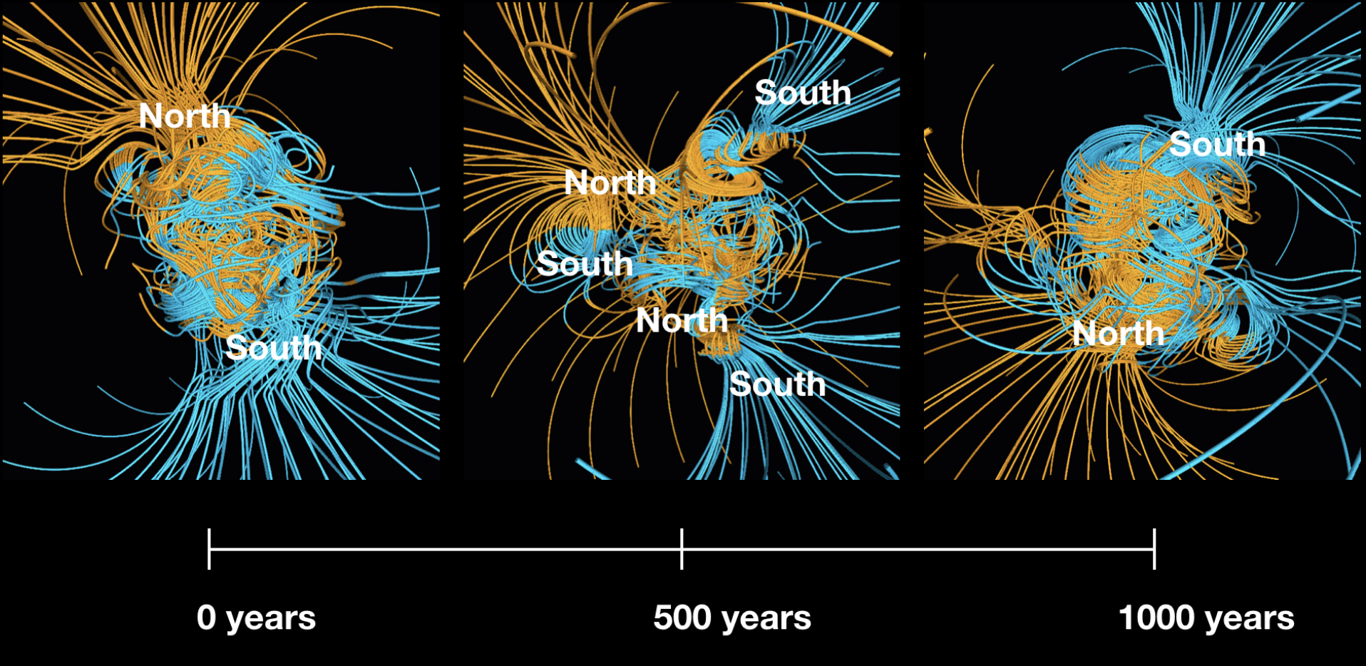
Normally, planetary polarity shifts happen somewhere between every ten thousand and fifty million years. Apparently, the actual process theoretically takes approximately a thousand years to occur. Ironically, for us, a polarity reversal had required only a few days.
Excluding our previous stop at American Samoa, which had been a weather diversion, it had been over five years since we had spent so little time in a country we had sailed to. And yet, only two weeks after arriving in Tonga, it was already into November with cyclone season technically underway.
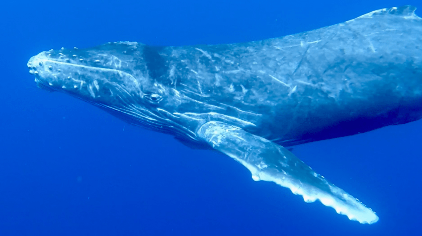
Nine months earlier, while still in the Sea of Cortez, after reading something online Kris had stated flatly, “I want to swim with whales in Tonga on my birthday.”
As it turned out, by October 26 this year the whales had already left Tonga, beckoned south towards Antarctica by an early cooling of the surrounding waters. It was our good fortune that, by that time, we had already sailed over six thousand nautical miles across the Pacific Ocean, arrived in Tonga, and dived with whales just three weeks earlier, not once, but twice.
Not quite perfect timing…but close. We couldn’t hold it against the whales.
It was late in the season. Still we had made it.
At anchor at Mala Island, Kingdom of Tonga
To be sure, getting to Tonga from French Polynesia had been an epic, at times harrowing, and certainly exciting journey. We had experienced both some of the most thrilling and nerve-wracking moments in the entirety of our sailing experiences.
The massive arc from French Polynesia to American Samoa, though nothing close to our 3000+ mile passage that initially got us to French Polynesia from Mexico, still represented only the second time we had ever travelled more than one thousand nautical miles in one go. And, though the American Samoa to Tonga leg was not nearly as dramatic as the Mexico to French Polynesia passage had been, it remained no small feat.
One thousand three hundred sixty six nautical miles from French Polynesia to American Samoa in just over ten and a half days. Followed by another three hundred fifty seven miles to the Kingdom of Tonga in just over two and a half additional days.
Those who wander are not always lost
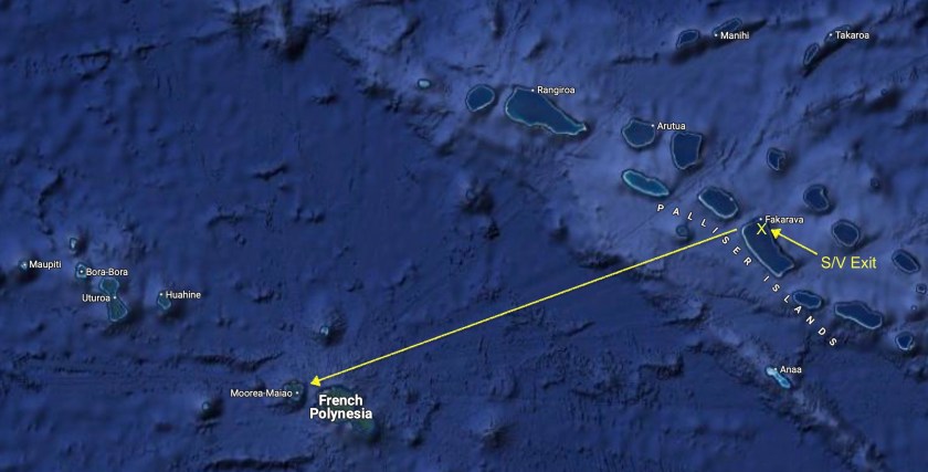
In retrospect, we had spent too much time in French Polynesia awaiting that optimal yet elusive weather window. Still, in the end, our choice to opt for a route that had ended up being over one thousand seven hundred nautical miles – four hundred miles farther than the actual distance separating the Society Islands of French Polynesia from the Kingdom of Tonga – had turned out to be a prudent tactic.
Ironically, arriving at the customs dock at Neiafu to clear into the Kingdom of Tonga on the island of Vava’u proved to be far more adrenaline inducing and nerve wracking than anything during the three hundred sixty nautical mile passage we had just completed. We managed to tie up to the vicious looking cement dock with its rusty rebar poking out, thirty feet directly behind us the definitive outline of a small sunken boat which jutted barely above the surface (obviously sunk while at the dock) and a local fishing boat tied to dock just in front of us. As the tide started dropping and we found ourselves struggling to keep the toe rail of Exit from slipping under the overhanging cement lip of the boat-killer dock we were secured to, we really began to sweat.
However, a short time later the authorities returned with all of our paperwork stamped and in order. We were officially cleared into Tonga. Gleefully, we untied Exit and, thanks to the absolutely benign conditions, separated ourselves from the ominous cement structure without incident.
Immediately afterward we were reminded why we so often lament having to be amongst a slew of other boats. Even though there must be at least fifty moorings installed in the bay just off Neiafu, we couldn’t find a single open mooring. Shit.
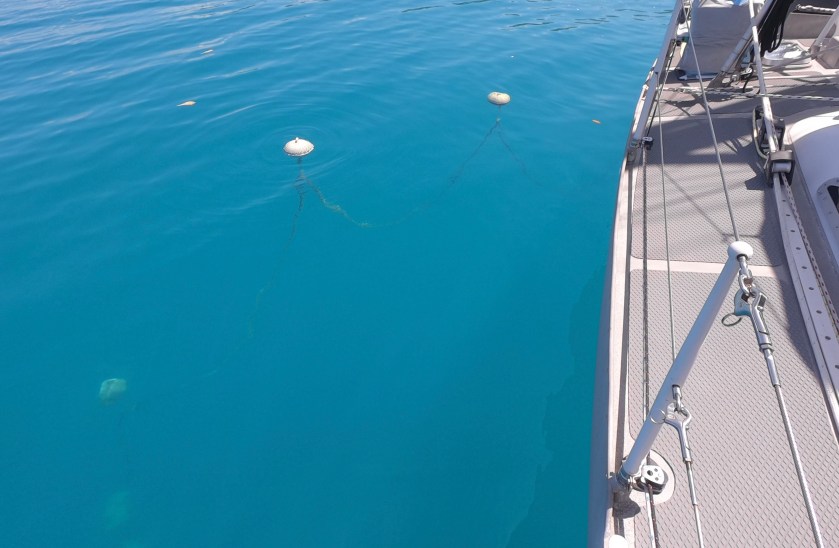
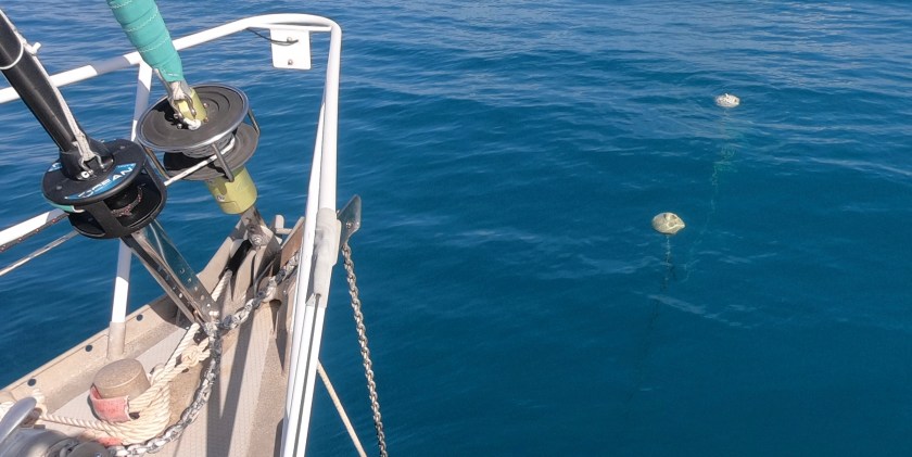
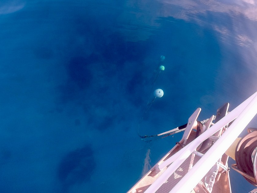
A handful of scattered mooring balls, obviously reserved only for small local boats based upon how close they were to shore, were the only ones that were unoccupied. Except for one single other mooring ball that had a small inflatable dinghy tied to it. Strange, we thought. But we passed by and continued on.
As we reached the outer edge of the mooring field, we still had found nothing.
The mooring field, large as it is, takes up only a fraction of the entire bay. One problem with anchoring is it would put the boat at least a half mile away from most of the town. Even more challenging is the fact that just off the shoreline, the shelf is very narrow. To be a reasonable distance from shore (at least by our standards) you find yourself having to anchor in a hundred feet of water.
For us, a ten to thirty foot depth is ideal for anchoring. Forty to sixty, though not a problem, starts putting the boat on a pretty damn large diameter to potentially swing if you have a reasonable amount of scope out for the chain. One hundred feet is getting pretty ridiculous. Doable. But with all of our 350′ of chain out in a hundred feet of water, we are still at less than a 4:1 scope; and now have the potential of swinging in an arc larger than a football field if the wind were to reverse 180°. That’s fine when we’re the only boat and we have the space. But, really? Here we knew we would be lucky if a boat that chose to drop anchor next to us allowed even a hundred feet of space between us.
And yet, we were pretty limited on options for the moment. We decided to drop anchor in deep water, hoping that someone else would choose to abandon their mooring in favor of heading out to one of over forty charted anchorages in the area.
We crept as close to shore as we dared, trying to get slightly shallower than a hundred feet, and dropped anchor in eighty five feet of water. Initially we couldn’t get the anchor to set. Then, after a couple of tries, we both concurred that we were simply too close to shore for comfort…especially if we were finding the holding marginal, as seemed to be the case. Having just arrived, we really didn’t know how breezes would play out in the bay, nor how consistent the wind direction would be. It wasn’t worth the risk.
As we started pulling up the chain, it stopped dead with over a hundred fifty feet still out.
Damn. We were fouled on something. Not a big deal.
But after a few minutes it became clear that it wasn’t just a snag. We were really stuck…again. We had just gone through this in American Samoa – probably our worst experience ever with a fouled anchor chain…until now. Fuck.
Once again, we found ourselves wrestling for over an hour struggling to free the chain. Once again, we found ourselves almost deciding to don scuba gear to sort it out. Double fuck.
Then, once again, as we neared the tipping point of frustration becoming rage, the damn thing came free. Arggggggh!
Five minutes later, as we motored back through the mooring field making one last search for what we hoped was an empty mooring ball we had missed earlier, the point from frustration to rage didn’t just tip – it was smashed.
The mooring ball we had passed by earlier with the dinghy tied to it now had a sailboat flying a yellow ‘Q” flag pulling up to it, with two people at the bow holding a boathook and lines to tie off with. Triple fuck.
Some asshole had used their own dinghy to reserve the last mooring right next to their boat for a bunch of jerkoffs that were arriving after us. Perfect. Thanks S/V Faraway. Another awkward reminder as to why I hate most people…especially those that own boats. At least I got to smile a few days later when I heard that theyhad blown out their spinnaker…ain’t Karma a bitch?
Kris scowled at me as I held up my middle finger while we passed by. I was furious, venting how we should have just pushed the dinghy aside and tied up to the mooring ball earlier. Fortunately, Kris’ cooler head prevailed and we said screw the mooring field, opting to anchor just off a small island a couple miles outside of town.
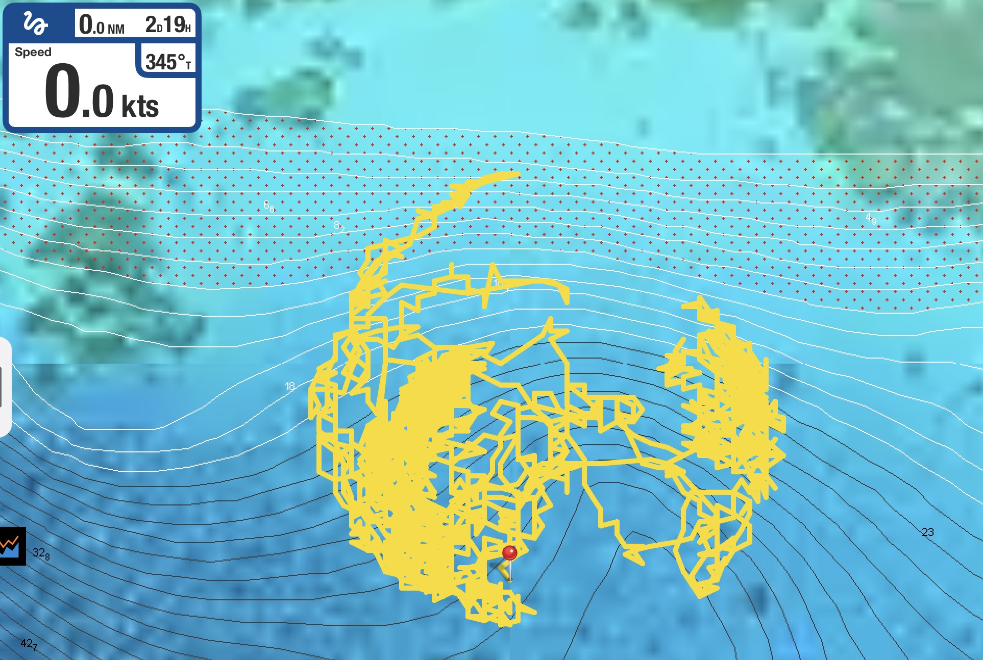
Screenshot
It had been two and a half hours since we had left the cement government dock. The engine had been running the whole time. Almost the same amount of time we had run the engine over two and half days getting here all the way from American Samoa. Only this time, we had travelled a whopping four and a half miles instead of nearly three hundred sixty…quadruple fuck.
These were some hard earned anchor beers we were gonna enjoy.
The following day we returned to the town. There were half a dozen unoccupied moorings…of course.
Unbeknown to us, we had arrived just as the week long 2024 Vava’u Sailing Festival was commencing. It offered us great insight into our new location, multiple presentations about potential future destinations in New Zealand, a number of opportunities to meet some locals, ex-pats, and other sailors, a fascinating and entertaining day trip to a cultural event, and some free meals. All in all, a win.
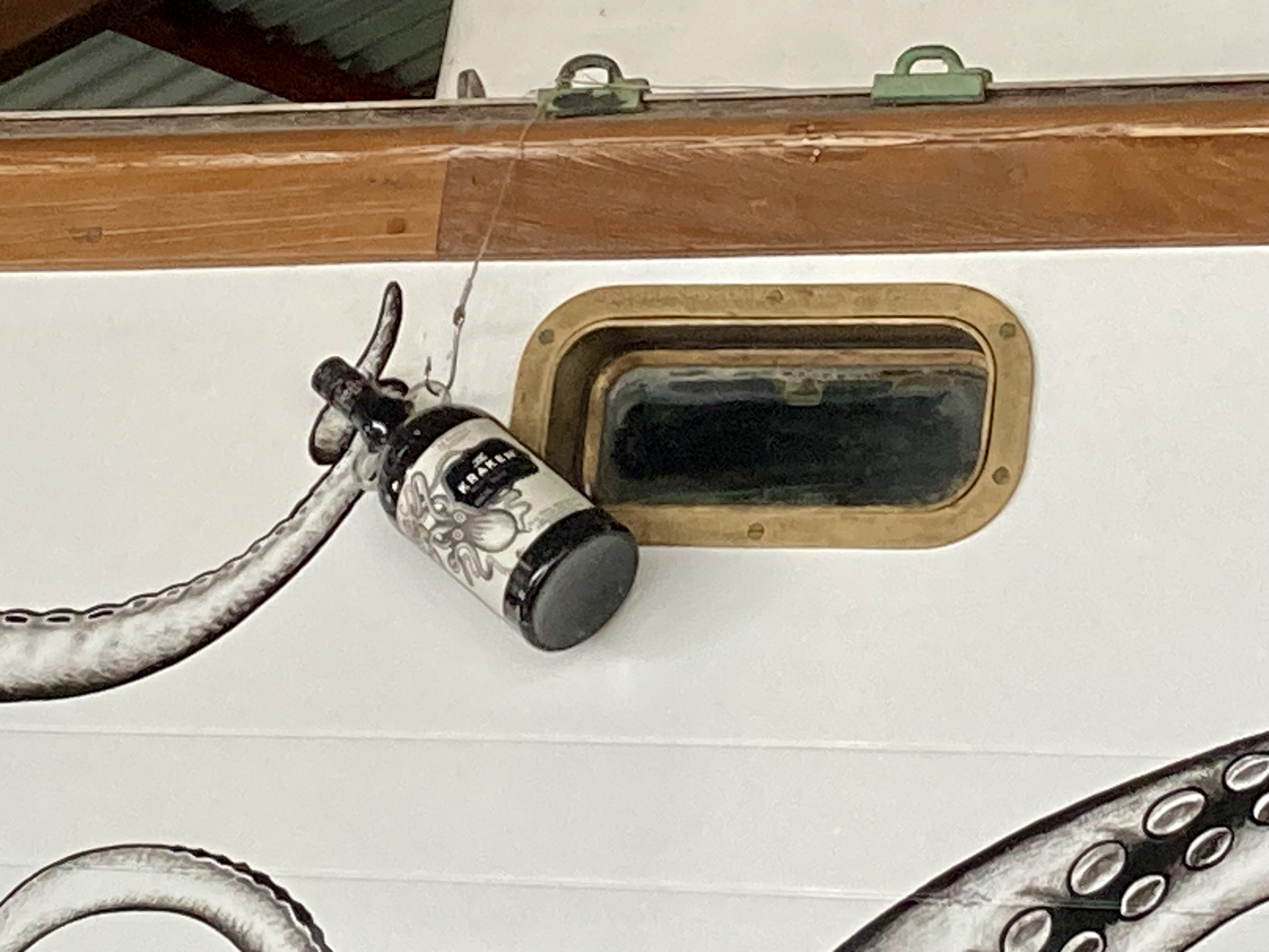
We were also introduced to The Kraken bar, where we spent a number of evenings enjoying food, conversation, and of course our favorite Kraken rum. It even had an actual sailboat, complete with Kraken graphics, integrated into the bar’s interior decor. As it turned out, they served a variation on the famous sailors’ drink of choice – “Dark and Stormy” (made from Pusser’s Spiced Rum and Goslings ginger beer). Mixed with Kraken spiced rum and Bunderberg ginger beer, “The Kraken”, as they called it, was the exact same drink we thought we had invented and named “Perfect Storm” years before!
By the end of the first week we felt well informed, privileged to be amongst such a hospitable group of Pacific Islanders (it immediately became apparent why the the Kingdom of Tonga is referred to as “the Friendly Islands”), as well as exhausted from all the social interactions. Having talked to more people on boats in five days than we had in the previous five months, we decided to restock some of our provisions and get the hell out of town.
We just had one task to accomplish beforehand.
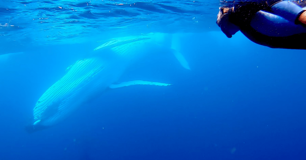
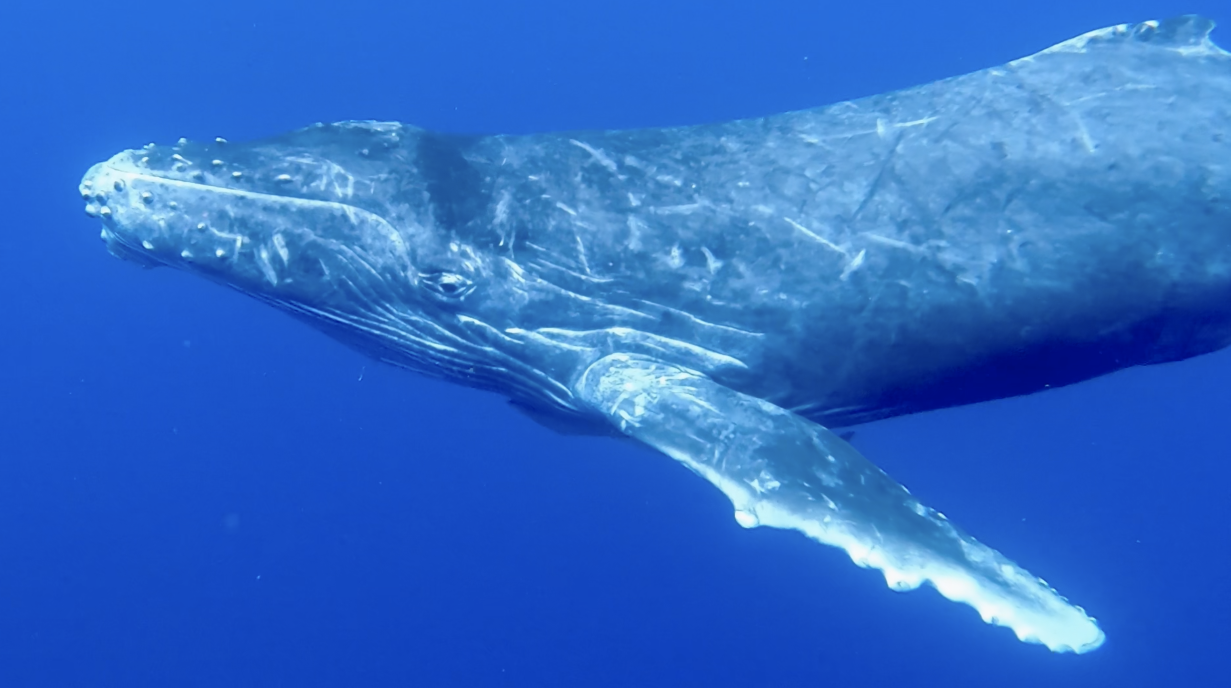
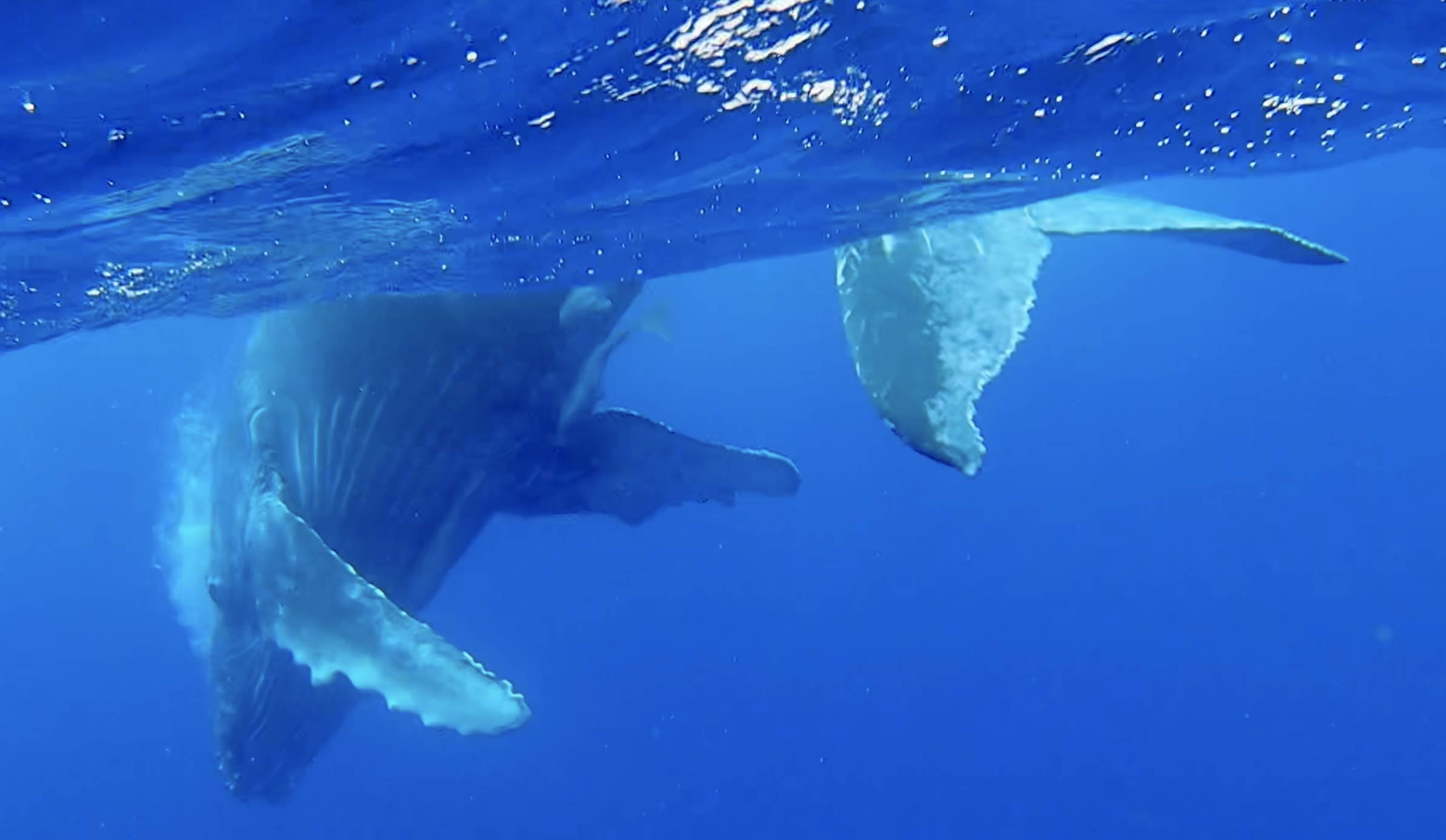
During our arrival to Tonga we had already experienced an amazing though brief whale encounter. Just as we were sailing into the channel entrance, we were greeted by a mother humpback whale and her calf. They were about five hundred feet away, but it was unbelievable…who could ask for a better welcome?
Every year, Tonga acts as a brief rest stop for humpback whales and their calves migrating to Antarctica. This certainty has provided Tongans with the opportunity to build a very respectful and conscientious tourism industry around seasonal whale watching encounters. It is also one of the only places on the planet where you can actually swim with these stunning creatures.
During the sailing festival we had learned that the numerous whales in the area, mostly mothers with their young calves and an occasional escort, had already begun departing, cued by the cooling of the surrounding waters. While these whales could often be spotted until the beginning of November, this year an early temperature drop in the water had triggered an early exodus. The locals believed that by the second half of October, the whales would all have already moved on.
The locals were also abuzz with reports of an albino baby humpback who had been seen recently this season. It was the first time in Tongan history that an entirely white albino calf had been seen, and as such, also spurred quite a lot of conjecture as to its mystical significance.
We held no expectations of a White Whale encounter (the albino calf’s wary mother had already understandably grown tired of all the excess attention they had received and likely moved on), but we had every intention of seizing the dwindling opportunity to swim with these magnificent mammals before the last ones departed.
Those in the tourism industry must walk a thin tightrope when balancing between tourist experiences and what is best for nature. Oftentimes the result is a shit show. In this case, it seems to be done admirably. In Tonga, whale interactions can only legally occur under the presence of a guide, limited to snorkeling at the surface, with only one boat in proximity and no more than four people (plus the guide) in the water at once. Boats aren’t permitted to chase whales and the guide must assess the demeanor of the mother and her calf before anyone is even permitted in the water.
The company that took us out was very professional, courteous, and conscientious. However, as is always the case, Mother Nature can be very fickle and the luck of the draw inevitably comes into play with the day’s outcome. A two hour mechanical setback on a boat that was slow to begin with, dwindling numbers of whales in the area, rough conditions that limited where we could go (especially with two young children aboard) all made for a challenging day. Furthermore, eight people aboard the boat meant any time in the water had to be split between two groups.
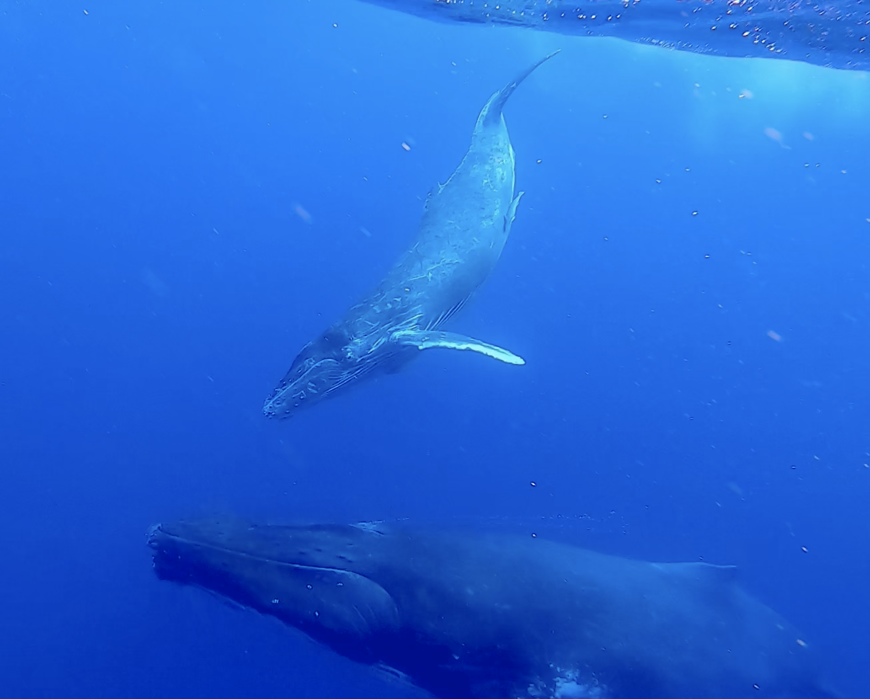
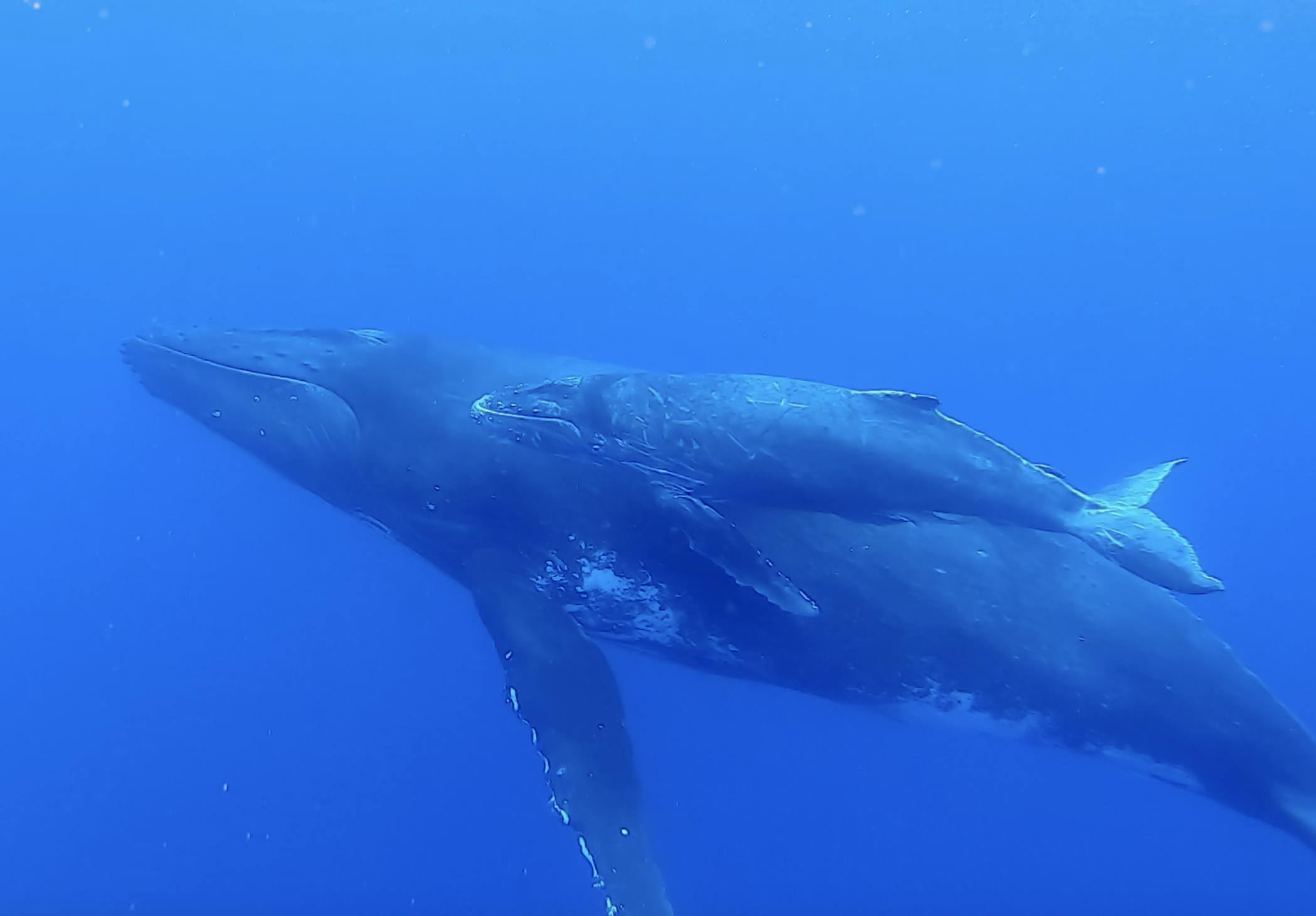
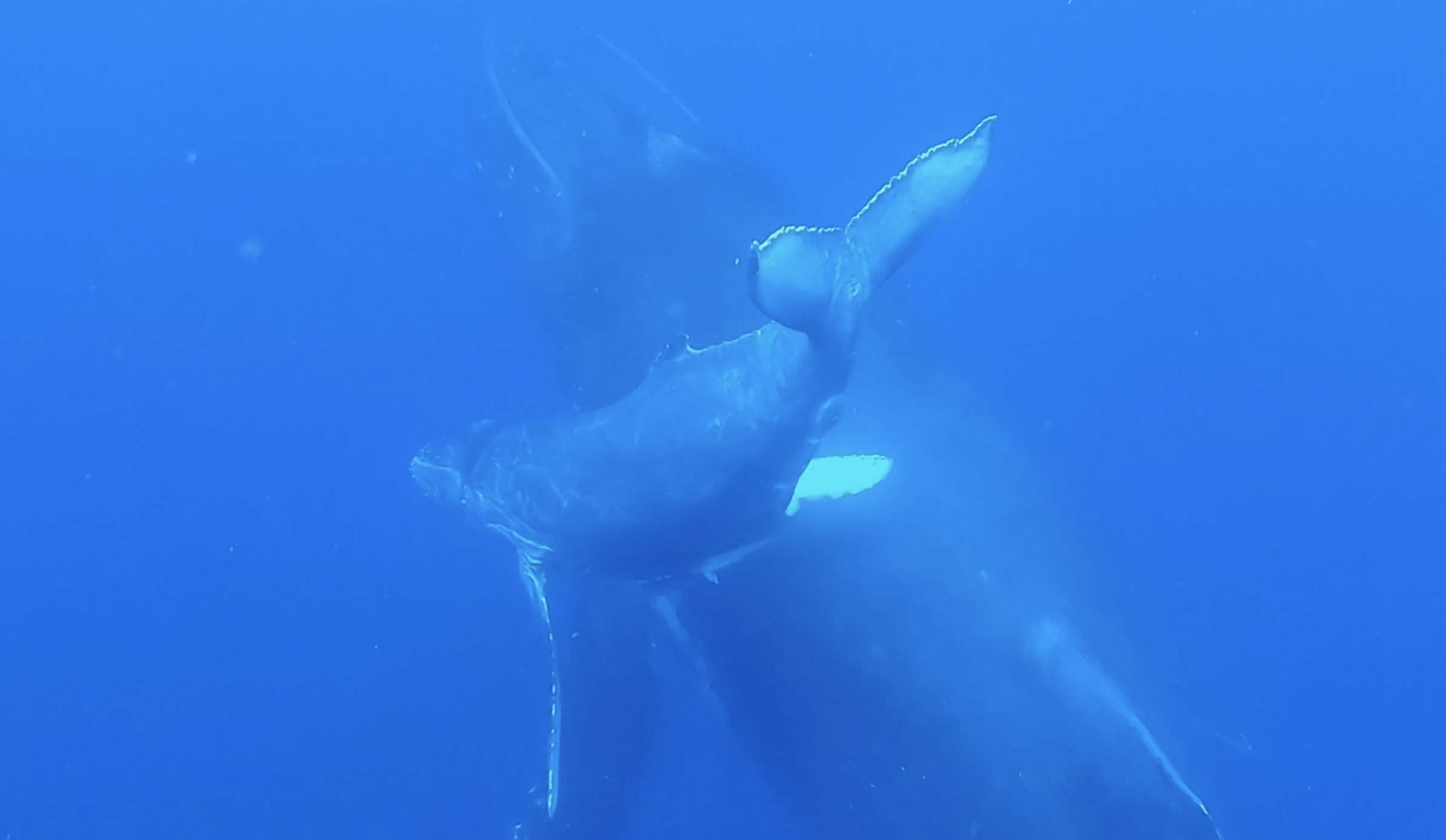
Eventually, we did see whales. Our group of four (myself, Kris and another couple) got in the water with a mother humpback, her calf, and a third escort. The moment was fleeting…seconds instead of minutes. Still, it was magical. And then they dove and were gone. When we came across another mother humpback and her calf a bit later, one of the two children in the family of four decided he didn’t want to get in the water, allowing Kris a second opportunity to enthusiastically jump in the water for an additional breathtaking, though brief, encounter.
We returned to Exit at the end of the day feeling simultaneously giddy with excitement and slightly guilty for a sense that things had fallen a bit short. After a great deal of discussion we decided to set aside our trepidations, ante up and roll the dice again, with a different company this time.
We weren’t disappointed…a faster boat with no mechanical issues, only four of us this time, a fantastic guide, and sympathetic Mother Nature. Jackpot! Our patience and persistence was rewarded with an absolutely brilliant day.
I think it would be fair to say Kris was more than a little stoked about the whole affair. But who’s kidding who, so was I.
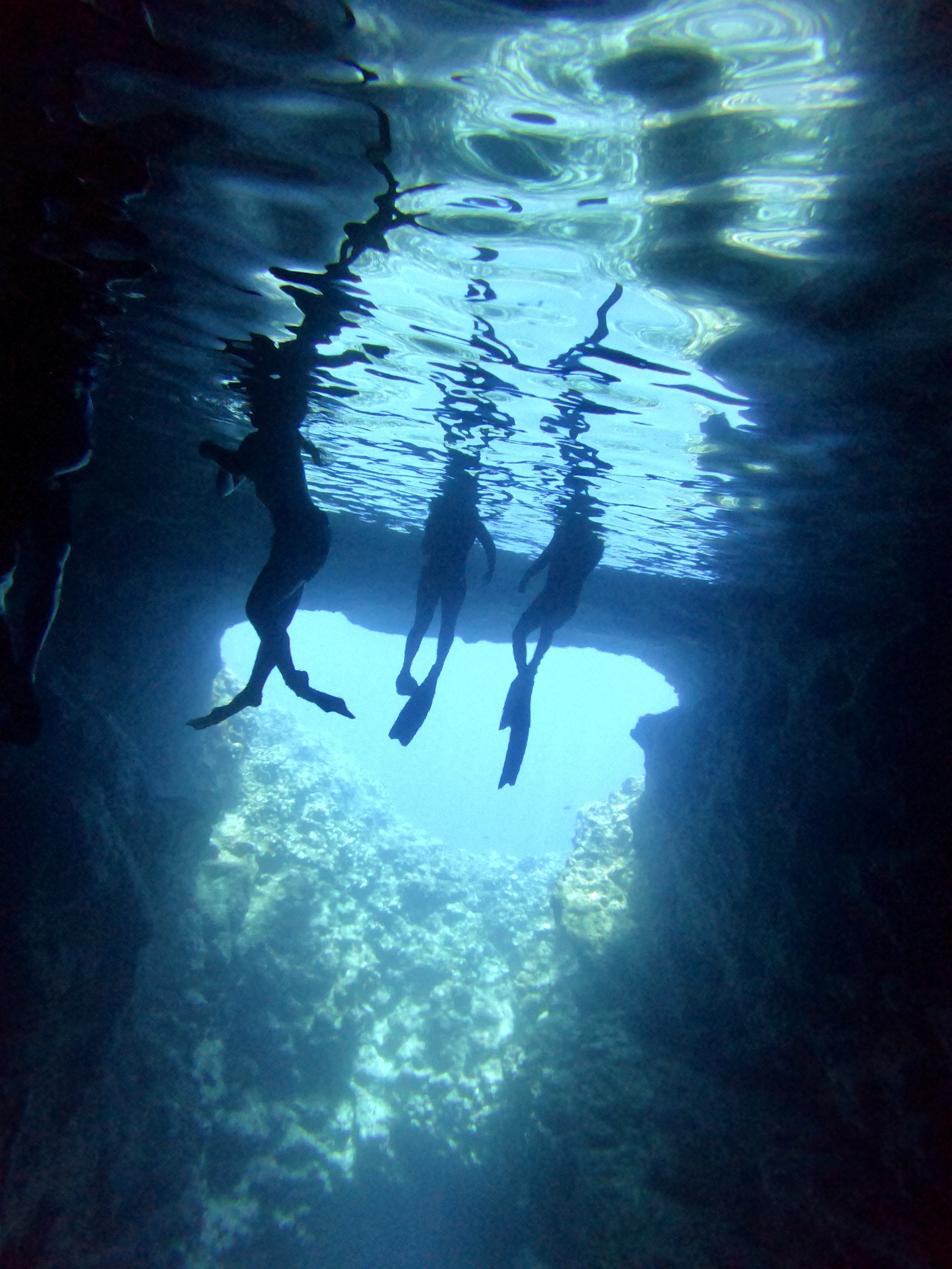
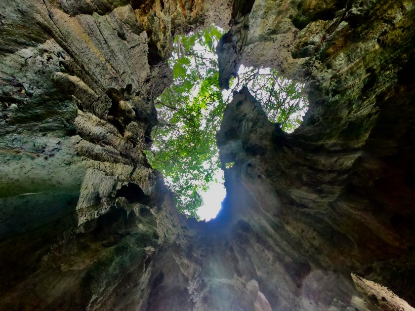
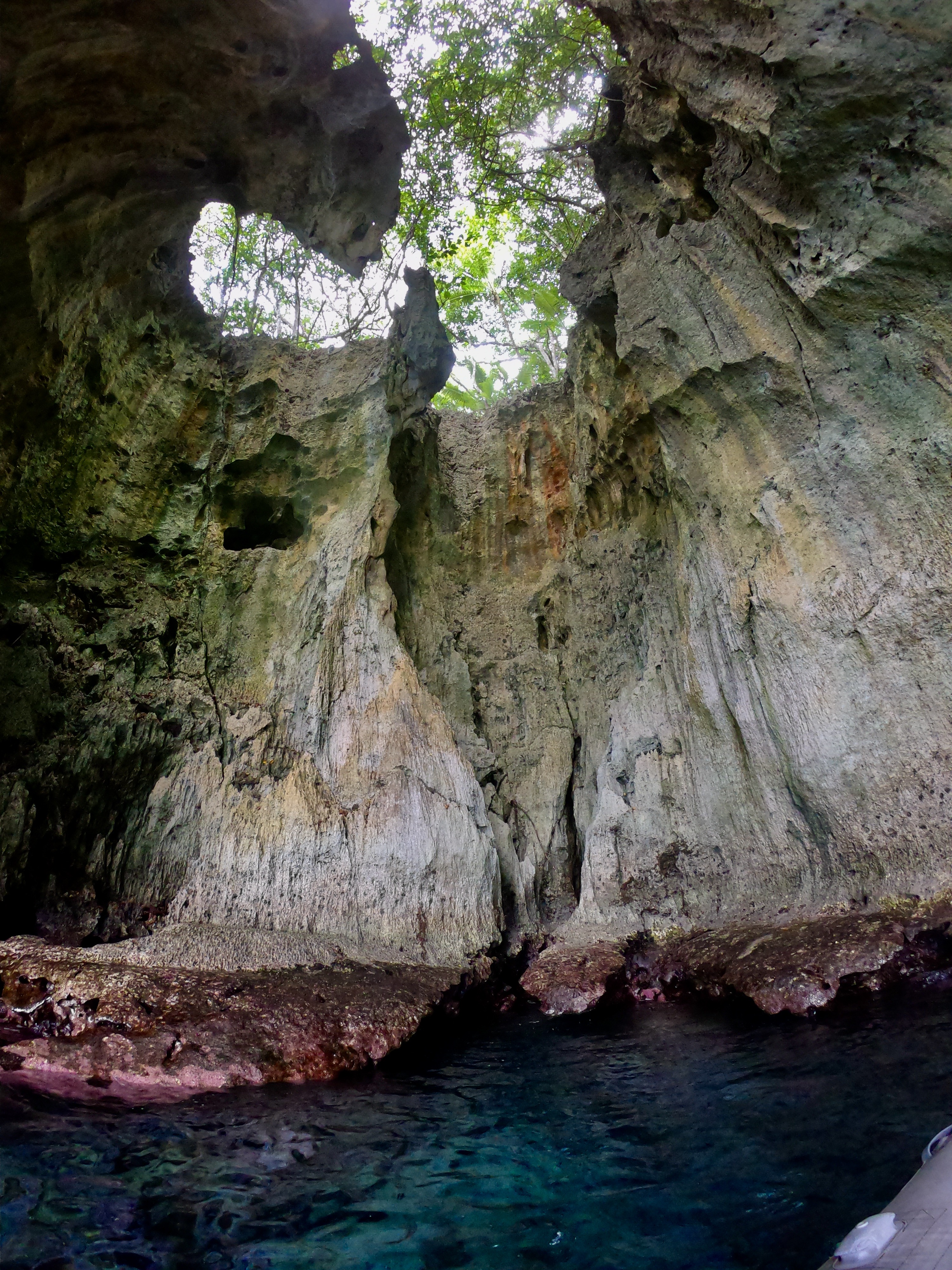
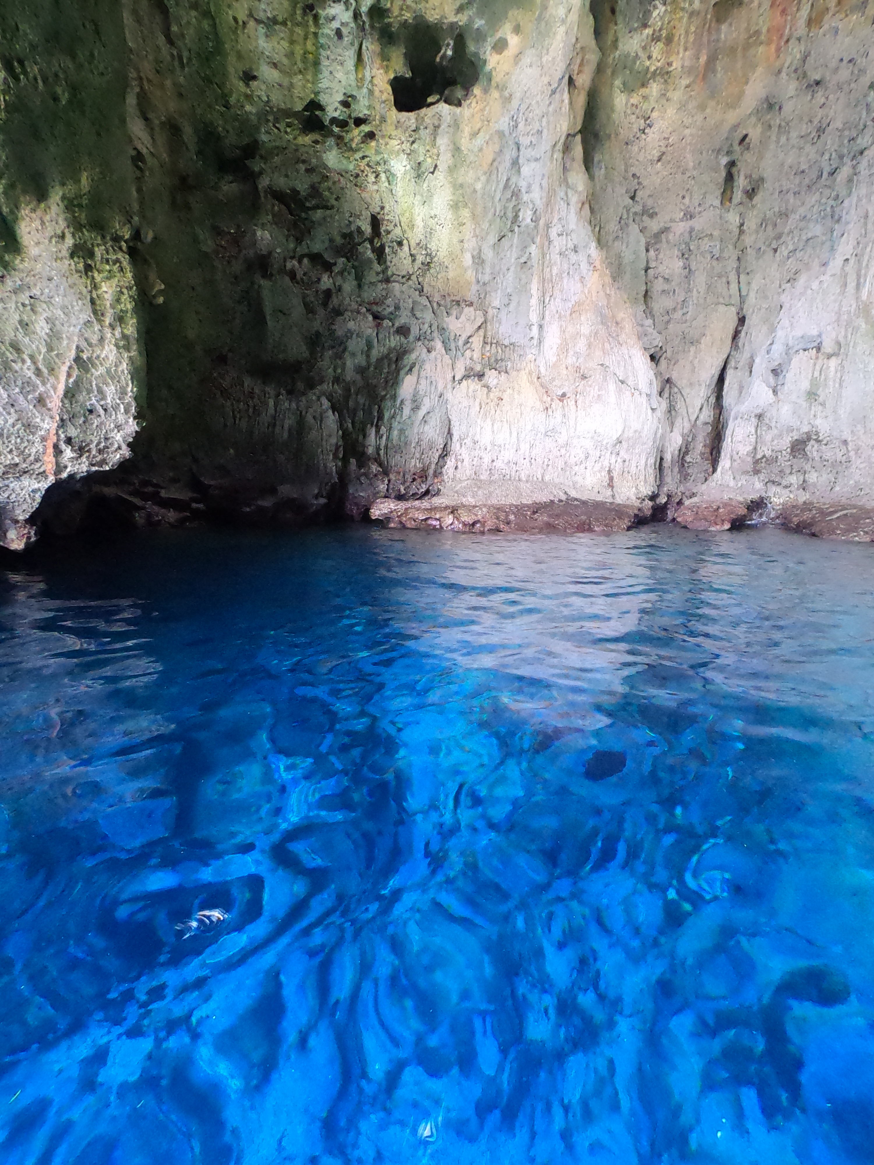
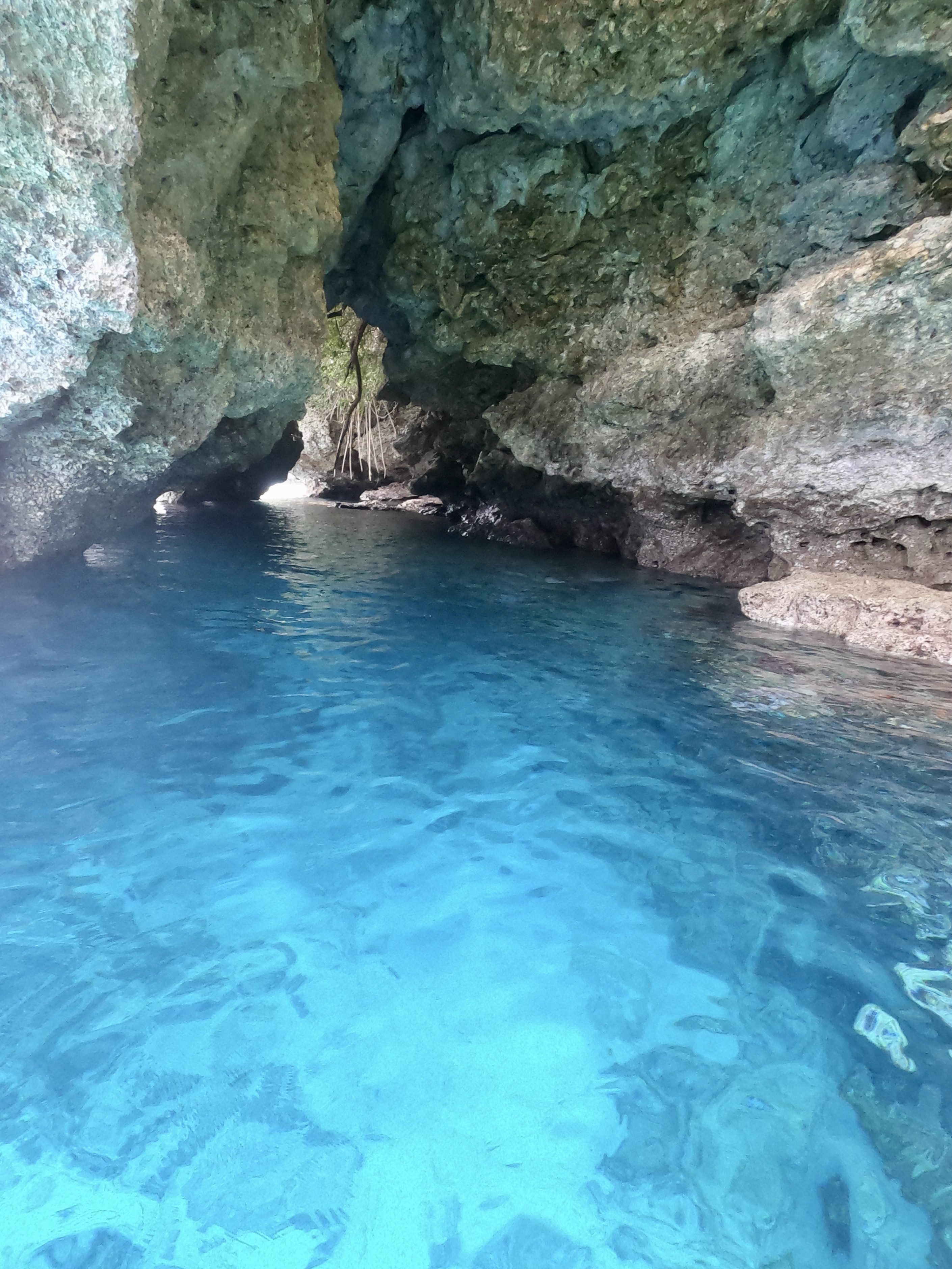
Afterwards, we took a brief detour to a submerged cave known as Mariners Cave before returning to town.
Freediving into Mariners Cave
Getting back out again…
The phenomenal whale interactions had far surpassed our wildest expectations, not to mention our budget. Sometimes life altering experiences like those can’t be judged on cost. They are too far and few in between; and, as such, need to simply be taken in for the magic they create.
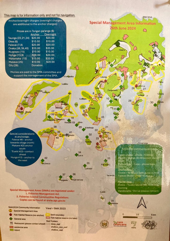
Still, when money is not an infinite commodity in one’s possession, there has to be a balance. The pendulum needed to swing back in the direction of zero expenditures for a while, so we set out to explore some of the anchorages scattered throughout the network of islands around Vava’u. With over forty charted anchorages, we had plenty to choose from. We also learned long ago that noted anchorages represent only a fraction of the actual possibilities.
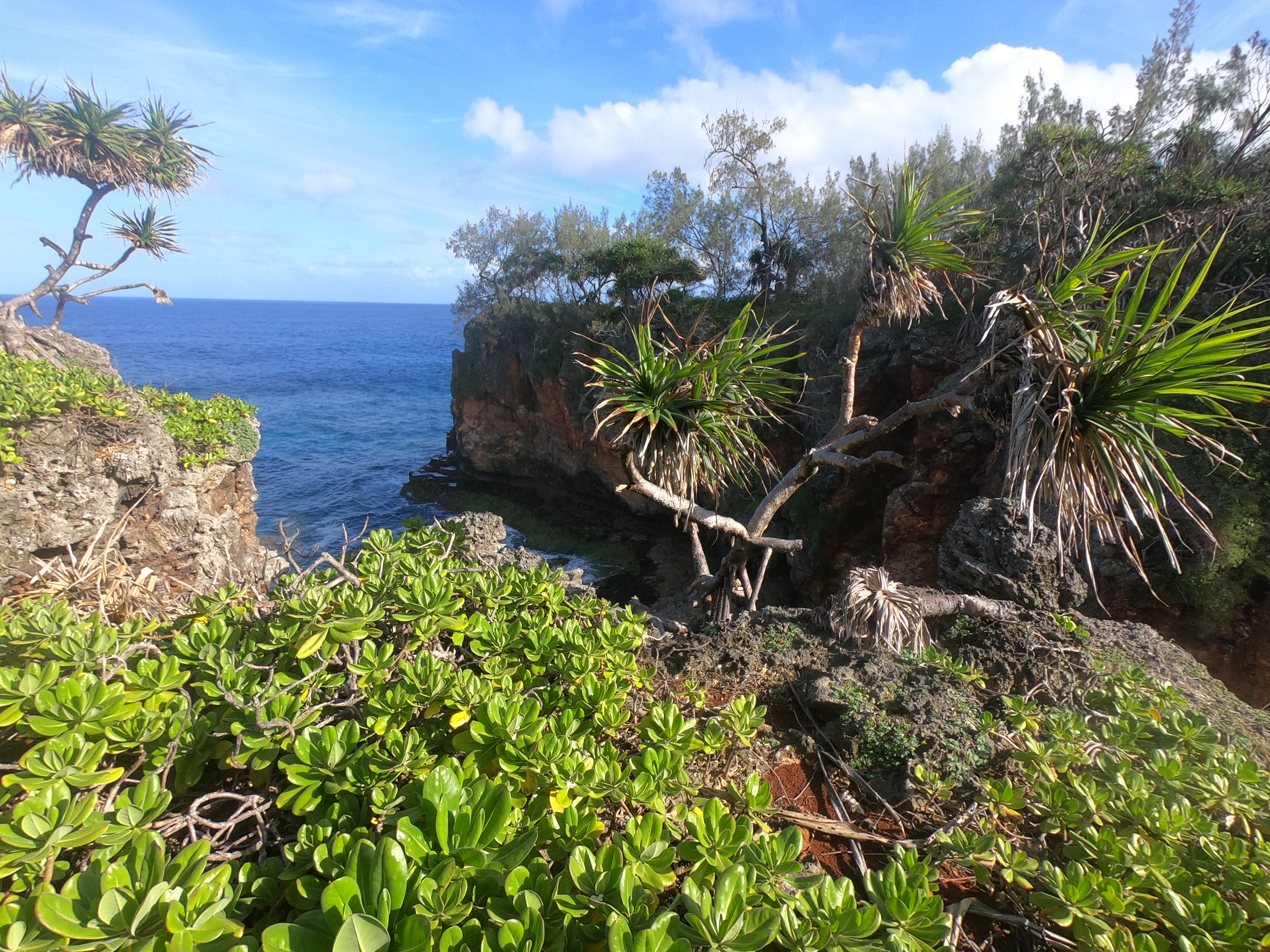
During a stretch of particularly calm weather we took advantage of the opportunity to sail to one of the outermost islands in the Vava’u chain, an island named Kenutu (#30 on the map of charted anchorages), where we found ourselves completely alone in an unbelievable and picturesque setting.
A hike to the far side of the island provided a fantastic view of the open ocean side.
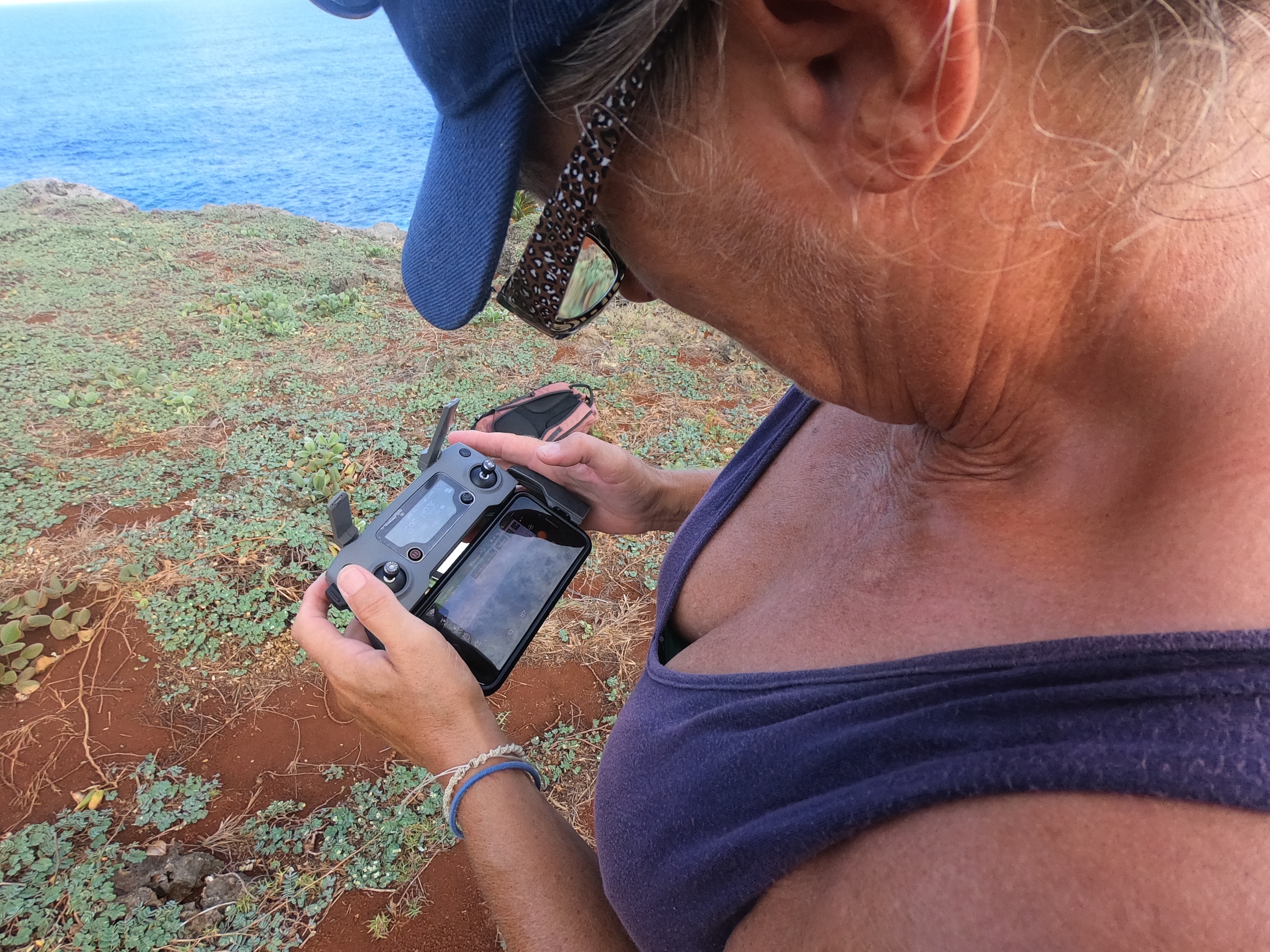
Given our isolation and the stunning view, we decided this was a perfect location to launch Space Exit. The perspective offered by a drone a couple of hundred feet in the air is so completely different from our typical orientation that it never ceases to amaze us.
Space Exit perspective
Birds eye view of Exit
During a different excursion to another anchorage we found ourselves within range of a dinghy ride to a popular spot called Swallows Cave. Though that cave was hopelessly overrun by other tour boats and sightseers when we arrived, we found the smaller cave right next to it to be well worth the journey.
Looking up from the dinghy inside the cave
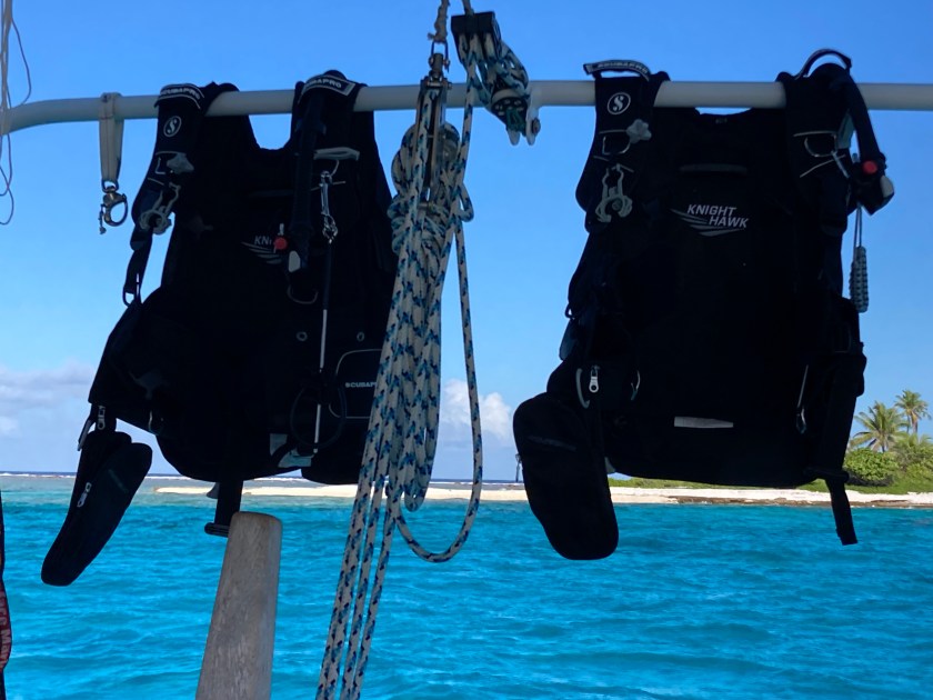
We had been made aware of the fact that a dive shop in town run by a German named Axel had built a great reputation taking divers to what was reported as a spectacular wreck just off the mooring field in town, as well as a night time “disco dive” utilizing UV, or black-light, dive torches to illuminate coral and other marine creatures in a completely unique way. And while I had experienced one of these “glow-in-the-dark” dives once before with a customer I took diving while working at Scuba Junkie which turned out both surreal and stunning, Kris and I were initially content to just do some exploratory dives on our own near the places we had anchored. As it turned out, whether right off of Exit’s transom or via short dinghy rides, we stumbled across some of the best dive sites we had experienced since the Cayman Islands.
Unfortunately, though we had managed to replace our GoPro that had been lost months prior at the end of a dive at Rangaroia in the Tuamotos during which we had seen our first tiger shark (!!!), we had not yet been able to secure an underwater housing, so we were unable to capture any photos or videos during any of the dives… oh well. Back to old school “just having to remember things”.
In Tonga, it seemed we had finally found the elusive paradise that had been hiding from us since commencing on our Pacific Ocean crossing six months prior. Plenty of anchorages; generally, not too many other boats around us; great diving; reasonably calm weather; decent provisioning and supply options; water temperature that didn’t keep us out of the water; and a handful of other sailors whose company we enjoyed.
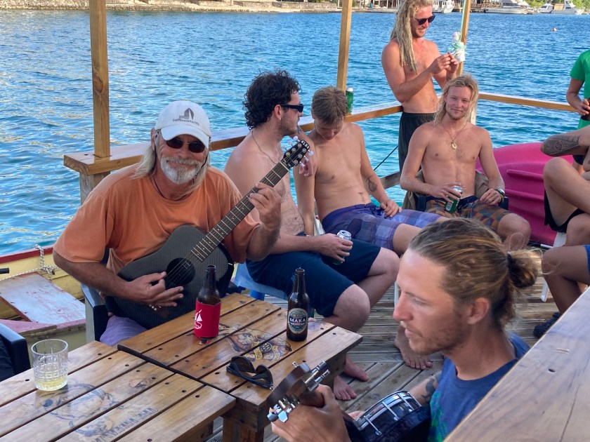
As it turned out, the couple and crew aboard the sailboat S/V Kahina, who we had gotten to know in French Polynesia after giving them a tow when their dinghy engine was on the fritz (they were also the other two people on our second whale watching tour) had quite a stash of instruments on their boat. One afternoon we had an epic three person jam session while enjoying drinks on a floating bar at the edge of the mooring field in Neiafu.
And then, in the blink of an eye, five weeks had passed and November was upon us.
Tick…tock…tick…tock…
The clock was ticking and we knew it.
We had to finalize our next destination, and soon. New Zealand had been the default choice for months, with Australia being a potential fallback. Unless we could come up with a viable alternative, it looked like we would be endeavoring to sail over fifteen hundred nautical miles with the rest of the herd for cyclone season. Six months. And, to be honest, in the wrong direction. Towards cold water…towards the source of most of the scary weather we had been watching since crossing the Equator…towards all the other boats that made the same herd decision.
Away from SE Asia, which was where we really wanted to be headed. We’d have to make the return trip after cyclone season ended as well.
What were we thinking? There had to be a better option…
And then we spoke to Ben and Sophia aboard S/V Kuaka. They told us they were heading north…
We had already completed clearing out of French Polynesia, gotten our passport stamps, and picked up all of our paperwork from the authorities in Huahine. We had three days remaining to depart French Polynesia.
This was one of the few places we had visited that would allow you to stay more than twenty four hours after clearing out. Some countries expected you to return to your boat, lift anchor, and be gone. Here we were allowed to take care of all the paperwork a few days in advance and get the passports stamped with a future date.
Because there were limited locations that even were possible to clear out from, it was not uncommon here in French Polynesia for boats to stop at one of the outlying islands after clearing out and end up exceeding their allowed time. Cheeky, to say the least. Completely intentional. Another example of assholes willing to disregard the law, willing to push the boundaries for their own convenience and personal schedule, and give everyone a bad reputation.
On more than one occasion, we had heard of boats doing this with the backup plan of pleading that they had some sort of mechanical problem if they were actually caught. Our own perspective was that sailors who lied about engine failure or some kind of serious boat problem as an excuse to break the immigration laws and overstay their visas were begging Fate to step in and actually impose that very problem upon them at some time in the not so distant future. The well-deserved justice of self-imposed Karma…
We had no desire to engage in such fuckery.
Despite our disappointment, we had no intention of stopping on the sly at Bora-Bora, or further along at Maupiti as was even more common, to discreetly and illegally hang out as we passed by.
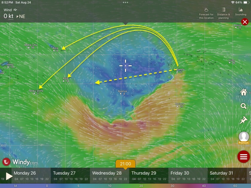
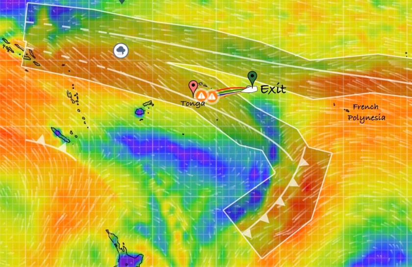
However, weather was not being very cooperative with our best laid plans to leave within three days time. We had been watching the weather forecast models already for quite some time. There was currently a massive zone of absolutely zero wind between us and Tonga, which was where we were trying to get to, and it didn’t look like there was any chance of it filling in before our deadline to be out of the country. By massive zone, I mean over a thousand miles – a distance that would take us over a week to motor through and would consume nearly the entire capacity of our two hundred gallon diesel tank…almost twice the amount we had used since departing Mexico four months ago.
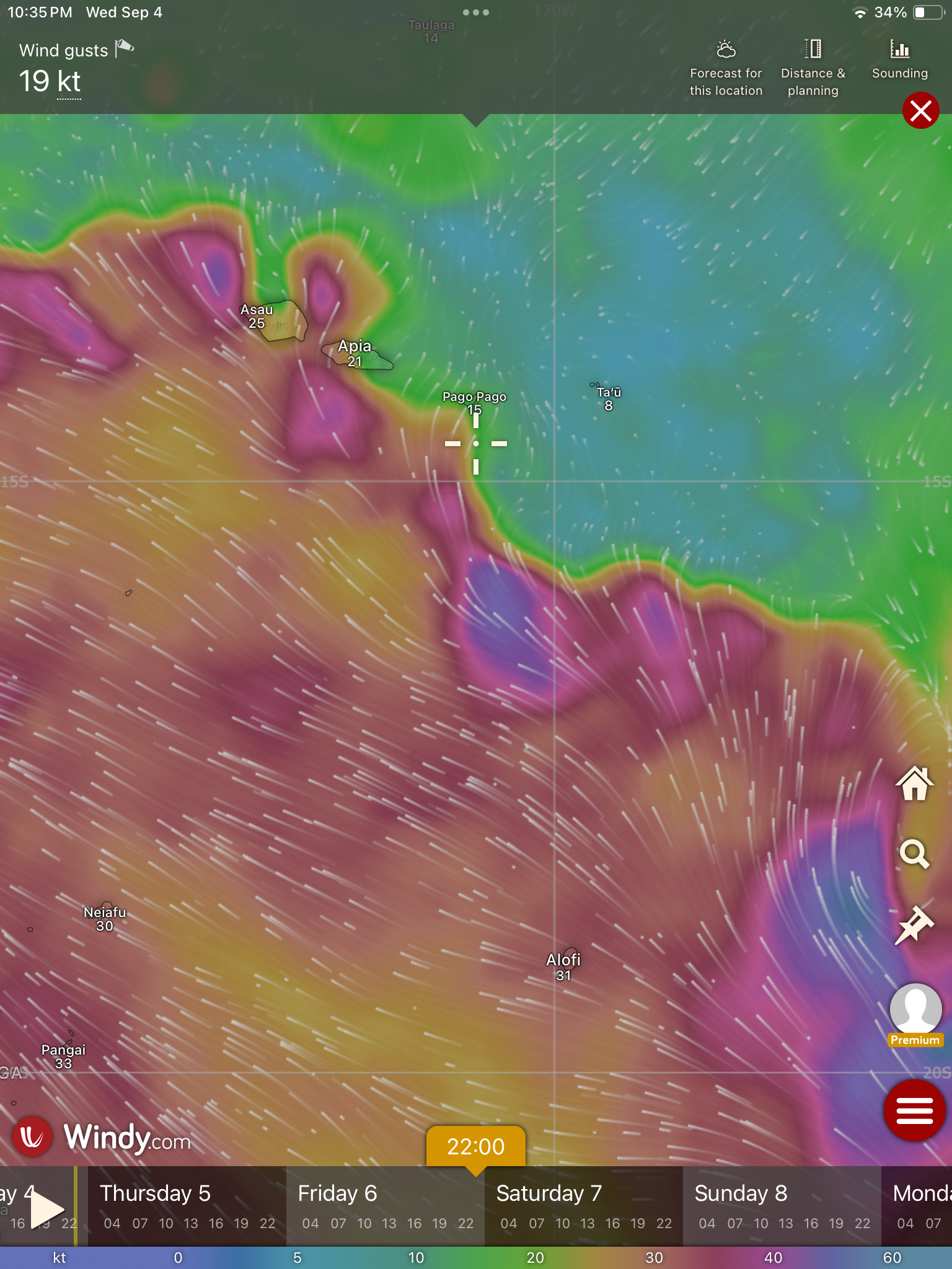
Wind forecast a day after our departure deadline
There were other boats that had already decided they were headed for Bora-Bora or Maupiti. They planned on just trying to hide out until the winds finally picked up.
An additional problem was the longer term projected forecast. By the evening of September 1, stronger winds that were currently arcing to the south, just under the present dead zone that represented our needed trajectory, were expected to not just fill in to the north, but actually kick up to pretty damn obnoxious levels. These could be winds reaching the thirties with seas building up to ten feet or higher…something we were not prepared to sail through.
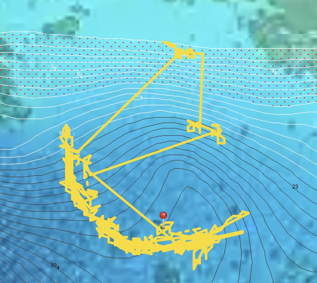
Screenshot
If we didn’t leave soon, we wouldn’t for quite some time…
We hatched a plan that seemed far more prudent than what amounted to the general consensus and groupthink among many of the other sailboats. It would mean we would be completely on our own, without the comfort or backup of nearby buddy boats, but we had never favored that strategy anyway.
Instead of attempting a straight shot involving potentially motoring for the better part of a week, or hiding in Bora-Bora or Maupiti hoping we wouldn’t get caught, we decided to head north. We calculated a broad arc in that direction, skirting along the edge of the dead zone would add potentially three hundred extra miles (maybe three days) to the projected thirteen hundred nautical mile, eleven day passage to Tonga, but should allow us the ability to sail instead of motor.
If the winds filled back in, we could cut back on a straighter course, possibly even stopping at Alofi on the tiny remote island of Niue (about two hundred miles short of Tonga) – an idea that intrigued us greatly. If things went completely to shit with that plan, American Samoa would be the bailout option at around eleven hundred miles, or nine days.
We set out on our own path, and for two days we enjoyed brilliant sailing conditions. Thirteen to eighteen knots in comfortable seas on a broad reach. Then the winds dropped to less than ten knots and we found ourselves motoring for half of the next forty-eight hours.
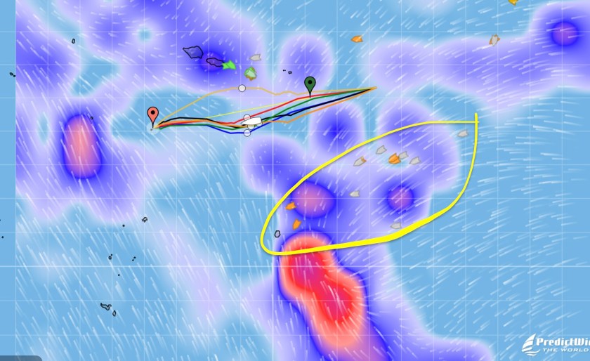
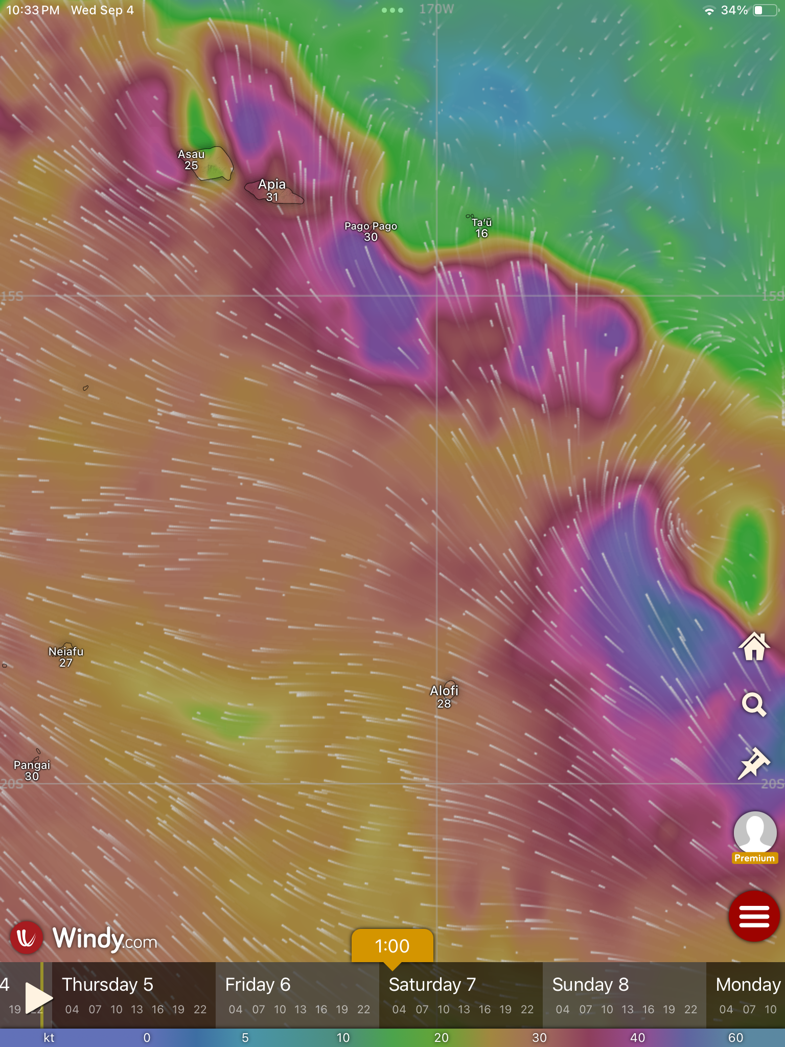
Once we got underway, the forecast models began to revise. The upside looked promising – though still covering a vast area of ocean, the zero wind area looked like it might shrink somewhat, potentially permitting us to avoid having to push as high northward as we originally anticipated. However, the downside looked slightly ominous – winds on the south side of the dead zone were probably going to be strengthening much more than originally forecasted. Niue would more than likely be too rough to stop at.
Screenshot
By our fifth day underway the winds had consistently returned. Nothing less than low teens and nothing more than low twenties. The skies were clear and we were smiling. It seemed our strategy had been a solid choice and we were making excellent progress.
August 31 underway
We were growing a bit concerned with shifts in the forecast models that were still over five days away – far enough ahead to likely change again but close enough that we would still be underway.
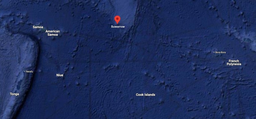
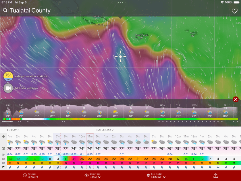
The projections were now looking at a major disturbance beginning to materialize stretching from Tonga all the way up to Samoa and nearly two hundred miles east of Niue.
We had all but removed Niue from the potential list of potential targets; it looked like it was going to be a mess. Instead, the tiny island of Suwarrow (technically part of the Cook Islands), east and slightly north of American Samoa, had now become our bailout option in case the original fallback option of American Samoa became untenable. It looked like the shit could hit the fan even as far north as Samoa. This was one of those times when our ability to connect to Starlink and get weather updates while more than five hundred miles from the nearest land in the middle of the Pacific Ocean was worth every penny we had to fork out to a prick like Elon Musk.
By sunset on day six, you wouldn’t have guessed what winds were in store for the near future. They had dropped back down to below ten knots and we would see as low as five. We had managed to sail for one hundred ten of the past hundred fifty hours underway – not perfect but our “northern arc strategy” had largely been paying off. Still, it became excruciating having to run the engine for a number of eight to fifteen hour stretches.
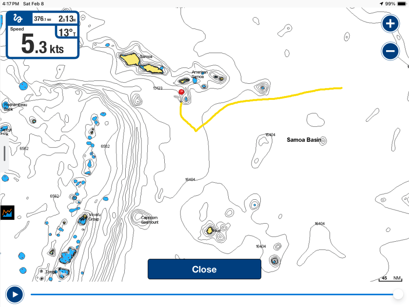
On day seven we scrapped our improvised tentative stop at Surarrow. We had made good on about seven hundred thirty miles and actually came within less than thirty miles of the island. The forecast was still ambiguous as to whether things were really going to get nasty and we had American Samoa 450nm ahead of us that we would pass in about three days. If we were able to press on to Tonga we had closer to 700nm ahead of us, meaning we had just passed the halfway point.
Meanwhile, we had been hearing reports from the armada of twelve or so sailboats three to four hundred miles to the south of us. This was the group that had hidden out in Bora Bora or Maupiti and made a run for Niue just ahead of the front that we had tried to get well north of. They were now being pummeled by brutal winds and high seas, still trying to make it to Niue before conditions deteriorated enough to make entering the pass into the atoll impossible, forcing them to continue all the way to Tonga. From the AIS positions that we were seeing on our PredictWind weather updates, it looked to us like very few of those boats would make that window.
That afternoon we celebrated having surpassed 22,000 nautical miles travelled aboard Exit. It was a welcome momentary distraction from worrying about weather forecasts. We were glad to have taken our own path and followed our own instincts.
Two days later we had to laugh. We were now making around one hundred fifty miles a day, averaging almost six and a half knots of speed – which for us is screaming along. Entering day nine of our passage, we had traveled more than one thousand nautical miles and were still yet to lock in a destination. Currently we were splitting the difference between Tonga and American Samoa, pointing right between the two of them. It was messy as hell all around us with seven to ten foot seas and winds averaging in the low twenties, but we were hauling ass on a broad reach, sailing in waters that would reach over 16,000 feet deep as we prepared to pass over the the Samoa Basin. Having to make almost no sail adjustments whatsoever, we were content to keep going.
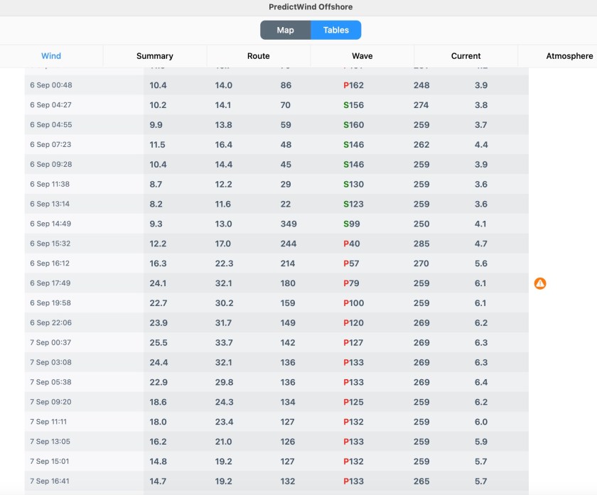
The following morning we realized we had travelled five thousand six hundred nautical miles since departing Mexico. Today we would pass twelve hundred miles on this passage and had made a definitive turn southward from American Samoa. Our sights were set on Tonga. The shifting weather forecasts were so schizophrenic they were making us dizzy, but we thought we had a narrow passage that would avoid the worst looking stuff that was threatening forty or so knot gusts. We had about 350nm to reach central Tonga; north Tonga was about one hundred miles closer.
Screenshot
Over the course of the next twelve to eighteen hours things would change drastically.
By midnight we were already more than one hundred nautical miles south of American Samoa. We had started experiencing squalls with wind gusts punching up to thirty knots.
That wasn’t pleasant at all.
But what began to grow scary very quickly was the rapidly changing forecast models which indicated a much worse deterioration of conditions and strengthening winds than we had previously seen indicated at all, up to this point.
When we briefly turned on Starlink at midnight we were shocked by the newest updated forecasts we had just downloaded.
The edge of the front had hardened up substantially and it no longer looked like a brief time period with gusts of thirty and some areas possibly reaching a bit higher. We were now seeing projections of much larger area that would be affected by longer lasting and much more substantial winds.
Now, in less than twenty-four hours, directly in the path of our current trajectory, we could expect to experience sustained winds into the forties with gusts ranging from the forties all the way up as high as the sixties for half the night! The models indicated fourteen foot seas could be anticipated!
Shit.
We immediately decided to abort, do an about face, and make a run for American Samoa. At about one hundred fifteen nautical miles away, we weren’t confident, even if we motor-sailed the entire way, that we would arrive in the harbor of Pago Pago before 9pm, when the shit was projected to hit the fan, much less getting there before dark.
Still, we had no choice.
Between midnight and dawn we tried to make as much progress towards American Samoa as we could; however we had to run with the wind and waves as squalls passed. Outside of the squalls, winds between eleven and fifteen knots from behind us limited our speed but we had to maintain pretty conservative sail configurations considering the number of squalls that were materializing around us and their intensity. By sunrise, we were motor-sailing to try to eke out every knot of speed we could squeeze.
At noon, we were less than fifty miles from Pago Pago and at 4:20pm the log noted we were twenty three nautical miles from the harbor. This meant we would arrive after eight…no chance of making it in before dark.
Approaching sundown and less than 20nm from American Samoa.
At least conditions had settled drastically as we approached the island. We knew this was deceiving; but it would certainly be in our favor to help us get into the harbor and try and find a safe place before all hell potentially broke loose.
Our no entering an unfamiliar anchorage after dark rule was sound practice but in this case we were going to have to say fuck it. There was no way we were going to risk sitting out for the entire night in potential fourteen foot seas with wind gusts possibly reaching fifty or sixty knots, and once things became untenable it would be even worse trying to get in.
We decided, especially if the current conditions maintained during our arrival, we could creep in slowly, hoping the lights of Pago Pago might help us to decipher things, and we would be taking the lesser risk. The maelstrom that was chasing us down from behind was now forecasted to hit American Samoa at 10:00pm. We estimated this would give us at least an hour to get our anchor set but certainly not more than two.
Pago Pago’s harbor opened out to the south; unfortunately, the direction the winds would be coming from. However, we knew that the anchorage itself was in the very back corner of the bay, which was tucked around a ninety degree corner to the west. Of course, it was impossible to know what we would find once inside the harbor and exactly where we would end up anchored, nor how the winds would funnel through.
Not ideal, but we felt it was undoubtedly our best option.
Though absolutely nerve-wracking and incredibly stressful, our entrance into Pago Pago Harbor was as smooth and uneventful as we could have hoped for. Lights from ashore both illuminated the bay to a certain degree but also made it very difficult to discern what it was we were seeing in front of us. A number of huge barges secured to massive industrial moorings with multiple derelict boats rafted up to them were nearly all but invisible to us, even with me at the bow with a handheld spotlight.
Regardless, after motoring amongst the barges and the handful of other sailboats at anchor, we managed to locate a spot that seemed to provide adequate room around us. We dropped anchor and got the snubber set just as the clock shown 10:00pm.
Pago Pago Harbor, American Samoa
After ten and a half days at sea and one thousand three hundred sixty six miles, we had reached our detour stop of American Samoa.
That night, when the winds began to pick up around midnight, the land mass we were now surrounded by did indeed offer us immense amounts of protection from the wind. The orientation of the harbor also ended up sheltering us from any waves and, indeed, most of the swell.
We had made the right choice.
In hindsight, we were a bit irritated at ourselves for not having made the call earlier to divert to American Samoa. It would have been much easier. But, hey…in the end, boom. It had only taken us two hundred twenty five hours and over twelve hundred nautical miles, but we had finally made a decision.
A couple of days later, we would learn from a sailboat that had to be towed in by the Pago Pago police patrol boat, just how bad things were on the open ocean that night. They had lost all engine power and were forced to sail through everything, too far away to make it into the harbor until after things had settled down. They experienced fifteen foot waves and upwards of fifty knot winds. The two short-term crew members said they actually began to fear for their lives and now were hoping the captain couldn’t sort out the engine issues in Pago Pago so they would have an excuse to find another way off the island.
We had definitely made the right choice, even if a bit late.
It turned out our biggest mistake was the precise location we chose to drop anchor the night we had arrived at Pago Pago. Not that we had a lot of options in the dark, nor specific local knowledge to guide us (aside from the general understanding that the bottom of the bay was potentially littered with a lot of shit and debris). As we started to raise anchor so we could move to the government dock to clear in, we quickly found the chain hung up on something. There was no indication on the charts, but there was no doubt whatsoever we were seriously wrapped around something. We tried everything we could think of – moving forward and backwards, letting out chain and bringing it in, different angles, over and over again. Nothing. We were getting close to reaching the frustration threshold of having to don scuba gear to jump in the near zero visibility water and try to sort things out fifty feet below. Finally, well after an hour of frustration and desperation, we somehow managed to free ourselves. Whew.
We were told a short time later that the massive barge that had been on our port side, which at the time we set anchor appeared to be plenty of distance away from us, once had a seventy foot sailboat rafted up on its starboard side just prior the last cyclone that had hit American Samoa. By the time that cyclone had passed, the sailboat was gone. It had broken free of the barge and immediately sank. Currently, it lay on its side in over fifty feet of water with its over hundred foot mast pointing straight towards where we were anchored.
We had most certainly gotten tangled up on its mast and or rigging. Major pain in the ass, no doubt. Close to a disaster.
But, now that we were here and cleared in and anchored in a slightly different location, we figured we might as well spend a bit of time enjoying things.
A number of times we found ourselves the recipients of the extra large hospitality and friendly nature of the extra large Samoan people. A few times, working our WSU Cougar Alumni status into conversations seemed to gain us even more traction – the historical list of Samoan Cougar football players is extensive, indeed. Confessing that I had watched the “Throwin’ Samoan” Jack Thompson quarterback for WSU all the way back in the 70’s when I was only ten years old got me instant cred with a guy who said he’d actually played high school football with NFL powerhouse linebacker Frankie Luvu. He shouted out “Go Cougs!” as he walked away, after offering to do anything he could to help us out while we were visiting.
One of the bonuses of a new country is being introduced to its local beer. Of course, with the local beer Vailima, the Samoans boast not only extra big cans but also extra big alcohol content. Woohoo!
We spent ten days in American Samoa. If you could ignore the imposing presence and especially imposing smell of the massive Starkist tuna cannery right along the nearby shoreline (a nearly impossible task when it was directly upwind), the scenery was rather breathtaking.
There was no way we weren’t taking advantage of the incredible provisioning options which Pago Pago offered. An actual Costco in the middle of the Pacific Ocean? Are you shitting me? But, of course…the American contribution to American Samoa.
We also opted for yet another car rental. Damn…between Mexico, Moorea, and Pago Pago, aside from our visits back to Washington state, we had driven more in 2024 than we had for the previous ten years combined.
In the end, we had thoroughly enjoyed our unexpected detour to American Samoa. But after ten days, ironically enough this was almost the exact same amount of time it took us to get here, it was time to pick up anchor and complete our passage to Tonga.
Prior to departing, we had been forewarned by a salty Kiwi who had spent years delivering charter boats between Tonga and New Zealand that the 300nm two to three day passage from American Samoa to Tonga could be bouncy and unpredictable.
Great.
After our meandering, indecisive, and dramatic last journey, that was just exactly what we didn’t need, thank you very much.
Nonetheless, we remained optimistic. As we picked up anchor and motored toward the opening of Pago Pago Harbor, a bright blue sky filled with puffy, white clouds floating above an equally bright blue and perfectly calm sea state seemed to reflect that optimism.
Likewise, Kris’ calm state and smile also seemed to reflect that optimism.
As we cleared past the outer the edge of the harbor, the water’s depth under Exit plummeted almost instantly to 10,000 feet. Within a mere additional two miles, that depth had doubled to 20,000 feet.
In fact, during the next two days 20,000 feet would be the average ocean depth under us as we crossed the Tonga Trench. Though we didn’t actually pass over Horizon Deep, which at 35,702 feet is the deepest point in the Southern Hemisphere (and second deepest on our planet after Challenger Deep in the Mariana Trench), the incredible indigo blue water surrounding Exit hinted at what seemed like infinity stretching out underneath us.
The first night sucked. Big winds that approached thirty knots; big waves eight to ten feet tall; big rain – water everywhere inside and outside the cockpit. More than once, we began to start questioning our choices. Exit’s log entry reads simply: What a fucking mess…not found anywhere in the brochure.
Just after midnight, a brief reprieve in the rain treated me to an amazing phenomenon I had never before seen. Against the overcast blackness of the night, a light blue haze began to materialize into a definitive arc that rose from the dark seas, bending upward and then returning to the currently invisible horizon line. As is often the case with nighttime lights underway, I spent a few confused seconds processing what I was looking at before smiling and saying out loud to myself – I was the only person in the cockpit during my turn at the night watch – “Holy shit, a midnight rainbow.” I later learned of the term nightbow.
Day two was about five knots calmer in wind. Sporty, to say the least. But we were hauling ass, averaging a speed of between six and seven knots.
Slo-T.H. holding on for dear life as we heel over in twenty one knot winds
The second night was what sailing is all about. No rain with no winds over twenty knots. We were zooming steadily along at between five and seven knots.
By 10:00am, the morning after our second night, we could see Tonga clearly on the horizon…land ho!
Land ho…Tonga!
Ninety minutes later, it seemed fitting as we passed over a canyon 23,000 feet deep to make a toast to our own achievement of having just surpassed 23,000 nautical miles traveled aboard S/V Exit in just over seven years.That included 6121nm since departing Mexico less than five months ago. Cheers!
We had been sailing non-stop without needing the engine for propulsion since two hours into the passage. Over three hundred nautical miles without having to adjust our heading by more than ten degrees. Nearly a straight line. You can’t ask for more. Well…you can, but now you’re being greedy dick.
By that afternoon we were inside the protection of the Vava’u island group. A mother whale and its baby had even briefly greeted us as we passed by.
With an hour to spare before sunset, we found ourselves toasting each other for the second time in one day. This time, anchor beers just off Mala Island.
Amazingly, we had averaged nearly one hundred sixty nautical miles for two consecutive twenty four hour periods. We had only surpassed one hundred sixty miles in twenty four hours once, that was four and a half years ago when Covid 19 was chasing us like a Hellhound on our trail, all the way from Grand Cayman to Bocas del Toro, Panama, just before the world shut down.
We had just sailed three hundred fifty seven nautical miles in under fifty six hours. That too, was a record for us.
We had arrived at Moorea to calm waters, lush green foliage covering the rugged peaks jutting up from the shoreline, and an electric blue sky almost devoid of even a single cloud. As had been the case twenty one years ago, the setting seemed magical.
Moorea and Huahine- The Society Islands, French Polynesia
However, this time our perspective, in the center of Cooks Bay, seemed quite different. Ironically, we found ourselves at anchor not more than a quarter-mile from the hotel we had stayed in over two decades ago. It was clearly visible from where we sat in Exit’s cockpit…it also appeared clearly to be no longer open (we later learned it was the victim of a land lease the local owners had refused to renew).
Anchor down – Cooks Bay, Moorea, Society Islands
Very shortly thereafter were reminded that the conditions we had enjoyed upon our arrival were not necessarily the norm. Clouds, daily rain, wind shifts…much more typical.
Within twenty-four hours we had declared Cooks Bay as the trophy holder for #1 Location of Shitty Wind Gusts. Four knots of winds to thirty-four knots of wind. Boom…just like that.
Regardless, we were ecstatic that we were back in Moorea. The location was still stunning; just as we remembered it.
And we couldn’t wait to arrange a day of diving.
Twenty-one years ago, scuba diving was still quite new to us. During our time here we saw massive lemon sharks, endless numbers of black tip reef sharks, huge Napoleon Wrasse, and stunning fields of plate coral at a dive site called The Roses. It was where we first really began to appreciate the incredible bond you can develop and life altering experiences you can have when you encounter a dive shop that has such amazing people. Hanging out with the dive staff ended up being as magical as the dives themselves.
We truly hoped that Bathy’s Dive Shop was still in business. A reunion with our dive guides Guillaume and Laurent would have been fantastic. Alas, Bathy’s was no more; Guillaume and Laurent had obviously moved on long ago.
Moorea dive sites
The dive shop we hooked up with was friendly enough, just not the same. We still wanted to return to The Roses, but even that was not to be. When we told the dive shop we had been there twenty years ago their response was, “Oh, we’re sorry.” We were stunned. They then explained that coral bleaching had wiped out almost everything there, and recommended we not return. Sadly, we took their advice. We did do one day’s diving with them, and saw massive lemon sharks again. But the lesson was unmistakable. Returning to Moorea by sailboat was truly a new experience to be savored, but trying to capture the magic of our first visit was an exercise in disappointment.
We also found that the people of Moorea, indeed the Society Islands in general, had a rather profound disdain for people who came visiting them on boats. There were too many of us. We invaded their paradise like locusts, acted rude, felt entitled to depleting their already very limited resources, and had a propensity to anchor just off of their front yards. We did our best to not be anything close to those people; however, being aboard a sailboat, we could understand why we would be grouped into that same general hoard.
Instead of dozens of boats experiencing friendly and hospitable receptions from locals like we saw in the Marquesas and Tuamotus, it was hundreds of boats being tolerated at best by people who would rather not interact with cruisers at all. We found the Society Islands also seemed inundated with French expat sailors, who we guessed probably also really contributed to this animosity.
Though it never happened to us, we witnessed other boats trying to anchor who were yelled at and given the middle finger by locals ashore. The hostility was palpable, but at times, understandable. We very conscientiously tried to avoid dropping anchor right in front of someone’s house. It didn’t even seem to occur to some people that might be frowned upon. They might bring their dinghy full of loud kids or pets to shore and expect to use someone’s front yard as a landing point. Some wouldn’t give a second thought about throwing food scraps or lime rinds overboard from their cockpit, which would inevitably end up floating ashore. Some would simply be loud in general with their conversations, music, and behavior. Mega-twats as we call them, the huge mega-yachts that are the worst of the worst, would drop their marine playgrounds into the water and, before you know it, would be zipping around the bays at breakneck speed on their stupid twat-skis (jet-skis to the less offended).
In the Tuamotus we had been surrounded by atolls. Here we felt surrounded by assholes.
We tried our best to not to be the shitty sailors and piss people off…tried our best to enjoy the beautiful surroundings we remembered from over two decades ago.
A day with a rental car was just what we needed to get off the boat and make exploring the island beyond the very limited range of foot travel possible.
33rd Wedding Anniversary – now that’s deep commitment
Te Fare Natura – L’écomusée, a nature and conservation museum, provided some fascinating insight to understanding the geological and social history of Moorea. Our guide was actually one of the children of the island’s royal family.
High tech architecture
Information regarding the Polynesians’ history of maritime exploration, nautical skill, and navigational expertise was both fascinating and inspiring.
Unexpectedly, we got a room full of sharks compliments of some pretty hip media technology they had installed that allowed a 360° panoramic view of underwater:
Later, the 360° panoramic view above water from a higher elevation provided an equally breathtaking sight for us.
That night, with our added mobility, we were able to take in a cultural show. Ironically, it was at the exact same cultural center we had attended the same show twenty one years prior, but it was still worth a second visit. Opting out of the buffet dinner this time made it that much more affordable.
Cultural Show, Moorea
After only one week, even though we had avoided incurring the direct wrath of any locals, we felt it was time to move on. We had done some diving, seen some sights, and eaten some incredible food.
Combining French Polyneisa’s global reputation for black pearls with our first ever tiger shark sighting in the Tuamotus, we couldn’t resist purchasing a black pearl / tiger shark tooth pendant we stumbled across. What made it so cool was the fact that the tiger shark tooth was actually carved out of bone…no shark had given its life for the jewelry, which sadly is typically the case.
Our lockers were once again full of provisions, our stores of fruits and veggies had been adequately re-stocked, and what had been days of high winds keeping us hunkered down uncomfortably at anchor, were finally giving way to sunshine and more pleasant breezes.
With a couple of days break before the next round of high winds were forecasted, we decided to make the eighty nautical mile overnight run to Huahine.
While we had really wanted to visit Bora-Bora, our experience in Moorea had made us re-think that idea. Bora-Bora, we felt, would be a picture perfect setting with all of the obnoxious people and bad vibes multiplied times ten. A perfect equation for experiencing a disappointing finale to French Polynesia.
We only had ten days remaining on our visa. The much lower key island of Huahine seemed like a much better bet for leaving the Society Islands with a pleasant taste in our mouths.
The overnight passage was calm as could be. Not more than two to three foot waves. No rain. Unfortunately, almost no wind as well. We never saw more than nine knots of wind, and much of it was more like six.
Even content with creeping along, we still had to run the engine for half the passage. That was okay though…along the way we had been visited by multiple whales and dolphins. By early morning we were nearing Huahine. The island provided a spectacular foreground for the striking colors of the rising sun.
Once inside the cut, as we passed by a fully restored three masted tall ship sitting at anchor, it felt as though we had gone back in time:
It had taken us a full twenty four hours to travel what ended up being ninety six nautical miles. But now we were enjoying ice-cold breakfast anchor beers on a mooring ball at Avea Bay with eagle rays swimming past us.
We were glad we had chosen Huahine over Bora-Bora. Not as sexy but also not as frantically crowded. Not empty but close enough for the world class view we were enjoying.
A day later we moved to the village of Fare to drop off our paperwork and start the process of clearing out.
The final ten days we spent in French Polynesia was a mixed bag. Thirty knot squalls both while we were at anchor and moving between anchorages. Difficult anchoring in water as deep as ninety five feet. Two separate visits by the police boat informing us once that we couldn’t stay where we were anchored and another time telling us we had to move within three days. We were struggling between weather forecasts to try to depart and finding places to stay until we actually could depart.
Star apple…better looking than tasting was the conclusion we came to
We had sailed three thousand one hundred twenty six nautical miles in twenty nine days to get to French Polynesia and then, during the subsequent three months, sailed another one thousand three hundred nautical miles visiting seven different islands stretched between three of French Polynesia’s island groups. Nearly four thousand five hundred nautical miles.
Ninety days…1300 nautical miles through French Polynesia
It was finally time to move on. A new country awaited us.
Only one problem…we weren’t sure where we were going to end up.
We knew we were headed west. Regardless of where we chose, it was going to be over a thousand miles before we reached land. American Samoa…eleven hundred miles and at least ten days? Tonga…fourteen hundred miles and thirteen or so days? Niue…twelve hundred miles in eleven days?
All options.
As is so often the case on a sailboat, multiple factors, many outside of our control or even awareness, would contribute to a final outcome. It turned out, this time it would largely be weather that would make the final decision for us.
“Well, the one absolute certainty is that, to get somewhere you don’t point towards it.”
Even spoken with an intended inflection of confidence built from living aboard S/V Exit for the last eight years straight, the words still sounded ridiculous as they spilled out of my mouth.
“As the crow flies…” sounds like a common sense approach to efficient, logical and savvy travel; and yet, outside of being drawn with a ruler or cut with a razor blade, lines are rarely found perfectly straight. Such is life.
Kris and I had been having endless discussions regarding our upcoming departure from French Polynesia. Potential destinations. Forecasted weather. Bailout options. Distances. Immigration requirements. Cyclone season considerations. So many options and variables.
The one unwavering absolute regarding our departure was the deadline on our French Polynesian immigration stamp. As of August 24, if we had not departed we were officially illegal – a serious offense which, if discovered, carried penalties that could include significant fines or even confiscation of our boat.
Approximately one thousand three hundred nautical miles, the distance we needed to travel to our next anticipated destination the Kingdom of Tonga, would require at least ten days and more than likely it would end up closer to two weeks by the time we arrived. The problem was the wind we would depend on to sail was displaying all the cooperation of a hardheaded teenager. Small windows of perfect conditions surrounded by large closed doors of either obnoxiously surly or downright scary weather, huge swaths of zero wind whatsoever that would necessitate days of motoring, or great sailing winds in completely the wrong direction.
We were in no hurry at all. However, two dates loomed on the horizon. November 1, technically the beginning of cyclone season in the Pacific, and December 1, when our insurance company mandated we be either in New Zealand or Australia, south of Brisbane and outside what was deemed “the hurricane box.”
We began looking at alternate and less direct paths that would ultimately get us further west rather than continuing to wait for a weather window that seemed to be more and more of a fantasy.
Aboard a sailboat, a circuitous path can be the result of many factors…weather, wind, waves, even currents. Whether actively circumventing an area threatening squalls, adjusting course to avoid uncomfortable or dangerous swell angle, involuntarily influenced by currents relentlessly pushing you in their own direction, or adhering to the laws of physics dictating inconveniences such as sailing directly into the wind quite simply, ain’t gonna happen, every sailor finds themself riding atop the meandering line of getting places. Oh ya, engines can change this equation, but only to a degree.
Rarely is the case that you get to sail in a perfectly straight line for fifty miles.
Even more rare is the instance that you are able to maintain that same efficient straight line for hundreds and hundreds of miles for days on end, as had been our good fortune both departing from Mexico as well as our passage between the Marquesas and Tuamotus.
Sometimes the track recorded on our the chart plotter, Exit’s digital footprint, has all the makings of a crisp and calculated military maneuver. Smart tacks or gybes. A geometric marvel…
Other times, a broad sweeping arc. Or what initially seems to be the wrong direction entirely. For example, the curious strategy of strategically heading north west to eventually get south. Still sound from a nautical sailing standpoint though harder to sell…
And then there are simply moments in which it appears a drunken sailor has taken control of the helm…
Add to the mix multiple possible destinations or altering and evolving destinations, especially while underway, and things grow quite dizzying very quickly. Despite having general strategies, intentions, tricks, and methodologies that are considered, every situation can be a unique bubble in time with a life of its own.
For all of the appeal of taking the shortest route, a situation in which adding two hundred or more nautical miles to a passage already clocking in at a thousand miles can make perfect sense if it allows you to sail the whole time instead of motoring for days…the balance of spending extra time underway to conserve fuel. Doesn’t sound so strange suddenly.
A couple hundred miles of arc may not add much to a 1000+ mile journey
Conversely, sitting in violently rolling swell or biblical pouring rain or some like form of masochistic misery for hours and hours just to stay true to the pure spirit of sailing, starts seeming insane when firing up the engine for a short period of time can end the brutal torture.
How long do you have to sit in zero wind without making forward progress? How much damage are you willing to risk to equipment or flesh? How tightly are you willing to desperately grasp to a principle? Understandably, that threshold is oftentimes just as bending, squiggly, and shifting as the damn track line on our chart plotter.
Sure…something may sound great in theory; but, theory has a way of getting bitch-slapped handily when confronted by reality.
Not so long ago, whilst discussing meandering track lines with a friend, who also happens to be a dirt dweller with zero interest in sailing, I found myself struggling to provide an adequate answer for our often wandering approach to movement. It seemed I could offer an explanation but very little perspective to the question, “Why in the hell would you add so many miles to an already slow and perilous journey?”
Like a good sailor making no progress into the wind, I chose to change tack and try a different approach… in this case, one more relatable for a non-sailor.
I asked why every morning he used a fast and efficient four lane highway to get to work; yet, every evening he took a much longer route home on a two lane road that detoured through residential and business areas. He quickly replied that afternoon rush hour traffic on the four lane highway was a nightmare, and the other way was actually much faster at that time. Asking about other alternate routes that seemed shorter, I was told that the afternoon sun made it impossible to see the street lights at a few intersections along one road resulting in a lot of accidents; and construction delays made another option even slower than the rush hour highway traffic.
I said this made perfect sense, but it would be difficult to understand or see if you hadn’t actually experienced it.
As my friend momentarily contemplated that, he began to nod and smile. It appeared a light of understanding had switched on.
Progress.
With confidence, I thought I’d be clever and drive the point home by pointing out that a person who didn’t drive a vehicle at all would think it was much more efficient to get from one side of a park to the other side by walking across the grass rather than to drive around it.
I was quickly reminded there is a very fine line between clever and stupid when he replied, “I think both you and the other dude need to crawl into the twenty-first century and get a fucking car.”
Hmmm…touché.
Sometimes progress comes in baby steps and perspective can only really be solidified by experiences. Or not.
Raroia, Fakarava, and Tahanea – The Tuamotus, French Polynesia
We had good light and nearly flat seas.
The pass into Raroia ranges from fifty to ten feet deep so we had plenty of depth to work with. And the pass is, by no means, narrow. At about a thousand feet wide, we had plenty of space to maneuver. However, with the oval shaped inner lagoon twenty miles long and about five miles across, the volume of water passing in and out of the atoll during tidal cycles could be huge. And with very few places for this water exchange to occur, this meant that currents inside the passes could be staggering.
At some atolls with narrow passes, combinations of strong currents and contrary winds could turn flat seas into six foot standing waves and create currents strong enough to prevent a sailboat engine from even being able to make forward progress.
The fair sea conditions we found ourselves in approaching Raroia bode well for our arrival. The wide pass helped to alleviate the nervousness of our first atoll pass entry. Even so, we found quickly how the conditions inside the pass could be quite different from those on either side.
Once through the pass, the lagoon immediately settled back to a serene calm. We decided to thread our way through the six mile stretch of coral shoals and bommies to the other side of the atoll to anchor instead of anchoring just off the town which had even more obstacles to avoid and reports of poor holding.
Inside the atoll of Raroia
On Google Maps, it looked more like a satellite photo of clusters of galaxies and stars in outer space than a lagoon in the Pacific Ocean. A closer look revealed the field of lights to actually be shallows of rock, coral and sand that would best be avoided if one wanted to remain floating.
Cautiously, with someone occasionally at the bow acting as lookout, we picked our way through the navigational minefield until we reached the other side. With our chart plotter indicating exactly 420 miles had passed under our hull since departing Tahuata, we finally set anchor.
June 14 – Raroia
The anchorage we were at was named Kon Tiki. It wasn’t simply an obscure and distant reference to the famous Kon Tiki expedition.
The tiny island currently in front of Exit was the exact location Thor Heyerdahl and his crew came ashore in 1947 after their balsa wood raft Kon Tiki beached having just struck the outer reef of Raroia, 4340 miles from Peru where they had set off from 101 days earlier. At the time, Raroia was uninhabited; Heyerdahl’s party had to wait alone on the island for days until they were rescued by villagers from a nearby island.
Fortunately, we had arrived at the island from the other direction, having had the advantage of accurate electronic charts, engine power, and a more functional sailing vessel. Instead of lying exhausted in the sand, traumatized by having nearly been drowned and crushed on a reef, we were able to enjoy ice cold anchor-beers in our cockpit.
Even better, a short time later, one of the local inhabitants came up alongside us in his small boat and indicated that he had fresh fish prepared three different ways available for us to purchase that was extra from a gathering that was about to commence. Sweeeeeet!
The following day we ventured onto the tiny island for a look around.
Sure enough, there was the Kon Tiki plaque which had been placed to commemorate Heyerdahl’s epic expedition. Even if contemporary opinion questioned the scientific validity and racial underpinnings of the crew’s adventure as quite controversial, we could certainly appreciate their accomplishment, having just travelled nearly the same trajectory. We thought we were slow moving…fortunately we had fared better than the 1.5 knots they averaged during their voyage.
In one of the tide pools we stumbled across what appeared to be a hermit crab orgy…
Subsequent days were spent doing daily boat tasks and projects interspersed with moments of rest and relaxation which included snorkeling, dinghy excursions, swimming off the transom, and trips to the nearby motus.
A ground level view from the outer edge of the atoll looking back towards the lagoon and then out into the open ocean:
Kris was finally able to get her SUP back up on deck (it had been deflated and stored belowdecks for the crossing from Mexico) and go out for regular paddles again. During one of these SUP explorations she happened across a moment of pure magic…a manta ray! It had been years since our last manta sighting and to say she was absolutely fucking stoked would be a hardy understatement.
Kris’ SUP encounter at Raroia Atoll
When we finally launched the drone, Space Exit gave us the best visual perspective we had seen so far. The view comparing Exit at anchor inside the atoll with its gin clear water and amazing colors, the untamed Pacific Ocean outside, and the slim strip of rugged tropical paradise separating the two was spectacular.
Space Exit above Raroia
A brief glimpse of a lone blacktop reef shark patrolling the lagoon was a bonus…
We spent about three weeks at anchor in Raroia splitting our time between the Kon Tiki anchorage and one at the north end of the atoll.
A view from the beach at the Northside anchorage
One day while we were out and about in the dinghy we happened across a dozen or so people. Half of them were people from other sailboats anchored nearby; the other half were local inhabitants who had motored up in their small boat from the village ten miles to the south, just beyond the pass we had entered when we first arrived at Raroia, for a relaxing day at the beach. The locals had brought food, drinks, and a couple of ukuleles. We spent the afternoon eating, drinking and getting to know each other. I even had the opportunity to play along when one of the guys offered up his ukulele to me for a while.
During this time we also made arrangements to have the captain come back by a few days later to take six of us out for a dive in the pass. There was no dive shop. No guide. We had to bring all our own gear and sort out the logistics ourselves. He was a local who had lived on Raroia his whole life – an experienced fisherman and boatman.
Within minutes of entering the water, just as we started descending, we came face to face with one of the three species of sharks we have always said would make us nervous encountering…a ten to twelve foot tiger shark! The first we had ever seen. None of the other divers even saw it. It had turned away and disappeared beyond our range visibility before the two inexperienced divers had even dropped below the surface, but we had sure as hell seen it.
Moments later we found ourselves an area at the side of the pass that opened up like a bit of a horseshoe, alongside a wall, where quite strong currents were picking up. Dozens of grey reef sharks were circling around. The inexperienced divers had already drifted off with the current towards the inside of the lagoon before we had even reached the bottom but seemed not to be stressed or panicking so we continued on with the other two divers. We managed to locate a spot that we could maintain our position and remained there for quite some time, enjoying the large gathering of sharks.
Even with a random drop in the pass, the dive was incredible. We had seen our first tiger shark and came up at the end with huge smiles plastered across our faces.
However, everything comes at a price. Apparently King Neptune required a sacrificial offering in exchange for his generosity. We were on a small local boat build for transporting people and fishing, not diving, and we had to wrestle a bit to get ourselves and our gear back inside the boat. Once everyone was inside and we started to head out, we realized the one thing we were missing was our GoPro in its underwater housing that we had taken on the dive. The wrist lanyard had obviously slipped off at the surface as we struggled to get our equipment off and into the boat. Shit. It was gone.
Unfortunately, it would not be in the cards for us to acquire a replacement until we reached Tonga. Definitely, a real bummer…but we had seen a tiger shark!
During another one of our dinghy excursions to a beach I had a deja vu moment back to Pulau when Kris took an entertaining video of me attempting to open a coconut. Though I had not grown that much more adept at the task during the past fifteen years, I was eventually able to harvest the luscious coconut water while managing to keep all ten of my fingers intact. Fortunately for Kris, I refrained from the fake Australian accent this time around.
On our final day at anchor inside the atoll of Raroia we were treated to a full rainbow, even though the squall that had generated it had passed around us… the beauty of seeing a rainbow while avoiding getting wet.
Rainbow on the final day at Raroia
The following day we departed Raroia bound for the atoll of Tahanea, some one hundred thirty nautical miles to the southwest. Makemo is the more popular destination for many sailboats, which may have helped prompt our decision.
Another overnight sail.
We expected winds in the upper teens. However, the twenty-four knot winds we were actually seeing as we picked up anchor, as well as a discrepancy in what we expected to be slack tide with no currents in the pass, led to one hell of a very messy start. As we bucked and rolled through the channel riding atop a four knot current (at least it wasn’t against us), we wondered if we had mis-calculated by a day or two.
We never saw less than nineteen knots of wind and it picked up as high as twenty-seven knots that evening with big eight foot waves. Sloppy…but doable. In the end, we endured what could be described as a quite sporty passage. But at least we were able to sail for twenty three of the twenty six hours. To our chagrin, our autopilot Jeeves once again decided to take part of the night off…at 1:30am of course. This was becoming a rather annoying habit.
We arrived at Tahanea just after noon and were digging anchor beers out of the freezer by early afternoon.
Over the course of a few days, we took the dinghy out for a reconnaissance and exploration in both passes.
The currents were too strong and conditions around the passes just not predictable and calm enough for us to consider an unassisted dive while leaving the dinghy unattended but snorkeling with the dinghy floating alongside us on a painter line seemed very doable.
Though disappointed to not be able to dive, we still maintained confidence that it would be worthwhile even snorkeling. We were soon very glad we had come to that conclusion. During our first snorkel in the left pass, we saw yet another tiger shark! At least ten feet long, it was just about the same size as the on we had seen on Raroia. However, without being underwater with our dive gear on (giving us more more of the appearance and feeling of being just another large predator), wearing only a mask, snorkel and fins at the surface left us feeling much more exposed and intimidated…more like prey rather than more like equal observers. Still, after a short time it gracefully glided off out of view. Holy shit… two atolls, two tiger sharks. We also saw big grey reef sharks and even bigger silver tip sharks swimming below us near the entrance of the pass over the next couple of snorkels. Amazing!
Again and again we find ourselves witnesses to breathtaking sunsets which simply cannot be adequately described nor captured by photos or video. Sometimes they manage to achieve even one degree beyond unimaginable.
Other days manage to be stunning for very different reasons. The holy shit moment of balancing an attempt to capture an incoming squall with the common sense of getting the boat buttoned down and prepared for the oncoming onslaught, even if short-lived can be quite entertaining. A common occurrence during these moments involves an exasperated Kris calling out, “What the fuck? Will you put that stupid camera away and come help me out?”
Making friends on the beach at the end of our stay at Tahanea:
After only one week in Tahanea, Exit set out for Fakarava. Not because we weren’t enjoying ourselves. Rather, because we had to keep reminding ourselves to not get stalled to the point we would end up regretting having run out of time before we had even arrived at the Society Islands.
The overnight seventy-two nautical mile passage from Tahanea to Fakarava was uneventful.
Underway to Fakarava
Despite having left late in the afternoon, by the following morning at 4:20am, we found ourselves only two miles offshore from the channel entrance at Fakarava, and ended up having to tack back and forth a safe distance away awaiting the rising sun.
Dawn arrival at Fakarava
We were glad we had not tried to enter the atoll in the dark. The channel didn’t offer a lot of room and was not a straight shot. Once through, we had to navigate around a marker that signaled a reef which split the channel in two and then thoroughly search through the anchorage area to find a clear enough spot to drop anchor. There were coral bommies everywhere.
Fortunately, we had grown comfortable with the technique of floating our anchor chain, and managed to get settled in a spot that wasn’t right next to other boats.
We had learned that Fakarava had a dive site in the south pass called The Wall of Sharks. In fact, Exit had passed directly over it on our way into the atoll. And while unaccompanied dives were something we had no problem with, we realized that diving the actual passes in the atolls created a whole different set of challenges, difficulties, and risks. This pass was not wide, had much more boat traffic, no ideal place to leave the dinghy, and potential for serious currents outside of slack tides. We concluded this was one of those times to simply anti up and pay to dive with an established dive shop.
We didn’t regret that decision.
The French divemaster Miti, her friend Helen, and another visiting diver with a massive camera were all incredibly friendly and very capable divers. The dive boat would drop us off out towards the outer entrance of the channel, and we would drift with the current back to the dive shop, located at the inside edge of the channel. Easy enough; plus we got to extend our dive at the end as long as our air would hold out.
The underwater landscape was breathtaking – stunning coral structures alongside the entire length of the pass we were diving. Hard coral – branching, brain, plate – soft coral, sponges, anemone. The amount of marine life was ridiculous. Hundreds of species of reef fish – more than we had seen anywhere in years – groupers, snappers, parrot fish, puffers, trumpetfish, needlefish, surgeonfish, triggerfish, trevally, anemone fish, damsels, stingrays, so many colorful anthias and other small coral dwellers, massive Napoleon Wrasse…and, of course, sharks.
So many sharks.
Often times dive sites are named for things that used to be present at one time in the long ago past. Or for something that, if you are really lucky and do enough dives at the same spot, you just might see. Or for nothing more than wishful thinking or marketing.
The Wall of Sharks was not one of these – no ifs, ands, or buts; it truly lived up to its name. Sharks and sharks and more sharks. True, we had seen bigger aggregations of sharks in a few places. Schools of hundreds, if not thousands, of hammerhead sharks – but only in the most remote corners of the Galápagos Islands. Congregating sharks in Palau and on the Great Barrier Reef of Australia- but only because they had been artificially attracted by food.
Here in Fakarava, it was different. These sharks were just hanging out in the pass. Naturally attracted to the area by consistent food and currents. And a lack of fishing boats. The visibility was amazing. The water was a comfortable 81℉ seventy feet underwater, more like 84℉ at the surface.
We could have dived the same area dozens of times without getting bored…or cold. A far cry from Mexico, where it seemed unbearable even just cleaning the bottom of the boat wearing two layers of wetsuits.
Unfortunately, our Go-Pro fiasco in Raroia, meant we had no way to document the experience. Still, sometimes diving without a camera allows you to really enjoy the experience even more – none of the distractions associated with bringing and using a camera underwater…relying on old school memory rather than digital storage. Great for the dive itself; not so much for the blog.
After the fact…
We enjoyed our first day’s diving with the dive shop so much, we did a few more after that. This included a fantastic dawn dive. The real challenge there was getting our dinghy to the dive shop in the pre-dawn darkness and currents. Once in the water, it was incredible – a night dive that transformed as the sun slowly rose during the course of the dive. The guy with the huge camera had a gigantic light attached which provided much better view of the area than our small torches. Dozens and dozens and dozens of grey reef and white tip sharks, still completely in their night hunting mode, patrolled around us continuously, circling in and out of the perimeter of our underwater lights. As light from the rising sun above us slowly penetrated the depths, we could make out more and more details of the surrounding area. Eventually, by the second half of the dive, the light illuminated the whole pass and the vast population of marine life transitioned back to its regular daytime activities. An unbelievable experience.
The divemaster’s familiarity with us after a couple of dives allowed Miti to grant us a lot of extra freedom to dive our own profiles. On one dive, there were a number of rather inexperienced divers in the group and she sent us on our way to essentially dive the whole time on our own. Phenomenal time!
Considering how little land makes up the actual land mass of an atoll, its actual size can be quite misleading, as was certainly the case with Fakarava.
After diving, we decided to move from the southern pass area (known locally as Tumakohua) up to the northern side as the forecast indicated we could start seeing winds from the north. It took us most of the day to traverse the thirty five nautical miles from the south end to the north end, even motoring.
Our electronic Navionics charts provided a very specific and accurate channel complete with green and red markers to follow the entire distance. Furthermore, we are able to superimpose Google maps satellite photos over the top.
Navigational channel up the east side of Fakarava
Still, despite the fact that some of the markers actually did exist and Google maps did do an excellent job of revealing the mine field of shoals, reefs, and rocks we needed to avoid (some visible jutting out of the water, but many submerged just under the surface), it was nonetheless mentally exhausting and stressful having to thread our way inside a mere six hundred foot wide track for the entire thirty five mile journey.
Furthermore, it was truly mind numbing to consider having to do that without the technology we had at our disposal.
It reminded us of navigating the ICW (Intracoastal Waterway) along the east coast of the U.S. years before. Though far longer, 3000 miles as opposed to 30 miles, at least a large number of the ICW hazards are nothing more than shoals and shallows. Much better to get stuck in the mud than sink after striking a seventy foot tall rock.
Fortunately, we made it to the north end without incident or drama.
Underway to Rotoava Village
Unfortunately, we didn’t have the opportunity to try diving the North Pass (which was reported to be not as stunning as the dives we had in the South Pass), but we did have a chance to visit the village of Rotoava while we were up in the northeast corner of the atoll.
After only a couple of days, including a ridiculously lumpy night with un-forecasted winds from the south, when the forecasts actually threatened south winds, we opted to head back south for better shelter and more diving.
Of course, gremlins and voodoo of the mechanical and electrical variety seem to come part and parcel with sailboat ownership. Even more so, the pendulum seems to swing even harder after exceptionally cool experiences like our dives in the pass.
Consequently, we shouldn’t have been surprised when, during the next big blow that passed through, we found ourselves having to sort out an impeller from our Perkins raw water system that appeared to have literally exploded while using the engine to charge our batteries at anchor during the relentless high winds, swell, and rain.
Mechanical headaches, stress, and unanswered troubleshooting questions that lead to periods of an out of commission engine in bad weather conditions while we are on a lee shore do not make for enjoyable situations…but such is life on a boat.
On the other hand, physics and the laws of Neptune dictate that the successful resolution of those obnoxious moments in time allow the pendulum to swing back in the other direction.
A more relaxing evening back at Tumakohua:
And a July sunset at Hirifa nearby in the southwest corner of Fakarava:
Of course, it all depended on what day you were talking about. Three days later the same spot at Hirifa presented quite a different scene.
The forecasts had been looking ominous for a number of days. It appeared as though Fakarava was about to be caught right in the middle of the meeting point of two opposing fronts – one coming from the northeast and another quite nasty one from the southwest. It wasn’t that one would prevail – the forecasts predicted they would merge into an ugly mess and the whole thing would press on to the southeast.
The real concern was the squeeze that the convergence was going to cause at our location. We knew we could expect a shit-ton of rain and violent squalls that could kick up winds anywhere in the upper twenties or thirties…maybe higher if we were really unlucky. The big question we couldn’t know until it happened was exactly where the wind would be coming from, when and how it would shift, and how severe would it be on either end. The forecasts gave us an indication, but weather events like these can be quite volatile and unpredictable…the exact shift was anyone’s guess.
At some point, a windward shore was likely to become a leeward shore either way. The best we could do was go with our gut feeling, pick the anchorage with the best holding, be prepared and stay aware.
When it came, it was not pleasant; but not as bad as stories we had heard from other sailors who had experienced similar situations.
Sometimes, when the wind shifts one hundred eighty degrees now putting you on a lee shore, picks up to more than twenty knots, and begins to throw a thoroughly uncomfortable one to three foot fetch that has built up over the entire thirty mile length of the atoll’s lagoon at you, the only thing left to do is pick up anchor, head to the opposite side of the atoll, and await the return of that lazy sunset you were enjoying not that long ago…
…especially when that move puts you back on the doorstep of a village with a restaurant that has scrumptious food, great local Polynesian music, and savory French desserts!
Local music
It’s so easy to lose track of time from day to day. And then, before you know it, you realize, “Holy crap, we’ve been here in French Polynesia for two months. We are already down to only thirty days left before we have to be out of the country.”
And just like that, the reality sets in. We’ve only been in Fakarava for less than three weeks but, once again, it’s time to move on. We have two hundred fifty miles to sail in order to reach the Society Islands – not that far, but also, no trivial coastal sail.
So far our trajectory had taken us from the Marquesas Islands to the Tuamotus Archipelago…nearly a thousand nautical miles through French Polynesia. The last group of islands we intended on visiting here were the Society Islands, which included the country’s most globally well-known locations of Tahiti, Moorea, and Bora-Bora. Destinations that evoke not only classic Polynesian images, but represent the actual definition of tropical South Pacific paradise in the mind’s eye of many travelers all over the planet.
We knew Rangaroa, in the Tuamotus, had a reputation as one of the best drift dives in the world for seeing sharks in the pass. After Fakarava, we didn’t doubt that a bit. It was near the top of our list for places we wanted to get to in French Polynesia; however, we were simply running out of time on our visa.
In hindsight, we could have shaved a bit of time off some of our previous stops and just barely slipped it in – but it already seemed like we were rushing. We already were coming to grips with the likelihood that we may not be able to fit Bora-Bora into the limited time we had remaining. We were also facing the realization that if weather didn’t cooperate, we could easily get stuck in Rangaroa awaiting a reasonable weather window for the passage to the Society Islands or, worse yet, be tempted to make poor decisions as we felt the pressure of time squeezing harder and harder.
The weather we had been experiencing in the Pacific was volatile and inconsistent enough that we felt it was inevitable, if we banked on trying to fit in too much, we would come to regret it.
Moorea had been magical for us twenty years earlier, both for diving and in general, and we were in agreement that it was absolutely our top priority. We hoped it would deliver again, dispelling any potential regrets or second guessing we might be saddled with later.
Some boats were headed for Rangaroa; others were headed for the civilization and provisioning oasis of Tahiti.
For Exit, we had decided the heart-shaped island of Moorea was the destination we were making for. About two hundred sixty nautical miles away…the Predict Wind weather router on our iPad estimated two days, two hours.
Even with sloppy conditions, and a temporary holiday declared by not one but both our autopilots Jeeves and Schumacher (Schumacher obviously felt quite guilty and returned rather quickly…Jeeves gave us the finger for the entire passage) we made good time.
After thirty four hours underway we had been sailing almost the entire time, having shut off the engine just one hour after lifting anchor in Fakarava. As the sun set off our starboard bow, we could barely make out the islands of Tahiti and Moorea, staring to come into view on the horizon. We enjoyed a rare toast while on passage to celebrate the twenty-one thousand nautical miles we had just surpassed since leaving Mexico exactly one hundred days ago.
We set anchor in Cooks Bay, Moorea after forty-seven hours thirty minutes…a full two and a half hours ahead of our Predict Wind estimate. In 2003, we had first visited Moorea, by plane. It had been magical. Now, twenty-one years later, we had returned the traditional Polynesian way…by sailboat.
In the Marquesas Islands of French Polynesia, the anchorages in Raroia had been good holding and we had been able to find pretty clear sandy patches. However, during our research before departing Mexico, we had learned that many boats in French Polynesia (especially in the Tuamotus Archipelago) chose to use a technique called “floating their chain” to help avoid issues with anchor chains getting wrapped around coral bommies. An anchor chain hung up or wrapped around coral can result, not only in the destruction of delicate coral but also in, at best, inconvenient hassles to free the chain and, at worst, dangerous situations for the unfortunate boat and crew.
Upon first hearing the term floating the anchor chain, our response had been, “Huh?”
We had further researched the concept and technique and, in Raroia, had actually purchased three hard plastic floats for ten dollars each from a local guy who was the caretaker at an abandoned pearl farm we visited in our dinghy near the Kon Tiki anchorage.
The plastic floats are abundant in French Polynesia – not only being used in the pearl farm industry, but also by fisherman for nets, as markers for navigation or moorings, and even as yard decorations in the villages and towns. We had heard that the savvy or frugal sailor could simply wander the leeward beaches after a good blow and stumble across them regularly. We did obtain two additional floats this way, but ultimately found the caretaker at the abandoned pearl farm to be a much more simple and reliable source.
Plastic floats from a dec0missioned pearl farm or beach combing
Once we had arrived at the anchorage inside Tahanea’s lagoon, looking over Exit’s toe railinto the crystal clear water, it immediately became very self-evident why this chain floating technique was needed.
We were going to have to sort our shit out. And as is often the case aboard a boat, that shit needed sorting sooner rather than later.
Simply deploying our anchor chain as we always had, would be the easy way out, but obviously here it would very likely lead to major issues.
It took a bit of time and a few tries to sort out all the logistics and variables. But very quickly we were sold on the technique. We would later conclude, even though we constantly heard other sailors asking about where they could get rid of their floats upon leaving the Tuamotus, that keeping the floats was a prudent idea and we found ourselves using the technique constantly even after departing French Polynesia.
As with any decision or strategy, all but the most foolish or naive understand that everything is a compromise of some kind. Advantages or benefits are always going to be accompanied by disadvantages or limitations.
Many boats don’t even consider the damage they can cause, not only by dropping their anchor right on top of something, but also by their chain dragging across the bottom while at anchor. Even in unobstructed patches of sand, there are endless numbers of marine creatures that can be disrupted and unseen ecosystems that can be decimated. In the case of hard coral, which may only grow at a rate of centimeters per year, an anchor chain that wraps around or sweeps across the top of a bommie can kill marine life that may take years to recover. Soft coral, sponges and other more delicate organisms may be wiped out completely. And with the destruction of these structures, comes the displacement of anything else which may be living there.
Even if you choose to completely disregard the potential damage to marine life, there remains a real risk to your ground tackle or the boat itself. Chain rubbing on rock and coral is bound to incur damage, not only to the galvanized outer layer, but also to the metal itself. Nylon rode can be chafed completely through in a manner of hours.
Getting wrapped around or caught on something at the bottom can be even worse. Even high tension half inch chain can snap if a boat finds itself on a short scope after becoming wrapped around coral bommies, rocks, or other obstructions in storm conditions which may bring high winds and/or building seas. And even if the chain doesn’t break, a damaged or destroyed bow roller or bow sprit, or a windless that rips clean off the deck can leave you in an equally big world of hurt.
The strategy of floating the anchor chain is to get as much chain off the bottom of the sea floor as possible.
Others try soft inflatable fenders, but hard plastic floats seem much easier and more consistent to work with. The buoyancy of inflatable fenders will change depending upon the depth they are at. Consequently, others who tried to use inflatable fenders complained that either the fenders were just sitting on the bottom (not doing much at all) or they constantly had to adjust how much chain was between each fender depending upon the depth the fender ended up at. If the fenders are large enough, I suppose they could just be floated at the surface and the length of the line attached to the float could be adjusted, but that seems like much more of a hassle.
We had a foot or two of 3/8″ nylon line with one end tied to the hard plastic float and the other end attached to a shackle that clipped directly to one of the links of the chain. Cheap clips corrode and wear quickly and the springs don’t function for very long at all. However, we found a bit more investment in a good quality stainless steel clip provided a durable connection that was very convenient and easy to clip and un-clip to the chain.
Stainless steel clipsDCIM100GOPROGOPR3195.JPG
To float the chain, as with any anchor spot, our strategy is to first to try to locate a bit of sand with good holding to set the anchor. In a perfect world, it would be completely clear of obstructions 360° around the spot the anchor was being dropped for a diameter twice the depth of the water. For example, if we were anchoring in twenty five feet of water, we want a clean sandy patch a minimum of fifty feet across. This would give us at least 2:1 scope of clear space as a starting point.
However, we find a 2:1 scope generally is not adequate for us to get a good initial anchor set. Oftentimes, the anchor drags and slides across the bottom without digging in. If the open area is bigger, great. If not, we try to orient Exit into the wind while aligning ourselves on a clear path as we approach the spot at which we actually drop anchor. Even if there are some coral bommies, rocks, or obstructions in the area, once we drop anchor and start drifting backwards with the wind or reversing engine, the chain will usually temporarily orient itself along the clear path we have just established.
This allows us to pay out enough chain to get a good set; more like a 3:1 or 4:1 scope. We can now set our ground tackle just like we would if we weren’t going to float the chain. We have a short snubber attached to the samson post at our bow that we clip/unclip on the chain as needed to absorb any shock loads until after everything is set; then we finally attach the regular snubber in the end. Once we have backed down at 2000rpm and are happy with the anchor set, we pull the chain back up again until we are somewhere around a 2:1 scope.
Now the first float can be attached. Then a bit of chain can be let out and the process repeated.
Obviously, the size of hard plastic float as well as size and type of anchor chain has an effect on float placement. We found with our 3/8″ G4 chain and the floats we acquired (about 13″ diameter), we were able to get the floats and chain oriented at a good depth with about 20-30 feet between each float.
If there is no wind the first float should be sitting at least five or so feet off the bottom. In twenty five feet of water, we would attach the first float at around 50-60 feet of chain; the second at around 80 feet; the third around 100 feet; the fourth at about 120 feet; and the 10-15 foot snubber at around 140 feet which would give us a final scope of 6:1.
Depending on the depth and the intended final scope, more or fewer floats can be used in conjunction with more or less distance between each float. In some conditions we found with 150′ of chain out, three floats actually worked better with a bit more chain hanging between each float and the floats sitting a bit deeper in the water.
The biggest concern we initially had was whether floating the chain would compromise our holding capability based upon the fact that there would not be as much chain on the bottom. Earlier, our mindset had often been themore chain on thebottom the better. While generally true, this doesn’t reflect potential damage that may be inflicted or limitations based upon surrounding obstructions in the area.
We found the cantilever effect of floating the chain seemed to be about the same as if there was twenty knots of wind. If there was any real breeze with the floats in place, there would be very little chain on the bottom at all, so we weren’t getting really any added holding from the weight of the chain. Without much breeze at all, there would always be that first 2:1 scope of chain on the bottom. As long as we were well set in good holding, we felt comfortable. If the anchor wasn’t set well enough that it would drag in 20-25 knot winds without the floats, we considered that a recipe for disaster anyway.
With very few exceptions this configuration helped immensely to avoid dragging over the top of or getting wrapped around coral. As Exit swung around, the suspended chain passed right over the top of any obstructions below it. There were numerous instances we watched other boats having to reset or move to an entirely new location with any changes in wind direction. Just as often we watched boats dealing with the misery of trying to raise anchor, only to realize they were hung up on something, oftentimes in the worst of conditions.
Without any doubt, having the chain floating off the bottom meant that Exit moved aroundmore than if the chain was sitting on the bottom. A LOT more. In fact, many times we would find the anchor track circling completely around the anchor point over the course of a couple of days, especially given the influence of changes in wind direction, squalls, and current changes. Still, as long as we had that 2:1 scope of clear sand around the anchor, we could circle the anchor with a hundred feet of chain passing over the top of dozens and dozens of coral structures without a single problem.
Anchor track with chain floated
The only time this wandering about becomes problematic for us is if there are obstructions within close proximity of the anchor. We found a handful of times, that the extra movement and drifting allowed by the floats could cause us to drift closer to these obstructions without the chain clearing over the top of them. In these cases, the weight of the chain on the bottom actually keeps us in place and out of the way of obstructions that we may pass across if the chain is being floated. As long as we are sitting clear of the obstruction, this is one situation where not having the floats out makes more sense.
Exit tends to hunt around a lot at anchor anyway, possibly because of our centerboard configuration, especially in gusting winds. When this was happening, we found a lot of the shock loading that we could experience as the boat reached its limit in one direction and turned back the other way was drastically reduced when our chain was floated. It acted as a bit of a snubber for the whole length of deployed chain, softening the loading or making it seem a bit spongier. This was truly an unanticipated benefit.
When the winds completely died, there were a few things we needed to be cognizant of. Without a breeze or currents pulling the boat at all, the floats may end up sitting on the surface, or just below. It some instances this can result in the floats actually banging against the side of the hull…minor, but an annoyance to say the least, especially at three o’clock in the morning. More serious can be the risk of floats being struck by passing boats. If the floats are actually on the surface, they can usually be seen; but submerged barely below, they can be almost impossible to notice before its too late, especially if the water is a bit choppy or a boat is passing close by and moving fast.
A problem we encountered a couple of times was having the chain, snubber, or floats becoming entangled with each other. If the boat drifts around a bit and the floats all congregate next to one another, the slack hanging down can get wrapped around one of the floats. Again, only an annoying inconvenience if it is noticed while there is still slack in everything.
But a couple of times we had a squall blow through or the wind picked up before this was noticed. Once we ended up with the snubber tensioned up around a middle float with fifty feet of chain and another float still slack between the tangled float and the boat; another time two of the floats were tangled together. Fortunately, even the 3/8″ nylon line we had attaching the floats to the chain was strong enough to hold. We were able to sort things out before the line parted and we lost a float or had bigger problems emerge. Still, it was literally a massive ball-ache to deal with.
Still, much more often than not, we were glad to be floating the chain. Later, once in Tonga and once in American Samoa, we experienced the two worst case of anchor chain fouling we had ever dealt with in over seven years. One was in over fifty feet of water; one was in nearly a hundred feet. In both instances, we were not floating the chain.
We experienced many instances where boats nearby found themselves hopelessly wrapped around coral bommies, even having to eventually dive their chains to free them. Numerous times we watched frustrated boat captains motoring around an anchorage looking for adequate open space to anchor. Even more often we saw boats make two, three, four, even five repeated attempts to anchor in limited space. Sadly, more commonly than anything else, we saw boats drop anchor without the slightest concern whatsoever for what was underneath them; completely oblivious to the damage they were obviously causing.
In sustained winds of thirty knots gusting into the upper thirties, both during harrowing squalls that jumped from four to thirty-four knots in one puff as well as consistent blows that lasted for multiple days, sometimes with winds funneling down from highlands or through valleys causing erratic shifts in wind direction, the floats never caused our Rocna 33kg anchor to drag.
We successfully used the floats anchoring at depths ranging from twenty to a hundred feet.
Removing floats in response to changing conditions was certainly much easier than having to lift the chain to put on floats we later deemed necessary. The floats can be removed quite quickly even by free diving down to them. On the other hand, the floats definitely can’t be pulled down to attach to the chain underwater, even with scuba gear.
Some time later, after departing French Polynesia, while anchored in a hundred feet of water without any way to see what was on the bottom, on multiple occasions we managed to successfully use the four floats with our entire 350′ of chain we have aboard out. We estimated there was never more than one hundred feet of chain on the bottom. It appeared to us that, even with our anchor track drifting across a diameter of 300-500 feet, we never hung up on anything. Each time, the anchor chain came up without an issue.
Out of fifty different times anchoring in probably forty different locations, we found floating the chain beneficial in all but a handful of instances. We only had two situations in which we had deployed the chain floats where we subsequently decided we needed to remove them.
After understanding the limitations of floating the chain and a few of its quirks, we have become absolutely enthusiastic advocates for the technique. Its advantages outweigh the disadvantages in almost every case.
As temporary visitors to an area, we have an absolute obligation to do everything possible to minimize the impact we create and reduce risk of damage whenever feasible. As sailors, sea gypsies, and offshore residents, it is imperative that we embrace our role of ocean stewardship and make every effort to protect the marine life around us. It is a minimal courtesy we can extend to our neighbors and fellow marine inhabitants.
Exit’s current location smack dab in the middle of the Pacific Ocean
May 27 – June 11, 2024
After more than twenty nine days sailing across the vast expanse of the Pacific Ocean, Exit had successfully carried us three thousand one hundred twenty six nautical miles. Our point of arrival at French Polynesia was Nuku Hiva, in the Marquesas Islands.
Scattered over an area of 1,200 miles in the South Pacific Ocean, the 121 islands and atolls (give or take some smaller islands included with their larger neighbors or that are little more than rocks sticking out of the water) that form the country of French Polynesia are divided into five different island groups – the Marquesas Islands, the Tuamotus Archipelago, the Society Islands, the Gambier Islands, and the Austral Islands.
The Society Islands (by far the most recognizable group which include Tahiti, Bora-Bora and Moorea) – subdivided into the Windward Islands with four high islands and one atoll and the Leeward Islands with five high islands and four atolls – represent almost half of the country’s total land mass and are home to nearly ninety percent of the country’s 300,000 or so citizens.
By comparison, the twelve high islands which make up the Marquesas Islands, almost the same number as the Society Islands group, are only about two-thirds as large and have a population of only about 9,500 people.
The Tuamotu Archipelago, an impressive 3,100 smaller islands or islets grouped into 80 atolls, whose population of 16,000 people is much higher than the Marquesas, has only about two-thirds of the Marquesas land mass, and many of the atolls are uninhabited and inaccessible.
The Austral Islands, with five high islands and one atoll, have about half as many people as the Tuamotus living on about one-fifth of the space.
Similar to the Austral Islands, the Gambier Islands have six high islands and one atoll. With less than 1600 inhabitants it, by far, has the lowest population; however, comprised of less than seventeen square miles of land it also has the second highest population density of the entire country.
Of the 121 islands and atolls that make up French Polynesia as a whole, only about seventy five are inhabited; and, of those even fewer have anchorages accessible or safe enough for Exit.
Still this left dozens and dozens of islands we had to choose from at which to spend the ninety days we had been allotted on our standard visa.
Nuku Hiva and Tahuata – The Marquesas Islands, French Polynesia
Nuku Hiva of the Marquesas Islands
Our clearing in process for French Polynesia had actually started before we departed Mexico. Even though we had decided against the more difficult six month visa, our ninety day visa was still complicated with lots and lots of paperwork. In fact, for only the second time since we had started entering countries by sailboat, we opted to hire an agent which cost only about $30. It took a lot of the grief out of the whole process and minimized any chance of mistakes.
After going ashore and completing our official clearing in procedures with our agent and island officials, we had a wander around. Having just completed thirty days at sea, there was no doubt that the ground around us seemed to be in motion; it would take quite some time before the sensation would completely subside. Not land sickness…there was no nausea; just a feeling that the solid land we were standing on wasn’t completely solid. The tipsiness of a phantom ocean motion.
Nuku Hiva – Looking out on Baie de Taioha’e
We decided that a bit of food prepared by someone else and a few Hinano Tahiti beers sounded like a great idea. We joked that maybe a few drinks would even help us to walk straight again!
It was already a forgone conclusion that the cost of things would be significant higher in French Polynesia. Of course, this was understandable. After all, we were thousands of miles from anything other than another island. In anticipation, we had stocked our lockers to the brim in Mexico, not just in preparation for the month at sea, but also to try to minimize both our impact on the local inventories as well as our bank account.
Everything we could think of that was packable for long term storage. Canned and packaged meat for me, dried beans, canned veggies and fruit, coffee, canned and boxed beverages, dozens of bags of chips, peanuts, cookies, various treats… and alcohol. Lots and lots of alcohol. We had departed Mexico with only about a case of beer; but we also had more than fifty bottles of wine, one and a half gallons of Jack Daniels, gallons of Kraken rum, gallons of gin, gallons of vodka, gallons of tequila.
After a month of sailing across the Pacific non-stop, thankfully, we had depleted very little of the alcohol stores. But some of the fresh vegetables, almost all of the fresh fruit, eggs, bread, and a number of other things were getting down to a pretty grim level.
Consequently, despite provisioning as though the Apocalypse was arriving (as we always do), we ended up experienced a rather stunning case of sticker shock as we actually began to make purchases…a loaf of bread $8; a six-pack of beer $21; any fresh fruit or veggies (what could be found) quickly racked up at least $10 per bag; and some commodities had caps on how much you were allowed to purchase (no more than two dozen eggs, for example). Yikes!
Another striking distinction from what we had become accustomed to in Mexico, was the overwhelming abundance of green. There was no doubt we had made a drastic transition in landscape.
For two years, we had become used to the browns, reds, pale yellows, and grays, characteristic of the Sea of Cortez, which represented a harsh and unforgiving climate almost completely devoid of moisture. Drought riddled parched earth, scrub brush, low-lying twisted bushes and yellowed grass. Green was a color reserved mostly for the hardy cactus – gnarled, scarred and weathered, armored with menacing needles and spikes instead of leaves.
Now, we could actually smell the dank and pungent odor of wet dirt. The endless shades of green that comprised the foliage covering the island were a complete contrast to Mexico. Rain was obviously no longer an event counted on fingers in a year; it was daily way of life.
Nuku Hiva, French Polynesia
Within a few days after our arrival, we felt fairly rested up and had re-stocked some of our depleted provisions. It was time to do some exploring.
We left Baie de Taioha’e and sailed six mile west to an anchorage called Anse Hakatea (or Daniel’s Bay).
June 1 – Daniel’s Bay
Daniel’s Bay
A few days later we sailed ten miles east, past Baie de Taioha’e, and dropped anchor at Anse Kahoe. Then back to Baie de Taioha’e, followed by another return to Daniel’s Bay.
The Marquesas Islands are the first French Polynesian island group one encounters when sailing from Mexico and so, after such an epic distance, it was an obvious place to begin our exploration of the country. There was no doubt, the landscape was breathtaking and the people seemed incredibly friendly. However, we had a lot of area to cover within the duration of our limited ninety day visa. Consequently, after a week bouncing between the three different anchorages on the south side of Nuku Hiva we concluded that it was time to move on.
Moving about Nuku Hiva
The distance between Nuku Hiva and Hiva Oa (the other main island in the Marquesas group) was about eighty-five nautical miles; a bit more than a day sail for us, but an easy overnight passage.
Hiva Oa is probably the most popular place to clear in, but we didn’t like the prospects of its anchorage nearly as much so we had chosen Nuku Hiva to clear in to the country. Having already accomplished that, combined with the knowledge that there would probably be a lot of sailboats just hanging out in Hiva Oa, we concluded that we preferred the smaller island of Tahuata as our destination. It was right next to Hiva Oa, making it essentially the same distance.
Overnight passage to Tahuata
We picked up anchor just before noon on June 7 and, after a very relaxing mostly downwind overnight sail that ranged between twelve and twenty knots, we arrived at Tahuata just after sunrise. A short time later we were enjoying breakfast beers at anchor in Baie Hanamoenoa.
Sunrise arrival at Tahuata
After two days, which included a very quiet and uneventful birthday for me, we moved to Baie Hanatefau, five miles to the south.
Baie Hanatefau provided not only a postcard perfect backdrop to anchor in, but also a very protected bay with absolutely flat surface conditions.
This allowed us to address our wind indicator sensor atop the mast, which had been out of commission for a month. Having it die midway between Mexico and French Polynesia had been, to say the least, less than ideal. We had ended up sailing sixteen hundred miles without it, which had reduced the accuracy of our data interpretation for sure.
Not that it wasn’t possible to still observe what direction the wind was coming from using the old school optical sensors we had been born with, as well as having some rough sense of wind speed by combining what we were seeing on our weather forecasts with the real-time data verification of the likewise old school technology of the licked finger in the air sensor.
Still, it was nice to have a better indication of wind than: not enough, just right, or too fucking much. And even nicer to have it clearly and conveniently available on a display in both the cockpit and at the nav table.
Hence, another trip up the mast. Fortunately, this time in perfect conditions – at anchor in flat water with enough clouds to prevent the sun from cooking me yet not enough to unleash a torrent of rain and/or lightning.
Best view in the house
We were relieved to learn, as is often the case, our wind sensor failure was the result of nothing more than a bad connection. Inconvenient, no doubt; but not catastrophic. Sometimes, it just gets lonely up there all alone, I reckon, and wants some attention.
Amazingly, we had fared very well with all our equipment considering the more than three thousand miles of exposure to all the elements and stresses the Pacific Ocean had subjected Exit to. Outside of the wind sensor, we had only temporarily lost our autopilot Jeeves (also probably an intermittent connection gremlin), had our genoa furling line destroyed in a squall (which had already been sorted), as well as two blocks on our preventer line (which prevents the boom from experiencing an uncontrolled gybe) having failed. But both blocks were rusted and exploded simply due to wear and tear, so we kind of had that coming anyway.
These had already been replaced by massive solid aluminum blocks we found in our spares locker which appeared rather bulletproof – it seemed to me that the boom would fail before these things would.
Getting the wind sensor at the top of the mast figured out meant we were back to 100%…or as close as you could ever ask for on a boat.
Which also meant we were good to go for a longer passage than day sailing or overnight island hopping.
Though we had been in the Marquesas for less than two weeks, we wanted to make sure we had plenty of time for what lie ahead. We had made a fairly firm decision to omit both the Austral Islands and the Gambier Islands groups from our itinerary. Had we arrived earlier with six month visas we may have approached things differently. However, after much research and discussion, we felt confident that the Tuamotus Archipelago and Society Islands would ultimately be where we wanted to concentrate our time. These, we felt, would be the places offering the most enjoyment and adventure.
At just over four hundred nautical miles distance, we expected it to take us three to four days to reach the Tuamotus Archipelago.
And so, with forecasted east winds in the twelve to eighteen knot range and fair weather expected, we set sail for the tiny atoll of Raroia.
Of course, we were learning quickly that forecasts in the middle of the Pacific were at least as inconsistent as we had come to know in the Sea of Cortez.
Threatening clouds underway
When we finally got our easterly winds, eighteen hours after departing Tahuata, they punched us with twenty four knot gusts. For a time, we saw more waves and spray make their way onto our dodger than ever before.
Just after sunrise on our second day, we experienced what appeared to be a union strike. Jeeves, the autopilot, and the wind indicator at the top of the mast (yes, the one we had just got working again) both decided to walk off the job. It was just going to be one of those passages.
No wind data on the displays
While our displays were down, our only crew member “Slo-T.H.”, seen in the previous photo resting in front of the displays, maintained a constant watch. For over 10,000 nautical miles – ever since Kris found the carved wooden sloth floating at the surface while paddling her SUP near the Bocas del Toro mangroves in Panama during Covid, Slo-T.H. has maintained a 24/7 vigil in that location.
The following afternoon we sailed between the Disappointment Islands. Apparently the natives encountered there some two hundred fifty years ago by John Byron, the British explorer who named the islands, were quite hostile to the idea of being conquered, colonized, or generally molested – hence the name. Not surprising, as far as I’m concerned. We didn’t find the islands disappointing at all. But we didn’t try to invade the few hundred residents, either. Just passed right on by.
Underway to Raroia, Tuamotus Archipelago
Ironically, we later learned, a sailboat that made the same passage a month or so after we did, had a quite different experience, and definitely concluded the Disappointment Islands to be aptly named. It turns out, if you don’t zoom in and magnify electronic charts far enough, you lose some degree of detail. In fact, some landmarks fail to even register on the screen – a detail which, for us, has resulted in our painstaking practice, without exception, of zooming in closely along the entire route of any plotted course we are on.
As it so happens, this other sailboat may have failed to note that digital chart quirk…apparently failed to note the existence of the Disappointment Island…and obviously failed to sail around them, opting instead to sail right into them. Ouch. We never found out whether the boat eventually got off the rocks or was lost entirely. Regardless of the circumstances, avoidable or not, an undisputedly tragic situation not to be wished upon even one’s worst enemies. There but for the grace of Neptune goes Exit.
Conversely, for us the passage had been as good as we could have hoped for. Despite the electronics setback with Jeeves and the mast wind indicator, which turned out to be a short lived union strike that was resolved by somehow placating the Gods of Electrical Voodoo, we had made excellent time. Overnight, as we approached completion of our third day underway, we actually had to slow our approach for the final thirty miles so as to avoid arriving at Raroia before sunrise. Another one of our conservative and sometimes inconvenient strategies to avoid running into things – don’t enter unfamiliar anchorages or passes, and don’t navigate through risky waters at night.
Occasionally you have to avoid all of the above at the same time.
Access to Raroia through its pass
The Tuamotus Archipelago is made up of atolls – peaks of inactive volcanoes which over time have eroded to sea level, filled with water, and eventually become enclosed lagoons surrounded by fringing reefs and/or narrow bands land. The land surrounding the lagoon, comprised of volcanic rock, sand, and dead coral may only be tens of meters wide and sections cab be completely submerged during high tides. Typically there is some sort of folliage – palm or various species of trees, bushes and tangled ground cover.
Though the land making up the atolls can be minuscule, the overall area that the atolls occupy can be quite large; hence, the volume of water inside the atoll lagoon is massive.
The atolls themselves range in size, shape, and depth; but most have some sorts of breaks in the reefs which may or may not permit vessels of various sizes to enter. Most have shallow bommies, shoals and small islets scattered inside which offer varying degrees of navigational risk. Many are inhabited.
With the light of a new day we were treated to the experience of sailing towards a rainbow.
Shortly afterwards we were introduced to our first atoll in the Tuamotus…Raroia.