The tiny island of Seguin only has a small bay measuring approximately five hundred by three hundred feet.There is also a power cable running across the bottom through the middle of the bay, which supplies power for the fifty three foot tall lighthouse standing regally atop Seguin Island.
Fouling your anchor is bad enough… causing a lighthouse blackout while trying to bring up an anchor caught on the lighthouse power cable would most likely bring down all kinds of grief upon us.
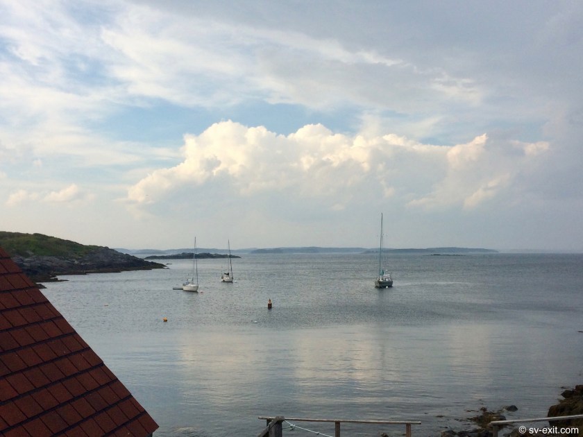
Fortunately, a non-profit group called the Friends of Seguin Lighthouse have set up, and maintain, a handful of free mooring balls in the bay.When we arrived, there was room alongside another sailboat and small trawler.It was the first mooring ball we had utilized since Carolina Beach last December, when we went on our epic road trip to New York City with Dena and James.
By the time Dena and James arrived at Seguin there was only one other boat in the bay, the rest obviously there for just a day trip. Essentially, we had the bay all to ourselves… sweet.
We took our dinghies ashore and climbed the path to the top of the island, one hundred forty five feet above the bay where the lighthouse, museum, and Lighthouse Keeper’s residence are.
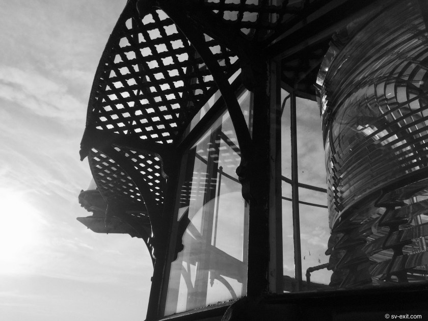
The Seguin Lighthouse was commissioned by none other than George Washington in 1795.Originally built as a wooden tower, it was constant exposure to the elements that eventually forced its’ reconstruction sixty two years later using granite brick.
By necessity, lighthouses are often built in inhospitable, dangerous, or remote locations.The Lighthouse Keeper, tasked with the imperative of keeping the light shining at all times, especially in the worst weather, had to endure those conditions year round.The mystique of a courageous individual, living in solitude, acting as the guardian and protector of sailors by warning them of impending dangers, has a very powerful resonance in the human psyche.
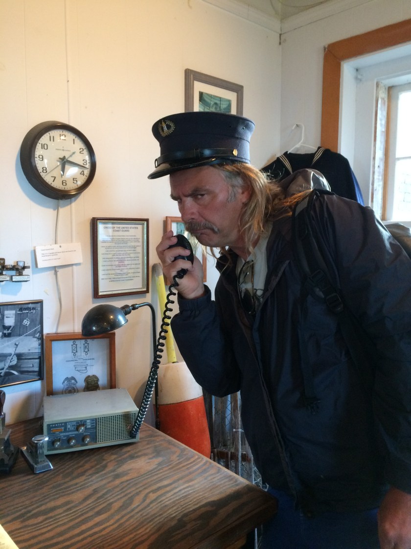
But, like so many of the once truly iconic paragons of classic Americana that now reside only in history books and stories, the Lighthouse Keeper has all but become extinct.
Today’s role of “Stoic Lighthouse Keeper” played by Steve
Alas, almost all lighthouses are now fully automated, as was the Seguin lighthouse in 1985.
Nonetheless, the Friends of Seguin Lighthouse do a brilliant job of maintaining the facilities largely through volunteer efforts.During the summer months, the lighthouse is also tended by two volunteer Keepers who live at the residence, keeping up the grounds and trails, giving tours, and looking after the museum and shop.
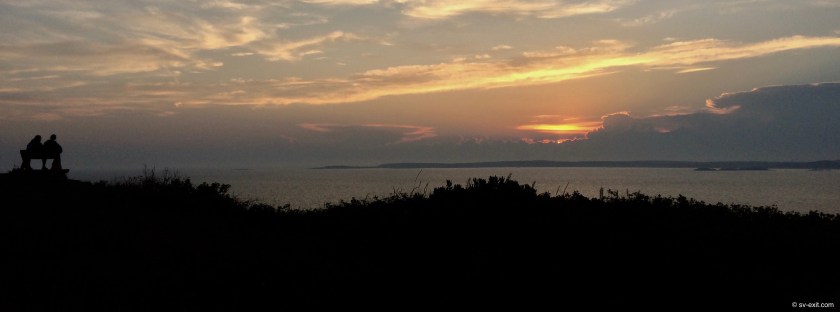
The volunteer Lighthouse Keepers enjoying a sunset
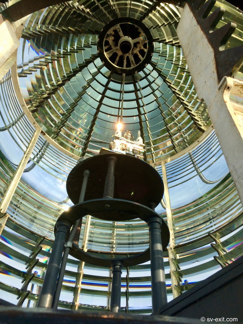
Though we arrived at the inopportune moment the volunteer Keepers had started making dinner, they were still kind and patient enough to take us up to the top of the lighthouse tower, letting us see the incredible First Order Fresnel lens, answering our questions, and chatting in the yard with us for quite some time.
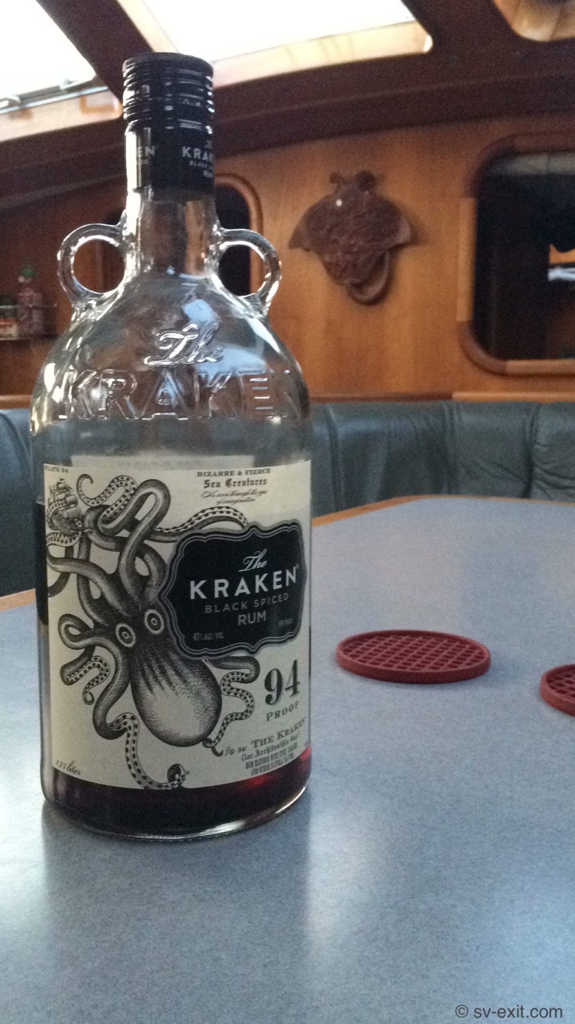
Returning to Exit, the night degenerated into a haze of Kraken-inspired conversations, stories, and laughter between the four of us.
Dena and James sailed off their mooring early the next morning.They were making a sprint for Robinhood Cove, only about fifteen nautical miles away, where they had the exhilarating and distinct possibility of both buying and selling a boat at the same location.If they could pull it off, it would be accomplishing what we thought would be an impossible task.
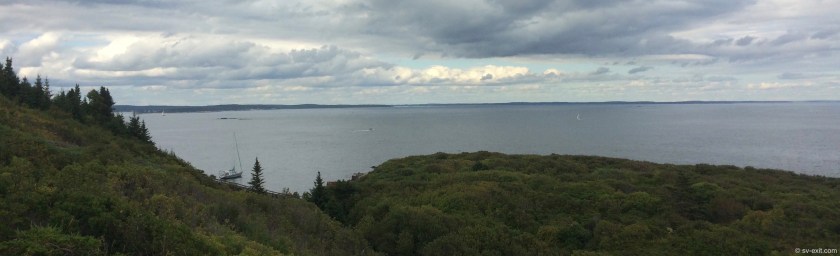
We stayed at Seguin Island for one more day so we could explore the many footpaths that spider out from the lighthouse grounds.Some paths led us to striking, rocky beaches pounded relentlessly by waves.Others to breathtaking vistas looking out over sweeping expanses of ocean and the shores of Maine to the north.
One of the paths took us to the northern tip of the island, where we could see Exit, at anchor in the bay next to us, as well as seals swimming through a channel fifty feet below us.
That same path had endless wild blackberry plants growing alongside its’ edges, which we collected and savored as dessert that night.
Mmmmm… free dessert.That may be $6.00 for the credit fund…
For fifteen years, Exit spent her winters hauled out at the Lyman-Morse boatyard in Maine.
Having been told numerous times, by many different people, that Maine was the perfect place to be sailing in autumn, it was high on our list of potential destinations during the fall of 2017.But, alas, the timing simply didn’t work out.
By the time we were ready to leave the Chesapeake last year, it was already November.Shifting winds and plummeting temperatures dictated that south was the only direction we would be sailing.
Now, ten months later, we had sailed right past New York City with the steadfast determination that we were going to get to Maine this year.We could always stop in the Big Apple when we returned south. If we didn’t press on, we might not make it again.
Having spent more than half her life in Maine, Exit was as much at home here as anywhere.
We were stricken with how much the coast of Maine reminded us of the San Juan Islands, back in our own stomping grounds, the Pacific Northwest, where we had both spent most of our lives.
It was easy to see why so many people had recommended we come here.It was also easy to see why our broker Pete had ultimately recommended starting in the Chesapeake Bay instead of Seattle.
In some ways, Maine represented the best preparation the East Coast could offer for much of what would be expected if we ever sailed up the coast of Washington State.
Rather than sandy beaches, jagged shorelines and rocky crags comprise most of the endless bays, inlets and shores of thousands of islands.An amazing variety of both evergreen and deciduous trees, now just beginning to show the first colorful signs of fall’s approach, interweave and merge together into dense forests running all the way down to the water’s edge.Long, rubbery tendrils of deep red seaweed, swaying in the current, can be seen just below the surface of the dark, cold water.
This was very different from the Chesapeake, with it’s softer slopes and endless places to drop the anchor (or run aground) in chocolate colored water.
Also, it was much different from the white sandy bottom of the Bahamas which could be easily seen below infinite shades of blue, crystal clear water that looked and felt more like a bathtub than an ocean.
Both the Chesapeake Bay’s very forgiving, mucky, muddy bottom as well as the sandy bottomed Bahamian Banks rarely reached deeper than twenty five feet, even miles from shore, offering solid and consistent holding to confidently anchor in.
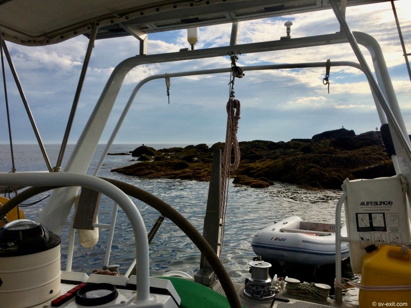
Here, in Maine, safe and/or feasible places to anchor are much farther and fewer between.As much as ten foot tidal exchanges resulting in monstrous shifting currents, and rocky bottoms scoured by millennia of water movement, can create treacherous conditions for even the best ground tackle and anchoring techniques.
It is not uncommon for depths immediately off the shoreline to be thirty to fifty feet which can, at times, put you uncomfortably close to unforgiving rocky shores.
Disconcertingly near the rocky shore on a mooring ball at Seguin Island
Even if you find a spot with good holding and enough room to swing at anchor, that’s getting to be two to three hundred feet of anchor rode required for adequate scope during even normal conditions
Conversely, fifteen foot depths at high tide may not be adequate to keep your boat off the bottom at low tide if the direction of a building wind opposes the currents and waves start kicking up.
A two mile wide channel between islands may run three hundred or more feet deep at its’ center.
All of these factors combine to make New England anchoring an adventure, both educating and humbling at the same time.
But, before you even have the opportunity to attempt setting anchor, you must first successfully navigate your way through never ending minefields of lobster pot buoys which seem to blanket Maine’s waterways, whose lines lurking just below the surface patiently await the chance to snag the prop of any inattentive captain’s vessel.
In spite of its’ formidable and sometimes apparently inhospitable challenges, Maine is a truly gorgeous andbreathtaking wonder to behold, especially from aboard a sailboat, proving the whole experience to be well worth the effort it demanded.
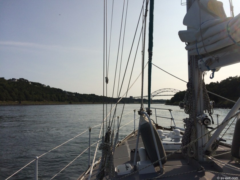
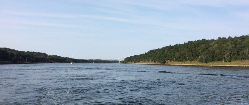
We departed P-Town, MA with the plan to detour slightly out of the way of our intended one hundred fifteen mile plotted course to Seguin Island, ME to pass over Stellwagen Bank.Just north of Cape Cod Bay and east of Boston, this twenty mile long plateau, surrounded by depths of two to three hundred feet, rises to within less than a hundred feet of the surface.
Apparently, it a a prime location to see whales during this time of year, as evidenced by the fleet of whale watching boats that depart P-Town every day, brimming with tourists who have paid $60 each to be taken to Stellwagen Bank for that very purpose.
What better situation than to have your own boat to do just such a thing?
We chalked up $120 to our “credit fund” (we have a running semi-joke that every time we do something aboard Exit ourselves rather than paying someone else to do it for us, that money goes into a theoretical “credit fund” which we feel much less guilty about spending later), and headed for P-Town via the Stellwagen Bank, on what we hoped would be a whale sail.
Of course, one very important lesson we have learned over years of diving is that absolutely the best way to maximize your chances of NOT seeing something is to go out with the intention of seeing it.
Consequently, we saw not a single whale that day.
However, any disappointment was diluted over the course of the twenty four hour passage, during which we spent over twenty of those hours under sail power alone… most relaxing and rewarding.
As we came within about ten miles of reaching Seguin island, I spotted a shark at the surface that seemed to be feeding on something.
When we turned Exit aroundunder sail, it immediately seemed like an impromptu man overboard exercise, only we were trying to get back to what we thought was already a carcass.
After a couple of tacks and gybes it became very clearly evident that, unless we intended to make this a rather drawn out exercise, we had best fire up the Perkins and douse the genoa.
Moments later, as the relative silence of our environment was replaced by the rumbling of the diesel engine, supplemented with the intermittent splashes of raw cooling water sputtering from the engine’s exhaust port, we approached what we thought were the remains of something.
The shark was no where to be seen…
The object was pinkish… it was roundish (like a big piece of ham)… it definitely had a gaping hole on one side…
…it was not dead.
But, then again, it had never been alive… because it was only a faded red boat fender… cue: game show “you just lost” sound effect here.
It looked like a huge, floating hunk of meat.Even the shark had taken a bite.In actuality, it was just floating garbage lost or abandoned by another boater.
On behalf of a species that had polluted far too much of the ocean, we now felt obligated to at least retrieve it from the water.
Though it was someone else’s litter, it would now become our garbage to deal with.A small attempt at reconciliation with the planet.We need to get a swimming pool cleaning net to help us snatch up rubbish that we see afloat.
At last, after numerous attempts, we managed to snag the fender with a boat hook and get it out of the water, where we unceremoniously threw it in the dinghy to await eventual disposal into a dumpster where it becomes someone else’s problem.
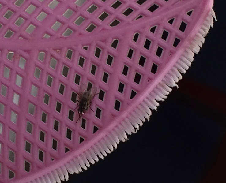
A less noble adventure that occupied the remainder of our time as we approached Seguin Island was a battle we found ourselves waging against the dark forces of biting black flies that had suddenly invaded our vessel.Possibly residents of the local lobster boats, temporarily stationed as sentinels on the lobster pot floats that surrounded us, dozens and dozens now flew about inside the cockpit, endlessly annoying, attacking, and biting us.
Armed with our trusty fly swatter Fly-calibur, the cockpit became a killing field.By the time we reached Seguin Island, dozens of fly corpses, smashed and broken, littered the floor of the cockpit underneath the teak grate.
It’s a fine line between bold……and stupid.
All the while, we were also having to constantly change course, dodging left and right to avoid the infinite number of lobster pot floats scattered in every direction. Oftentimes they couldn’t be seen until we were nearly on top of them.
In the cockpit, it sounded something like, “Lobster pot to the left… ouch!Fucking fly…. Oh shit… back to the right now… ouch!Where’s Fly-calabur?Do you see that pot just ahead?Ouch!Ha… got you fucker…”
…cue Benny Hill theme song here.
However, while managing to successfully navigate without running over a single lobster pot, ultimately, we were unable to fully repel the invading flies. We subsequently found ourselves involved in repeated skirmishes that occasionally broke out aboard.
I have heard of Boston, MA being referred to as Bean Town.So upon hearing the nickname for Provincetown, MA (located at the very tip of Cape Cod, just opposite Boston on the mainland), I naturally assumed it was either a tip of the hat or a slam towards Bean Town… or Pea Town.
Wrong.In actuality it is apparently simply P-Town… just a shortening of the name.
And, though we only spent a few days in P-Town, we had an incredibly enjoyable time.
Plenty of partying and socializing with James and Dena, both ashore and aboard our boats; exploring the beaches and the town; and planning our next steps occupied most of the time.
P-Town certainly has a conspicuously visible LGBTQ population and visitor base to it. I say this as an observation only, without any judgement or implications intended.
Pairs of men and women walking hand in hand… gay pride messages and slogans on t-shirts hanging prominently on the walls of souvenir shops… even a huge banner displayed overhead across the main street advertising performances of the musical Broke-la-homo.
I actually consider it quite refreshing to see that a community, in the heart of historically colonial and Puritan America, can be so open-minded and open-armed in this time of Trump-endorsed (and oftentimes Trump-initiated) overt narrow minded prejudice and paranoid bigotry.At least not everyone is crazy.
At the same time, I should consider how ridiculous it is that open-mindedness and acceptance within a community could be considered a refreshing and noteworthy distinction, as opposed to just being the norm… maybe most people are crazy.
Since moving aboard Exit, we have seen dolphins in the water around us fairly regularly… always a welcome sight that brings smiles to our faces as well as an immediate time-out from whatever we are doing to more fully appreciate and revel in the moment.
One morning, sitting in the cockpit while at anchor, we were flabbergasted to see what had to be a pod of well over a hundred dolphins meandering through the bay.
We immediately hopped in the dinghy, motored to a location a few hundred yards in front of their path, shut off the engine and waited.
As they approached and eventually passed by on all sides of us, we watched with the giddy enthusiasm of children on Christmas morning.
For well over an hour, we repeated this process again and again.
Eventually, as the pod worked its way towards the far side of the bay and appeared to be slowly headed back in the direction of the open ocean, we began to have more difficulty getting ahead of them.
Opting not to motor straight into the pod, as some other boats which had begun to congregate were doing, we decided to return to Exit, content to have had the opportunity for such a magical experience.
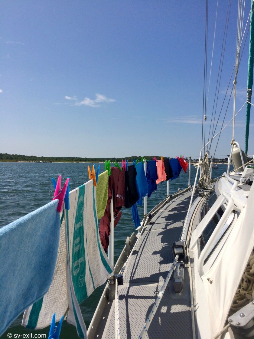
After a few days of exploring, re-provisioning, and relaxing, it was time to once again lift anchor and move on farther into the heart of beautiful New England.
To get to Cape Cod, we decided to motor through the Cape Cod Canal rather than sail back in the direction from which we had just come and navigate all the way around the outside of the Cape.
A minimum of one or two hours of engine use during the thirty miles between Buzzards Bay and Provincetown, via the canal, made far more sense than the nearly two hundred mile sail all the way around the outside (still one hundred thirty miles if you were daring enough to thread the needle behind Martha’s Vineyard, Nantucket Island, and Nantucket Shoals).
Onset sunrise
From Onset, the key was to time our departure to coincide with favorable currents.The ninety minute trip through the canal was only possible for us if we were traveling with the current, which exceeded a staggering four knots in the most constricted spaces of the canal.
There was a two hour time limit to complete the passage, turning around was not allowed, and sailing was prohibited… rules established and enforced by the patrolling Canal Control authorities.
Dena and James were already underway (as was always the case – I am not known as an early riser by any stretch of the imagination) by the time we started to pull up anchor.
Aside from the hard left hand turn we had to make into four knot currents from a very narrow channel to get into the main channel leading to the canal, and a large barge coming from the opposite direction once we were inside the canal which through up a wake that still had us bouncing around on confused waves for many minutes after it had passed, the journey through the canal was without drama.
The most exhilarating part was the speed we were traveling at.Though we were forced to motor through the canal, the favorable current we were riding on had us zipping along at between nine and ten knots of speed in places.
When we reached the other side of the canal we had officially made it to Cape Cod Bay.
We could see Dena and James not too far ahead.Nomad’s sails were already up.They hate using their engine even more than we do (Dena would not so affectionately refer to it as the infernal combustion engine).
Our own wind speed display indicated less than five knots of breeze to work with, but we had plenty of time to cross the bay to reach Provincetown by sunset.We were already tired of listening to the drone of the engine so we turned into the wind, got up the main, unfurled the genoa, and shut off the engine.
As is so often the case, just as we finished getting the sails up, the wind died off even further.It was now less than two knots and our forward movement had all but ceased.
In an absolutely classic moment, the radio crackled to life with James’ voice.
“Exit…Exit…Exit…this is sailing vessel Nomad.You appear to be dead in the water.Can we offer any assistance?”
With a smile I replied, “Nomad…Nomad…Nomad…this is sailing vessel Exit.This is how fast we go when there is no wind.”
After a brief silence, James voice came back over the speaker with a chuckle, “Oh… we’re running our engine.You guys are our heroes.”
Hmmmm…
Needless to say, within about five minutes we had the engine running and ended up motorsailing for half an hour before the winds creeped above five knots, allowing us a quiet five hours of sail time and a brief deck to deck conversation as we eventually caught up to Nomad.
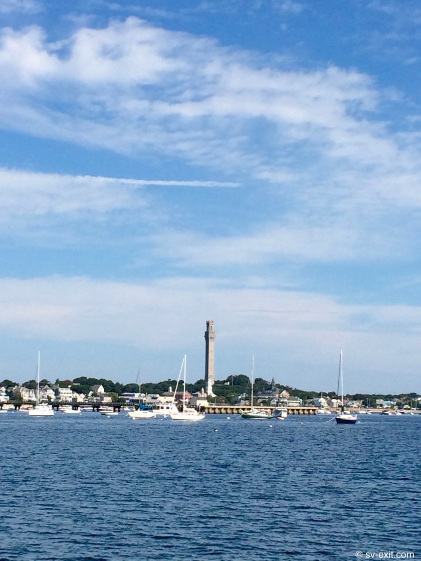
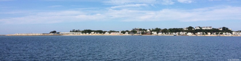
We crossed Cape Cod Bay in about six hours, reaching Provincetown, which is tucked just under the curl at the very tip of Cape Cod, by mid-afternoon.
They have converted the entire area around the main docks to mooring balls, which are either private or have to be paid for to use; but we were able to find a spot on the west side of the bay with fifteen feet of depth, good holding, and plenty of space.
It made for about a ten minute dinghy ride each way… oh well.
As we were setting the anchor, we realized the boat next to us was aluminum.Though we don’t purposely seek out other metal boats, we find a disproportionate amount of time that we are in the same anchorage, we end up near each other… a strange coincidence.
Even more strange was a third aluminum boat and a steel trawler which anchored next to us over the next couple of days… metal heads unite!
We arrived at Onset, MA on the 18th and planned to pass through the Cape Cod Canal at the next opportunity, which would give us access to Cape Cod. We were just awaiting a more favorable schedule of currents, which would allow us to get through a rather tight chokepoint from our anchorage and into the channel that would take us to the canal.
Plenty of time to chill out and plenty of time to catch up with friends.
Photo by Dena
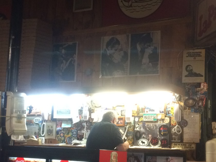
One evening’s shore excursion with James and Dena, which found us caught in a torrential downpour, led us to Marc Anthony’s Pizzeria.Though the pizza itself was the ultimate highlight, the true entertainment came when someone named David failed to appear at the counter to pick up his pizza, despite his name being called out repeatedly.Finally, after some time, with the entire restaurant chanting his name loudly in unison, a very embarrassed David sheepishly slinked up to the counter to claim his dinner.Some people are just idiots.
The guy responsible for getting David connected with his pizza
Onset also showed us the generous hospitality we found in Cuttyhunk.After a local fisherman passing by Exit stopped and had a brief conversation with us, we were amazed to see him return later with a gift of a dozen or so quahogs (a type of hard clam native to the eastern shores of North America) he had collected.Though Kris (who isvegetarian) opted out, James, Dena (also both vegetarians who still eat seafood), and I enjoyed deliciously fresh quahogs on the half-shell upon Exit’s transom later that evening.
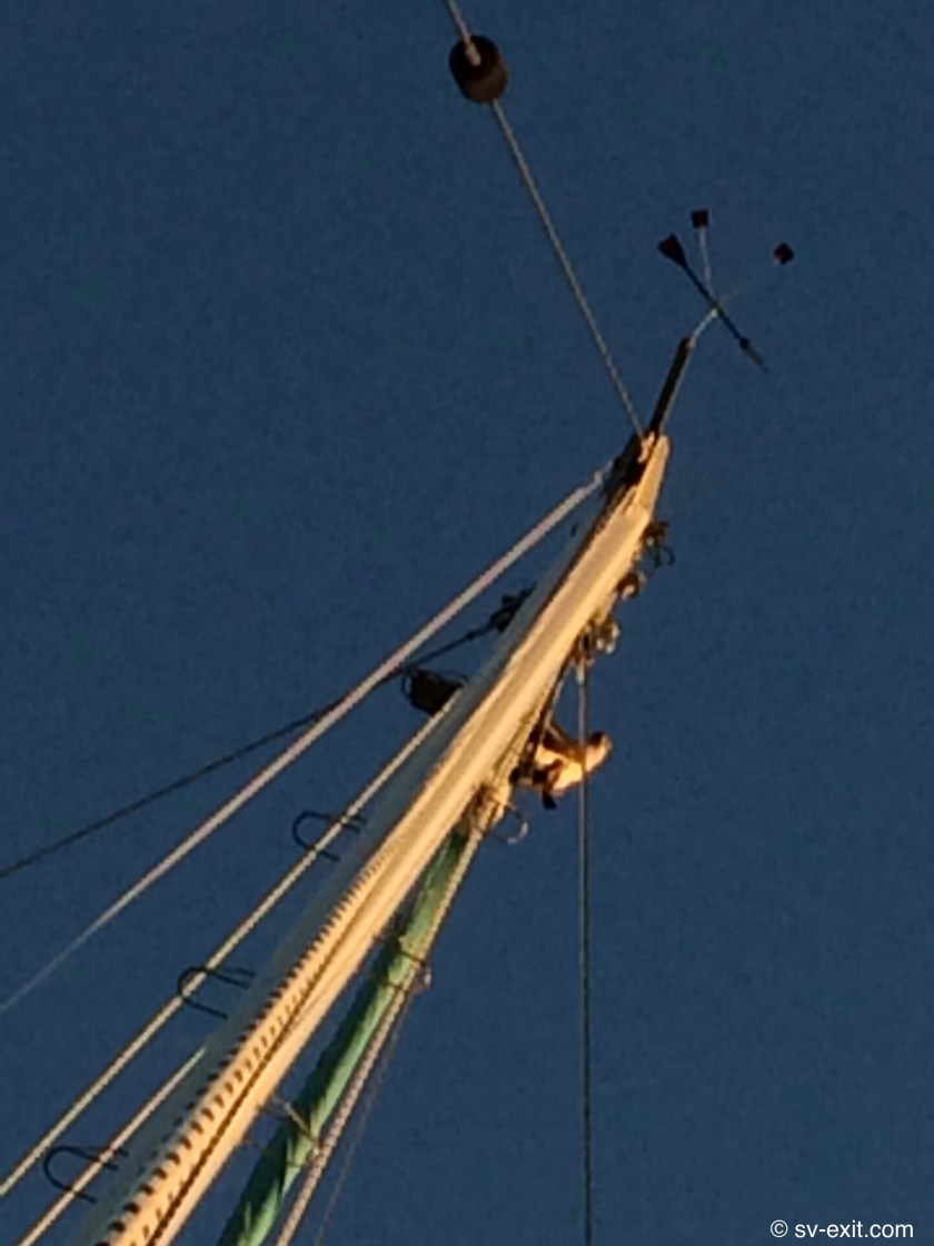
Less hospitable was the very large Osprey (magnificent birds of prey that can be seen all along the eastern coast) who decided the top of our mast offered the best vantage point in the area to occupy.It resulted in our wind indicator once again lying on its’ side. This is a phenomenon we seem to experience every few months.At least in this case it was a really cool bird that was the culprit instead of a lowly seagull… or a buzzard.
Regardless, it meant that once again I had to go sixty two feet up in the air to the top of the mast and reset the position of the wind indicator.On the plus side, every time I go up the mast it seems to become a less daunting and intimidating task.I don’t think I’ll ever relish the duty, but it is encouraging to know it can be done with a low fear factor.Still, I won’t be following Benjamin’s lead by utilizing free-climbing tactics to shimmy up without being attached to any lines.Call me me chicken… call me old… I’m happy just to not be called a corpse.
After departing Block Island on August 15, we headed for Cuttyhunk, our first destination in Massachusetts.It was the one year anniversary since we had splashed Exit inMaryland, a day comprised of seven hours of sailing without any engine noise… nice.
We arrived already aware of the fact that nearly the entire inner bay of Cuttyhunk was occupied by mooring balls.So we anchored just outside the breakwater, where we found very few boats and plenty of space.
Looking outside the breakwater
For the first time this year, our Rocna didn’t grab the bottom on the first try.A thick bed of long sea grass just below us prevented the anchor from digging in.We found ourselves drifting backwards within close proximity to a mega-yacht. Though it was never that close a call, it was amusing to to see the very concerned expressions on the faces of two crew standing behind the window of the bridge… certainly a turning of the tables.
We moved to a completely different area and had no trouble on the second try… anchor beers well deserved.
Without the tourist traffic of Block Island, Cuttyhunk provided a quieter stop to explore.Oysters on the half shell and clam chowder on the docks made for a proper New England experience.
We found the residents to be very boater friendly.
While wandering ashore, we happened across an unoccupied golf cart with a large crate of fresh corn.Above the box was a sign indicating one dollar per ear… honor system payment into a box.Though we subsequently found corn for less money at grocery stores in other locations, we thought it was money well spent at the time.
At Block Island we had seen tables set up outside some of the residences, where free fresh vegetables from private gardens were offered to those passing by, but our timing had always been poor and any vegetables were already long gone.
The day before we left Cuttyhunk, while we were heading back to Exit in our dinghy, we were approached by a man in a small power boat.Initially, I thought he was trying to get around us so I slowed down and steered out of the way.
We were a bit confused when he slowed down, pulled up alongside us and asked if we needed any maple syrup.We thought he was trying to sell it to us until he handed us a bottle, said it was homemade by his family, and told us it was a gift… awesome!
Again and again, we find these random acts of kindness (free syrup in Cuttyhunk, free rides offered in Charleston, our guardian angel Ray in Nassau) to be among some of the most rewarding exchanges we have while cruising.
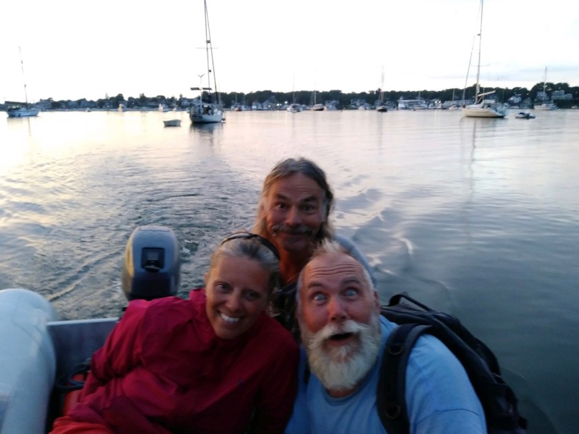
It was at Cuttyhunk that we finally met up once again with our cruising friends and soulmates Dena and James (aboard S/V Nomad), who we hadn’t seen since they dropped us off at the dock in Carolina Beach after our road trip to NYC which was over eight months ago.
Now, we were in the same place at the same time again.In fact, it was James who had suggested we jump the Gulf Stream from Georgia and head straight for Long Island.
At the time, it had seemed overly ambitious and beyond our capabilities.
In the end, we had taken the plunge and done just that… and were ecstatic that we had. Now, they rolled into Cuttyhunk a day behind us.
James and Dena have been both an inspiration for us, as examples of two committed individuals living on a very limited budget who have proven for over twenty years that living aboard a sailboat was an attainable goal, as well as being a wellspring of knowledge regarding how to actually do it.
They were the first full-time liveaboard sailors we met after arriving at Back Creek just outside Annapolis right after we purchased Exit.It also became immediately evident that they were of the very same mindset as us.
Being able to re-connect with them was energizing, to say the least.We could once again enjoy each others’ company swapping stories, as well as get lots of advice.They have always shown real interest and been exceptionally patient and helpful, especially considering how inexperienced we are.
They continually express how impressed they are with Exit’s construction, and have repeatedly assisted us in better understanding her.In addition, they offer endless moral support and help us to gain confidence.Having two people with their experience tell us that we display good judgement, decision making skills, and resourcefulness regarding sailing carries a great deal of weight and is quite reassuring.
After so many years living aboard a sailboat, they have an unfathomable number of stories.We were thoroughly amused to be told that, for them, it is unique to know two people who have an equal number of interesting stories to tell as well.
Now, after nearly eight months, it was invigorating and exciting to have finally caught up with our likeminded liveaboard friends.
Fortunately, East Coast liquor stores were well stocked with Kraken rum, James and Dena’s drink of choice to which we have become converted connoisseurs of.
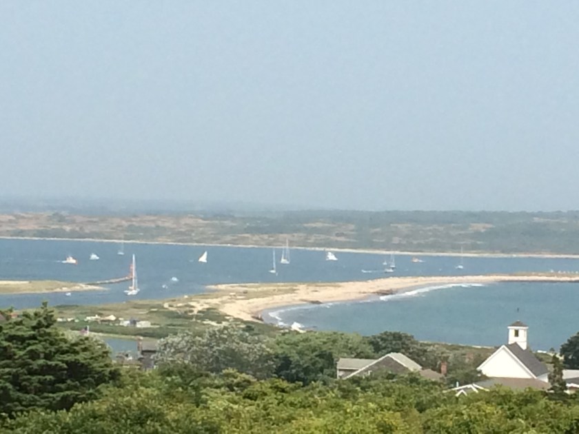
Block Island walks a tightrope, maintaining its small island identity with a permanent population of only one thousand people while hosting a remarkable ten to twenty thousand visitors every day (mostly day trippers arriving via high speed ferries).
Our first impression was not favorable, though it was based entirely upon a unanticipated introduction involving hundreds and hundreds of boats occupying the bay in which we were trying to find a spot to anchor – far too much sensory overload for two people who had just spent nearly a week alone on the ocean.
Ultimately, we came to a very different conclusion.
Block Island beggar
Mystic Whaler sails through the anchorage
Anchorage rainbow…
…just off the bow
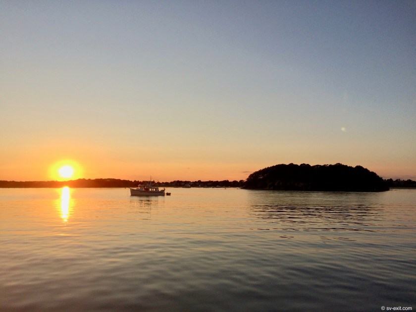
Block Island sunset
As we were wandering around on our first day ashore, we stumbled across a music festival that was underway near the waterfront.It was called Conservefest, and was dedicated to raising money and awareness regarding Block Island’s sincere efforts towards conservation.
We learned that the anchoring restrictions of some areas of the bay were aimed at preserving the sea grass beds imperative for local marine life.
The island also carefully monitors water quality in the bay, an especially important task considering the number of visiting boats.
One could make the argument that the extensive field of the mooring balls is largely a strategic source of revenue for the community.However, it also helps to prevent potential damage caused by irresponsible or poorly executed anchoring practices.
Our arrival at Conservefest was perfectly timed to coincide with the performance of a band called Z Boys.Though we had never heard of them before, they absolutely blew the other acts off the stage.For nearly an hour, the guitarist, bass player, and drummer put on a stellar and smoking performance of original instrumental material.It was reassuring to see that the power trio is still alive and kicking in rock music.
Concerfest 2018
Z Boys
However, our primary focus initially was to get our depth gauge sorted out.After troubleshooting multiple possibilities, we had concluded that it was almost certainly the transducer itself, mounted to the underside of the boat via a through hull, that had to be the problem.
As it seems is always the case, we had to wait through the weekend before being able to locate replacement parts. After endless phone calls on Monday, we located a supplier who could ship us a new transducer immediately.It shipped out on Tuesday and we received it on Friday.
After a quick switchover, there was an oh shit moment when the depth gauge still showed nothing but dashes.But after further checking, we discovered it was merely an adjustment in the systems setup menu that needed to be configured for the new transducer.
Our depth gauge was back in business… and it read forty five feet… holy crap!
We also had the bonus of meeting one of James and Dena’s friends Benjamin, single-handing aboard his sailboat S/V Crackertale.Not only was he a great character, but also an exceptional rigger.We were able to get a clean bill of health after he thoroughly inspected Exit’s rigging, which included him scrambling up the built-in mast steps in fifteen knot winds without even the assistance of the Bosun’s chair or any safety lines… another holy crap moment.
We spent nearly two weeks at Block Island, and had the opportunity to wander around other parts of the island, including a great hike out to one of the lighthouses at the end of a sandy peninsula occupied by a family of relaxing seals.
Today has just become yesterday.Tomorrow has just become today.July has just become August.
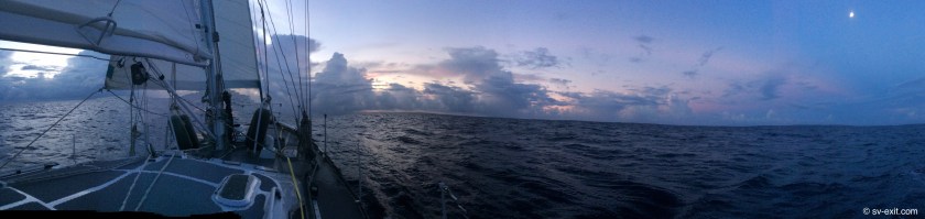
As I sit in the cockpit, a striking waning gibbous moon, still fairly low in the sky and only three nights past full, shines brightly through the dodger window.It’s brightness is the only thing partially obscuring the millions of stars which veil the night sky above.Not a single cloud can be seen from horizon to horizon.
The moon casts an intense and coruscating beam of light across the surface of the unsettled seas, leading from directly under the moon straight to our boat.Though it is purely the result of optics relative to our position, it has the appearance of a spotlight… Mother Nature in control of an imaginary light board at a concert, with Exit as the onstage soloist.
A depth gauge is among the four screens on the instrument panel front of me, illuminated in a soft red light to minimize the effect on our night vision.Normally, it would be displaying only dashes as we are sitting over a staggering five thousand feet of water (it’s depth limit is well under a thousand feet).However, now it blinks sporadically, repeatedly showing depths ranging from thirty five to sixty feet.Is it a pod of dolphins?Kris heard the unmistakable blow of one surfacing a short while ago before our watch change.Maybe a whale… or just a mundane school of fish.Whatever it is, something has been tracking underneath us, shadowing our movements for the past hour.Quite eerie.
The loud creaking of the reefing line in the boom is constant, as it strains under the loads created by winds approaching twenty knots.Just as constant, though much more subtle, is the hum coming from our autopilot Jeeves every time he makes a steering adjustment to maintain our course.During the past eighty four hours, he’s been remarkably well behaved.Bit of down time… now he’s back in the game.
Occasionally, the disconcerting noisy snap of the mainsail or genoa sail overwhelms all the other sounds, as Exit rolls back and forth in the motion of the swell, causing the sails to relax as a roll to one side releases the load, and then snap and bang as the roll back to the other side reloads the sail with wind again.
Every now and then it is significant enough to send a vibrating shudder throughout the boat.If it is allowed to advance out of control, it could tear the sail or even break the boom, so it must be heeded as a plea from the boat that a course adjustment or sail trim is in order.
Powerful roars erupt from the water around us, sounding not unlike a passing semi-truck on a highway, as a passing wave breaks or is crushed underneath the weight of the hull.
I have my jacket on for the second night in a row.It’s been six months since the damp night air on deck carried enough of a chill to warrant wearing one.
We glide through the night, floating atop a feisty sea at between six and eight knots of speed, a welcome turnabout from earlier in the day.
We had started the engine at 7:00am, unable to maintain even one knot of speed, and it’s droning noise had carried on for seven hours.Quite the departure from the previous three days which had been absolutely brilliant sailing.
In fact, apart from a two hour stretch on the second day, when a passing storm forced us to run the engine as we passed fifty five miles offshore from Cape Fear, this morning was the only time we had run the engine since raising anchor three and a half days ago.
Though we had been struggling somewhat with our sailing angle, we had managed to run the engine for less than ten hours of the eighty four hours we had been underway.For us, this was a big deal.
Now, under the power of our sails alone, the unnatural engine noises are replaced by far more organic sounds I much prefer.
Our friend James, aboard S/V Nomad, expressed to us that three days offshore was merely enough time to “go feral”. We still hadn’t quite deciphered the precise subtleties of that idea but were getting the gist of it.Four days is what it takes to really get into a rhythm on an offshore passage as far as sleeping, eating and watch schedules, as well as getting to a point of coming to a state of Zen one-ness with the boat.
Eee-ahh… Eee-ahh… Eee-ahh…
The moment of reflection vaporizes instantly as the annoying London police car sound blares out again… Jeeves is tired.
Back to the reality of constant challenges that come part and parcel with cruising aboard a sailboat.
Fortunately, a reset is all it takes this time, averting the need to rig up our backup autopilot, Schumacher, as we eventually had to do between St. Marys and Charleston.
For us, this is truly a passage of passing states in the Atlantic.
Not just in the sense of nonstop passing of geographical states while fifty to eighty-five nautical miles offshore since departing Charleston… South Carolina, North Carolina, Virginia, and Maryland… with Delaware, New Jersey, New York, and Connecticut still to come before reaching our destination of Block Island, Rhode Island.
But also a continual passing of states of mind along the way – from bliss and elation to exhaustion and frustration.
******
We set out from Charleston, SC at noon on July 28th with as promising sailing conditions and forecasts as we could hope for.Nearly a week without major storm fronts forecasted anywhere along the East Coast; only the occasional unforeseeable thunderstorm or squall which is part and parcel to this time of year along this coast.
Our Navionics program said this would be a seven hundred nautical mile passage… more than twice the non-stop distance we had ever attempted previously.Six days and change…
From the ship’s log:
July 28: 11:45am – Anchor up.Making for Block Island, RI – 699nm @ 5 days 19 hours; Forecast is fair weather with <20 knot winds for a week
18:00 – Winds SSW at 10-12 knots; swells have increased to 3-4ft.
22:00 – Killer full moon if the ominous building clouds would just give way.
July 29: 00:30 – No rain but 20-25 knot winds blew through during Kris’ two hour 10-12 watch.Having to delay pushing toward Gulf Stream to steer away from big swell.Wind currently SW at 16-18 knots.Winds making 4-6ft. seas surly and stacked up with some 6-8 footers passing through.
01:30 – Daggerboard down now; trying to keep waves more astern.Wind SSW at just under 20 knots.Seas are still very snotty with the occasional 7-9 foot monster crashing by.
04:20 – Winds <15 knots and seas settling slightly.Just saw first ship lights of the night on horizon; currently 50nm offshore
By 8:00am, the winds had shifted south and dropped below ten knots, and the seas had settled to between two and four feet.
We were even visited by a pod of dolphins.
The afternoon proved to be quite challenging.Winds that constantly changed speed (from below five to over fifteen knots) as well as shifting direction, in addition to a two hour squall that forced us to run the engine, resulted in us continually having to change course and adjust our angle, relative to either the wind, or swell, or both.
During our second night, we finally became aware we were fully inside the coveted Gulf Stream currents.In a “south-ish” wind of only seven knots that was shifting all over the place, the speed indicator in our cockpit displayed a sad three to four knots of boat speed.
Yet, when we checked the chart plotter (which monitors speed over ground via satellite GPS, instead of utilizing the paddlewheel under the hull which the cockpit speed indicator uses), we found our actual speed to be ranging from five and a half to seven knots.
We were picking up two and a half knots of speed with the favorable current… yes!!!
Throughout the night, things proved to remain interesting.
There is a ship’s log entry indicating:
02:30 – Spent last hour making sure we didn’t get run down from behind by a 1200 foot ship moving at 15 knots;Never received an answer to our repeated hails on VHF – obviously no one on watch.Have turned on transom light and been shining a light on our sails… thanks M/V Gerd Maersk… good seamanship.
An hour later we passed by Cape Lookout.Though we had been seventy-five nautical miles offshore all night, the shoals of Cape Lookout, stretching outward far from the coastline, sat less than forty miles off our port side.
By 4:30am, as my watch ended, winds had finally climbed above ten knots.That, as well as our better than two knot Gulf Stream boost, had combined forces and we were currently racing along at an impressive eight knots.
We had spent most of the the night flying under a full moon.
Kris, who had the previous watch, definitely got the shit deal on that one.She had enjoyed the privilege of sitting through over two hours of rain and slop… bad luck there.
During our third day, we started seeing a lot of boat traffic, which had been conspicuously absent up to that point.
At one time, we were converged upon by a two hundred foot Coast Guard cutter, a six hundred foot freighter, a thousand foot container ship, in addition to three other ships… eek! We found ourselves threading a needle in an ocean of endless expanse.
WTF???!!!
Later our AIS display looked like we were at the outer edge of a literal armada of ships. We were relieved, after recalling a conversation we overheard on the VHF not long before, to decipher what we were actually seeing on the screen as local fisherman using AIS to track and identify their fishing gear, not individual ships… whew.
Still, that had to be a mess of fishing nets out there just to starboard. Best to avoid those as well…
Another challenge we faced was the fact that we had been cursed for days with an almost nonstop stint ofcloud cover, severely limiting our solar charging capabilities.
Sailing for days on end is something we aspire to do.However, the downside of sailing for days on end involves not getting any sort of battery charge from the engine.While we are underway, the electronics we run tax the battery banks much more quickly than while we are anchor…
Not a problem if the solar panels are bathed in sunshine during the day.But after experiencing extensive cloud cover for days in a row, we start running a power deficit that the solar panels can’t keep up with.
So, for only the second time since installing our solar panels in February, we had to run the genset for the sole purpose of charging our house battery bank.The previous situation was due to a week of rain and clouds while we were at anchor in the Bahamas.
I had recently calculated that, since February, our solar panels had generated nearly 35,000 amp-hours of power.The genset would have needed to run for over twelve hundred hours to create that same amount of battery charge. That’s about a thousand dollars in diesel fuel, alone.
The solar charging system install had already proven to be worth more than its weight in gold.
If we finally had to fire up the generator as a result of sailing in cloudy weather instead of motoring, well then… so be it… no brainer… no problem.
With the autopilot being one of the primary offenders in the category of offshore energy consumers, in the future, we may just have to do more hand steering, especially when it’s cloudy out.
As midnight approached on our second night, Cape Hatteras was about forty miles behind us, putting us right about at the halfway point of our passage… three hundred sixty miles… a solid six knots averaged consistently over sixty hours.
We were impressed with ourselves.
One hundred fifty six nautical miles in a twenty four hour period was a record for us. It was only the second time we had broken the one hundred fifty mile marker.Plus, it had been almost entirely under sails alone, aside from the two hours we had decided to run the engine during the storm.
However, as is often the case, our luck would not hold out.
The free push we had been receiving from the current quickly began to dwindle away.As the Gulf Stream veered to the east, the four knots of current we had been riding on dropped down to only one knot.
Around 10:00pm, a fleet of a dozen or so passing fishing boats had been clearly visible in the distance.After that, we didn’t see a light from another boat anywhere on the horizon all night.
By 7:00am, the winds, which were only about forty five degrees off our stern, had died to less than five knots.
Offshore morning storm clouds
Unable to maintain more than one knot of speed, our steering became sluggish and we struggled with the two to five foot swells coming from the same direction as the wind.
Any option of just sitting and drifting until the wind improved was ruled out.Without steering, we would end up helplessly bobbing around in the swell until we were taking far too big of waves directly on our beam.
Eventually we acknowledged that we needed to call on the Perkins for assistance.One important compromise we have learned over the past year is that, as cruising sailors, we may strive to do things a certain way; yet, when push comes to shove, everything aboard the boat is a tool to be used at the discretion of necessity or safety.
Not using the engine when it’s needed, based upon principle, is perhaps more block headed than using the engine when it’s not needed.It’s just another resource in the tool box… maybe the question more often should be am I currently using the best tool for the job at hand?
The wind direction had forced us to angle farther west, towards the coast, than we had wanted.With the engine now running for the foreseeable future, we tried to push farther back offshore.
After seven hours of motor-sailing, the winds finally increased to above twelve knots.Though we could sail again without the relentless drone of the engine, we were once again having to point ourselves far too much in the direction of Maryland instead of New York.
Another compromise we’ve learned is sometimes the wind just won’t cooperate, and you have to accept that.We were seriously starting to consider the possibility of heading on in to the mouth of the Chesapeake.
The last thing we wanted to do was resort to motoring all the way from Maryland to Rhode Island; but we also had very little confidence that we would find winds more favorable to get us north once we were inside the Chesapeake.
We weren’t ready to give up yet.As long as we could keep moving in a reasonably forward direction, we would continue on and remain patient.
The strategy at this point was to just try to keep sailing.
Possibly a blessing in disguise, our navigational dilemma was temporarily put on hold when Kris discovered a large nylon washer on deck, near the mast.It was obviously broken… it was obviously for a big bolt… big bolts hold together big things on the boat… not good.
Further inspection revealed the washer to be from the bolt securing the boom to the mast, or the gooseneck; the same bolt Kris had discovered had lost a nut while we were at anchor in Marsh Harbor.
In Marsh Harbor, the bolt had unscrewed itself halfway out of the mount, leaving the boom hanging precariously.Fortunately, we had been able to get the bolt re-threaded through the mount and secure the nut back in place.Even more fortunately, it had been caught before we had gone sailing again.
Now, one of the nylon washers had split and fallen out while we were underway, leaving an un-tightened nut on a bolt that kept our boom from falling off… a boom currently under the load of a mainsail in twelve knots of wind… not good.
I found a spare washer in the locker under the salon table I refer to as The Hardware Store. The repair seemed pretty straightforward.Much less dicey than the last time, since the bolt was still in place.
The big question was could I do this while we were sailing at five knots, with the mainsail up?
As long as the boom didn’t get shoved around once I took the nut off, it seemed like a quick fix.So I told Kris to manually take the helm… and keep the boom steady… please.
The nut came off… Kris kept the boom steady… the washer went on… Kris kept the boom steady… the nut went back on… Kris kept the boom steady… Voila!Another crisis averted.
In addition, an important point was reinforced:while underway, periodic inspections of the equipment, rigging, and deck area, even (and especially) in rough conditions, helps to maintain the safety of the ship and crew.
Confident that the boom was, once again, secure, we could turn our attention back to trying to keep Exit headed in the right direction.
We spent the entire rest of the evening and night adjusting our angles of sail to compensate for wind shifts.Over twelve hours, our heading changed from pointing towards the entrance of the Chesapeake, to headed for New York Harbor, to pointing due east into the Atlantic Ocean, and eventually back towards Block Island.
By morning, we still hadn’t given up.However, winds approaching twenty knots and swells that were building again to upwards of five feet were forcing us to rethink our approach.
Our biggest shortcoming had been an inability to sail dead downwind (with the wind directly behind us) under many conditions… our inability for sure.Still unsure how to safely deploy the reaching pole for the genoa, we oftentimes couldn’t keep that sail from luffing.And without a preventer rigged up, the boom and mainsail crashed and banged around far too much in many situations.
Our few previous attempts at a wing and wing configuration (both sails fully sheeted out on opposite sides of the boat) had been marginal, at best, as we were never really able to get the sails even approaching perpendicular to the hull.
But necessity breeds ingenuity.
If we could just sort out running dead downwind, our course would be perfectly lined up with Block Island.What was needed was a bit of open-minded experimentation.
We agreed that trying to figure out how to rig up the fifteen foot reaching pole on a pitching deck, while moving at six knots through very confused seas in fifteen to twenty knots of wind, sounded like a recipe for disaster.We would have to forego that part of the experiment for now, and rely on partially furling in the genoa to keep it from luffing if necessary.
After some discussion, we rigged up a temporary preventer.It was a line, just tied off near the back of the boom and run to a forward deck cleat.I still had to go forward any time the boom was adjusted to release and re-secure the line to the cleat. Primitive… but functional.
The preventer eliminated almost all of the boom movement and sail noise caused by our rolling motion in the swell; and, even more importantly, eliminated any risk of an accidental gybe.
With at least ten knots of wind, we found that we could keep the sails filled with minimal slapping, and move comfortably dead downwind with three to four foot swells chasing us.
We sheeted both the main and genoa farther out than we ever had before.
This became a game changer for us. Suddenly, we had the option of running dead-downwind, something that had caused us nothing but grief up to this point.
We experimented with the wing and wing setup throughout the afternoon, as the winds slowly climbed to above twenty knots.
At least one reef in the main overnight had become standard practice for us.We figured it was better to potentially lose half a knot of speed overnight to insure we didn’t get caught unprepared if a squall hit, or have to wake the sleeping off-watch person to deal with an increase in the winds.
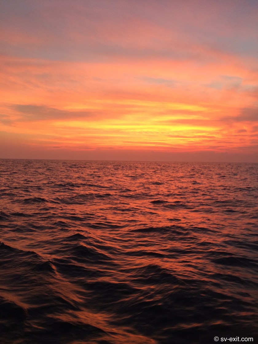
Tonight, as the sky offered up another spectacular sunset, for the first time we put a second reef in the main before furling in the genoa.
The winds had climbed to between twenty five and twenty seven knots, and six to nine foot seas were described in the ship’s log as downright stinky.
With no certainty as to how the night would progress, we had to plan for the worst and hope for the best.We weren’t sure if the winds would increase, and these were the most intense winds we had ever experienced off anchor.Kris expressed more than a small amount of trepidation regarding the current conditions.
But, with two reefs in the main and no genoa out, we should have been good for up to forty or fifty knots, so we felt confident that we were solid with how much sail we had out.After re-setting the main sail and preventer for the night, we rode out winds upwards of twenty knots through the night.
As an extra storm precaution, we had even removed the midship dorades (scoops to allow wind below decks) and replaced them with covers to further reduce any potential points of entry for the ocean.
As it turned out, the winds never increased above twenty seven knots.It was more than we had ever sailed under.But, especially with the winds behind us, it ultimately turned out to be quite digestible.
By far, the most intimidating element was the swell that continually rolled in from behind us.
I realize that NOAA’s wave assessments can be quite distinct from reports sourced from the average sailor.NOAA rates waves on a scale based upon average wave height, of which 50% of the waves are higher than.But, as an “average sailor”, I must confess that it is actually those waves in the above-fifty-percent category that really grab your attention.
So when I say, waves came up behind us that were seven to nine feet, I am not trying to stretch my semantics into a salty yarn.
Following swells, not all but some, crested above our stern arch and davit while we were in the trough of the swell… a structure which stood just above my head level… which stood six feet above the deck… which stood three feet above the water… nine feet in total… chasing us down from behind.
Fortunately, we were maintaining six knots speed, barely slower than the passing swell.
Consequently, instead of following waves breaking on our stern and pooping the cockpit, we were picked up by the rising swell and, as it passed underneath us, we surfed back down the other side.
This delicate balance continued throughout the night.
With the rising sun came another day.We had maintained confidence in Exit and she had delivered.After sailing for twelve hours straight with winds in excess of twenty knots (reaching a high of twenty seven), we had, once again, learned about Exit’s capabilities.
For us, it was an open ocean storm with unlimited potential for disaster.For her, it was home.
Day six seemed to be the day we fell into a real rhythm.Two days prior we had struggled so much with wind that we began to doubt we’d make it past the Chesapeake Bay entrance.Day five had been a great day of sailing; but experimentation with running wing and wing, as well as winds between 20-27 knots for twelve hours had made for some tiring, daunting, and stressful periods.
By mid-afternoon of our sixth day at sea, we were only fifty five miles southeast of New York Harbor.We had settled into a comfortable stride, and hadn’t used the engine in forty eight hours.
As the sun set on what would most likely be the last night of our passage, the winds once again picked up to over twenty knots.
Flying along at between six and eight knots, our speed made the five to six foot swells that approached from our stern quarter feel remarkably smooth.Inside of smashing through them, or being tossed from side to side as they rolled passed, we surfed atop the waves as they passed underneath us.Considering the conditions, we were experiencing an unbelievably effortless sail.
To cope with all of the shipping traffic, New York has three traffic separation zones just outside the harbor, extending out in different direction.Each zone is ten miles wide, with an incoming and outgoing lane separated by a stretch of ocean median.Large ships are required to navigate within these lanes.Two of the zones end approximately forty miles outside the mouth of New York Harbor.The third continues all the way around Cape Cod and into Boston.
We were far enough offshore that we only had to cross the third, and northernmost, traffic separation zone, which we anticipated could be somewhat nerve racking and tense.
In actuality, while we watched shipping traffic, displayed on the AIS, moving in the lane opposite ours, we saw no boat traffic in the lane we currently occupied during our entire crossing of the separation zone.
The only exception was what appeared to be a fishing boat playing chicken with a huge freighter about five miles away from us.Watching on the chart plotter, it looked as though the smaller sixty foot boat made three separate attempts to cut just in front of the passing freighter.Eventually, the captain must have decided tonight was not a good night to die, as he finally acquiesced, and ultimately made a course change that brought him around behind the freighter… a much smarter maneuver.
We anticipated that we would get to Block Island around noon, or early afternoon.However, at 4:30am we misjudged what we thought was a final gybe that would bring us directly to the New Harbor channel.
Swell direction and wind shifts contributed to the error.But, more than that, it probably came down to the fact that, after six nights at sea, we were just a bit loopy in our timing.Ultimately, the result was nothing worse than a few additional gybes required to zig-zag into the channel and a bit later in getting there.
Considering it had been an epic sailing passage, we were adamant that we were going to sail the rest of the way, and not fire up the engine just to shave off a few extra hours.
After all, we had come eight hundred twenty three nautical miles in one hundred forty nine hours, and used less than ten gallons of diesel the entire time – a much better result than our Navionics estimate which calculates projected fuel consumption based upon an assumption that we would be motoring the whole way, or one hundred forty gallons!
Our arrival at Block Island, RI provided one of those sensory overload moments which seem more and more common on the boat.
After spending six days eighty miles offshore completely by ourselves, a crowded anchorage provides a dizzying array of information, noise, distractions, and hazards to try to process.
But, as far as crowded anchorages go, this was one of the most crowded we had ever experienced.There may have been a thousand boats in the bay.
I said to Kris, barely joking, it’s like traveling for six days, only to arrive at your destination… a Walmart parking lot.
We had been recommended this place by Dena and James, on S/V Nomad.As like-minded souls, we trust their judgement and perspectives.They wouldn’t steer us wrong.
What we obviously needed was a long nap, a few cockpit cocktails and a trip ashore to gain a better appreciation.
But, first, we needed a place to anchor.
Considering New Harbor is approximately one mile long by half a mile wide, there is a lot of space.However, in addition to the sheer volume of boats, Block Island residents have taken a very virtuous and honorable approach to conservation, prohibiting anchoring in certain sections of the bay.
We weren’t about to slalom through the entire bay looking for the perfect gap.
And, we had one further problem.Even after returning to depths our charts indicated were less than four hundred feet, then one hundred, then seventy, our depth gauge still only displayed dashes.
Depth gauge no worky… shit.
We asked a couple of people on the decks of boats we passed alongside of what depth the gaps next to them were… forty plus feet.We had never anchored in water deeper than about twenty five feet. Even at that depth, just under a 5:1 scope was the best we could do.
The decision was made to drop the hook, back down on the anchor at 3000rpm (instead of our usual 2000rpm), and keep an anchor watch overnight if we weren’t confident by then.
After the anchor had been set, I dropped a lead line off the stern with forty feet of line on it.It didn’t touch the bottom… not ideal at all.This meant we were at a 3:1 scope, at the most… half of the minimum we’d like.
In spite of that, we sat in that spot for twelve days and held fast.Even given the option of moving a few days later, we opted to stay put.
Though we would never do that again if we could at all avoid it, it was reassuring to know that our ground tackle was solid enough to carry us through.
Chalk another one up to the Rocna anchor and half inch chain.